
Loch Leven
The named loch wraps around the lower and right-hand edges of the illustrated park.
ILLUSTRATED PARK MAP · P174
Invercoe Highland Holidays, Glencoe, Argyll · United Kingdom
 Enlarge the map ↗
A SENSE OF THE PLACE
Invercoe Highland Holidays is a family-run park in Glencoe with a lochside touring setting. Cottages, timber lodges and pods complement the caravan and motorhome pitches.
Different accommodation options suit self-catering holidays and simpler camping-style stays. Mountain scenery and the historic glen provide the wider backdrop, while the map helps visitors locate accommodation and shared facilities around the park.
LOOK CLOSER
The named loch wraps around the lower and right-hand edges of the illustrated park.
A pale shore strip, outlined stones, wave marks and a projecting grey shoreline feature distinguish the waterfront touring edge.
Dense mixed planting follows the road, waterfront and northern lodge boundary, with smaller planted islands between accommodation groups.
An information symbol appears in the shared facility cluster beside the long blue-roofed building on the eastern side.
A shopping-trolley symbol marks the shop in the eastern facility cluster.
A washing-machine symbol places the laundrette alongside reception, the shop and toilets.
The toilet symbol is grouped with the main eastern facilities.
A house symbol identifies the building immediately beside the entrance on the B683.
An information symbol appears in the shared facility cluster beside the long blue-roofed building on the eastern side.
A shopping-trolley symbol marks the shop in the eastern facility cluster.
A washing-machine symbol places the laundrette alongside reception, the shop and toilets.
The toilet symbol is grouped with the main eastern facilities.
A house symbol identifies the building immediately beside the entrance on the B683.
Illustrated swings and a slide stand on a bright yellow patch near the exit and western end of the main lodge row.
A barbecue symbol marks an orange-backed area near the small lodges and eastern facilities.
Blue tap symbols recur along the waterfront and beside the roadside accommodation strip.
Bin symbols are distributed near the play area, eastern accommodation and waterfront routes.
A chemical-disposal symbol is placed beside the western tent area, below the road.
Red fire-extinguisher symbols appear in the lower touring rows and near the eastern entrance and barbecue area.
A green assembly symbol is positioned just inside the eastern entrance.
The named loch wraps around the lower and right-hand edges of the illustrated park.
A pale shore strip, outlined stones, wave marks and a projecting grey shoreline feature distinguish the waterfront touring edge.
Dense mixed planting follows the road, waterfront and northern lodge boundary, with smaller planted islands between accommodation groups.
The entrance is labelled at the eastern end of the B683 frontage; a separate exit is labelled farther west near the play area.
The grey public road crosses the composition diagonally, with arrows towards Kinlochleven on the left and Glencoe Village on the right.
Broad white routes connect the entrance, touring rows, lodge groups and waterfront. A separate curving network serves the northern lodge area.
A named blue-roofed building stands within a fenced western enclosure. Its function is not specified by the map key.
READING THE MAP
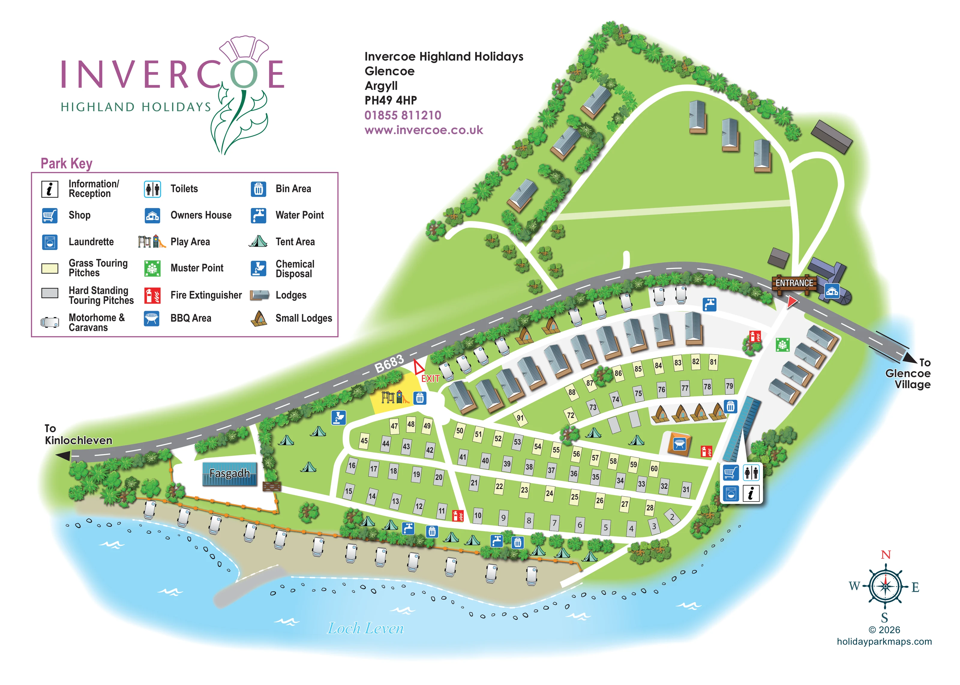
This illustrated map of Invercoe Highland Holidays brings together a varied lochside park in Glencoe, Argyll. Loch Leven curves around the lower edge of the plan, while the B683 crosses diagonally between the main touring area and a separate group of lodges. That relationship gives the artwork a clear organising structure: visitors can recognise the road, shoreline and accommodation groups before looking for an individual pitch or facility.
The map shows grass and hard-standing touring pitches, waterfront caravan and motorhome positions, larger lodges, small lodges and tent areas. Numbered rectangles provide practical pitch identification, while shaded buildings and leafy boundaries give the plan a more illustrative character. Reception, the shop, laundrette and toilets are grouped on the eastern side, with a play area near the separate exit and a barbecue area beside the smaller lodges.
A generous three-column key explains the accommodation and service symbols. The prominent Invercoe thistle logo, purple headings and green landscape create a coordinated page that combines the park's identity with straightforward visitor wayfinding.
The artwork is a single landscape-format plan, with branding and a large Park Key occupying the upper-left portion and the illustrated park spreading across the right and lower page. Its overhead geometry is softened by oblique lodge illustrations, shaded roofs and varied clusters of trees and shrubs. The detail view enlarges the same key and western area rather than showing another section or a separate site.
The B683 forms the main diagonal landmark, labelled with directions towards Kinlochleven and Glencoe Village. The entrance sits at its eastern end beside the owners house, while the exit is farther west near the playground. Above the road, a curving white access route serves lodges arranged around open green space and planted boundaries. Below it, a long lodge row overlooks the central touring layout, with another shorter row on the eastern side.
Grass touring pitches are pale cream and hard-standing pitches grey, both carrying black numbers. Broad white routes separate their angled rows. Caravan and motorhome illustrations identify additional positions beside the road and along the shore. Tent symbols mark less formal grassy areas, and compact pointed-roof small lodges appear in two groups.
The eastern service cluster is marked with reception, shop, laundrette and toilet symbols. Water points, bin areas and fire-extinguisher points are repeated around the plan; chemical disposal, a muster point and a barbecue area have their own markers. Fasgadh is labelled inside a fenced western enclosure. Light blue water, wave strokes, shoreline stones and a compass complete the setting without obscuring the practical pitch and route information.
KEEP EXPLORING
Chosen for shared landscapes, accommodation or facilities.
 Explore the map ↗
United Kingdom
Woodland park map with mixed pitches, bell tents, lodges and a fishing lake.
 Explore the map ↗
United States
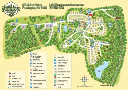
Woodland RV campground map with mixed camping, three water landmarks and a central recreation hub.
 Explore the map ↗
United Kingdom
Colour-coded accommodation, lakeside facilities and woodland routes at Burton Constable Holiday Park & Arboretum.
Features may come from the sample artwork, its key or published park information. Approximate numbers describe the drawing and may cover only part of a park. They are intended to help you compare map examples. Current facilities and booking information should be checked with the park.
TAKE A CLOSER LOOK
View the illustrated map in detail or choose a file to download. These are sample maps; contact the park for current visitor information.

LET’S MAP YOUR PARK
For a map quotation, find your park and draw a rough boundary around it. The area you select helps us work out the design time and price.
Draw your park for a quote ↗Or talk to our map designers
01751 473136