
Loch Oich shoreline
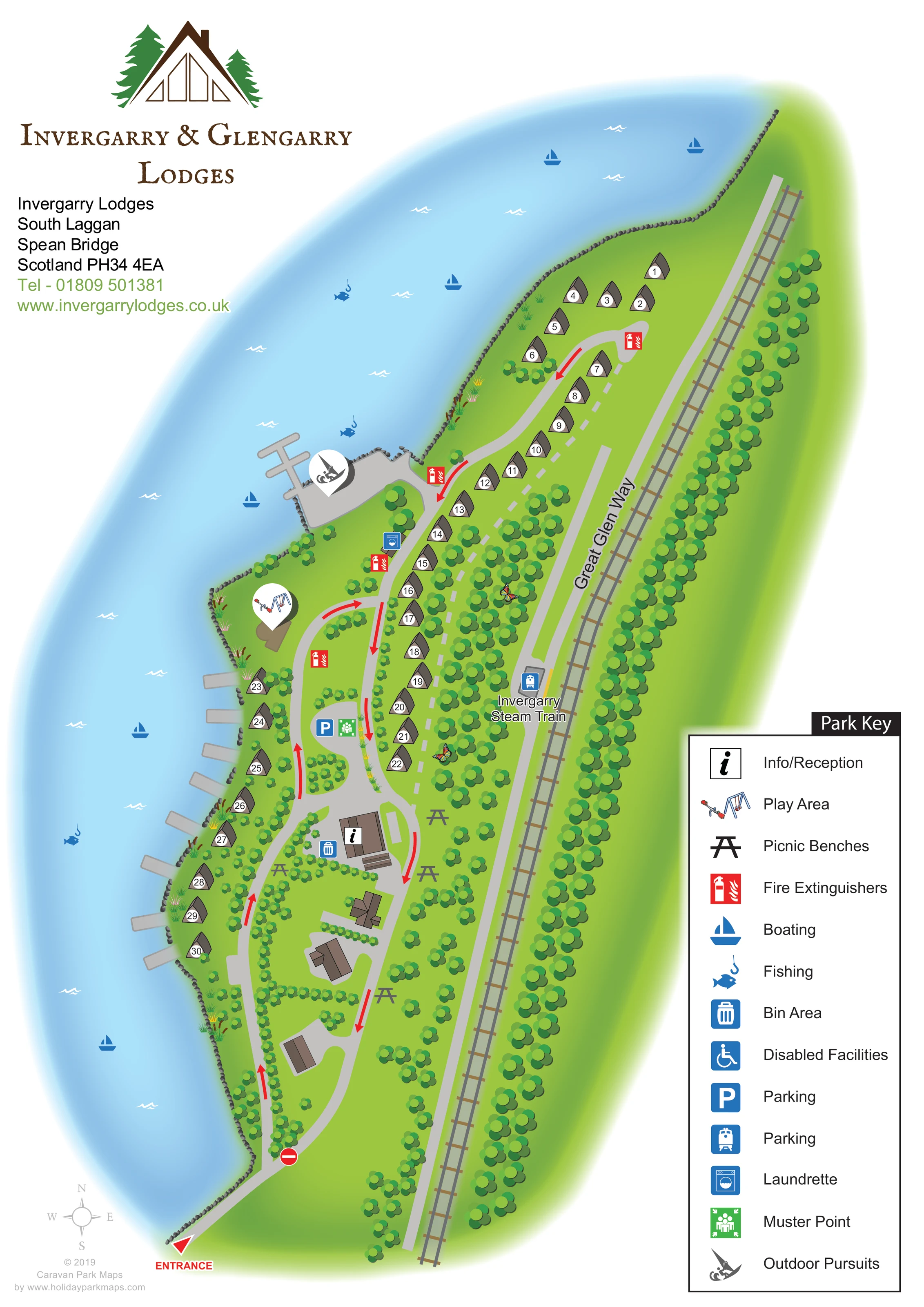
A broad blue loch occupies the western side of the artwork, following an irregular, stone-edged shore. Catalogue context identifies the setting as the southern end of Loch Oich.
ILLUSTRATED PARK MAP · P506
Invergarry Lodges, South Laggan, Spean Bridge, Scotland · United Kingdom
 Enlarge the map ↗
A SENSE OF THE PLACE
The Invergarry and Glengarry lodge maps show accommodation at the southern end of Loch Oich in the Great Glen. The estate is accessed from the A82 near Laggan Swing Bridge and lies beside the Great Glen Way.
The artwork presents the lodge areas in their lochside setting. It is retained as a map showcase, with older references to a bar, restaurant and leisure facilities omitted because their current operation is not established.
LOOK CLOSER
A broad blue loch occupies the western side of the artwork, following an irregular, stone-edged shore. Catalogue context identifies the setting as the southern end of Loch Oich.
Dense tree belts line the eastern boundary and railway, with smaller trees and shrubs separating lodges, roads and communal areas.
A red arrow and ENTRANCE label identify arrival at the bottom of the plan.
Grey roads run up the narrow site, with a lower loop, an extended northern branch, red directional arrows and a no-entry symbol near the southern junction.
A named pale-grey route follows the eastern side of the lodge grounds, parallel to the illustrated railway.
A railway track runs along the eastern edge, with an Invergarry Steam Train label and a blue train symbol beside a small platform-like area.
An information symbol identifies a brown-roofed building in the lower central part of the park.
A white location pin containing illustrated play equipment marks a play area near the western shore, above the parking area.
A broad blue loch occupies the western side of the artwork, following an irregular, stone-edged shore. Catalogue context identifies the setting as the southern end of Loch Oich.
Dense tree belts line the eastern boundary and railway, with smaller trees and shrubs separating lodges, roads and communal areas.
A red arrow and ENTRANCE label identify arrival at the bottom of the plan.
Grey roads run up the narrow site, with a lower loop, an extended northern branch, red directional arrows and a no-entry symbol near the southern junction.
A named pale-grey route follows the eastern side of the lodge grounds, parallel to the illustrated railway.
A railway track runs along the eastern edge, with an Invergarry Steam Train label and a blue train symbol beside a small platform-like area.
An information symbol identifies a brown-roofed building in the lower central part of the park.
A white location pin containing illustrated play equipment marks a play area near the western shore, above the parking area.
Several black picnic-table symbols appear around the lower central buildings and neighbouring green spaces.
Blue sailing-boat symbols are distributed across the illustrated loch.
Blue fish-and-hook symbols mark fishing on the loch.
A large activity pin marks a paved waterside area with a branching jetty near the middle of the shoreline.
A branching jetty and several smaller grey projections extend into the water beside the loch-edge accommodation.
A blue P symbol marks a central parking area beside the internal road and muster point.
A blue washing-machine symbol appears beside the road near the waterside activity area and inland lodge row.
A blue bin symbol is positioned beside the information/reception building.
Repeated red extinguisher symbols identify points along the main lodge access road and near the waterside activity area.
A green assembly symbol is shown beside the central parking symbol.
A wheelchair symbol is defined in the Park Key, but a corresponding location is not clearly visible on the plan.
READING THE MAP
This illustrated map of Invergarry & Glengarry Lodges presents a narrow Scottish lochside development where water, woodland and linear routes shape the visitor experience. Set at South Laggan near Spean Bridge, the artwork places approximately 30 lodges between the shore of Loch Oich and the railway corridor, with the Great Glen Way clearly named alongside the eastern edge.
Rather than arranging accommodation in a regular grid, the plan follows the site’s natural outline. One lodge row runs inland through the trees, while another follows the water’s edge. A southern entrance leads into a grey road network, with red arrows making the illustrated circulation easy to follow. Reception, parking, a play area, picnic benches and waterside activities provide recognisable destinations between the accommodation groups.
The design combines practical numbering with a strong sense of place. Blue water, bright green grounds, rounded trees and small chalet symbols make the layout approachable, while the large Park Key keeps service information separate from the landscape. It is a useful example of a visitor map for a compact lodge estate whose shoreline and neighbouring routes matter as much as its buildings.
The portrait composition uses the loch as its largest visual element, sweeping around the left side of the park and leaving a white area for the logo, title and contact details above. The site itself forms a long green strip, edged by a textured shoreline on one side and dense planting beside the railway on the other. A small compass appears near the southern entrance.
Numbered chalet symbols organise the accommodation into a long inland row, a northern cluster and a shorter waterside row. Grey roads connect these groups with the lower central reception area and several unlabelled brown-roofed buildings. Red arrows indicate the circulation shown in the artwork, and a no-entry symbol distinguishes one side of the entrance junction. A pale dashed line accompanies part of the inland lodge row.
The reception building carries an information symbol, with a bin point nearby. Parking and a green muster-point symbol sit farther north. The play area is marked by a large white pin containing illustrated equipment; a second pin identifies outdoor pursuits at a paved waterside area and branching jetty. Smaller shore projections appear beside the western lodges. Boating and fishing symbols are spread across the water, while picnic tables, a laundrette and repeated fire-extinguisher markers add practical detail on land.
Along the eastern edge, the named Great Glen Way runs beside a clearly drawn railway, with an Invergarry Steam Train label near a small platform-like feature. The large right-hand key explains the pictograms, including a disabled-facilities entry without a clearly visible mapped position. The accompanying enlargement repeats this same legend and eastern-edge detail; it is not a separate park section.
KEEP EXPLORING
Chosen for shared landscapes, accommodation or facilities.
 Explore the map ↗
United Kingdom
Woodland park map with mixed pitches, bell tents, lodges and a fishing lake.
 Explore the map ↗
United Kingdom
Illustrated lakeside park plan with numbered holiday units, leisure buildings and a looping Woodland Walk.
 Explore the map ↗
United Kingdom
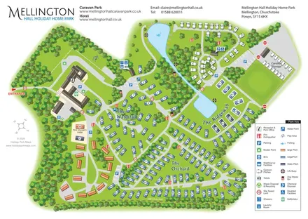
Wooded estate map with named lodge areas, lakeside touring, a hall-side arrival hub and Offa's Dyke Path.
Features may come from the sample artwork, its key or published park information. Approximate numbers describe the drawing and may cover only part of a park. They are intended to help you compare map examples. Current facilities and booking information should be checked with the park.
TAKE A CLOSER LOOK
View the illustrated map in detail or choose a file to download. These are sample maps; contact the park for current visitor information.


LET’S MAP YOUR PARK
For a map quotation, find your park and draw a rough boundary around it. The area you select helps us work out the design time and price.
Draw your park for a quote ↗Or talk to our map designers
01751 473136