
River corridor
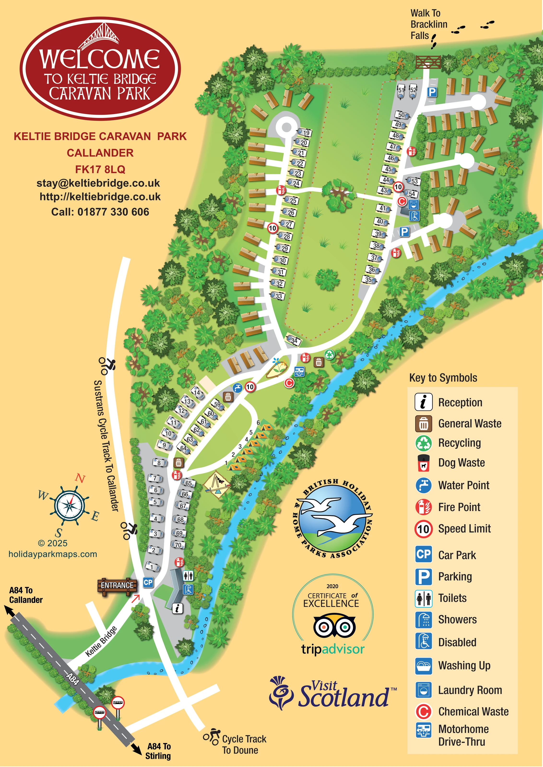
A bright blue, stone-dotted river curves around the lower approach and continues along the eastern park boundary. It is not named on the artwork.
ILLUSTRATED PARK MAP · P178
Stirling Road, Callander · United Kingdom
 Enlarge the map ↗
A SENSE OF THE PLACE
Keltie Bridge Caravan Park is based at Stirling Road, Callander. This is a riverside park near Callander within Loch Lomond and the Trossachs National Park. Small tent pitches lie beside the river; limited electric hook-up is available.
Indoor drying room and washing-up facilities with microwave and fridge/freezer are provided.
LOOK CLOSER
A bright blue, stone-dotted river curves around the lower approach and continues along the eastern park boundary. It is not named on the artwork.
Dense illustrated trees and shrubs surround the accommodation and line both sides of the river.
An elongated pale-green open area, edged with a small dashed boundary and dotted with trees and grass tufts, separates the main touring rows. No specific recreational use is labelled.
An ornamental flower illustration marks a small island where the lower access road meets the main loop.
An information symbol identifies reception at the elongated building beside the entrance and river.
A toilet symbol is placed at the entrance-side service building.
Wheelchair-and-shower symbols mark facilities at the entrance building and the upper service building. These symbols do not establish wider park accessibility.
A washing-machine symbol marks the service building beside the eastern touring row.
An information symbol identifies reception at the elongated building beside the entrance and river.
A toilet symbol is placed at the entrance-side service building.
Wheelchair-and-shower symbols mark facilities at the entrance building and the upper service building. These symbols do not establish wider park accessibility.
A washing-machine symbol marks the service building beside the eastern touring row.
Washing up appears in the symbol key, but a corresponding location is not clearly identified on the plan.
The key includes a standard shower icon. The shower-related symbols clearly located on the plan are the accessible shower icons.
A blue tap symbol marks a water point near the junction between the lower touring area and main accommodation loop.
Red C symbols identify disposal points at the central junction and beside the upper service building.
A dedicated blue motorhome service symbol appears beside the central junction, close to chemical waste and refuse facilities.
General waste symbols recur along the lower touring corridor and central junction; a recycling symbol is shown near the river at the junction.
A dog waste bin is included in the key, without a clearly identifiable matching placement on the plan.
Repeated red fire-point icons are distributed along accommodation roads and near service areas.
A CP marker identifies parking near reception, while P markers and drawn bays appear in the upper eastern section.
Illustrated swing equipment stands on a pale triangular play surface beside the riverside tent area.
A bright blue, stone-dotted river curves around the lower approach and continues along the eastern park boundary. It is not named on the artwork.
Dense illustrated trees and shrubs surround the accommodation and line both sides of the river.
An elongated pale-green open area, edged with a small dashed boundary and dotted with trees and grass tufts, separates the main touring rows. No specific recreational use is labelled.
An ornamental flower illustration marks a small island where the lower access road meets the main loop.
The entrance is prominently signed beside reception. The approach is labelled Keltie Bridge, with A84 arrows towards Callander and Stirling.
An external white route beside the western boundary is labelled Sustrans Cycle Track To Callander; the continuation below the entrance is labelled Cycle Track To Doune.
A gate at the upper end of the park, footprint symbols and the label Walk To Bracklinn Falls indicate an onward walking connection, not a complete walking-route map.
Two bus pictograms stand beside the illustrated A84 approach. No timetable or service information is provided.
Red-ringed 10 markers appear along the internal roads and are explained as speed-limit symbols in the key.
Operator information describes an indoor drying room and washing-up facilities with a microwave and fridge/freezer; these details are not individually located on the map.
The catalogue places this riverside park near Callander within Loch Lomond and the Trossachs National Park.
READING THE MAP
This illustrated map of Keltie Bridge Caravan Park in Callander brings a long riverside site into a single portrait layout. The river forms a bright blue thread along the park’s eastern edge, while dense tree illustrations frame the accommodation and separate it visually from the surrounding page. A large red welcome badge gives the artwork a clear identity without obscuring the plan.
The map shows a mixture of touring pitches, static caravans and a small riverside tent area. Numbered white touring symbols follow the entrance road and border a long central green; ochre-roofed static caravans occupy the outer rows and short cul-de-sacs. Reception, parking and practical service points are marked with a colour-coded symbol system explained in the right-hand key.
The setting also shapes the wayfinding. The A84 approach, Keltie Bridge and directions towards Callander and Stirling help explain arrival, while cycling connections towards Callander and Doune and a walking connection towards Bracklinn Falls extend the map beyond the park boundary. It is a useful example of combining mixed accommodation, visitor services and nearby outdoor routes in one illustrated design.
The portrait plan follows the park from its narrow entrance at the bottom to the wider accommodation area above. A dark grey A84 strip carries directional arrows for Callander and Stirling, with bus-stop pictograms beside it. The approach labelled Keltie Bridge leads to a timber-style entrance sign, a car-park marker and the reception building beside the river.
Beyond reception, touring pitches flank a white internal road. A short riverside strip contains numbered tent illustrations, with a small swing area nearby. At the junction further up, a planted island provides a visual landmark among water, waste, chemical-disposal and motorhome drive-through symbols. The main route then divides around a long open green. Touring pitches face this central space, while static caravans sit along the wooded western edge and in short eastern branches with circular turning heads.
Service symbols identify toilets at the entrance building, accessible shower facilities at two buildings, and laundry beside the upper touring row. Parking bays, fire points and red-ringed speed markers are distributed through the plan. The tall legend also explains washing-up, standard shower and dog-waste symbols, although their individual positions are not clearly marked.
The landscape is strongly illustrated rather than reduced to flat boundary lines. Layered trees, scattered grass tufts, river stones and shaded banks establish the riverside character. Outside the accommodation layout, cyclist symbols identify routes towards Callander and Doune. A gate and footprints at the upper edge indicate the connection towards Bracklinn Falls. The artwork is a single integrated plan, with branding, a decorative compass and association graphics arranged in the surrounding gold space rather than in separate map insets.
KEEP EXPLORING
Chosen for shared landscapes, accommodation or facilities.
 Explore the map ↗
United Kingdom
A lakeside holiday-park and fishery map with numbered accommodation, fishing positions and clearly grouped visitor services.
 Explore the map ↗
United Kingdom
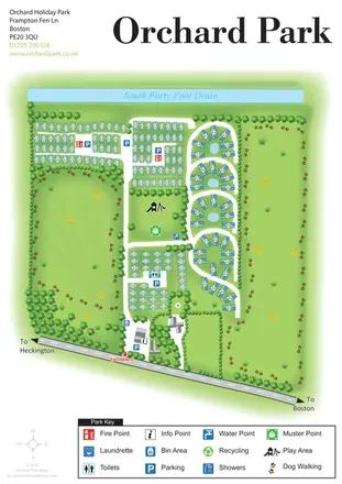
Orchard Holiday Park map with curved accommodation clusters, dog-walking lawns and a named waterside boundary.
 Explore the map ↗
United Kingdom
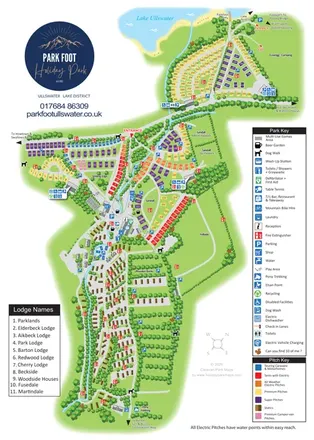
Portrait park map combining colour-coded pitches, static-caravan areas and Ullswater access.
Features may come from the sample artwork, its key or published park information. Approximate numbers describe the drawing and may cover only part of a park. They are intended to help you compare map examples. Current facilities and booking information should be checked with the park.
LET’S MAP YOUR PARK
For a map quotation, find your park and draw a rough boundary around it. The area you select helps us work out the design time and price.
Draw your park for a quote ↗Or talk to our map designers
01751 473136