
River Ribble
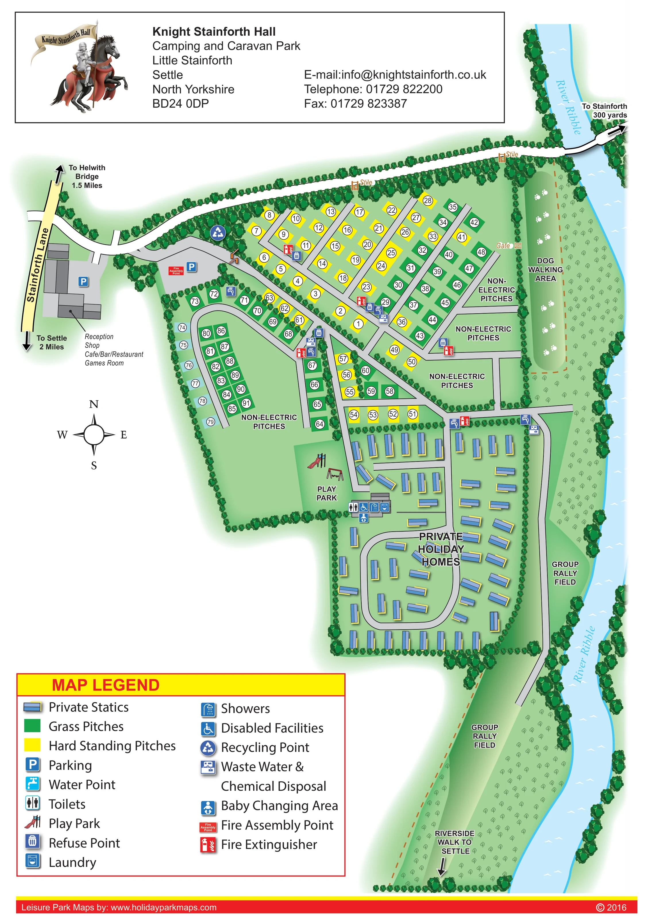
The named river runs down the eastern side of the artwork and curves alongside the lower rally field.
ILLUSTRATED PARK MAP · P514
Knight Stainforth Hall, Little Stainforth, Settle, North Yorkshire · United Kingdom
 Enlarge the map ↗
A SENSE OF THE PLACE
Knight Stainforth Hall Caravan and Camping Park sits beside the River Ribble near Settle in the Yorkshire Dales. The family-run site has a long camping history within the hall's estate.
Touring and tent pitches are available with a choice of electric arrangements. Toilets, showers, laundry and washing-up facilities support stays, while a restaurant, bar and wood-fired sauna add leisure options on site.
LOOK CLOSER
The named river runs down the eastern side of the artwork and curves alongside the lower rally field.
Dense illustrated trees frame the river, boundary road and accommodation enclosures, while smaller hedge-like rows separate pitch groups.
An annotation identifies reception within the entrance-side building complex beside Stainforth Lane.
Named alongside reception in the entrance building annotation.
The entrance complex is labelled Cafe/Bar/Restaurant.
A games room is included in the entrance building's list of uses.
Blue parking symbols mark spaces beside the entrance buildings and within the arrival area.
Illustrated slide and swings occupy a green space between the western touring area and the private holiday homes.
An annotation identifies reception within the entrance-side building complex beside Stainforth Lane.
Named alongside reception in the entrance building annotation.
The entrance complex is labelled Cafe/Bar/Restaurant.
A games room is included in the entrance building's list of uses.
Blue parking symbols mark spaces beside the entrance buildings and within the arrival area.
Illustrated slide and swings occupy a green space between the western touring area and the private holiday homes.
A grey building beside the play park carries toilet, shower and laundry symbols.
The legend's wheelchair symbol appears at the washroom building. It identifies mapped facilities rather than establishing wider site accessibility.
A baby-changing symbol is shown at the washroom building beside the play park.
Tap symbols are distributed around the touring pitch roads and near the northern edge of the private static area.
Refuse symbols occur at several pitch-road junctions; a recycling symbol is positioned near the wooded entrance-side boundary.
Disposal symbols mark service locations within the touring layout and beside the road towards the riverside fields.
Red extinguisher symbols are distributed through the pitch areas, with a labelled assembly point near the arrival parking.
The named river runs down the eastern side of the artwork and curves alongside the lower rally field.
Dense illustrated trees frame the river, boundary road and accommodation enclosures, while smaller hedge-like rows separate pitch groups.
A long riverside strip is explicitly labelled as a dog walking area and illustrated with white paw prints.
Two labelled open field areas extend along the river beyond the private holiday homes.
A dashed brown route continues through the lower riverside landscape, with a directional arrow towards Settle.
The western entrance connects to Stainforth Lane, with off-site arrows towards Settle and Helwith Bridge.
A white route follows the northern boundary and crosses the river towards a labelled Stainforth direction.
Two stiles are labelled along the northern boundary route, and a gate is marked between the pitch area and dog walking strip.
Mentioned in the supplied park information, but not identified on this artwork.
READING THE MAP
This illustrated map of Knight Stainforth Hall Camping and Caravan Park brings together a mixed accommodation layout and a distinctive riverside setting near Settle in North Yorkshire. The River Ribble runs down the right-hand side of the page, giving visitors an immediate reference point for the dog walking area, group rally fields and riverside route towards Settle.
Within the park, green grass pitches and yellow hardstanding pitches are arranged around a network of grey access roads. A separate enclosure of blue private static holiday homes occupies the lower part of the plan, while larger non-electric areas remain visibly open. Reception, the shop, café/bar/restaurant and games room are identified at the entrance from Stainforth Lane.
The artwork combines practical pitch numbering with recognisable trees, play equipment and facility symbols. A prominent two-column legend explains the services, and a mounted-knight logo gives the contact panel a park-specific identity. As a gallery sample, it demonstrates how a portrait site map can accommodate touring pitches, private holiday homes and surrounding recreational landscape without treating them as one undifferentiated area.
The single portrait plan is organised around a diagonal internal road running from the western entrance towards the centre of the park. Reception and the other entrance facilities occupy a grey building complex beside Stainforth Lane, with parking symbols and a nearby fire assembly point. Beyond this arrival area, straight road branches serve compact rows of numbered pitches. Yellow and green blocks distinguish hardstanding from grass, while a curved road encloses another touring group on the western side.
Several larger spaces carry non-electric pitch labels rather than individual accommodation symbols. Below the touring area, private holiday homes are illustrated as blue rectangular statics, arranged in rows and around a rounded road loop. The play park sits at the transition between these accommodation zones, with a slide and swings drawn beside a washroom building. Symbols there identify toilets, showers, laundry, disabled facilities and baby changing. Water, refuse, disposal and fire-extinguisher symbols appear at useful points throughout the road network.
The River Ribble defines the eastern boundary. A narrow dog walking area, decorated with paw prints, lies between the upper pitches and the river. Farther south, two group rally fields create a more open landscape, with a dashed walking route and an arrow towards Settle. Along the top of the plan, a white route crosses the river towards Stainforth; labelled stiles and a gate help explain connections around the boundary.
Dense tree belts, lighter hedging and soft green shading give the compartments a clear visual structure. The lower-left legend balances the tall river strip, while the upper identity panel and red footer frame the page. The enlarged detail views show portions of this same artwork, not separate park sections or additional accommodation.
KEEP EXPLORING
Chosen for shared landscapes, accommodation or facilities.
 Explore the map ↗
United Kingdom
Riverside park map with named pitch fields, illustrated huts and a paw-print dog walk.
 Explore the map ↗
United Kingdom
A woodland estate park map combining caravan loops, touring pitches, riverside paths and Bruce’s Cave landmarks.
 Explore the map ↗
United Kingdom
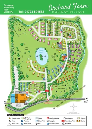
Colour-coded caravan sections, a fishing lake and tent meadow on a tree-lined Hunmanby holiday village map.
Features may come from the sample artwork, its key or published park information. Approximate numbers describe the drawing and may cover only part of a park. They are intended to help you compare map examples. Current facilities and booking information should be checked with the park.
TAKE A CLOSER LOOK
View the illustrated map in detail or choose a file to download. These are sample maps; contact the park for current visitor information.


LET’S MAP YOUR PARK
For a map quotation, find your park and draw a rough boundary around it. The area you select helps us work out the design time and price.
Draw your park for a quote ↗Or talk to our map designers
01751 473136