
Fishing lake
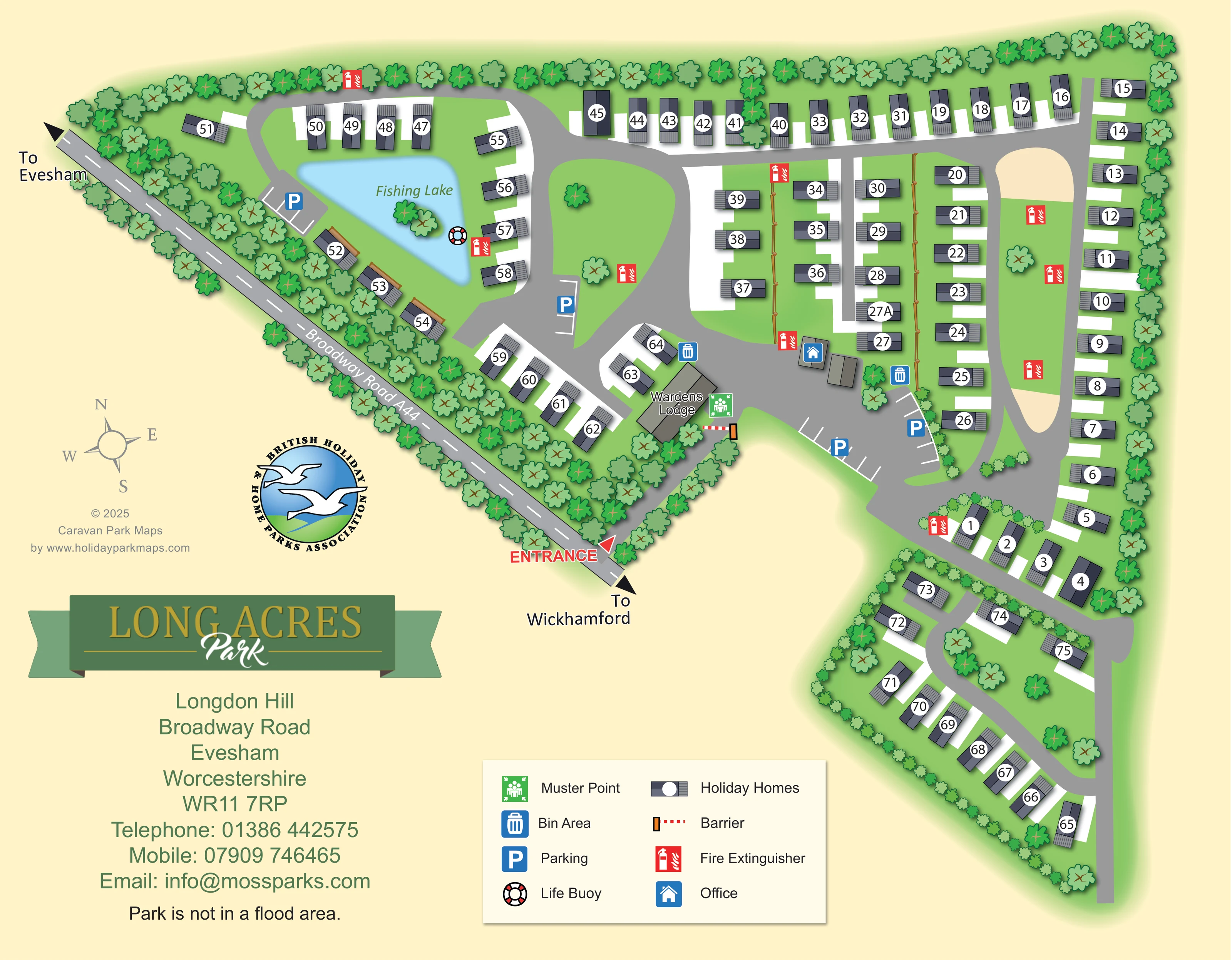
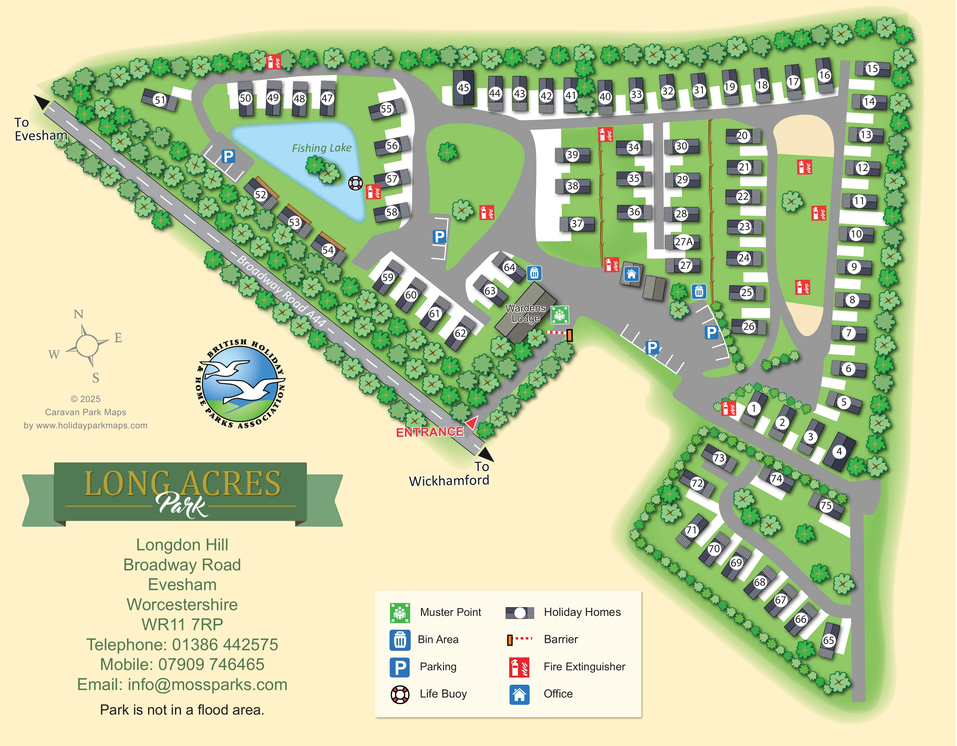
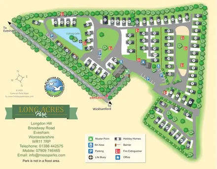
A labelled pale-blue, roughly triangular lake occupies the upper-left accommodation loop, with a small tree-covered island or planted feature within it.
ILLUSTRATED PARK MAP · P196
Longdon Hill, Broadway Road, Evesham, Worcestershire · United Kingdom
 Enlarge the map ↗
A SENSE OF THE PLACE
Long Acres Park is based at Longdon Hill, Wickhamford, Evesham, Worcestershire. The lodge park is near Evesham on the edge of the Cotswolds. An operator booking page links individual lodges available for holiday hire. The operator markets furnished holiday lodges and plots for purchase.
The map brings the site layout and its access routes together in one view, providing a reference for understanding the arrangement of the grounds.
LOOK CLOSER
A labelled pale-blue, roughly triangular lake occupies the upper-left accommodation loop, with a small tree-covered island or planted feature within it.
Dense stylised trees line much of the perimeter and the A44 frontage. Smaller shrubs divide accommodation sections, with scattered trees on the internal greens.
A blue office symbol marks a small building in the central arrival and parking area.
A larger grey building beside the entrance drive is labelled Wardens Lodge; it is separate from the numbered visitor accommodation.
Blue P symbols and white bay markings identify parking in the main arrival area, beside the lake and beside the central green.
Blue bin symbols mark disposal areas near the wardens' lodge and the central parking area.
Repeated red extinguisher symbols are distributed around the lake, accommodation rows, green spaces and internal roads.
A green assembly symbol is positioned beside the wardens' lodge near the entrance barrier.
A labelled pale-blue, roughly triangular lake occupies the upper-left accommodation loop, with a small tree-covered island or planted feature within it.
A blue office symbol marks a small building in the central arrival and parking area.
A larger grey building beside the entrance drive is labelled Wardens Lodge; it is separate from the numbered visitor accommodation.
Blue P symbols and white bay markings identify parking in the main arrival area, beside the lake and beside the central green.
Blue bin symbols mark disposal areas near the wardens' lodge and the central parking area.
Repeated red extinguisher symbols are distributed around the lake, accommodation rows, green spaces and internal roads.
A green assembly symbol is positioned beside the wardens' lodge near the entrance barrier.
A red-and-white life buoy symbol appears at the eastern edge of the fishing lake.
A red entrance label and arrow mark access from Broadway Road A44. A red-and-white barrier is shown on the entrance drive beside the wardens' lodge.
The diagonal public road is labelled Broadway Road A44, with arrows towards Evesham at the upper-left end and Wickhamford at the lower-right end.
Broad grey roads connect the entrance hub with the lake loop, central accommodation rows, a long right-hand loop and the smaller lower-right section.
Dense stylised trees line much of the perimeter and the A44 frontage. Smaller shrubs divide accommodation sections, with scattered trees on the internal greens.
READING THE MAP
This illustrated map of Long Acres Park brings a tree-lined holiday-home layout near Evesham into a single, readable plan. Set at Longdon Hill on Broadway Road, Worcestershire, the park is presented through its entrance, linked internal roads, numbered homes and a distinctive fishing lake. The lake gives the upper-left part of the map a clear focal point, while long perimeter rows, shorter central rows and a smaller lower-right section show how the accommodation is organised across the grounds.
The artwork combines practical visitor information with a recognisable park identity. Parking areas, the office and wardens' lodge are easy to locate around the arrival hub, and coloured symbols identify bin areas, fire extinguishers, the muster point and a life buoy. Direction arrows towards Evesham and Wickhamford connect the internal plan to the surrounding road network. A cream background, leafy green borders and dark-roofed home symbols keep the site distinct, while the ribbon-style Long Acres branding and compact legend give the page a clear information hierarchy.
The plan is anchored by Broadway Road A44, which runs diagonally along the left-hand boundary. Arrows indicate Evesham in one direction and Wickhamford in the other, and a bold red entrance label marks the turn into the park. The entrance drive passes the wardens' lodge and a red-and-white barrier before opening into the central office and parking area. From this hub, broad grey roads connect the main accommodation groups.
At the upper left, a curved road wraps around the labelled fishing lake, with holiday homes arranged along its outer edge and beside the wooded road frontage. A small planted feature appears within the blue water, and a life buoy symbol sits near the lake's eastern edge. Elsewhere, homes form a long upper boundary row, several short central rows and a tall right-hand loop surrounding an elongated landscaped island. The lower-right extension has a more enclosed character, with shrubs defining its boundary and homes following a curved road around scattered trees.
The accommodation is drawn as dark roof shapes with striped decking ends, adjacent white plot areas and large circular number labels. Larger grey footprints distinguish the office and wardens' lodge. Parking is shown through blue P symbols and white bay lines; bin areas and the muster point are concentrated around the arrival zone, while red fire extinguisher symbols appear throughout the site.
A two-column legend explains the symbol system beneath the plan. The green-and-gold park logo, address block, compass rose and association emblem occupy the open cream space to the left. The complete artwork is a single-page plan; its enlarged views reveal details of the same layout rather than separate park sections or additional maps.
KEEP EXPLORING
Chosen for shared landscapes, accommodation or facilities.
 Explore the map ↗
United Kingdom
Illustrated lakeside park plan with numbered holiday units, leisure buildings and a looping Woodland Walk.
 Explore the map ↗
United Kingdom
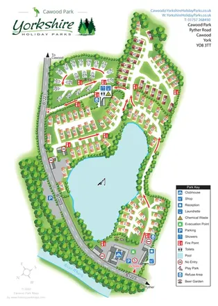
A lake-centred Cawood Park map with touring pitches, tree-lined holiday homes and clear entrance facilities.
 Explore the map ↗
United Kingdom
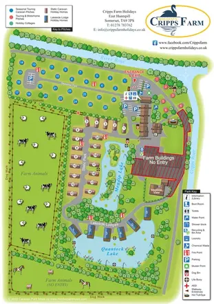
Illustrated farm holiday park plan combining riverside pitches, lakeside accommodation, animal fields and paw-print walking routes, with separate accommodation and facilities keys.
Features may come from the sample artwork, its key or published park information. Approximate numbers describe the drawing and may cover only part of a park. They are intended to help you compare map examples. Current facilities and booking information should be checked with the park.
TAKE A CLOSER LOOK
View the illustrated map in detail or choose a file to download. These are sample maps; contact the park for current visitor information.


LET’S MAP YOUR PARK
For a map quotation, find your park and draw a rough boundary around it. The area you select helps us work out the design time and price.
Draw your park for a quote ↗Or talk to our map designers
01751 473136
 afoldflyer_Page_2.png