
Dunes, beach and sea
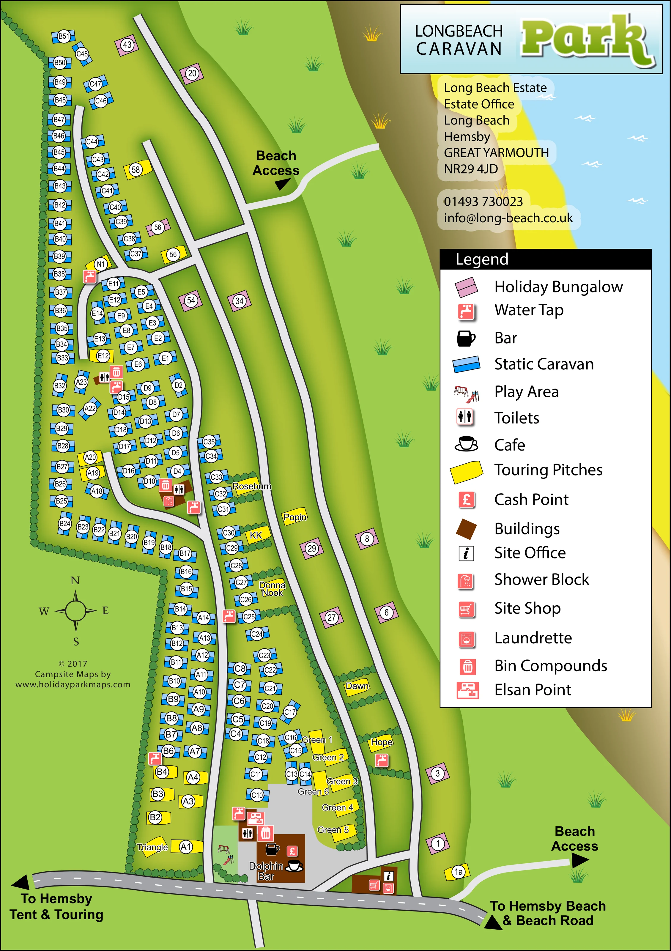
Broad green and brown dune bands run down the eastern side, leading to a bright yellow beach and pale blue sea with white wave marks.
ILLUSTRATED PARK MAP · P527
Long Beach, Hemsby, Great Yarmouth · United Kingdom
 Enlarge the map ↗
A SENSE OF THE PLACE
Long Beach Park is based at Long Beach, Hemsby, Great Yarmouth. The coastal park at Hemsby has access over dunes to the estate's beach. The park offers bungalow hire, glamping, static caravan ownership and seasonal touring; limited tent/touring stays are also advertised.
The park lists the Dolphin Bar, laundry, playpark, Wi-Fi, EV charging and grocery essentials.
LOOK CLOSER
Broad green and brown dune bands run down the eastern side, leading to a bright yellow beach and pale blue sea with white wave marks.
Repeated rounded hedge symbols enclose the western accommodation area and divide several named touring spaces.
Named building near the southern entrance, accompanied by the legend's bar symbol.
A cup-and-saucer symbol marks the Dolphin Bar building as a café location.
A red pound-sign icon is placed at the Dolphin Bar building.
An information symbol identifies the entrance-side building immediately north of the bottom road.
A shopping-trolley icon appears on the entrance-side service building.
A washing-machine icon is grouped with the shop and office symbols at the southern entrance.
Named building near the southern entrance, accompanied by the legend's bar symbol.
A cup-and-saucer symbol marks the Dolphin Bar building as a café location.
A red pound-sign icon is placed at the Dolphin Bar building.
An information symbol identifies the entrance-side building immediately north of the bottom road.
A shopping-trolley icon appears on the entrance-side service building.
A washing-machine icon is grouped with the shop and office symbols at the southern entrance.
Small swing and slide illustrations mark a play area beside the Dolphin Bar and southern caravan rows.
Toilet symbols are distributed through the accommodation area, including the internal loop and southern service cluster.
Shower icons identify facilities within the central caravan area and near the southern touring-pitch cluster.
Repeated red tap symbols mark water points along the accommodation lanes and beside touring pitches.
Bin icons are grouped with other service symbols at several points within the park.
An Elsan disposal symbol is shown in the southern service cluster near the Green touring pitches.
Two pale routes into the eastern dune area are labelled 'Beach Access', one towards the upper part of the plan and one beside the southern entrance road.
The bottom road points west to Hemsby Tent & Touring and east to Hemsby Beach & Beach Road.
Long north–south lanes, a western internal loop and short connecting roads organise access to the accommodation.
Broad green and brown dune bands run down the eastern side, leading to a bright yellow beach and pale blue sea with white wave marks.
Repeated rounded hedge symbols enclose the western accommodation area and divide several named touring spaces.
READING THE MAP
This map of Long Beach Park in Hemsby, Great Yarmouth, brings a long coastal site into a single portrait-format plan. Static caravans form the main accommodation area, with yellow touring pitches woven between the rows and pink holiday bungalows set more loosely beside the dune-side roads. To the east, broad bands of grass, dunes, beach and sea establish the park's coastal setting without competing with the practical information.
The southern entrance is a clear starting point: the office, shop and laundrette sit close to the road, while the Dolphin Bar and neighbouring play area provide recognisable landmarks just inside the park. Two labelled beach-access routes connect the accommodation lanes with the open landscape. Numbered plots, named touring spaces, a compass and a large pictorial legend support everyday navigation.
The sample is particularly relevant to mixed caravan and touring parks that need to show individual accommodation locations, dispersed services and access to a neighbouring beach in one readable design.
The plan follows the park's elongated shape, with a road across the bottom feeding several north–south lanes. A looping road serves the denser western caravan groups, while straighter lanes separate the central accommodation from the more open eastern side. Blue caravan symbols are arranged in rows and compact clusters, each identified by a white circular label. Yellow touring pitches appear among these rows and in named spaces divided by small illustrated hedges. The Green pitches form a distinctive group towards the southern end. Pink holiday bungalows are scattered beside the eastern roads rather than packed into the main caravan blocks.
Shared facilities are concentrated around the arrival area and repeated at useful points further into the site. The Dolphin Bar is labelled on a brown building footprint, with bar, café and cash-point symbols. A nearby playground is represented by a swing and slide. The entrance-side building carries office, shop and laundrette symbols. Toilets, showers, water taps and bin compounds are marked through the accommodation area, with an Elsan point near the southern touring cluster.
The right-hand landscape changes from green grass and dune bands to brown-toned slopes, yellow sand and pale blue water. Two narrow paths are labelled as beach access. The bottom road has arrows towards Hemsby Tent & Touring and towards Hemsby Beach & Beach Road, distinguishing onward destinations from accommodation shown within the plan.
A large legend occupies the right side below the branding and estate details. The accompanying enlargement is a closer view of this same legend and adjacent artwork, not an additional map or accommodation section.
KEEP EXPLORING
Chosen for shared landscapes, accommodation or facilities.
 Explore the map ↗
United Kingdom
Coastal park plan with colour-coded pitches, named neighbourhoods and a Morecambe Bay walking route.
 Explore the map ↗
United Kingdom
A colour-zoned coastal park map with touring areas, woodland trails, ponds and a leisure club.
 Explore the map ↗
United Kingdom
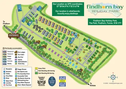
Illustrated mixed-accommodation park plan with colour-coded caravans, named eco units and a touring loop.
Features may come from the sample artwork, its key or published park information. Approximate numbers describe the drawing and may cover only part of a park. They are intended to help you compare map examples. Current facilities and booking information should be checked with the park.
TAKE A CLOSER LOOK
View the illustrated map in detail or choose a file to download. These are sample maps; contact the park for current visitor information.


LET’S MAP YOUR PARK
For a map quotation, find your park and draw a rough boundary around it. The area you select helps us work out the design time and price.
Draw your park for a quote ↗Or talk to our map designers
01751 473136