
Alpaca Field
Named central field illustrated with alpacas; additional alpaca artwork appears nearby.
ILLUSTRATED PARK MAP · P528
Longthorns Farm, Longthorns Wareham, Dorset · United Kingdom
 Enlarge the map ↗
A SENSE OF THE PLACE
Longthorns Farm offers camping and glamping in rural Dorset beside Monkey World. Spacious pitches, woodland walks and resident alpacas contribute to the farm setting.
Electric connections, showers and toilets support stays, with campfires part of the experience under site arrangements. The park welcomes dogs, and nearby attractions include the Tank Museum and the wider Dorset countryside and coast.
LOOK CLOSER
Named central field illustrated with alpacas; additional alpaca artwork appears nearby.
Named grass areas structure the plan. Airfield is a field name here, not evidence of an operational aviation facility.
Dense illustrated trees form the eastern boundary and wrap around the southern camping area.
Marked within the central building and service cluster just beyond the entrance.
Information symbol beside the entrance and initial internal road.
Shopping trolley symbol beside reception.
A grouped toilet, shower and disabled-shower symbol set marks facilities beside the central buildings.
Leaf-topped toilet symbol located in the Glamping Field.
Marked within the central building and service cluster just beyond the entrance.
Information symbol beside the entrance and initial internal road.
Shopping trolley symbol beside reception.
A grouped toilet, shower and disabled-shower symbol set marks facilities beside the central buildings.
Leaf-topped toilet symbol located in the Glamping Field.
Repeated blue dishwashing symbols serve the central facilities, Woodland Field and glamping area.
Tap symbols are distributed between the main pitch fields, service area and glamping approach.
Several waste-bin symbols appear around the site; recycling is marked at the central service area.
Yellow triangular disposal symbols appear near the entrance and central facilities.
Yellow lightning symbols identify selected hookup locations, rather than every pitch.
A picnic-table symbol appears beside Woodland Field.
Labelled beside the central buildings, west of reception.
A woodland wedding location is labelled at the northern end of the plan and marked with interlocking rings and a heart.
A long enclosed field beside the northern glamping area is labelled with a dog silhouette and paw prints.
Named central field illustrated with alpacas; additional alpaca artwork appears nearby.
Named grass areas structure the plan. Airfield is a field name here, not evidence of an operational aviation facility.
Dense illustrated trees form the eastern boundary and wrap around the southern camping area.
A yellow dashed route winds through the eastern woodland towards the northern wedding location.
Labelled at the southern woodland boundary where the dashed walking route begins.
The main entrance branches from Tout Hill, with external direction arrows to Bere Regis and Wool.
Black drinks pictograms appear beside the central service strip, but their precise service meaning is not explained in the key.
Included in the symbol key; no definite mapped location is identified.
Included in the symbol key without a clearly identifiable location or coverage area.
READING THE MAP
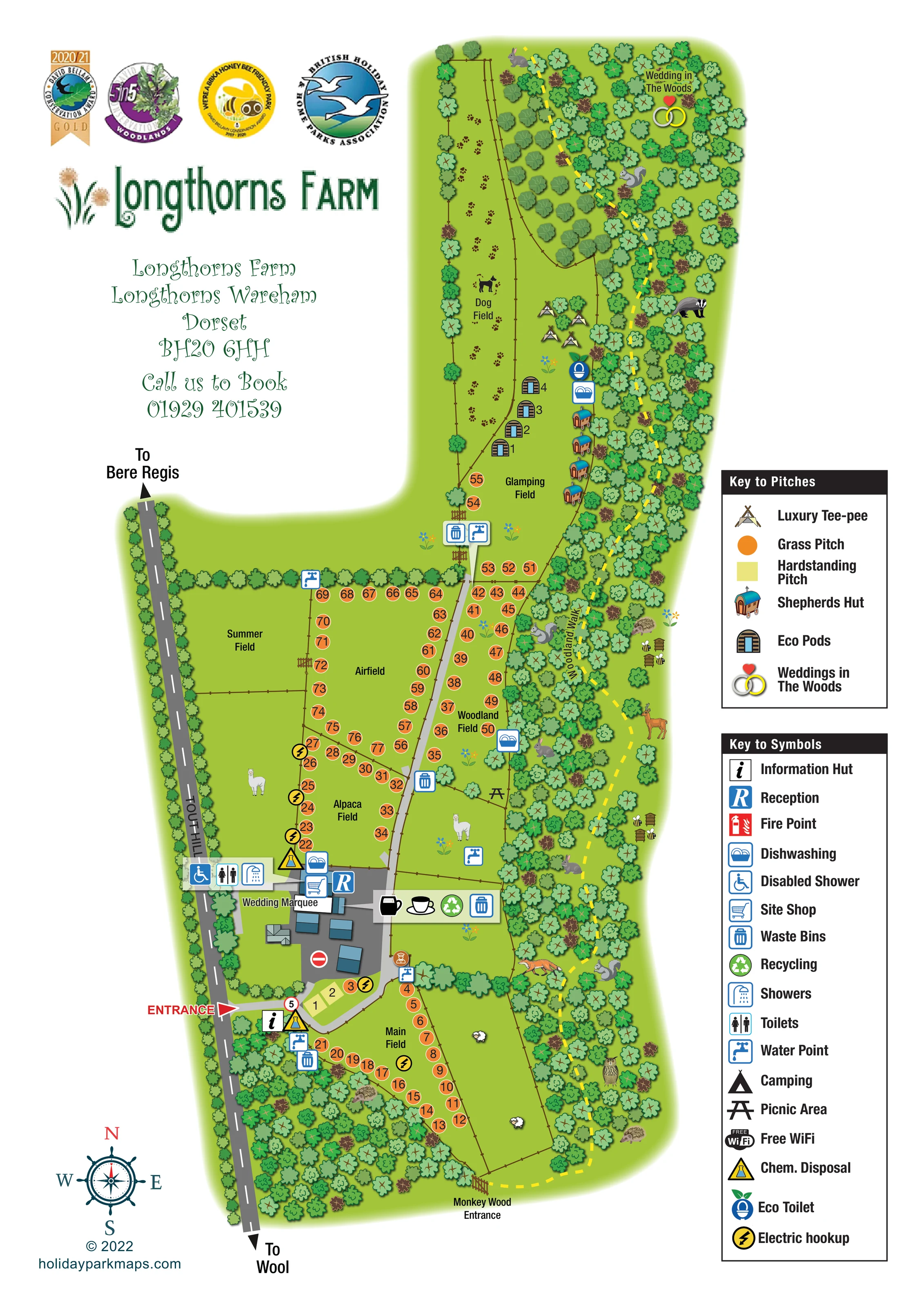
This illustrated map of Longthorns Farm brings together camping, glamping and woodland activities in a rural Dorset setting. The long, narrow site is arranged between Tout Hill and a richly drawn belt of trees, with named fields providing an easy framework for finding pitches and facilities. Orange pitch markers stand out against bright green grass, while miniature tee-pees, eco pods and shepherds huts give the northern Glamping Field a distinct identity.
The farm character is an important part of the artwork. Alpacas appear in the central fields, paw prints lead through the Dog Field, and woodland animals accompany a yellow dashed walking route. Wedding locations are also integrated into the plan, from the marquee near reception to the woodland ceremony setting at the northern end.
Practical information remains clearly separated from these illustrative details. Two keys explain pitch types and visitor symbols, while reception, washing facilities, water points and waste services are positioned around the site. The portrait composition leaves room for prominent farm branding and contact information without compressing the elongated layout.
The plan follows Longthorns Farm from its southern Main Field to the woodland wedding location at the northern tip. Tout Hill runs down the left-hand side, with arrows towards Bere Regis and Wool. A red entrance marker identifies the turn into the farm, where a short curved road passes the information hut and a small hardstanding area before reaching the central buildings.
Reception, the site shop, toilets, showers and a disabled-shower symbol are grouped around this arrival hub. Nearby markers identify dishwashing, chemical disposal, recycling and waste facilities, while the Wedding Marquee label sits to the west. Water and waste points recur farther into the pitch areas, helping the map serve visitors beyond their initial arrival.
The camping layout is divided into Main, Alpaca, Airfield and Woodland fields, with Summer Field shown alongside. Most numbered grass pitches follow the edges of these spaces rather than filling their centres. A pale grey internal lane continues north towards Glamping Field, where separate illustrations distinguish luxury tee-pees, eco pods and shepherds huts. An eco toilet and dishwashing point are shown nearby, and the elongated Dog Field occupies the neighbouring strip.
A dense band of illustrated trees defines the eastern side. Through it, the yellow dashed Woodland Walk links the southern Monkey Wood Entrance with the northern woodland wedding setting. Wildlife drawings and beehives add character along this route without acting as navigation symbols. The two right-hand keys explain accommodation styles and practical facilities, and a compass completes the orientation information. The accompanying detail view enlarges this same woodland edge and legend; it is not an additional site section or alternative layout.
KEEP EXPLORING
Chosen for shared landscapes, accommodation or facilities.
 Explore the map ↗
United Kingdom
Woodland-framed Barnsoul map with mixed accommodation, shared facilities and paw-marked walking routes.
 Explore the map ↗
United Kingdom
Illustrated farm campsite map with touring pitches, pods, camping fields and a riverside dog-walk route.
 Explore the map ↗
United Kingdom
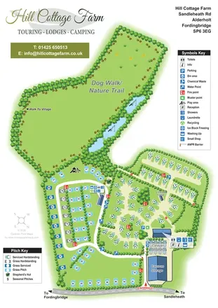
Portrait park map with mixed touring pitches, seasonal rows, ponds and an extensive dog walk.
Features may come from the sample artwork, its key or published park information. Approximate numbers describe the drawing and may cover only part of a park. They are intended to help you compare map examples. Current facilities and booking information should be checked with the park.
LET’S MAP YOUR PARK
For a map quotation, find your park and draw a rough boundary around it. The area you select helps us work out the design time and price.
Draw your park for a quote ↗Or talk to our map designers
01751 473136