
Recreational area
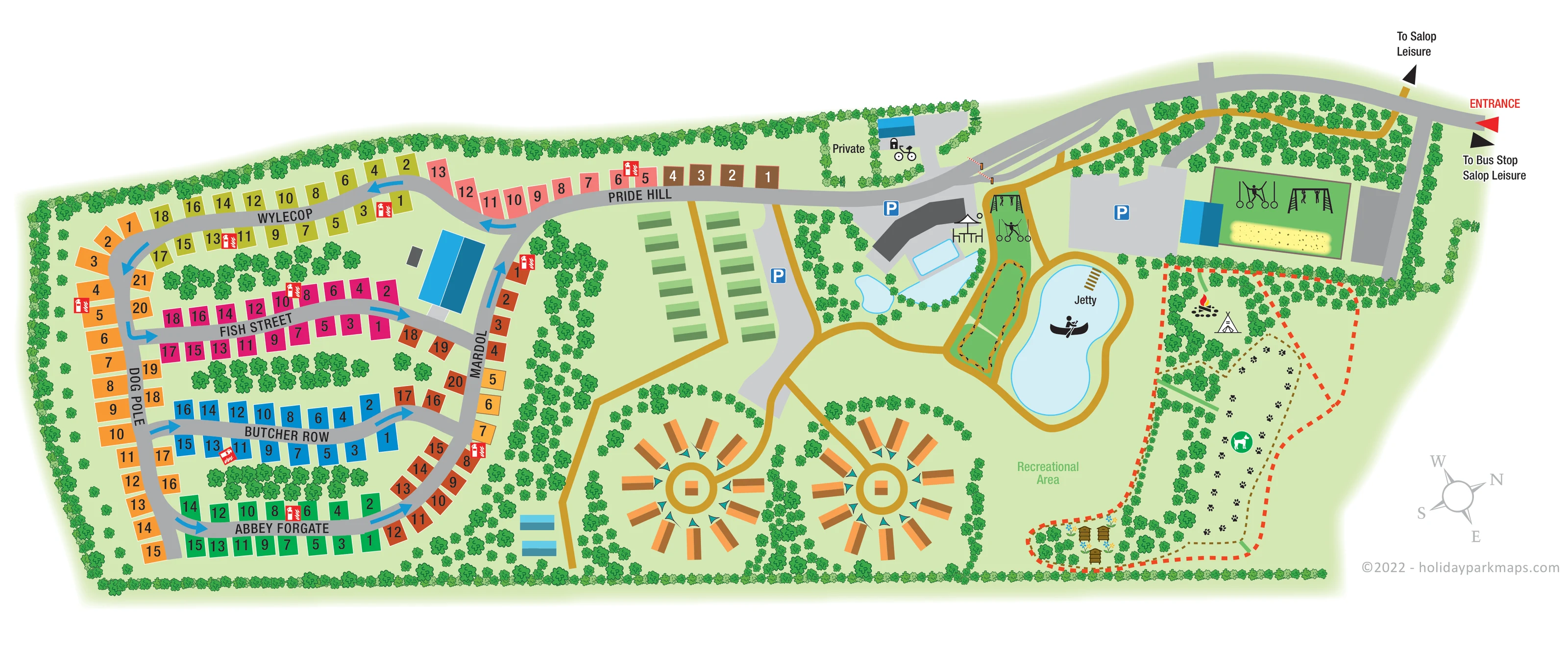
A broad open lawn south of the lake is explicitly labelled Recreational Area.
ILLUSTRATED PARK MAP · P529
Emstrey, Shrewsbury, Shropshire · United Kingdom
 Enlarge the map ↗
A SENSE OF THE PLACE
Love2Stay Shrewsbury offers glamping and serviced touring pitches at Emstrey in Shropshire. Landscaped grounds provide a setting close to the town and the Shropshire Hills.
The resort combines accommodation with family activities and shared leisure spaces. The map helps visitors navigate the Shrewsbury site and distinguish its touring and glamping areas from the operator's separate Mid Wales resort.
LOOK CLOSER
A broad open lawn south of the lake is explicitly labelled Recreational Area.
Continuous boundary planting, tree-filled islands between pitch roads and curved planting around glamping groups divide the site into distinct spaces.
A red ENTRANCE label and triangular marker identify arrival at the upper-right end of the approach road.
Black directional markers point towards Salop Leisure and the bus stop near the entrance.
Wylecop, Pride Hill, Fish Street, Butcher Row, Abbey Forgate, Dog Pole and Mardol organise the numbered pitch areas.
Large blue arrows indicate directions through the western accommodation road network.
Ochre paths link the entrance, central facilities, accommodation circles, activity spaces and lake perimeter.
Two small striped barrier arms are drawn on the internal approach near the private area.
A red ENTRANCE label and triangular marker identify arrival at the upper-right end of the approach road.
Black directional markers point towards Salop Leisure and the bus stop near the entrance.
Wylecop, Pride Hill, Fish Street, Butcher Row, Abbey Forgate, Dog Pole and Mardol organise the numbered pitch areas.
Large blue arrows indicate directions through the western accommodation road network.
Ochre paths link the entrance, central facilities, accommodation circles, activity spaces and lake perimeter.
Two small striped barrier arms are drawn on the internal approach near the private area.
Blue P symbols identify several parking areas beside the central buildings, green accommodation rows and eastern activity area.
Repeated red extinguisher-and-flame symbols mark fire points throughout the touring section.
An angular dark-roofed building and several blue-roofed structures provide prominent landmarks. Their individual functions are not named.
Pale-blue rectangular and irregular water shapes sit beside the main dark-roofed building, with a small pavilion-like structure nearby.
A kidney-shaped lake has a labelled jetty and a canoe pictogram, with a path around its edge.
Black silhouettes show hanging rings, climbing or monkey-bar frames and human figures in two activity spaces. The larger rectangular area also includes a yellow sand-like strip.
An elongated green loop with small dark edge details lies between the central water area and the lake. Its specific activity is not labelled.
A broad open lawn south of the lake is explicitly labelled Recreational Area.
A dog pictogram and repeated paw prints identify a long eastern exercise area outlined by a brown dashed line.
Campfire and tipi symbols appear in a tree-lined area above the dog exercise space; the tipi is not treated as accommodation capacity.
Three stylised beehives and flowers occupy a small planted corner at the southern end of the eastern activity grounds.
Continuous boundary planting, tree-filled islands between pitch roads and curved planting around glamping groups divide the site into distinct spaces.
A tree-enclosed plot beside the approach is labelled Private and includes a small building, padlock and bicycle symbols.
READING THE MAP
This illustrated map of Love2Stay at Emstrey, Shrewsbury, brings together a substantial touring area, distinctive glamping clusters and landscaped leisure grounds in one wide-format plan. Its most striking contrast is between the colour-coded pitch roads on the left and the more open arrangement of paths, water and activity spaces on the right.
The touring section uses numbered rectangles and road names drawn from Shrewsbury, including Pride Hill, Fish Street and Butcher Row. Two circular glamping groups create memorable landmarks along the southern edge, while the entrance and links towards Salop Leisure sit at the upper right. Between these areas, the map shows parking, central buildings, pool-like water spaces and a lake with a labelled jetty.
Trees do more than decorate the drawing: they separate pitch rows, frame accommodation groups and define the activity grounds. Dog-exercise symbols, a campfire and tipi, outdoor equipment and a small beehive corner add character without overwhelming the main routes. The result is a useful sample for parks needing to explain both accommodation choices and a varied outdoor visitor experience.
The plan reads from the entrance at the upper right towards the touring accommodation on the left. A broad grey approach curves past planted areas, parking and access barriers before joining Pride Hill. Black pointers provide outward directions to Salop Leisure and the bus stop, while the red entrance marker stands out from the quieter landscape colours.
The western touring area is organised around named roads, including Wylecop, Fish Street, Butcher Row and Abbey Forgate, connected by Dog Pole and Mardol. Brightly coloured pitch rectangles carry large numbers, and blue arrows show directions through the network. Tree-filled islands break up the rows, while repeated red fire-point symbols remain easy to pick out. A large blue-roofed building forms another visual landmark within this section.
Towards the middle, two parallel rows of green rectangular units sit beside a path and parking area. Below them, two orange glamping groups radiate around circular shared spaces. Small teal details and enclosing trees give these clusters a different visual identity from the touring pitches.
The eastern half contains most of the illustrated leisure features. An angular dark-roofed building overlooks pale-blue water spaces and a small pavilion-like structure. Beyond it are activity frames, a narrow green loop and a kidney-shaped lake with a jetty and canoe symbol. Ochre paths connect these features and continue around the lake towards the labelled recreational lawn.
At the far right, paw prints and a dog symbol distinguish an exercise area. Nearby are campfire and tipi symbols, with illustrated beehives and flowers at the southern end. The single panoramic artwork finishes with a compass and designer credit in the white lower-right margin.
KEEP EXPLORING
Chosen for shared landscapes, accommodation or facilities.
 Explore the map ↗
United Kingdom
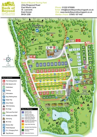
Colour-coded touring pitches, named glamping units and woodland routes at Back of Beyond Touring Park.
 Explore the map ↗
United Kingdom
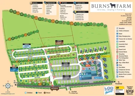
Colour-coded camping and touring sections, illustrated glamping units and a detailed amenities hub at Burns Farm.
 Explore the map ↗
United Kingdom
Illustrated farm campsite map with touring pitches, pods, camping fields and a riverside dog-walk route.
Features may come from the sample artwork, its key or published park information. Approximate numbers describe the drawing and may cover only part of a park. They are intended to help you compare map examples. Current facilities and booking information should be checked with the park.
TAKE A CLOSER LOOK
View the illustrated map in detail or choose a file to download. These are sample maps; contact the park for current visitor information.


LET’S MAP YOUR PARK
For a map quotation, find your park and draw a rough boundary around it. The area you select helps us work out the design time and price.
Draw your park for a quote ↗Or talk to our map designers
01751 473136