
Wooded lake island and shoreline planting
A substantial tree-covered island and a narrow planted strip within the eastern part of the lake give the water feature a distinctive wooded character.
ILLUSTRATED PARK MAP · P208
Sheriff Hutton Road, Strensall, York · United Kingdom
 Enlarge the map ↗
A SENSE OF THE PLACE
Manor Country Park is based at Sheriff Hutton Road, Strensall, York. The countryside location is near York, with shops, bars and restaurants in Strensall village. The gated park offers holiday lodges and cottages.
The page lists a fishing lake and Wi-Fi; cottage options include private gardens and hot tubs.
LOOK CLOSER
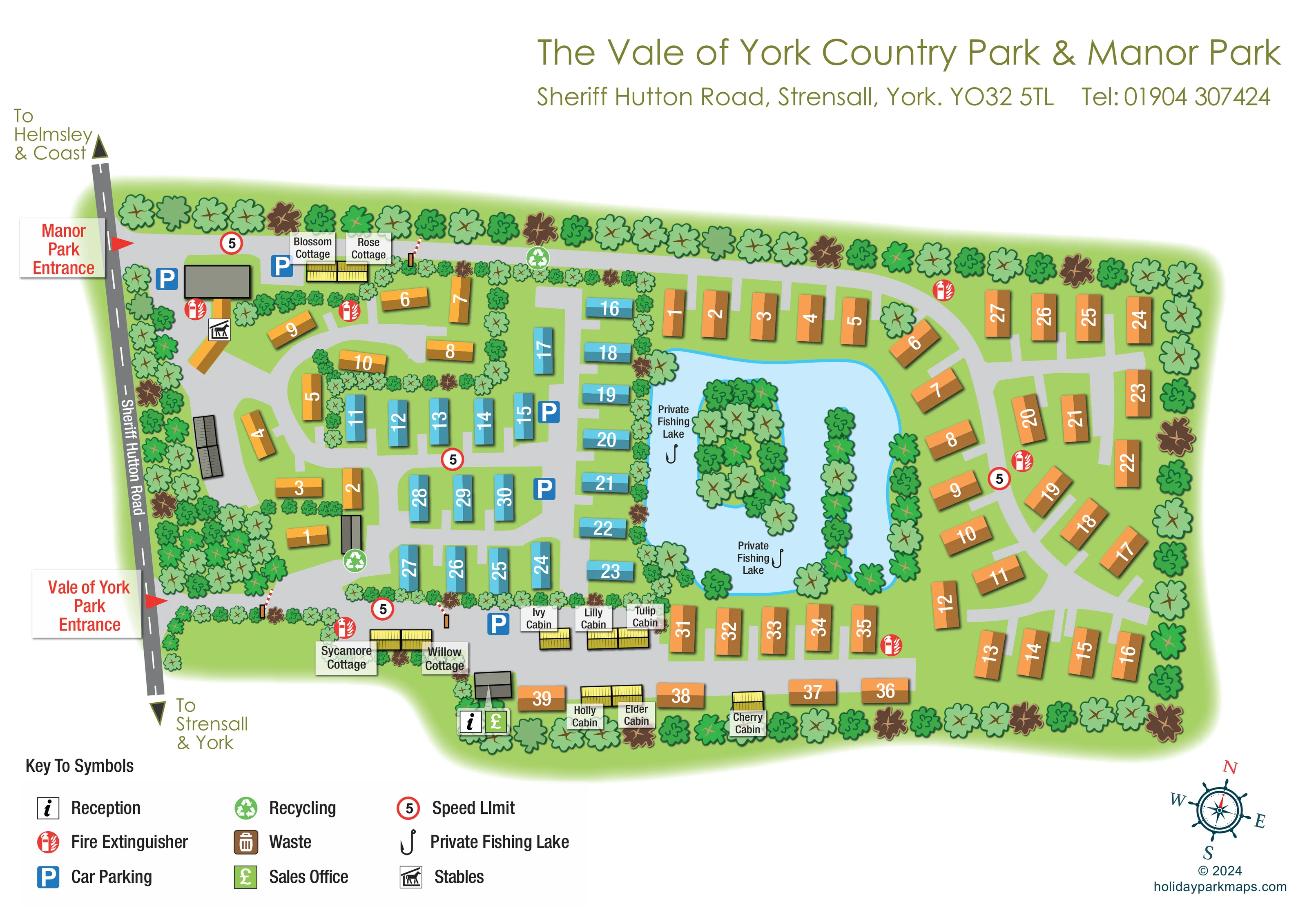
A substantial tree-covered island and a narrow planted strip within the eastern part of the lake give the water feature a distinctive wooded character.
Repeated tree crowns enclose much of the park, divide western accommodation groups and frame the lake and southern boundary.
A large, irregular blue lake occupies the centre-right of the plan, with two fishing labels and hook symbols within the same depicted waterbody.
The reception information symbol is beside a grey building near the southern boundary, close to the named cabins and lower accommodation road.
A green pound-sign symbol marks the sales office beside reception at the southern edge.
A horse-and-roof pictogram identifies stables within the western entrance area.
Blue parking symbols appear near the upper entrance, central accommodation rows and southern cottages and cabins.
Green recycling symbols mark points beside the northern road and in the western accommodation area.
A large, irregular blue lake occupies the centre-right of the plan, with two fishing labels and hook symbols within the same depicted waterbody.
A substantial tree-covered island and a narrow planted strip within the eastern part of the lake give the water feature a distinctive wooded character.
The reception information symbol is beside a grey building near the southern boundary, close to the named cabins and lower accommodation road.
A green pound-sign symbol marks the sales office beside reception at the southern edge.
A horse-and-roof pictogram identifies stables within the western entrance area.
Blue parking symbols appear near the upper entrance, central accommodation rows and southern cottages and cabins.
Green recycling symbols mark points beside the northern road and in the western accommodation area.
Red fire extinguisher symbols are distributed around the accommodation roads and entrance areas.
Red-ringed signs displaying 5 appear at several points on the internal road network; the legend identifies them as speed-limit symbols.
A brown waste-bin symbol is included in the key, but a corresponding location is not clearly identifiable on the main plan.
Two red-arrow entrance callouts sit on Sheriff Hutton Road: Manor Park above and Vale of York Park below.
Small red-and-white barrier illustrations appear on internal approaches near the upper cottages and lower entrance route.
The external road follows the left edge, with directional arrows towards Helmsley and the coast above, and Strensall and York below.
Broad grey roads form western loops, central short spurs and a curving circuit around the lake and eastern accommodation.
Repeated tree crowns enclose much of the park, divide western accommodation groups and frame the lake and southern boundary.
Wi-Fi is listed in the operator information for Manor Country Park, but is not represented on this map.
The operator information describes cottage options with private gardens and hot tubs; these amenities are not specifically labelled in the artwork.
READING THE MAP
This illustrated map brings Manor Park and The Vale of York Country Park together on one landscape-format plan at Sheriff Hutton Road, Strensall, near York. Two clearly marked roadside entrances establish the starting points, while a large private fishing lake gives the accommodation layout an immediately recognisable centrepiece. Trees frame the grounds, divide smaller groups of units and fill an island within the lake.
The artwork combines numbered holiday accommodation with individually named cottages and cabins. Orange and blue roof blocks make the accommodation groups visually distinct, while yellow-roofed buildings and compact name labels identify the smaller named properties. Broad grey roads show how the western loops, central rows and lakeside accommodation connect.
Practical information remains separate from the landscape illustration: parking, reception, the sales office, stables, recycling and fire extinguisher points use clear pictograms, explained in a key beneath the plan. The result is a useful sample for countryside holiday developments that need to show adjoining park areas, several accommodation groups and a strong landscape landmark without losing the detail needed for visitor orientation.
Sheriff Hutton Road runs down the left side of the artwork, with arrows pointing towards Helmsley and the coast at the top and Strensall and York at the bottom. Red callouts identify the Manor Park entrance and the Vale of York Park entrance separately. Small illustrated barriers and nearby parking symbols add detail to the arrival areas.
Inside the grounds, the western section uses curved roads and planted divisions to organise a compact group of orange numbered units. Blossom and Rose cottages sit close to the upper road, while Sycamore and Willow cottages appear towards the lower entrance area. The central section is more regular, with blue accommodation blocks arranged along short road spurs and down the western side of the lake.
The eastern half is dominated by the pale blue private fishing lake. Its irregular shoreline, wooded island and narrow strip of planting make it the main visual landmark. Orange accommodation follows the upper boundary, curves around the eastern shore and continues along the southern road. Named cabins, including Ivy, Lilly, Tulip, Holly, Elder and Cherry, occupy the lower edge of the plan. Reception and the sales office are marked together beside a small grey building nearby.
A three-column key explains the practical symbols, including stables, parking, recycling, fire extinguishers and speed-limit markers. Waste also appears in the key, without a clearly identifiable plotted position. The white page leaves space for the joint park heading above and a decorative compass below right. The accompanying detail views enlarge the key and compass area; they are crops of this same artwork, not additional park sections.
KEEP EXPLORING
Chosen for shared landscapes, accommodation or facilities.
 Explore the map ↗
United Kingdom
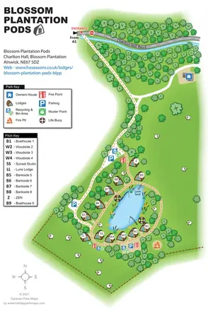
Illustrated lakeside pod map with woodland arrival routes, named lodges and a waterside circuit.
 Explore the map ↗
United Kingdom
Woodland park map with mixed pitches, bell tents, lodges and a fishing lake.
 Explore the map ↗
United Kingdom
Illustrated lakeside park plan with numbered holiday units, leisure buildings and a looping Woodland Walk.
Features may come from the sample artwork, its key or published park information. Approximate numbers describe the drawing and may cover only part of a park. They are intended to help you compare map examples. Current facilities and booking information should be checked with the park.
LET’S MAP YOUR PARK
For a map quotation, find your park and draw a rough boundary around it. The area you select helps us work out the design time and price.
Draw your park for a quote ↗Or talk to our map designers
01751 473136