
Tree-bordered parkland
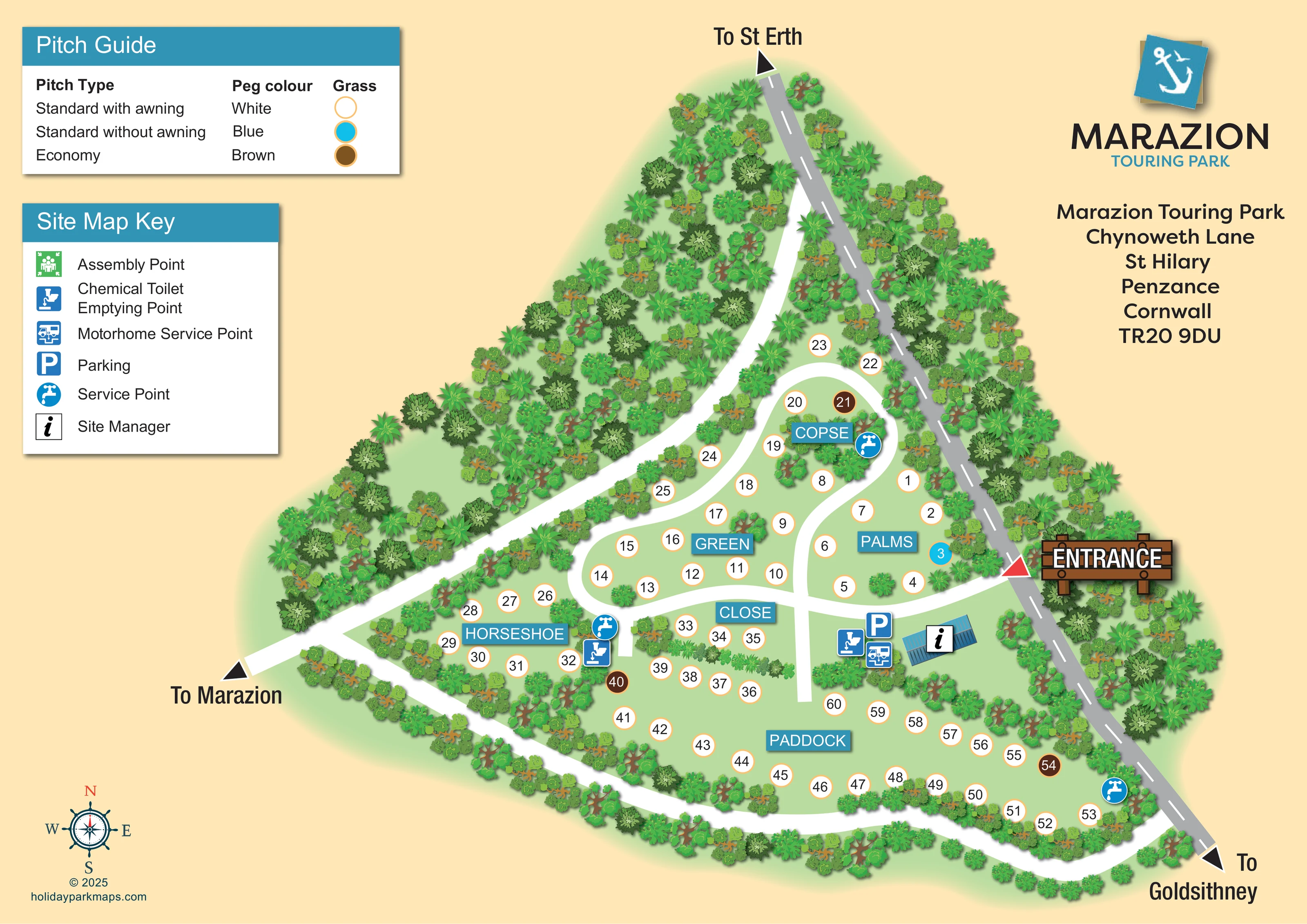
Dense illustrated trees enclose much of the site, with a particularly broad wooded strip on the north-western side and planted divisions between pitch areas.
ILLUSTRATED PARK MAP · P210
Marazion Touring Park, Chynoweth Lane, St Hilary, Penzance, Cornwall · United Kingdom
 Enlarge the map ↗
A SENSE OF THE PLACE
Marazion Touring Park is set in countryside near St Hilary in west Cornwall. Grass pitches within tree-bordered parkland provide a base for exploring Marazion, Penzance and St Michael's Mount.
Many pitches have electric connections and space for an awning. Toilets and showers support camping as well as touring stays, and dogs are welcomed. The map helps visitors find their way around this quieter rural site.
LOOK CLOSER
Dense illustrated trees enclose much of the site, with a particularly broad wooded strip on the north-western side and planted divisions between pitch areas.
Spiky palm-like crowns are mixed with broadleaf tree symbols around the boundary and internal planting.
Palms, Copse, Green, Close, Horseshoe and Paddock divide the numbered pitches into recognisable groups.
The guide identifies standard with awning, standard without awning and economy pitches, using white, blue and brown peg colours respectively. Matching circular markers appear on the plan.
A small blue-roofed building near the entrance carries the site manager information symbol.
A parking symbol is positioned beside the entrance-side service cluster and site manager building.
A motorhome service point is marked beside the parking and site manager area.
Disposal symbols appear at the entrance-side service cluster and near the junction of Horseshoe and Close.
Palms, Copse, Green, Close, Horseshoe and Paddock divide the numbered pitches into recognisable groups.
The guide identifies standard with awning, standard without awning and economy pitches, using white, blue and brown peg colours respectively. Matching circular markers appear on the plan.
A small blue-roofed building near the entrance carries the site manager information symbol.
A parking symbol is positioned beside the entrance-side service cluster and site manager building.
A motorhome service point is marked beside the parking and site manager area.
Disposal symbols appear at the entrance-side service cluster and near the junction of Horseshoe and Close.
Blue tap symbols mark service points near Copse, beside Horseshoe and Close, and at the eastern end of Paddock.
The site map key includes an assembly point symbol, but its position is not evident on the main plan.
Dense illustrated trees enclose much of the site, with a particularly broad wooded strip on the north-western side and planted divisions between pitch areas.
Spiky palm-like crowns are mixed with broadleaf tree symbols around the boundary and internal planting.
A timber-style entrance sign and red triangular marker identify access from the grey road along the eastern edge.
Broad white routes loop and branch through the pitch groups, with a perimeter connection around the southern side and a route extending north through the trees.
Directional arrows indicate St Erth to the north, Goldsithney to the south-east and Marazion to the west.
A nautical-style compass rose at the lower left provides north, south, east and west orientation.
Park information describes toilets and showers for touring and camping stays; these facilities are not separately labelled on this artwork.
Park information states that many pitches have electric connections. The map does not identify individual electric hook-up allocations.
READING THE MAP
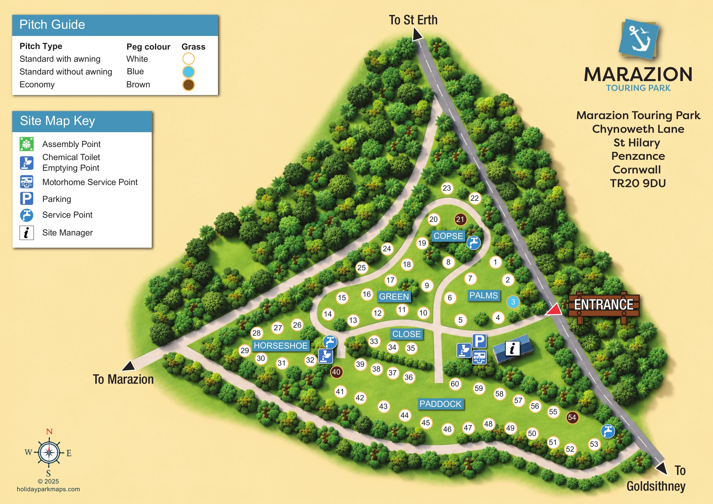
This illustrated map presents Marazion Touring Park as a compact, tree-bordered touring site in the countryside near St Hilary, west Cornwall. Its roughly 60 grass pitches are organised into six named areas: Palms, Copse, Green, Close, Horseshoe and Paddock. Rather than filling the plan with caravan illustrations, the design uses clear numbered circles, allowing visitors to follow the site's curving routes and understand the relationship between each pitch group.
The entrance is prominent on the eastern edge, close to the site manager building, parking and motorhome service point. Blue facility symbols stand out against pale green grass, while white routes connect the smaller northern pockets with the broader southern Paddock. A separate pitch guide explains the white, blue and brown markers used for the different grass pitch categories.
Dense illustrated planting gives the map its rural character. Turquoise headings, an anchor-themed park logo and a nautical compass add a coastal visual accent, while directions to Marazion, St Erth and Goldsithney place the site within its local surroundings.
The main plan has an irregular triangular shape, with a grey road running down its eastern boundary and dense trees wrapping around much of the remaining perimeter. A timber-style entrance sign marks the point where visitors turn into the park. Just inside, a blue-roofed site manager building sits beside parking, a motorhome service point and a chemical toilet emptying point, making the arrival area easy to recognise.
Broad white routes branch through the site. Palms occupies the grass immediately north of the entrance, while Copse forms a smaller pocket further north. Green lies centrally, with Close below it and Horseshoe towards the western side. Paddock extends across the broad southern section. Numbered pitch circles follow the curves of these spaces, and planting clusters separate groups without hiding their connections. Further service points appear near Copse, between Horseshoe and Close, and towards the eastern end of Paddock.
Two reference panels occupy the upper-left part of the page. The Pitch Guide distinguishes standard grass pitches with awning space, standard pitches without awning space and economy pitches through white, blue and brown markers. The Site Map Key explains the facility pictograms, including an assembly point symbol listed in the key. Turquoise area-name plaques provide larger landmarks among the individual pitch numbers.
Direction arrows point towards St Erth, Goldsithney and Marazion, and a compass rose anchors the lower-left corner. The park logo and postal address balance the legends at upper right. The accompanying enlarged view shows the same artwork's facility key, planting and western route towards Marazion; it is a detail view, not a separate park section.
 Enlarge this map ↗
KEEP EXPLORING
Chosen for shared landscapes, accommodation or facilities.
 Explore the map ↗
United Kingdom
Ashby Park map with seven fishing lakes, colour-coded accommodation and illustrated wooded shorelines.
 Explore the map ↗
United Kingdom
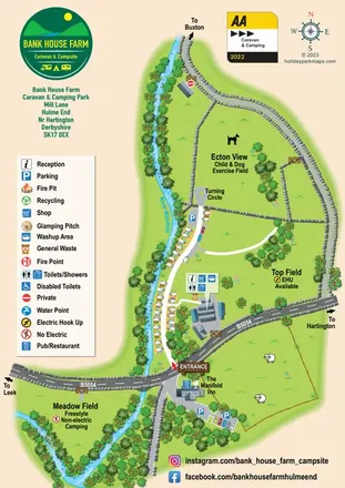
Riverside campsite map with named camping fields, touring-caravan rows and illustrated stone-wall boundaries.
 Explore the map ↗
United Kingdom
Woodland-framed Barnsoul map with mixed accommodation, shared facilities and paw-marked walking routes.
Features may come from the sample artwork, its key or published park information. Approximate numbers describe the drawing and may cover only part of a park. They are intended to help you compare map examples. Current facilities and booking information should be checked with the park.
LET’S MAP YOUR PARK
For a map quotation, find your park and draw a rough boundary around it. The area you select helps us work out the design time and price.
Draw your park for a quote ↗Or talk to our map designers
01751 473136