
Alpaca Field and Alpaca Shed
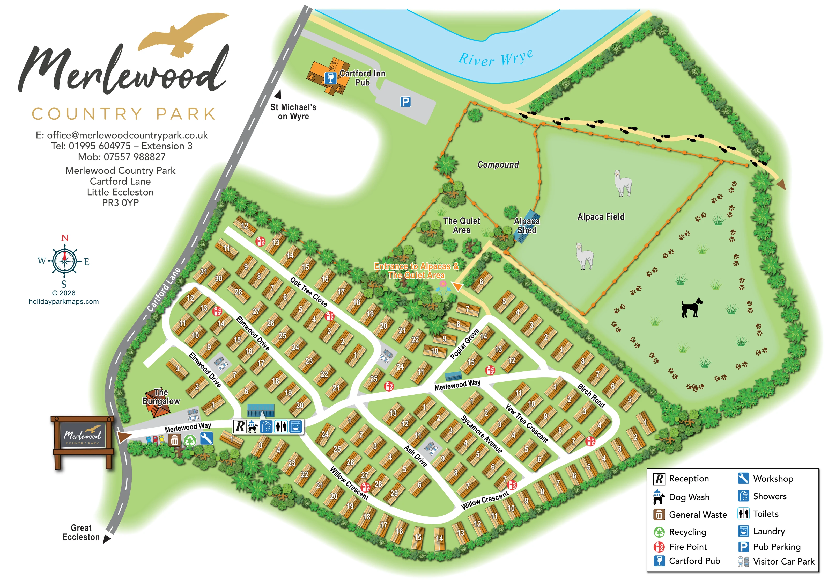
A large orange-fenced field contains alpaca illustrations. A small blue-roofed shed is labelled at its western edge.
ILLUSTRATED PARK MAP · P213
Compound Merlewood Country Park, Cartford Lane, Little Eccleston · United Kingdom
 Enlarge the map ↗
A SENSE OF THE PLACE
Merlewood Country Park occupies a hillside at Little Eccleston, with views over the River Wyre and surrounding hills. Its pitches are developed for privately owned caravan holiday homes.
A laundry and dedicated dog walk support owners' stays. Leisure-club access is offered at the separate Acresfield Health Club and Spa, rather than as an on-site swimming facility. The map illustrates the park's hillside layout.
LOOK CLOSER
A large orange-fenced field contains alpaca illustrations. A small blue-roofed shed is labelled at its western edge.
A planted area between the accommodation and the fenced compound is labelled The Quiet Area. A highlighted entrance leads towards it and the alpacas.
An elongated green area along the eastern side of the alpaca field is identified pictorially by a dog silhouette and repeated pawprints.
A broad pale-blue river curves across the top of the composition, with a cyan outline and an italic blue name.
Dense illustrated vegetation encloses much of the park, separates the homes from the fields and gives The Quiet Area a more wooded character.
An R symbol marks reception beside Merlewood Way near the entrance, within a grouped service callout.
Three facility symbols appear together beside reception, pointing towards a blue-roofed service building.
A dog-and-water symbol is included in the reception-side facility group.
An R symbol marks reception beside Merlewood Way near the entrance, within a grouped service callout.
Three facility symbols appear together beside reception, pointing towards a blue-roofed service building.
A dog-and-water symbol is included in the reception-side facility group.
Waste and recycling symbols, accompanied by illustrated coloured bins, mark a service area just inside the Cartford Lane entrance.
A blue spanner symbol marks the workshop in the entrance-side service area.
Red circular fire-point symbols are distributed through the accommodation neighbourhoods.
Small grey parking areas containing paired car illustrations appear at several locations among the holiday homes.
The nearby pub is labelled outside the accommodation area, beside Cartford Lane and the River Wyre, with an illustrated orange-roofed building and a blue glass symbol.
A separate grey parking area beside the Cartford Inn is marked with a blue P symbol.
A large orange-fenced field contains alpaca illustrations. A small blue-roofed shed is labelled at its western edge.
A planted area between the accommodation and the fenced compound is labelled The Quiet Area. A highlighted entrance leads towards it and the alpacas.
An elongated green area along the eastern side of the alpaca field is identified pictorially by a dog silhouette and repeated pawprints.
An irregular fenced enclosure north of The Quiet Area is labelled Compound; its particular use is not specified.
A distinct orange-roofed building is labelled near the western entrance. The map does not identify it as visitor accommodation.
A broad pale-blue river curves across the top of the composition, with a cyan outline and an italic blue name.
Dense illustrated vegetation encloses much of the park, separates the homes from the fields and gives The Quiet Area a more wooded character.
Pale-yellow paths connect the highlighted alpaca and Quiet Area entrance with the field margins and riverside. Black footprints distinguish the upper walking route.
A brown triangular marker and illustrated park sign identify the western entrance where Merlewood Way meets Cartford Lane.
Merlewood Way links Elmwood Drive, Oak Tree Close, Poplar Grove, Birch Road, Ash Drive, Sycamore Avenue, Yew Tree Crescent and Willow Crescent.
Black arrows along Cartford Lane indicate St Michael's on Wyre towards the top of the map and Great Eccleston towards the bottom.
READING THE MAP
This illustrated map of Merlewood Country Park brings together a substantial holiday-home layout and the quieter green spaces beside it. Set at Little Eccleston near the River Wyre, the park is shown as a network of tree-named drives and crescents, with golden-orange caravan roofs arranged along clear white roads. Cartford Lane anchors the western edge, while the river and nearby Cartford Inn give the plan a useful connection to its surroundings.
The artwork has several particularly recognisable features: a fenced alpaca field, a labelled alpaca shed, The Quiet Area and a dog-walking space illustrated with pawprints. These are not left as anonymous patches of green; their different purposes are communicated through labels, paths and small pictorial details. Reception, washing facilities and practical services are concentrated around the arrival route, with additional parking and fire-point symbols placed throughout the accommodation area.
A large Merlewood logo, decorative compass and compact two-column legend complete the page. The result is a sample suited to a holiday-home park that needs both detailed unit-finding and a clear introduction to its landscape.
The single landscape-format plan places the main entrance on the left, where Merlewood Way leaves Cartford Lane beside an illustrated park sign. Reception is marked a short way inside, with a grouped callout for the dog wash, showers, toilets and laundry. Waste, recycling and workshop symbols sit close to the entrance, while small paired-car illustrations identify visitor parking areas within the park. Red fire-point symbols are repeated across the holiday-home neighbourhoods.
The accommodation occupies the lower portion of the artwork. Regular rows of numbered caravan roofs follow Elmwood Drive and Oak Tree Close to the west, Poplar Grove towards the centre, and Birch Road along the eastern side. Ash Drive, Sycamore Avenue and Yew Tree Crescent divide the lower interior, with Willow Crescent sweeping around the southern boundary. Bold road names follow the angle of the white routes, helping readers distinguish streets without relying on unit numbers alone.
Above the homes, the map changes from a closely organised road plan to a more open landscape. The Quiet Area contains clustered planting beside a fenced compound. An orange entrance label points towards this area and the alpacas. The neighbouring Alpaca Field is enclosed by orange fencing and includes animal illustrations and a labelled blue-roofed shed. A dog silhouette and pawprints identify the green walking space to its east. Pale-yellow paths connect these areas with the river edge, where black footprints mark a walking route.
The River Wyre curves across the top, beside the Cartford Inn and its separate parking area. Large branding occupies the upper-left margin, balanced by the boxed legend at lower right. The enlarged detail views show portions of this same composition rather than additional map variants.
KEEP EXPLORING
Chosen for shared landscapes, accommodation or facilities.
 Explore the map ↗
United Kingdom
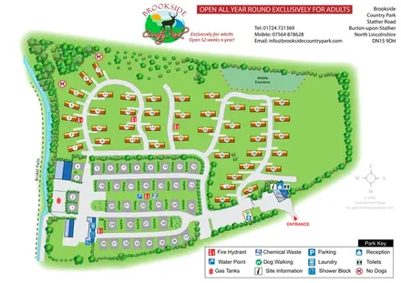
Tree-framed park plan combining touring rows, holiday homes, a brook and a wildlife enclosure.
 Explore the map ↗
United Kingdom
Riverside park map with named pitch fields, illustrated huts and a paw-print dog walk.
 Explore the map ↗
United Kingdom
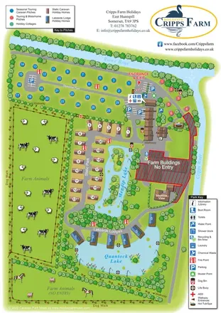
Illustrated farm holiday park plan combining riverside pitches, lakeside accommodation, animal fields and paw-print walking routes, with separate accommodation and facilities keys.
Features may come from the sample artwork, its key or published park information. Approximate numbers describe the drawing and may cover only part of a park. They are intended to help you compare map examples. Current facilities and booking information should be checked with the park.
TAKE A CLOSER LOOK
View the illustrated map in detail or choose a file to download. These are sample maps; contact the park for current visitor information.

LET’S MAP YOUR PARK
For a map quotation, find your park and draw a rough boundary around it. The area you select helps us work out the design time and price.
Draw your park for a quote ↗Or talk to our map designers
01751 473136