
Tree-lined villa grounds
Dense mixed tree and shrub illustrations enclose the park and separate villa groups, with scattered planting across green lawns.
ILLUSTRATED PARK MAP · P214
1 Mairburn Road, Metung, Victoria · Australia
 Enlarge the map ↗
A SENSE OF THE PLACE
Metung Holiday Villas provides self-contained accommodation in Victoria's Gippsland Lakes region. A range of villas caters for different groups, with boat-parking arrangements available by request.
A seasonal heated outdoor pool and guest laundry are among the shared facilities. Selected villas have access features for guests with mobility needs, and the map helps visitors locate accommodation within the park.
LOOK CLOSER
Dense mixed tree and shrub illustrations enclose the park and separate villa groups, with scattered planting across green lawns.
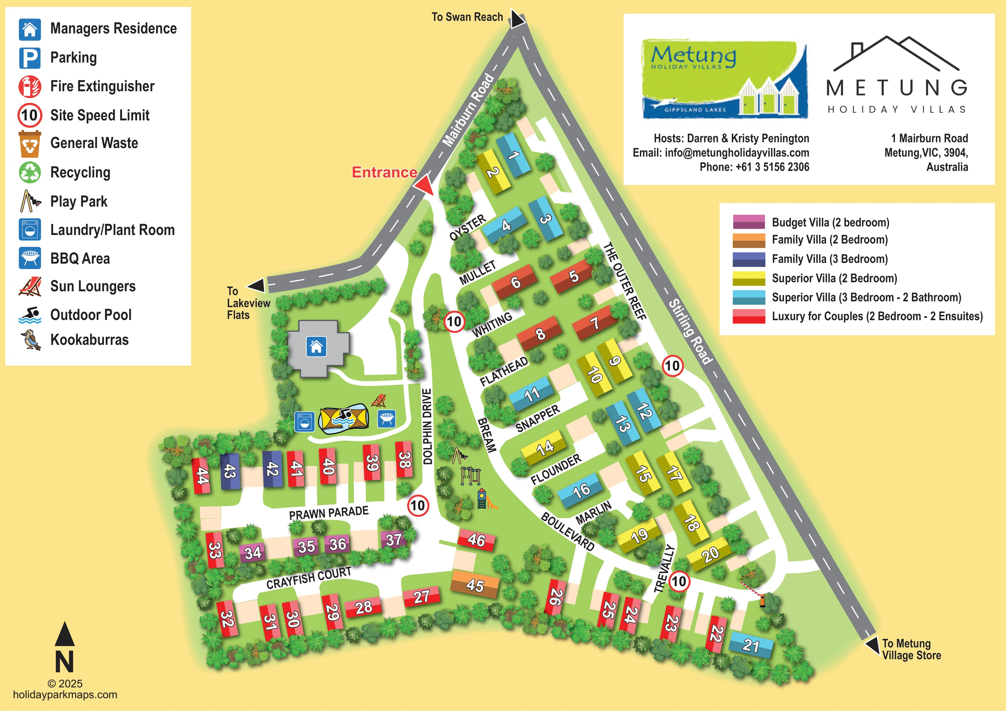
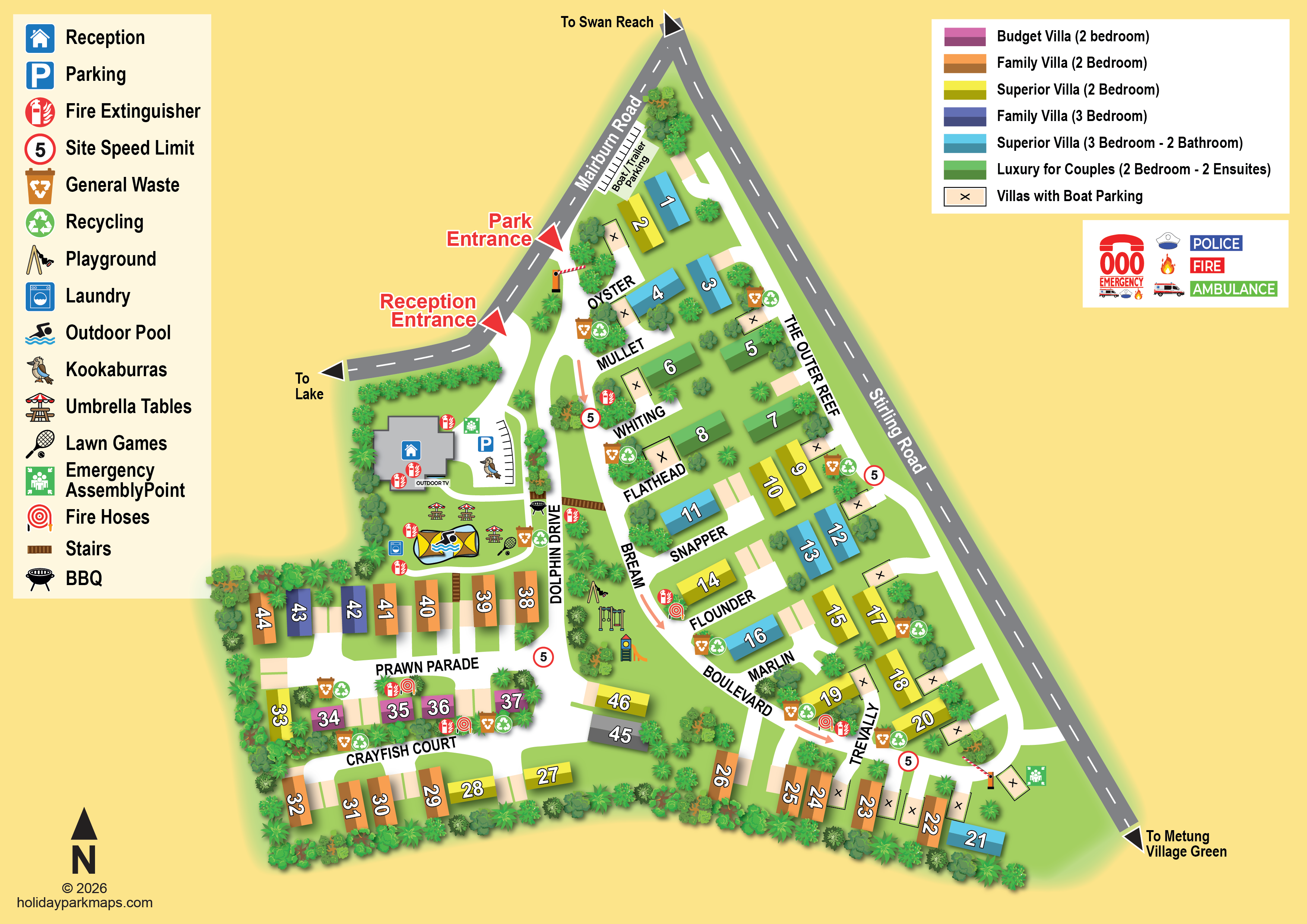
A large grey building with a blue house symbol stands west of Dolphin Drive, close to the entrance and pool facilities.
An illustrated pool with a swimming symbol sits between the managers' residence and the western villa rows.
A deckchair illustration marks sun loungers beside the pool.
A blue washing-machine symbol locates the laundry/plant room immediately west of the pool.
A blue barbecue symbol appears east of the pool, beside the curving internal route.
Swings, climbing equipment and a slide are illustrated on a central green island between Dolphin Drive and the Bream/Boulevard route.
A prominent red arrow labels the entrance from Mairburn Road into the internal road network.
A large grey building with a blue house symbol stands west of Dolphin Drive, close to the entrance and pool facilities.
An illustrated pool with a swimming symbol sits between the managers' residence and the western villa rows.
A deckchair illustration marks sun loungers beside the pool.
A blue washing-machine symbol locates the laundry/plant room immediately west of the pool.
A blue barbecue symbol appears east of the pool, beside the curving internal route.
Swings, climbing equipment and a slide are illustrated on a central green island between Dolphin Drive and the Bream/Boulevard route.
Dense mixed tree and shrub illustrations enclose the park and separate villa groups, with scattered planting across green lawns.
A prominent red arrow labels the entrance from Mairburn Road into the internal road network.
Dolphin Drive, Prawn Parade, Crayfish Court, The Outer Reef, Bream, Boulevard and Trevally connect shorter lanes named Oyster, Mullet, Whiting, Flathead, Snapper, Flounder and Marlin.
Mairburn Road and Stirling Road frame the upper and eastern sides, with arrows towards Swan Reach, Lakeview Flats and Metung Village Store.
A red-and-white barrier arm is drawn across the lower eastern internal connection near Stirling Road; no operating instructions are supplied.
Repeated red-ringed signs displaying 10 appear at internal junctions and near the eastern edge, keyed as Site Speed Limit.
A blue P symbol is included in the facility legend, but a corresponding position is not clearly identifiable on the plan. Pale rectangular areas beside villas are not explicitly keyed.
A red fire-extinguisher symbol is explained in the legend without a clearly identifiable mapped location.
Separate general-waste and recycling symbols appear in the legend; their positions are not clearly shown in the plan.
A small illustrated kookaburra is included in the legend as a local wildlife motif, without a clearly identifiable location on the plan.
READING THE MAP
This illustrated map of Metung Holiday Villas presents a compact self-contained villa park in Victoria’s Gippsland Lakes region. Set against a warm yellow background, the plan combines green landscaped grounds, white internal roads and brightly coloured accommodation blocks to make the park’s organisation easy to follow. Roughly 45 villas are shown, with a separate colour key explaining the different budget, family, superior and couples’ categories.
The entrance from Mairburn Road is marked by a red arrow, while surrounding roads and destination arrows connect the site with Swan Reach, Lakeview Flats and Metung Village Store. Within the park, marine-themed names such as Dolphin Drive, Prawn Parade and Crayfish Court give visitors another way to recognise their route.
Shared facilities form useful landmarks: the outdoor pool, sun loungers, barbecue area and laundry sit near the managers’ residence, while a play park occupies a central green island. The sample demonstrates how a villa-focused map can combine accommodation choice, arrival guidance and everyday orientation without losing the character of a leafy holiday setting.
The artwork is a single landscape-format site plan, with an irregular triangular footprint extending into a broader western accommodation area. Mairburn Road approaches the narrow northern end, and Stirling Road follows the long eastern edge. Grey road surfaces, dashed centre lines and destination arrows distinguish these external connections from the white internal routes.
A red entrance arrow leads visitors towards Dolphin Drive and the managers’ residence. From there, the network branches into short lanes and connecting roads. The Outer Reef follows the eastern side, while Bream, Boulevard and Trevally link the central and southern groups. Prawn Parade and Crayfish Court organise the western rows. Shorter fish-named lanes, including Oyster, Whiting, Snapper and Flounder, help divide the eastern accommodation into recognisable sections.
Each villa is represented by a shaded rectangular roof with a prominent outlined number. Six accommodation categories are explained in a separate colour key, including two- and three-bedroom options and villas with additional bathrooms or ensuites. Pale adjoining rectangles and planted gaps give the rows a spacious rhythm without overloading the plan with detail.
The recreation areas receive more illustrative treatment. A swimming symbol overlays the pool near the managers’ residence, with laundry, barbecue and sun-lounger markers alongside. Swings, climbing equipment and a slide identify the central play area. Dense tree belts enclose the boundary, and scattered planting softens junctions and villa groups.
A large facility legend sits at upper left; branding, contact details and the villa key occupy the right. The north arrow anchors the lower-left corner. The enlarged quadrant views reveal details of this same composition rather than separate map variants.
KEEP EXPLORING
Chosen for shared landscapes, accommodation or facilities.
 Explore the map ↗
France
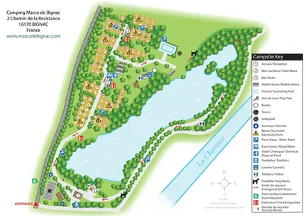
Bilingual lakeside campsite map with numbered pitches, recreation areas and colour-coded service points.
 Explore the map ↗
United Kingdom
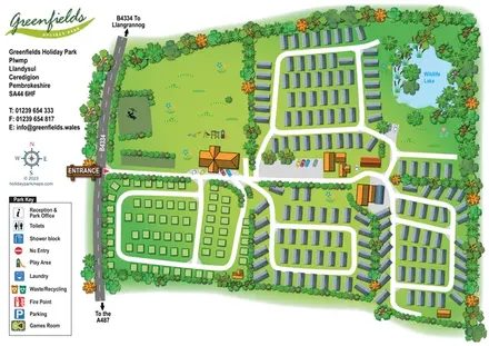
Illustrated Greenfields park plan with distinct accommodation areas, looping roads and a wildlife lake.
 Explore the map ↗
United Kingdom
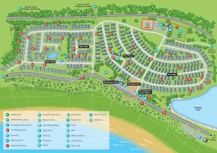
Coastal holiday-park plan with named caravan neighbourhoods, dune paths, leisure facilities and a wildlife lake.
Features may come from the sample artwork, its key or published park information. Approximate numbers describe the drawing and may cover only part of a park. They are intended to help you compare map examples. Current facilities and booking information should be checked with the park.
TAKE A CLOSER LOOK
View the illustrated map in detail or choose a file to download. These are sample maps; contact the park for current visitor information.
LET’S MAP YOUR PARK
For a map quotation, find your park and draw a rough boundary around it. The area you select helps us work out the design time and price.
Draw your park for a quote ↗Or talk to our map designers
01751 473136