
Fishing lake
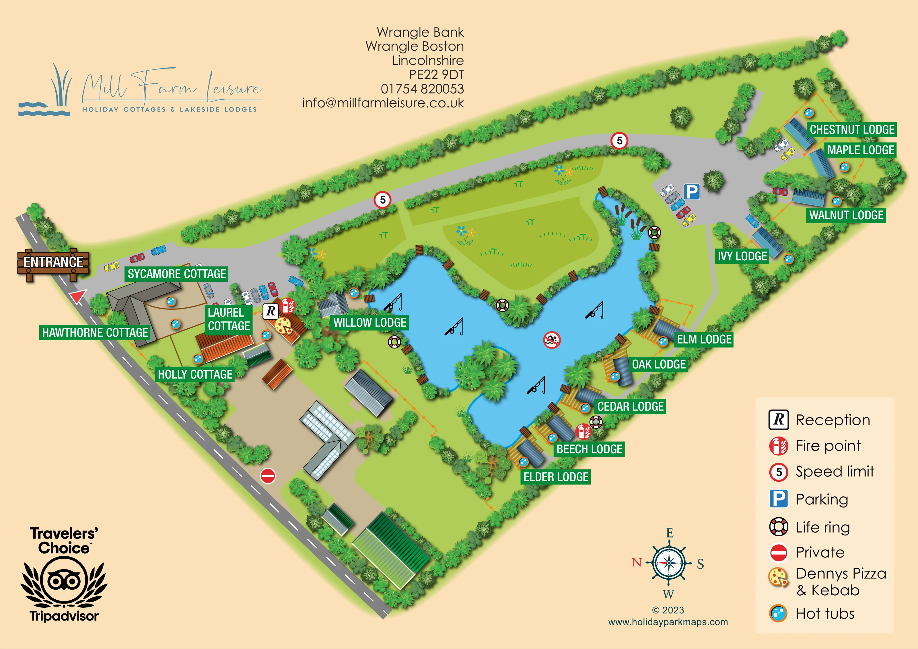
A large irregular blue lake forms the centre of the accommodation layout; repeated fishing-rod pictograms communicate its fishing role.
ILLUSTRATED PARK MAP · P215
Wrangle Bank, Wrangle Boston, Lincolnshire · United Kingdom
 Enlarge the map ↗
A SENSE OF THE PLACE
Mill Farm Leisure offers cottages and lakeside lodges at Wrangle in Lincolnshire. The small site's focus is a quieter countryside break with fishing available beside the accommodation.
Private hot tubs are included with selected properties, and some accommodation welcomes dogs. Fishing access is managed by accommodation allocation, helping maintain the lake's quieter setting. The map shows the relationship between the properties and water.
LOOK CLOSER
A large irregular blue lake forms the centre of the accommodation layout; repeated fishing-rod pictograms communicate its fishing role.
A small planted island sits within the lake, while a broad lawn peninsula creates a deeply indented shoreline.
Dense mixed tree and shrub illustrations line the boundary, drive and water's edge. Reeds, grass tufts and decorative flowers distinguish the open lawns.
An R symbol locates reception within the entrance-side cottage and building cluster.
Named in the legend and represented by a pizza symbol beside reception.
Turquoise circular symbols with orange borders identify hot tubs beside the depicted cottages and lodges.
Small brown slatted platforms punctuate the lake bank, including positions beside lodge terraces and along the central grassy peninsula.
A prominent timber-style ENTRANCE sign marks the connection from the road along the left-hand boundary.
An R symbol locates reception within the entrance-side cottage and building cluster.
Named in the legend and represented by a pizza symbol beside reception.
Turquoise circular symbols with orange borders identify hot tubs beside the depicted cottages and lodges.
A large irregular blue lake forms the centre of the accommodation layout; repeated fishing-rod pictograms communicate its fishing role.
Small brown slatted platforms punctuate the lake bank, including positions beside lodge terraces and along the central grassy peninsula.
A small planted island sits within the lake, while a broad lawn peninsula creates a deeply indented shoreline.
Dense mixed tree and shrub illustrations line the boundary, drive and water's edge. Reeds, grass tufts and decorative flowers distinguish the open lawns.
A prominent timber-style ENTRANCE sign marks the connection from the road along the left-hand boundary.
A broad grey drive runs from the entrance along the upper boundary to a parking court and the upper-right lodge group. A narrower grey route continues beside the right-hand lakeside lodges.
A blue P marks the upper-right parking court. Illustrated cars also indicate parking near the entrance buildings and individual lodges.
Red fire-point symbols appear near reception and beside the lower-right lakeside lodge group.
Life-ring symbols are distributed around the lake edge and explained in the legend.
Red-bordered signs bearing 5 are shown at intervals along the internal drive.
A no-entry-style symbol, defined as Private in the legend, marks the entrance to the lower courtyard containing unlabelled buildings.
A crossed-out swimmer symbol is placed over the lake, separate from the main legend.
READING THE MAP
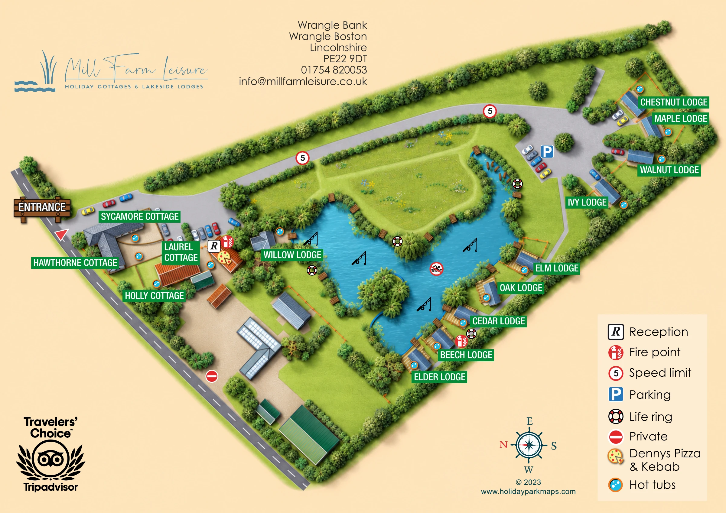
This illustrated map of Mill Farm Leisure presents a small cottage-and-lodge retreat at Wrangle, near Boston in Lincolnshire. Its defining feature is the fishing lake: a bright blue, irregular stretch of water around which much of the accommodation is arranged. A grassy peninsula, planted island and tree-lined banks give the setting a recognisable shape, while individually named properties make the plan useful for guests finding their accommodation.
The map shows roughly 15 cottages and lodges, with the cottages grouped near the entrance and reception and most lodges following the shoreline. Hot-tub symbols sit within the illustrated property gardens, and timber terraces and waterside platforms help explain how the accommodation relates to the lake. Parking, fire points, life rings and the named Dennys Pizza & Kebab outlet are also marked.
The presentation combines a practical overhead layout with textured roofs, colourful cars and layered planting. Dark green name panels stand out against the lawns, while generous cream margins hold the park branding, contact information, compass and symbol key. It is a useful sample for a small countryside accommodation business whose landscape is central to the guest experience.
The single-page plan is arranged diagonally across a warm cream background, with north pointing towards the left of the page. A timber-style entrance sign anchors the arrival point on the left-hand boundary road. From here, a broad grey drive passes the cottages and follows the upper edge of the grounds before opening into a parking court beside the upper-right lodge group.
The cottage cluster includes Hawthorne, Sycamore, Holly and Laurel, with reception identified by a boxed R nearby. A pizza pictogram locates Dennys Pizza & Kebab in the same arrival-side area. Willow Lodge occupies the opposite bank from the main lakeside row. On the right, named lodges are arranged between the water and a planted boundary, with striped terraces, outlined gardens and a narrower access route. Another group sits around the end of the main drive.
The lake is the visual centre of the map. Its indented outline wraps around a broad grassy peninsula, and a small tree-covered island breaks up the blue water. Fishing-rod symbols establish its recreational purpose, while brown timber platforms identify waterside positions. Life rings are shown around the banks, alongside a no-swimming pictogram over the water. Fire points appear near reception and the lower-right lodges, and signs bearing 5 punctuate the main drive.
A private symbol distinguishes the lower courtyard and its unlabelled buildings from the visitor accommodation. Dense trees and shrubs soften the boundaries, while reeds, grass tufts and decorative flowers enrich the lawns and shoreline. Large white-on-green property names provide the main wayfinding layer. The lower-right key explains the facility symbols, with the compass and designer credit beside it. The enlarged quadrant views reveal details of this same artwork rather than separate map variants.
 Enlarge this map ↗
KEEP EXPLORING
Chosen for shared landscapes, accommodation or facilities.
 Explore the map ↗
United Kingdom
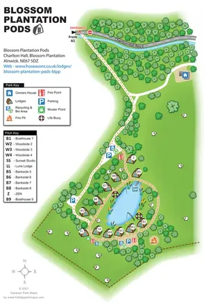
Illustrated lakeside pod map with woodland arrival routes, named lodges and a waterside circuit.
 Explore the map ↗
United Kingdom
Woodland park map with mixed pitches, bell tents, lodges and a fishing lake.
 Explore the map ↗
United Kingdom
Illustrated lakeside park plan with numbered holiday units, leisure buildings and a looping Woodland Walk.
Features may come from the sample artwork, its key or published park information. Approximate numbers describe the drawing and may cover only part of a park. They are intended to help you compare map examples. Current facilities and booking information should be checked with the park.
LET’S MAP YOUR PARK
For a map quotation, find your park and draw a rough boundary around it. The area you select helps us work out the design time and price.
Draw your park for a quote ↗Or talk to our map designers
01751 473136