
Colebrook River
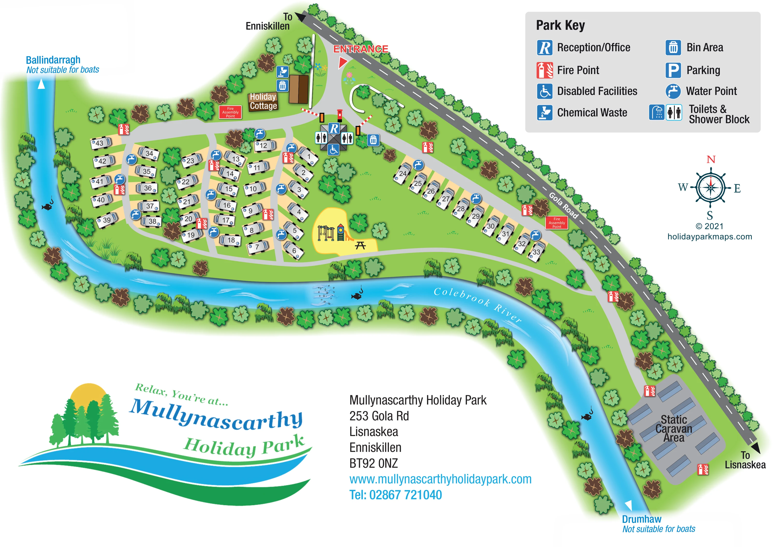
The named blue river curves around the western and southern edges of the grounds before continuing past the static caravan area.
ILLUSTRATED PARK MAP · P545
Mullynascarthy Holiday Park, 253 Gola Rd, Lisnaskea, Enniskillen · United Kingdom
 Enlarge the map ↗
A SENSE OF THE PLACE
Mullynascarthy Holiday Park provides touring stays near Lisnaskea in County Fermanagh. Hardstanding pitches accommodate caravans, motorhomes and campervans.
Its location provides a base for exploring the Lough Erne area and local attractions. The map shows the touring layout and routes around the grounds, helping visitors plan their arrival and find their way through the park.
LOOK CLOSER
The named blue river curves around the western and southern edges of the grounds before continuing past the static caravan area.
Stylised trees line the road and river, separate some touring rows and frame a substantial central green space.
An R symbol identifies the central service building just inside the entrance.
Toilet symbols flank the entrance-side service building; the key names the facility category Toilets & Shower Block.
A wheelchair symbol is positioned at the central service building. It identifies a mapped facility, rather than demonstrating accessibility throughout the park.
A chemical waste symbol appears near the cottage and entrance-side service area.
Bin symbols mark locations beside the cottage and near the central service building.
Repeated blue tap symbols are distributed among the touring rows, including the longer row beside Gola Road.
An R symbol identifies the central service building just inside the entrance.
Toilet symbols flank the entrance-side service building; the key names the facility category Toilets & Shower Block.
A wheelchair symbol is positioned at the central service building. It identifies a mapped facility, rather than demonstrating accessibility throughout the park.
A chemical waste symbol appears near the cottage and entrance-side service area.
Bin symbols mark locations beside the cottage and near the central service building.
Repeated blue tap symbols are distributed among the touring rows, including the longer row beside Gola Road.
Red fire-point symbols are repeated around the touring pitches, entrance and static caravan area.
Two red labelled assembly-point panels appear near the cottage-side entrance area and alongside the eastern touring row.
A bright yellow area on the central lawn contains illustrated swings and a climbing frame with a slide.
An illustrated picnic table stands beside the play equipment on the yellow recreation area.
Parking is included in the key, but a corresponding marked parking location is not clearly visible on the plan.
The named blue river curves around the western and southern edges of the grounds before continuing past the static caravan area.
Stylised trees line the road and river, separate some touring rows and frame a substantial central green space.
The main entrance is prominently labelled where a curved drive leaves Gola Road near the northern end of the site.
Light-grey routes connect the entrance, touring rows, riverside edge and static caravan area. Red-and-white barrier graphics mark the entrance-side junction.
Black arrows at opposite ends of Gola Road indicate Enniskillen and Lisnaskea.
White arrows at the river's ends accompany the names Ballindarragh and Drumhaw, each with the note Not suitable for boats.
READING THE MAP
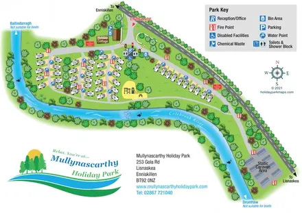
This illustrated map of Mullynascarthy Holiday Park places the site's riverside setting at the heart of its layout. The Colebrook River curves around the grounds, while Gola Road forms a strong diagonal boundary with directions towards Enniskillen and Lisnaskea. Between them, numbered touring pitches, a holiday cottage and a separate static caravan area are presented in a compact, readable plan.
The arrival point is easy to pick out: red entrance lettering leads into a reception and facilities hub near the cottage. Blue service symbols identify practical amenities around the touring rows, while red fire markers remain visually distinct. A yellow play area with a picnic table provides a memorable landmark within the central green space.
Designed for a park in County Fermanagh, the artwork combines practical visitor information with a colourful impression of tree-lined grounds and flowing water. Its large key, clear accommodation labels and contrasting road treatments show how a relatively small park with several accommodation types can be explained on one landscape page without losing its individual character.
The plan follows the shape of the land between Gola Road and the Colebrook River. The public road runs diagonally across the upper edge and down the right-hand side; the river sweeps around the western touring area, along the lower boundary and past the static caravans. Rows of illustrated trees reinforce both edges, with more planting between pitches and around the open lawn.
A curved drive enters from Gola Road near the top of the map. Beside it are the labelled holiday cottage, chemical waste and bin symbols, and a grey-roofed service building marked for reception, toilets and disabled facilities. Red-and-white barrier graphics help distinguish this arrival junction. From here, light-grey internal routes connect the compact western touring rows with a longer row running parallel to the road. A lower route skirts the central lawn and continues towards the separately labelled Static Caravan Area.
Touring pitches are represented by small white caravans on buff bases, each carrying a clear black number. The static units use simpler blue-grey shapes, making the two accommodation areas visually different. The central yellow recreation patch contains illustrated swings, a slide and climbing frame, plus a picnic table. Water points and fire points recur around the grounds, and two fire assembly points receive their own red text panels.
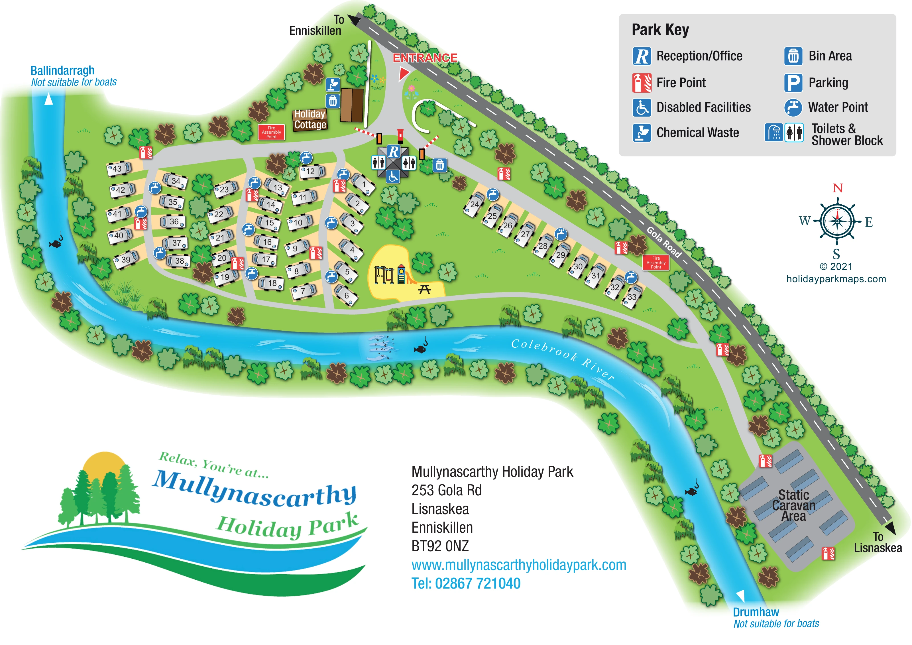
The upper-right Park Key explains the service symbols, including a parking symbol whose location is not separately marked on the plan. Beneath it sits a decorative compass rose. Road arrows identify Enniskillen and Lisnaskea, while the river ends name Ballindarragh and Drumhaw with boating suitability notes. A large park logo and contact block balance the lower page. The accompanying enlargement repeats the key and adjoining artwork for legibility; it is not a separate map variant.
KEEP EXPLORING
Chosen for shared landscapes, accommodation or facilities.
 Explore the map ↗
United Kingdom
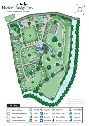
A lakeside holiday-park and fishery map with numbered accommodation, fishing positions and clearly grouped visitor services.
 Explore the map ↗
United Kingdom
Riverside park map with colour-coded pitches, static caravan groups and a comprehensive facilities key.
 Explore the map ↗
United Kingdom
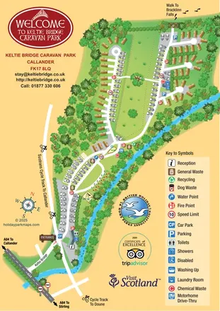
Illustrated riverside park map with mixed accommodation, a central green and walking and cycling connections.
Features may come from the sample artwork, its key or published park information. Approximate numbers describe the drawing and may cover only part of a park. They are intended to help you compare map examples. Current facilities and booking information should be checked with the park.
TAKE A CLOSER LOOK
View the illustrated map in detail or choose a file to download. These are sample maps; contact the park for current visitor information.


LET’S MAP YOUR PARK
For a map quotation, find your park and draw a rough boundary around it. The area you select helps us work out the design time and price.
Draw your park for a quote ↗Or talk to our map designers
01751 473136
 mullynasgarth_large.png