
Fishing lake
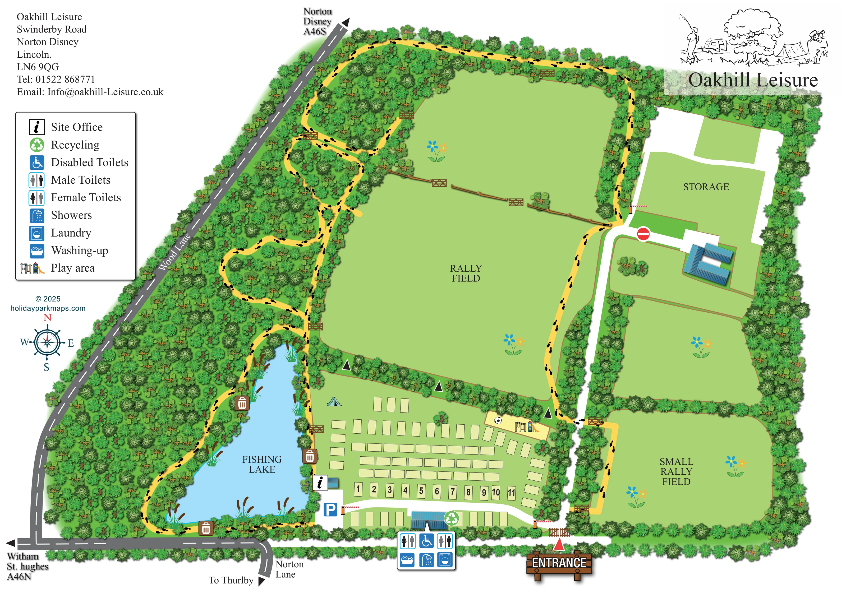
A tapered blue lake lies west of the main pitch field, with illustrated reeds and a walking route around its banks.
ILLUSTRATED PARK MAP · P233
Oakhill Leisure, Swinderby Road, Norton Disney, Lincoln · United Kingdom
 Enlarge the map ↗
A SENSE OF THE PLACE
Oakhill Leisure provides camping and touring at Norton Disney near Lincoln. Level grassland is enclosed by hedges and trees, with a fishing lake contributing to the setting.
Electric and non-electric arrangements offer a choice of camping styles. Toilets and showers, including facilities for disabled guests, support stays. The map helps visitors understand the layout of pitches and the relationship to the lake.
LOOK CLOSER
A tapered blue lake lies west of the main pitch field, with illustrated reeds and a walking route around its banks.
Dense woodland fills the western side, while continuous tree and hedge belts enclose the park and divide its fields.
A broad central RALLY FIELD and a separate SMALL RALLY FIELD in the south-east are shown as open grass areas without individual pitch allocations.
An information symbol marks a small blue-roofed building beside the fishing lake and the western end of the main pitch access lane.
A blue P symbol identifies parking beside the site office, close to the lake and a pitch-area barrier.
A callout attached to the southern amenity building groups male toilets, female toilets, disabled toilets and showers.
Laundry and washing-up symbols share the amenity-building callout below the main pitch field.
A green recycling symbol is positioned at the southern amenity building.
An information symbol marks a small blue-roofed building beside the fishing lake and the western end of the main pitch access lane.
A blue P symbol identifies parking beside the site office, close to the lake and a pitch-area barrier.
A callout attached to the southern amenity building groups male toilets, female toilets, disabled toilets and showers.
Laundry and washing-up symbols share the amenity-building callout below the main pitch field.
A green recycling symbol is positioned at the southern amenity building.
Repeated brown bin symbols appear around the fishing lake's walking circuit.
An elongated pale-yellow play strip lies along the north-eastern edge of the pitch field, illustrated with swings, a climbing tower and slide, plus a football motif.
A large area labelled STORAGE occupies the north-east of the plan, reached by branching white access lanes. The stored items are not specified.
A tapered blue lake lies west of the main pitch field, with illustrated reeds and a walking route around its banks.
Dense woodland fills the western side, while continuous tree and hedge belts enclose the park and divide its fields.
A broad central RALLY FIELD and a separate SMALL RALLY FIELD in the south-east are shown as open grass areas without individual pitch allocations.
Yellow paths with black footprint motifs form woodland loops, circle the lake, follow the northern boundary and connect towards the rally fields.
A timber-style entrance sign and red pointer mark the southern gate. White lanes lead west towards the pitches and north towards storage and other grounds; gates, striped barriers and a no-entry symbol mark particular access points.
Wood Lane borders the western side. Norton Lane and a direction towards Thurlby appear at the bottom, with arrows towards Norton Disney and the A46 south, and towards Witham and the A46 north.
READING THE MAP
This illustrated map of Oakhill Leisure at Norton Disney, near Lincoln, brings together a compact pitching area, open rally fields and a particularly strong woodland-and-water setting. The fishing lake sits beside the main pitch field, while dense trees frame the western side and divide the wider grounds into recognisable spaces. Yellow walking paths, marked with footprints, invite the eye around the lake and through a network of woodland loops.
The plan gives arrival and everyday facilities clear visual anchors. A large timber-style entrance sign marks the southern gateway, white lanes explain vehicle access, and a small office and parking point sit beside the lake. Toilets, showers, laundry and washing-up facilities are grouped in a callout attached to the southern amenity building. A play area occupies the edge of the main pitch field, with storage and rally grounds shown farther north and east.
For a sample gallery, this is a useful example of a campsite map that gives landscape and walking routes as much attention as pitches, without losing the practical information visitors need to orientate themselves.
The single landscape plan is organised around a southern entrance and a north-running internal access lane. A western branch serves the main pitch field, where pale rectangular spaces form parallel rows and a perimeter arrangement. Selected pitches beside the southern lane are numbered. The site office and a parking symbol sit at the lake-side end of this area, while a blue-roofed amenity building along its southern boundary is linked to a compact callout for toilets, disabled toilets, showers, laundry and washing-up. Recycling is marked at the same building.
Immediately west, the blue fishing lake narrows towards its northern end. Reeds, surrounding trees and repeated bin symbols give the banks a recognisable character. A yellow walking circuit follows the water, then joins several winding woodland loops between the lake and Wood Lane. The footprint motif distinguishes these paths from the white vehicle lanes. Further routes follow the northern boundary and connect towards the eastern fields through illustrated gates.
The broad central rally field contrasts with the close arrangement of the main pitches. A separate small rally field occupies the south-east, while storage is labelled in the north-east beside branching access lanes and a larger blue-roofed building. The illustrated play strip sits at the north-eastern edge of the pitch field, showing swings, a slide and a football motif.
The page balances this detailed landscape with a left-hand contact block and symbol key, a compass rose below, and the Oakhill Leisure line-art logo and name at the upper right. External road arrows add local orientation. The enlarged views show details of this same plan rather than additional sections or separate accommodation areas.
KEEP EXPLORING
Chosen for shared landscapes, accommodation or facilities.
 Explore the map ↗
United Kingdom
Woodland park map with mixed pitches, bell tents, lodges and a fishing lake.
 Explore the map ↗
United Kingdom
Illustrated caravan park plan with woodland and riverside walks, fishing pools and wildlife panels.
 Explore the map ↗
United Kingdom
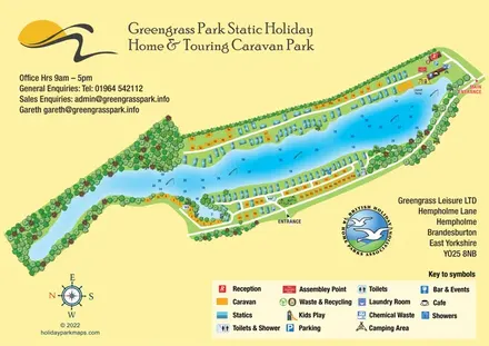
Colour-coded lakeside accommodation and illustrated facilities at Greengrass Park, East Yorkshire.
Features may come from the sample artwork, its key or published park information. Approximate numbers describe the drawing and may cover only part of a park. They are intended to help you compare map examples. Current facilities and booking information should be checked with the park.
LET’S MAP YOUR PARK
For a map quotation, find your park and draw a rough boundary around it. The area you select helps us work out the design time and price.
Draw your park for a quote ↗Or talk to our map designers
01751 473136