
Woodland belts and wooded margins
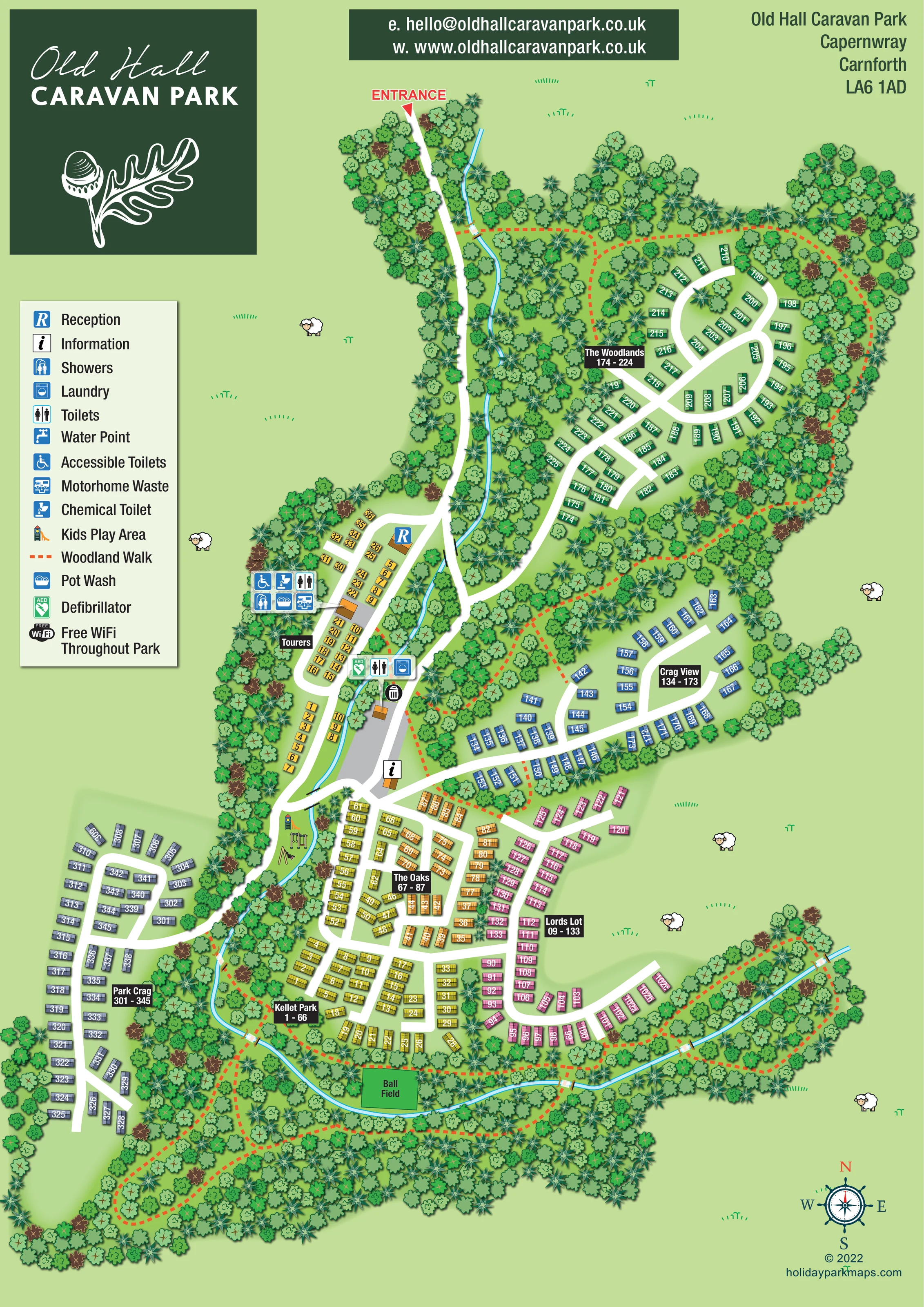
Dense illustrated trees frame the park, separate accommodation neighbourhoods and form substantial wooded areas to the north-east and south.
ILLUSTRATED PARK MAP · P557
Old Hall Caravan Park, Capernwray, Carnforth · United Kingdom
 Enlarge the map ↗
A SENSE OF THE PLACE
Old Hall Caravan Park is located at Capernwray near Carnforth. Woodland and designated walks surround a site offering touring stays and holiday home ownership.
A children's play area adds a family facility on the grounds. The location provides access to the Lake District, Yorkshire Dales and Lancashire countryside, while the map helps visitors navigate the park's own wooded layout.
LOOK CLOSER
Dense illustrated trees frame the park, separate accommodation neighbourhoods and form substantial wooded areas to the north-east and south.
A narrow blue watercourse follows the arrival corridor before winding past the play area and around the southern edge of the holiday-home areas.
Pale green open ground, scattered grass marks and decorative sheep give the surrounding space a pastoral character.
A blue R identifies an orange-roofed reception building at the northern end of the touring area, beside the main arrival road.
An information symbol marks a small building at the central road junction, near the grey service forecourt.
Grouped callouts identify toilets, showers and accessible toilets at the touring service building, with another toilet symbol at the nearby laundry and defibrillator callout.
A washing-machine symbol identifies laundry facilities beside the main road, just south of the touring pitches.
A pot-wash icon appears in the grouped facility callout serving the touring area.
A blue R identifies an orange-roofed reception building at the northern end of the touring area, beside the main arrival road.
An information symbol marks a small building at the central road junction, near the grey service forecourt.
Grouped callouts identify toilets, showers and accessible toilets at the touring service building, with another toilet symbol at the nearby laundry and defibrillator callout.
A washing-machine symbol identifies laundry facilities beside the main road, just south of the touring pitches.
A pot-wash icon appears in the grouped facility callout serving the touring area.
A motorhome waste icon is included in the touring service-building callout.
Chemical toilet disposal is identified alongside the touring washroom and waste facilities.
The legend includes a tap symbol for water points, but a corresponding position is not clearly identifiable in the artwork.
A green AED symbol appears in the facility callout beside the toilets and laundry.
A black circular bin symbol marks a point beside the central service forecourt.
Illustrated slide, swings and climbing equipment occupy a green space beside the stream, immediately south of the central junction.
A bright green rectangular space labelled Ball Field sits below Kellet Park, beside the stream and woodland paths.
The legend states Free WiFi Throughout Park; it is a park-wide textual statement rather than a plotted location.
Dense illustrated trees frame the park, separate accommodation neighbourhoods and form substantial wooded areas to the north-east and south.
A narrow blue watercourse follows the arrival corridor before winding past the play area and around the southern edge of the holiday-home areas.
Pale green open ground, scattered grass marks and decorative sheep give the surrounding space a pastoral character.
Orange dashed walking routes loop around The Woodlands and through the southern tree belts, with branches linking the accommodation areas and stream crossings.
Small bridge and crossing marks show where roads or walking routes pass over the watercourse.
A red ENTRANCE label and triangular arrow identify the arrival road at the top of the plan.
Broad white roads form a north–south arrival spine, branching loops and short access lanes through the numbered accommodation areas.
READING THE MAP
This illustrated map of Old Hall Caravan Park at Capernwray, near Carnforth, brings a large wooded holiday park into a single portrait plan. Its most recognisable feature is the combination of colour-coded caravan areas, broad white roads and orange dashed woodland walks, all set within dense bands of illustrated trees. A blue watercourse threads through the layout, helping connect the arrival corridor with the play area and southern woodland.
The map shows six named holiday-home neighbourhoods alongside a separate touring area near reception. Individual numbers support finding a particular accommodation position, while larger black area labels help visitors understand the park in manageable sections. Facility callouts identify the touring services, laundry, information point and defibrillator without crowding the main routes.
The children's play area and labelled ball field give the recreational spaces a clear place in the plan. Dark green branding, an oak-leaf-and-acorn emblem and pastoral details reinforce the woodland setting. This sample is particularly relevant to parks that need one map to explain both a substantial accommodation layout and a network of leisure walks.
The plan begins with a red entrance arrow at the top of the page. From here, a white road descends between trees alongside a narrow blue watercourse. Reception stands beside the northern end of the yellow touring area, with the touring pitches arranged along a compact loop and short access lanes. Nearby callouts identify showers, toilets, accessible toilets, pot washing, chemical toilet disposal and motorhome waste disposal. A second callout marks the laundry, toilets and defibrillator beside the grey service forecourt, while an information symbol identifies a building at the central junction.
Beyond this arrival zone, the accommodation divides into six named neighbourhoods. Green symbols distinguish The Woodlands in the north-east; blue marks Crag View below it. The southern core combines yellow-green Kellet Park, orange The Oaks and pink Lords Lot, while slate-grey Park Crag extends to the west. Numbered caravan roofs follow the orientation of the surrounding roads, and black name plaques provide a larger-scale reference within each area.
Orange dashed woodland walks form loops around The Woodlands and through the extensive southern tree belts. Small crossings punctuate the stream, which curves past the illustrated children's play equipment and the bright green Ball Field. These elements make the recreational landscape readable alongside the accommodation rather than relegating it to the background.
The single portrait artwork is framed by a large logo at upper left, contact and address details across the top, a pale facility legend on the left and a compass rose at lower right. The enlarged detail views reveal the same continuous plan; they are not separate park sections or additional map variants.
KEEP EXPLORING
Chosen for shared landscapes, accommodation or facilities.
 Explore the map ↗
United Kingdom
Woodland holiday homes, named camping fields and farm buildings on a colour-coded Nether Wasdale park map.
 Explore the map ↗
United Kingdom
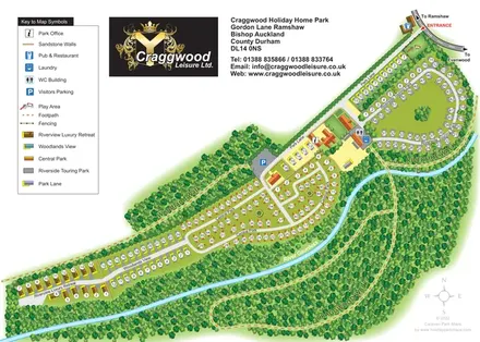
Colour-coded holiday-home and touring areas beside the River Gaunless, with woodland walks and a detailed visitor key.
 Explore the map ↗
United Kingdom
Illustrated caravan park plan with woodland and riverside walks, fishing pools and wildlife panels.
Features may come from the sample artwork, its key or published park information. Approximate numbers describe the drawing and may cover only part of a park. They are intended to help you compare map examples. Current facilities and booking information should be checked with the park.
LET’S MAP YOUR PARK
For a map quotation, find your park and draw a rough boundary around it. The area you select helps us work out the design time and price.
Draw your park for a quote ↗Or talk to our map designers
01751 473136