
Orchard-style tree planting
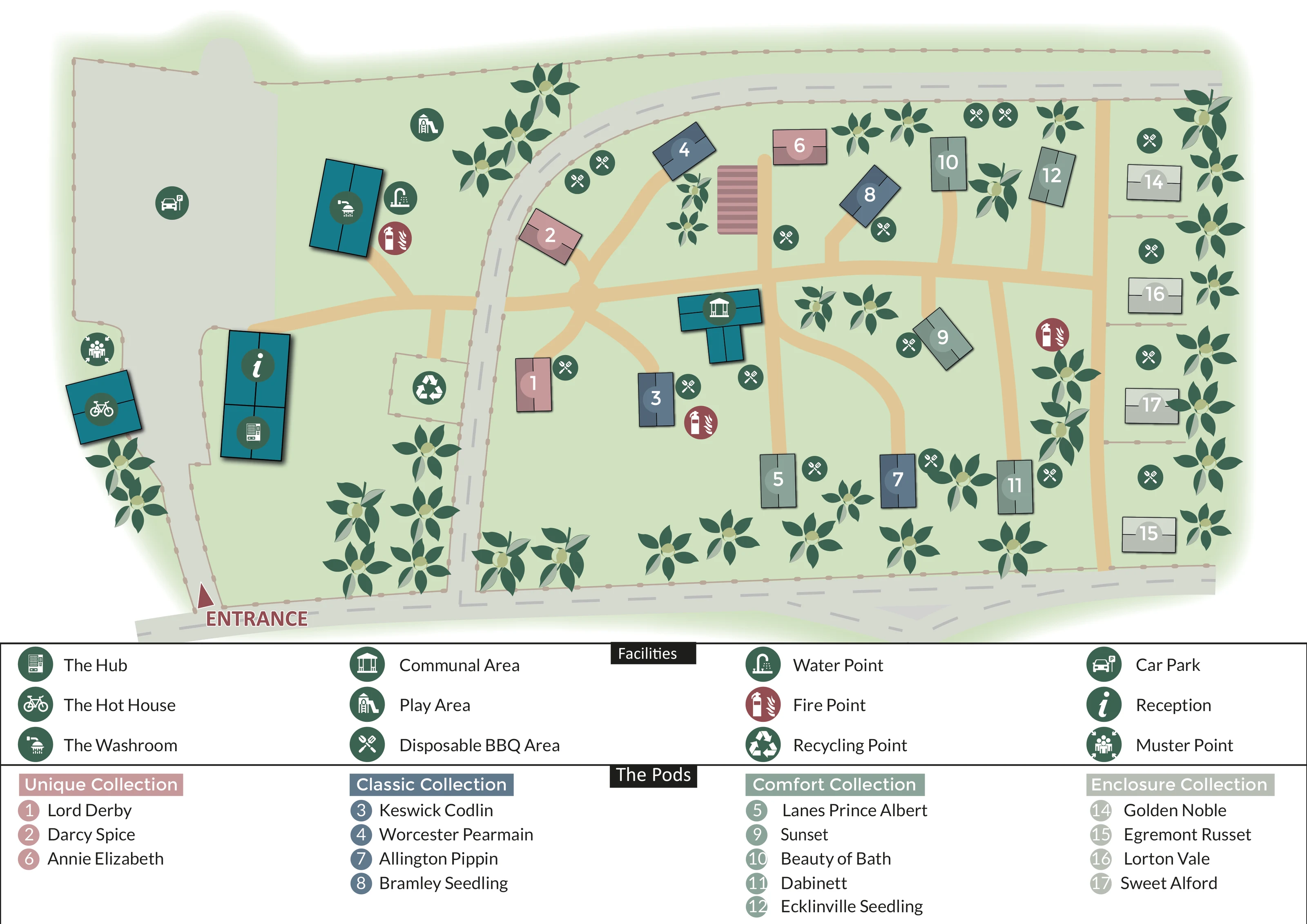
Stylised leafy tree crowns stand between pods and around the site edges, reinforcing the orchard identity without depicting individual tree species.
ILLUSTRATED PARK MAP · P559
Redhills Lane, Redhills, Penrith · United Kingdom
 Enlarge the map ↗
A SENSE OF THE PLACE
Orchard Hideaways is based at Redhills Lane, Redhills, Penrith. The glamping village is near Penrith and provides access to the Ullswater area. Heated, insulated pods are advertised for year-round stays.
Communal spaces include covered outdoor cooking and a spa with hot tub, sauna and cold plunge. Whole-site bookings are advertised for groups, with social and dining spaces.
LOOK CLOSER
Stylised leafy tree crowns stand between pods and around the site edges, reinforcing the orchard identity without depicting individual tree species.
Thin taupe lines with rounded post-like marks define site edges, parking boundaries and divisions between the right-hand Enclosure Collection pods.
Information symbol on the upper part of the long teal building beside the arrival area.
Located in the same long building as reception and identified by the legend's vending-machine-style pictogram.
Separate teal building between the car park and the curving road, marked with a shower pictogram.
Small teal building on the left of the entrance approach. Its mapped symbol is a bicycle, which the legend labels The Hot House.
Central T-shaped teal building or shelter, marked with a pavilion pictogram and reached by the main ochre path network.
Play-equipment symbol in the open green area above the washroom and beside the car park.
Information symbol on the upper part of the long teal building beside the arrival area.
Located in the same long building as reception and identified by the legend's vending-machine-style pictogram.
Separate teal building between the car park and the curving road, marked with a shower pictogram.
Small teal building on the left of the entrance approach. Its mapped symbol is a bicycle, which the legend labels The Hot House.
Central T-shaped teal building or shelter, marked with a pavilion pictogram and reached by the main ochre path network.
Play-equipment symbol in the open green area above the washroom and beside the car park.
Repeated crossed-utensil symbols distributed beside pods and near the communal area, including the right-hand enclosure row.
Tap symbol immediately beside the washroom building.
Muted red extinguisher symbols beside the washroom and at locations within the pod area.
Recycling symbol in a small outlined space beside the curving road, between the arrival facilities and the pods.
Assembly symbol near The Hot House on the left-hand side of the arrival area.
Large pale-grey parking area occupying much of the upper-left portion of the plan.
Prominent burgundy arrow and ENTRANCE label at the lower-left approach from the road along the bottom of the map.
Grey roads with dashed centre lines frame the lower and upper edges and curve between the facilities and pods. Ochre paths link the arrival buildings, central communal area and individual accommodation.
Stylised leafy tree crowns stand between pods and around the site edges, reinforcing the orchard identity without depicting individual tree species.
Thin taupe lines with rounded post-like marks define site edges, parking boundaries and divisions between the right-hand Enclosure Collection pods.
READING THE MAP
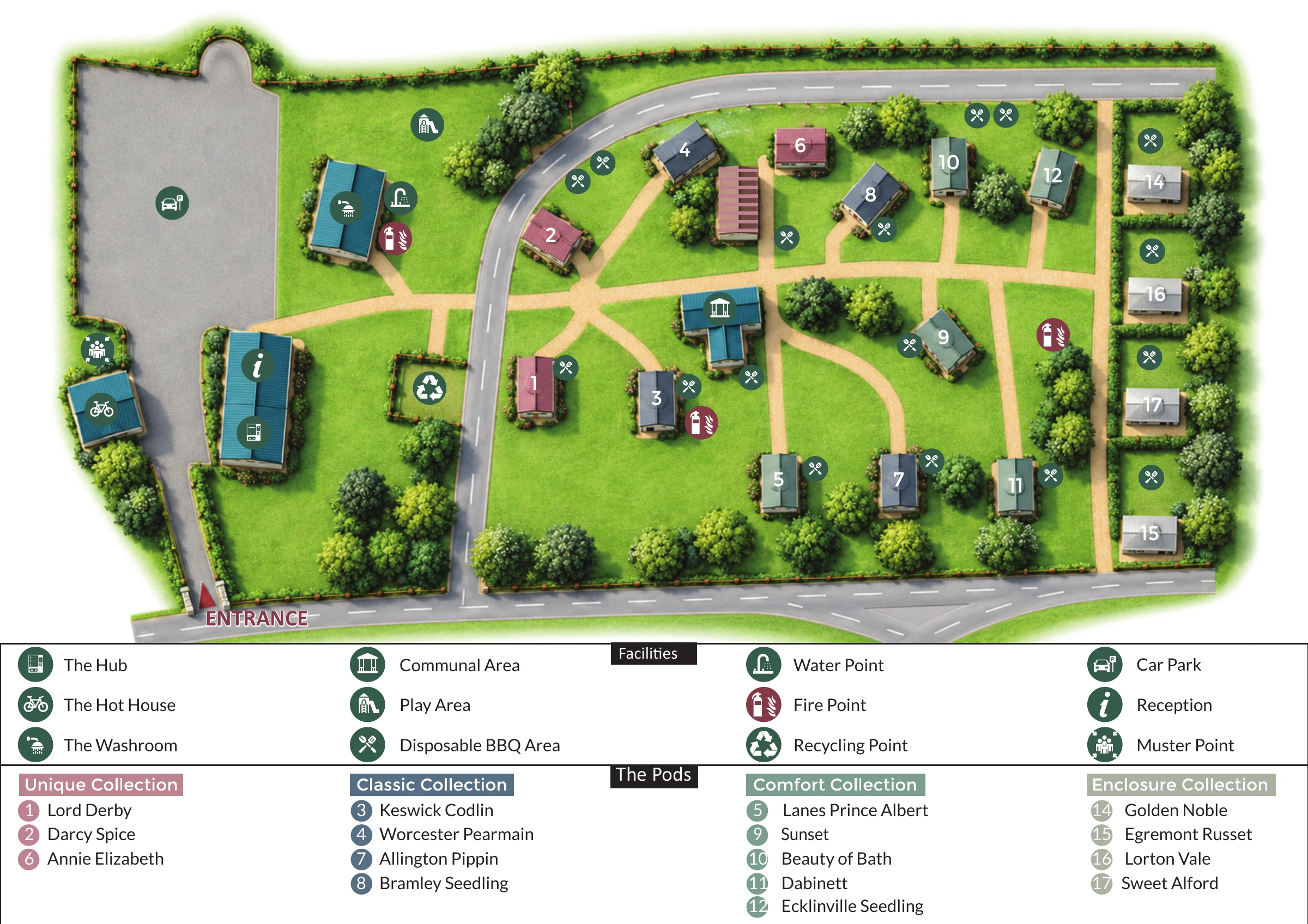
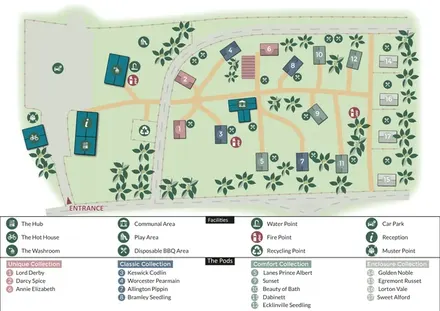
This Orchard Hideaways map presents a small glamping village at Redhills, near Penrith, through a compact overhead plan and a clear accommodation directory. The orchard character runs through the artwork: stylised leafy trees sit between the pods, while names such as Lord Derby and Bramley Seedling connect the accommodation to an apple-growing theme. A muted green background, ochre paths and teal shared buildings establish a visual hierarchy without relying on a detailed landscape painting.
The map shows roughly 15 pods organised into four colour-coded collections. Their individual numbers link directly to the directory below, helping guests distinguish the scattered central pods from the more regular Enclosure Collection along the right-hand boundary. Arrival facilities are grouped on the left, with the entrance, reception, The Hub and car park easy to locate. A central communal area, play area, washroom and distributed disposable BBQ areas give the plan a practical focus beyond finding a pod. This sample demonstrates a mapping approach for a small accommodation business that needs named-unit navigation, shared-facility identification and a recognisable setting in one page.
The single landscape-format artwork places the site plan above a full-width, two-tier key. At the lower left, a burgundy arrow and large ENTRANCE label mark the arrival approach from the road along the bottom edge. Reception and The Hub share a long teal footprint nearby, while a large pale-grey car park extends towards the upper-left corner. The Hot House occupies a separate small building to the left, with the muster point close by. Further up, The Washroom is accompanied by water and fire-point symbols, and the play area is marked in the adjacent green space.
A grey road curves upwards between the arrival facilities and accommodation before continuing across the top of the plan. Ochre paths provide a contrasting network through the pod area, branching from a rounded central junction and connecting to a T-shaped communal building. The main pods have varied orientations and generous green spaces between them. Along the right-hand edge, a straight path serves the Enclosure Collection, where taupe boundary lines distinguish the individual spaces. Repeated BBQ symbols appear around the accommodation; fire points and a recycling point are also located on the plan.
The pod footprints use dusty rose, slate blue, muted sage and pale grey-green to match the Unique, Classic, Comfort and Enclosure directory headings. Large white numbers provide the link to each apple-themed pod name. Stylised tree crowns reinforce the setting, while black outlines and subtle shadows keep buildings distinct from the ground. The lower key groups facilities into four columns, then lists the pod collections beneath. The enlarged views show portions of this same composition rather than additional map variants.
 Enlarge this map ↗
KEEP EXPLORING
Chosen for shared landscapes, accommodation or facilities.
 Explore the map ↗
United Kingdom
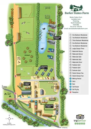
Portrait farm-stay map with pond-side lodges, glamping pods, orchard and illustrated animal paddocks.
 Explore the map ↗
United Kingdom
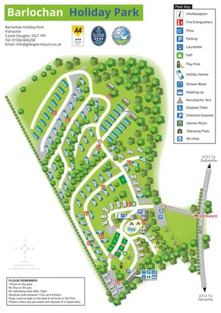
A wooded, mixed-accommodation park plan with winding lanes, a pool, camping areas and a clear facility key.
 Explore the map ↗
United Kingdom
Woodland-framed Barnsoul map with mixed accommodation, shared facilities and paw-marked walking routes.
Features may come from the sample artwork, its key or published park information. Approximate numbers describe the drawing and may cover only part of a park. They are intended to help you compare map examples. Current facilities and booking information should be checked with the park.
TAKE A CLOSER LOOK
View the illustrated map in detail or choose a file to download. These are sample maps; contact the park for current visitor information.


LET’S MAP YOUR PARK
For a map quotation, find your park and draw a rough boundary around it. The area you select helps us work out the design time and price.
Draw your park for a quote ↗Or talk to our map designers
01751 473136