
Dog-walking area
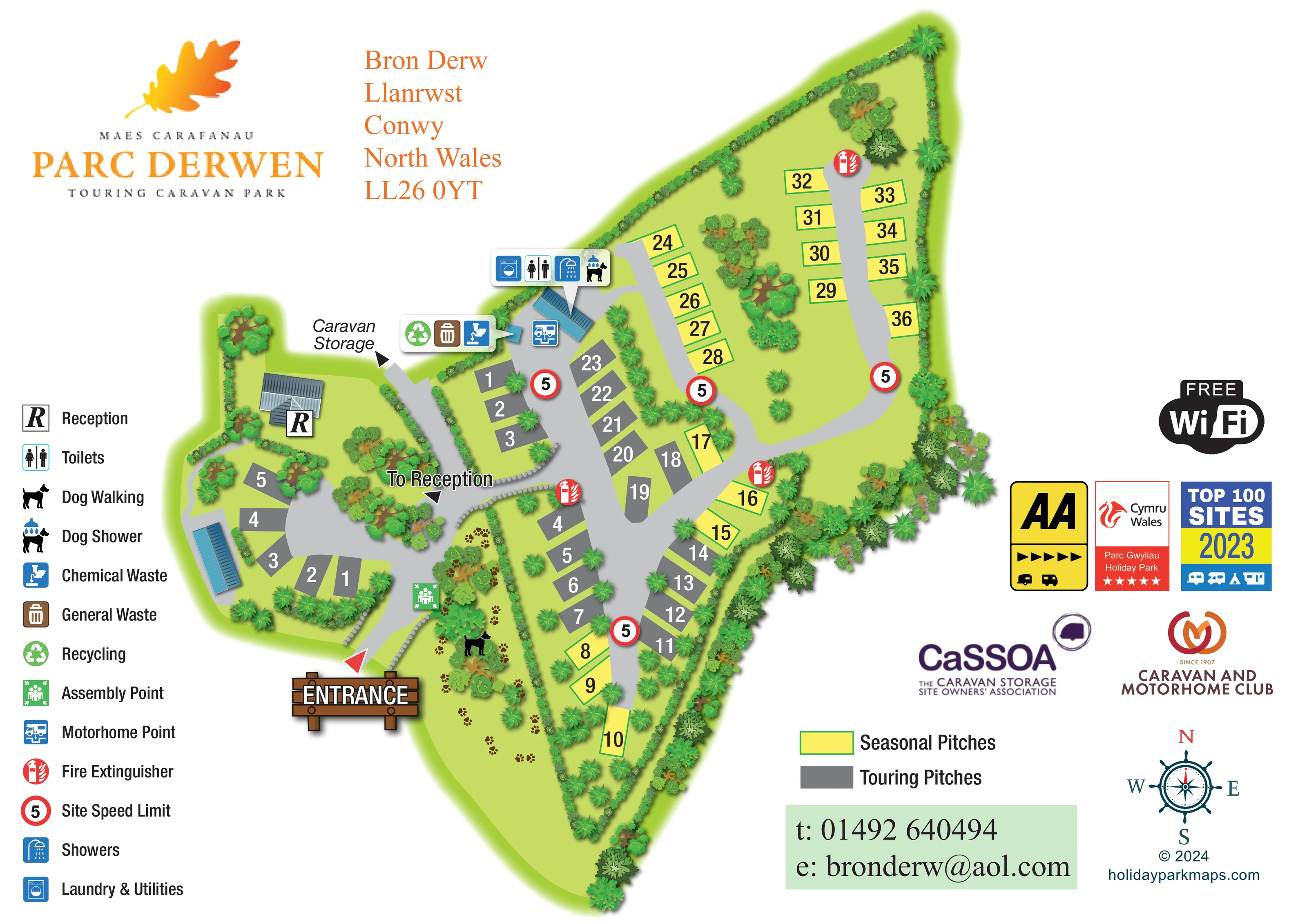
A long planted green strip beside the southern entrance is marked with a dog silhouette and trails of brown paw prints.
ILLUSTRATED PARK MAP · P238
Bron Derw, Llanrwst, Conwy, North Wales · United Kingdom
 Enlarge the map ↗
A SENSE OF THE PLACE
Parc Derwen Adults Only Touring Park is based at Bron Derw, Llanrwst, Conwy, North Wales. Fully serviced touring pitches include 16-amp electricity, water, drainage and TV connection.
Washrooms include an accessible suite; laundry and washing-up facilities are available. Up to two dogs per pitch are permitted under the published lead and supervision rules.
LOOK CLOSER
A long planted green strip beside the southern entrance is marked with a dog silhouette and trails of brown paw prints.
Continuous hedges define much of the irregular perimeter, while illustrated trees and shrubs separate pitch groups and fill planted islands.
Rows of small grey stone shapes outline parts of the entrance route and its junction with the reception approach.
A roofed building in the western part of the plan carries a prominent R marker, supported by a 'To Reception' arrow at the access-road junction.
Toilet and shower symbols appear in a shared callout pointing to the blue-roofed amenities building near the north-western end of the main touring area.
The amenities-building callout includes the washing-machine symbol labelled 'Laundry & Utilities' in the legend.
A dog-under-shower symbol is grouped with the washroom and laundry icons at the amenities building.
A blue motorhome service symbol is positioned beside the amenities building and the adjoining road.
A roofed building in the western part of the plan carries a prominent R marker, supported by a 'To Reception' arrow at the access-road junction.
Toilet and shower symbols appear in a shared callout pointing to the blue-roofed amenities building near the north-western end of the main touring area.
The amenities-building callout includes the washing-machine symbol labelled 'Laundry & Utilities' in the legend.
A dog-under-shower symbol is grouped with the washroom and laundry icons at the amenities building.
A blue motorhome service symbol is positioned beside the amenities building and the adjoining road.
A grouped callout locates chemical-waste disposal, general waste and recycling beside the amenities area.
A long planted green strip beside the southern entrance is marked with a dog silhouette and trails of brown paw prints.
A 'Caravan Storage' label and arrow indicate a route off the western side of the main access road; the storage compound itself is not depicted.
A large illustrated timber entrance sign and red arrow mark arrival from the lower edge of the plan.
Broad pale-grey roads connect the entrance, western reception court, main touring rows, southern spur and two northern seasonal-pitch branches.
A green assembly-point symbol stands beside the entrance road, close to the dog-walking strip.
Repeated red fire-extinguisher markers are distributed along the pitch roads, including the northern turning area.
Red-ringed signs displaying 5 appear at several points on the internal roads and are identified in the legend as the site speed limit.
Continuous hedges define much of the irregular perimeter, while illustrated trees and shrubs separate pitch groups and fill planted islands.
Rows of small grey stone shapes outline parts of the entrance route and its junction with the reception approach.
A large 'FREE WiFi' badge appears in the right-hand information area, without a mapped coverage boundary or location.
The supplied operator information describes an accessible suite within the washrooms. The artwork does not identify it separately.
Washing-up facilities are described in the supplied operator information but are not separately labelled on the plan.
READING THE MAP
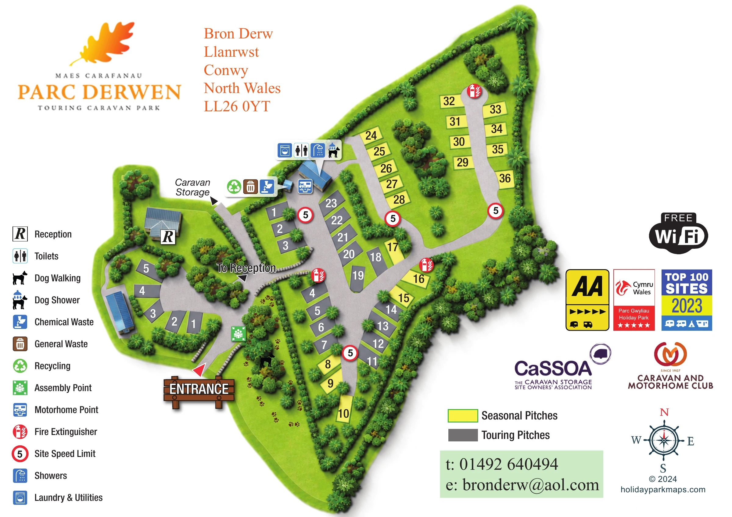
This illustrated map of Parc Derwen Touring Caravan Park presents a small, landscaped touring site at Bron Derw in Llanrwst, Conwy, North Wales. Its elongated outline is organised around branching access roads, with a smaller reception-side court to the west and a planted dog-walking strip beside the entrance. Numbered pitches remain the main focus: grey blocks identify touring pitches, while yellow blocks with green outlines distinguish seasonal pitches.
The map combines practical arrival information with a clearly illustrated sense of the grounds. A timber-style entrance sign, reception arrow and large pitch numbers help visitors orientate themselves, while trees, hedges and stone edging explain how the different areas relate. Grouped symbols locate the washrooms, showers, laundry, dog shower and waste facilities near the main amenities building.
The page also accommodates the park’s orange oak-leaf branding, a full facility legend, a compass and an information area for contact details and badges. It is a useful sample for touring-park operators who need pitch allocation, service locations and landscaped character to work together on one visitor-facing plan.
The single landscape-format plan shows an irregular, tapering site, with the main entrance near the lower-left side of the illustrated grounds. A red arrival arrow and a large timber-style sign establish the starting point. From here, a broad grey road reaches a junction: one route turns towards the western reception building and its small pitch court, while the other continues through the main touring area. An additional labelled arrow points towards caravan storage beyond the depicted grounds.
The central road serves rows of grey touring pitches before dividing into two northern branches lined largely with yellow seasonal pitches. A shorter southern branch serves another mix of pitch colours. Large numbers sit directly inside each footprint, keeping the accommodation information separate from the more expressive landscape drawing. Hedges trace the perimeter, and groups of trees and shrubs create planted divisions between roads and pitches.
Near the upper-left edge of the main accommodation area, rounded callout panels identify toilets, showers, laundry and utilities, a dog shower, recycling, general waste and chemical waste. A separate motorhome-point symbol sits beside the same service area. Fire-extinguisher and speed-limit markers recur along the roads, and an assembly point is marked near the entrance. The adjoining dog-walking strip is especially distinctive, using a black dog silhouette and scattered paw prints through the planting.
A vertical facility legend occupies the left margin. The right margin holds the Wi-Fi badge, award and organisation graphics, pitch-colour key, contact panel and compass. Blue-grey roof illustrations and softly shaded planting add depth without obscuring the underlying road-and-pitch plan.
 Enlarge this map ↗
KEEP EXPLORING
Chosen for shared landscapes, accommodation or facilities.
 Explore the map ↗
United Kingdom
Ashby Park map with seven fishing lakes, colour-coded accommodation and illustrated wooded shorelines.
 Explore the map ↗
United Kingdom
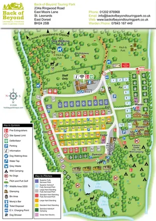
Colour-coded touring pitches, named glamping units and woodland routes at Back of Beyond Touring Park.
 Explore the map ↗
United Kingdom
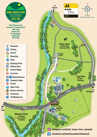
Riverside campsite map with named camping fields, touring-caravan rows and illustrated stone-wall boundaries.
Features may come from the sample artwork, its key or published park information. Approximate numbers describe the drawing and may cover only part of a park. They are intended to help you compare map examples. Current facilities and booking information should be checked with the park.
LET’S MAP YOUR PARK
For a map quotation, find your park and draw a rough boundary around it. The area you select helps us work out the design time and price.
Draw your park for a quote ↗Or talk to our map designers
01751 473136