
River Dane
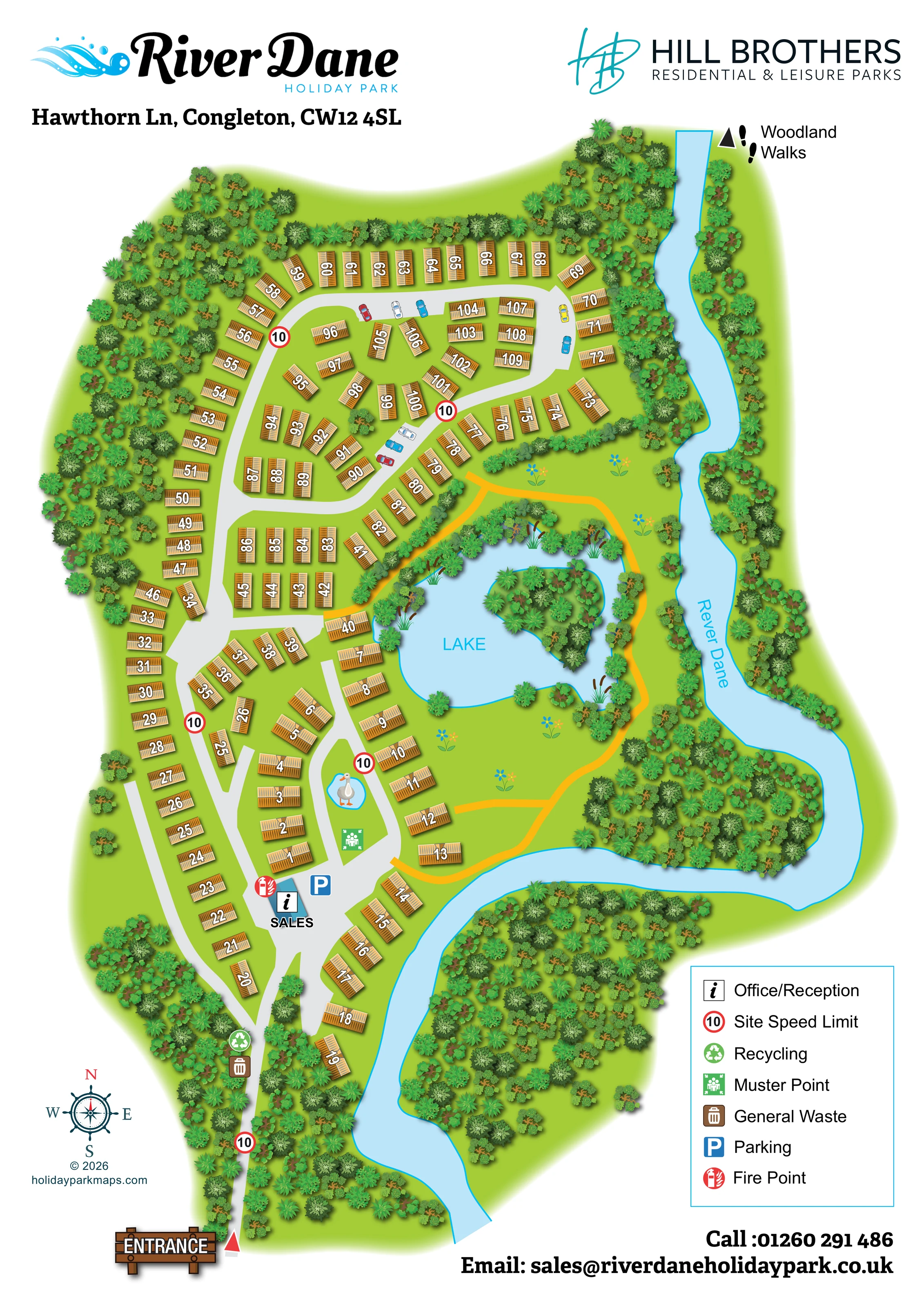
A broad pale-blue river follows the eastern edge, bends around a wooded peninsula and continues towards the southern edge.
ILLUSTRATED PARK MAP · P273
Hawthorn Ln, Congleton · United Kingdom
 Enlarge the map ↗
A SENSE OF THE PLACE
River Dane Holiday Park is located at Somerford near Congleton, within Daneside Country Park. Its parkland setting provides views across the Cheshire countryside.
Static caravans, lodges and holiday homes are offered for ownership, with families and pets welcomed. The map gives an overview of the plots and access routes within the grounds, supporting owners planning repeated breaks in the area.
LOOK CLOSER
A broad pale-blue river follows the eastern edge, bends around a wooded peninsula and continues towards the southern edge.
The central-eastern lake is labelled LAKE and illustrated with an irregular shoreline, reeds, marginal trees and a densely planted island.
Dense mixed tree symbols surround much of the park, line the riverbanks and frame the lake, with larger woodland masses inside and beyond the river bend.
A small blue pond with a decorative waterbird is drawn on the road island north of reception; it is not labelled as a visitor facility.
A blue-roofed building at the lower road junction is labelled SALES and carries the office/reception information symbol.
A blue parking symbol marks the arrival area beside the sales office. Small illustrated cars also appear along the northern roads.
Paired general-waste and recycling symbols are placed on the entrance approach, south of the main accommodation area.
A green muster-point symbol appears on the grassy island just north of the sales office.
A blue-roofed building at the lower road junction is labelled SALES and carries the office/reception information symbol.
A blue parking symbol marks the arrival area beside the sales office. Small illustrated cars also appear along the northern roads.
Paired general-waste and recycling symbols are placed on the entrance approach, south of the main accommodation area.
A green muster-point symbol appears on the grassy island just north of the sales office.
A red fire-point symbol is positioned beside the sales office.
Repeated red-ringed signs displaying 10 mark the entrance approach and several internal road sections.
The southern entrance is highlighted by a timber-style ENTRANCE sign and a red triangular pointer.
Light-grey roads branch from the entrance into linked loops and short access spurs serving the numbered plots.
Golden-yellow paths run around the lake's eastern side and through the open ground between the lake and river, with links towards nearby accommodation.
A directional triangle and footprints at the north-eastern edge indicate Woodland Walks; the onward route is not detailed.
A broad pale-blue river follows the eastern edge, bends around a wooded peninsula and continues towards the southern edge.
The central-eastern lake is labelled LAKE and illustrated with an irregular shoreline, reeds, marginal trees and a densely planted island.
Dense mixed tree symbols surround much of the park, line the riverbanks and frame the lake, with larger woodland masses inside and beyond the river bend.
A small blue pond with a decorative waterbird is drawn on the road island north of reception; it is not labelled as a visitor facility.
READING THE MAP
This illustrated map of River Dane Holiday Park near Congleton brings together numbered holiday-home plots, arrival information and a distinctive waterside landscape. The River Dane curves down the right-hand side of the portrait plan, while a lake with a wooded island creates a second prominent landmark within the grounds. Dense tree planting frames the accommodation and gives the artwork a strong sense of its Cheshire parkland setting.
The map shows roughly 110 accommodation plots arranged along branching roads and a broad northern loop. Grey vehicle routes are clearly separated from golden-yellow paths through the lakeside green space, and a woodland-walks marker points beyond the north-eastern edge. At the southern entrance, a timber-style sign leads the eye towards the sales office, parking and essential site symbols.
River Dane and Hill Brothers branding share the header, with a compact facility legend and contact details placed around the lower margins. It is a useful sample for ownership parks needing a numbered site overview that gives equal attention to practical orientation and the landscape surrounding their holiday homes.
The single portrait plan is organised around a southern entrance and an eastern river boundary. A narrow grey approach passes through woodland before dividing into the accommodation roads. Recycling and general-waste symbols sit along this approach, followed by a blue-roofed sales office at the first main junction. The office/reception information symbol, parking marker and fire point make this a recognisable arrival hub. A muster point is shown on the grassy island immediately to the north, alongside a small illustrated pond with a waterbird.
Accommodation occupies most of the western and northern ground. Numbered roof symbols follow curved perimeter rows, fill small internal blocks and turn at different angles around road junctions. The northern road forms a broad loop around several compact groups, while the southern roads serve more widely spaced units beside the river and lake. White numbers with dark outlines stand out against ochre roofs without requiring individual plot boundary lines.
The lake sits just right of centre, edged by trees and reeds and containing a heavily planted island. Golden-yellow paths connect the accommodation edge with the open ground around its eastern and southern sides. Beyond them, the pale-blue River Dane makes a pronounced bend around a wooded peninsula. A separate footprints-and-arrow marker identifies the direction of woodland walks at the top right.
Repeated red-ringed speed markers, a lower-left compass and a seven-entry legend support navigation. The green landscape fades into the white margins, leaving room for the park and operator logos above and contact details below. The enlarged views show overlapping portions of this same artwork, rather than separate park sections or alternative map designs.
KEEP EXPLORING
Chosen for shared landscapes, accommodation or facilities.
 Explore the map ↗
United Kingdom
Illustrated lakeside park plan with numbered holiday units, leisure buildings and a looping Woodland Walk.
 Explore the map ↗
United Kingdom
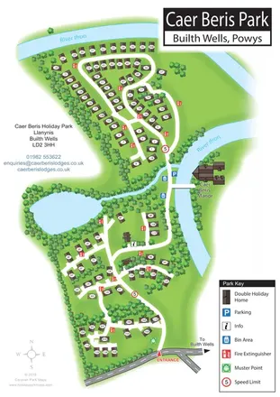
Portrait holiday-home park map with riverside loops, a tree-fringed pond and a separate manor landmark.
 Explore the map ↗
United Kingdom
Woodland camping, lodges, lakes and colour-coded bike trails at Avon Tyrrell Outdoor Centre.
Features may come from the sample artwork, its key or published park information. Approximate numbers describe the drawing and may cover only part of a park. They are intended to help you compare map examples. Current facilities and booking information should be checked with the park.
TAKE A CLOSER LOOK
View the illustrated map in detail or choose a file to download. These are sample maps; contact the park for current visitor information.

LET’S MAP YOUR PARK
For a map quotation, find your park and draw a rough boundary around it. The area you select helps us work out the design time and price.
Draw your park for a quote ↗Or talk to our map designers
01751 473136