
River Vyrnwy
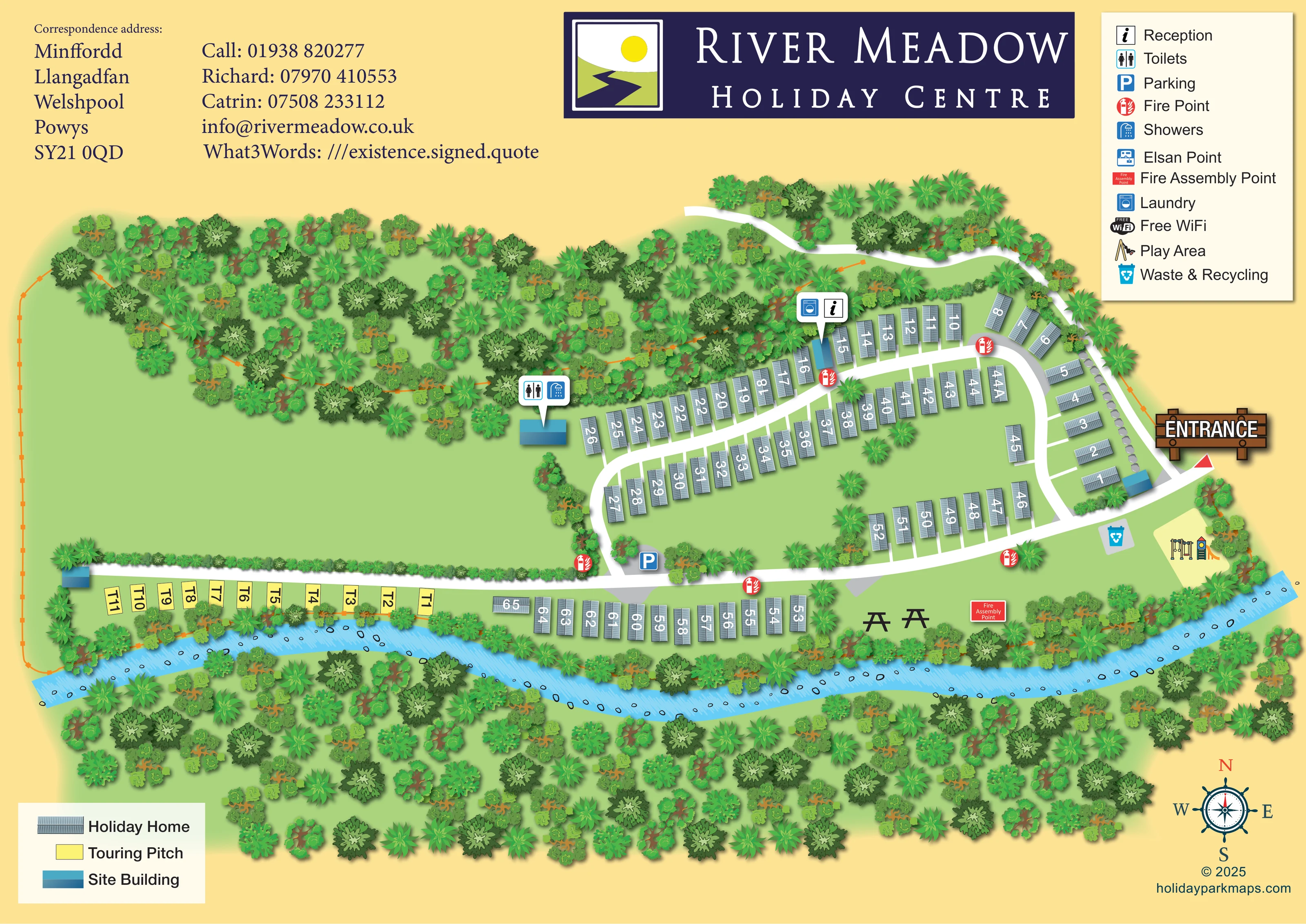
A winding blue river runs across the southern edge of the illustrated park, with water strokes and outlined stones. Its name comes from the park context rather than a label on the artwork.
ILLUSTRATED PARK MAP · P274
Park near Pont Llogel; office: Minffordd, Llangadfan, Welshpool, Powys · United Kingdom
 Enlarge the map ↗
A SENSE OF THE PLACE
River Meadow Holiday Centre is based at Park near Pont Llogel; office: Minffordd, Llangadfan, Welshpool, Powys. This is a family-run park in a sheltered valley beside the River Vyrnwy. A separate riverside area accepts touring caravans and campers, with electric and TV hook-ups.
The park lists Wi-Fi, laundry, play equipment and a games/football field.
LOOK CLOSER
A winding blue river runs across the southern edge of the illustrated park, with water strokes and outlined stones. Its name comes from the park context rather than a label on the artwork.
Dense, varied tree illustrations frame the northern edge and both riverbanks, while hedges divide the open field from the touring access lane.
A substantial unlabelled green field occupies the western part of the plan, above the touring pitches.
A reception callout points to a blue site building along the northern holiday-home row, shared with the laundry symbol.
The laundry is located by a callout at the same northern building as reception.
A combined toilet-and-shower callout marks a blue building at the western end of the main holiday-home rows.
A blue parking symbol identifies a grey area near the junction between the main accommodation road and the riverside access lane.
Repeated red fire-point symbols are distributed around the accommodation roads.
A reception callout points to a blue site building along the northern holiday-home row, shared with the laundry symbol.
The laundry is located by a callout at the same northern building as reception.
A combined toilet-and-shower callout marks a blue building at the western end of the main holiday-home rows.
A blue parking symbol identifies a grey area near the junction between the main accommodation road and the riverside access lane.
Repeated red fire-point symbols are distributed around the accommodation roads.
A red labelled assembly point appears on the riverside grass near the picnic tables.
An illustrated swing and slide occupy a pale yellow play-area patch near the entrance and river.
A turquoise recycling-bin symbol marks a grey pad beside the entrance-side access road.
Two dark picnic-table illustrations sit on the grass between the riverside holiday homes and the play-area end of the park.
Chemical toilet disposal is included in the facility key, but no corresponding position is clearly marked on the plan.
Free Wi-Fi appears in the facility key without a mapped coverage area or identifiable location.
A winding blue river runs across the southern edge of the illustrated park, with water strokes and outlined stones. Its name comes from the park context rather than a label on the artwork.
Dense, varied tree illustrations frame the northern edge and both riverbanks, while hedges divide the open field from the touring access lane.
A substantial unlabelled green field occupies the western part of the plan, above the touring pitches.
The eastern arrival point is emphasised by a large timber-style ENTRANCE sign and a red triangular marker.
Broad white routes connect the entrance, curved holiday-home roads and the long riverside touring lane; short white spurs serve individual homes.
Operator information lists a games/football field. The large field on the artwork is unlabelled, so its purpose is not confirmed by the map.
READING THE MAP
This illustrated map of River Meadow Holiday Centre presents a compact riverside park near Pont Llogel in Powys. The River Vyrnwy provides the main visual anchor, winding across the lower part of the page beneath a mixture of holiday homes, touring pitches and shared outdoor spaces. Dense tree illustrations around the park and along the riverbanks give the artwork a sheltered, green character.
The map makes the accommodation mix easy to recognise. Grey, roof-textured holiday homes occupy the main curved road network, while a smaller strip of yellow touring pitches follows the river at the western end. A large open grass area sits above this touring section, creating a clear contrast with the more closely arranged homes to the east.
Practical visitor information is integrated through numbered accommodation, service-building callouts and a prominent entrance marker. Reception, laundry, toilets and showers are located on the plan, alongside parking, recycling, play equipment, picnic tables and fire facilities. A navy branded header and two separate legends complete a sample suited to parks that need to explain both their accommodation layout and their landscape setting.
The plan is organised around an eastern entrance, marked by a large illustrated timber sign and red triangular pointer. From here, a broad white access route leads westwards above the river, connecting the main holiday-home area with the touring section. Branching roads curve through the central and northern accommodation rows, with short white spurs showing access to individual homes. A further line of holiday homes follows the riverside lane.
The accommodation symbols use distinct visual treatments. Holiday homes have grey-blue ridged roofs and large white numbers, while touring pitches are yellow blocks with black T-prefixed labels. Blue rectangular symbols identify site buildings. Reception and laundry share a pointer callout on the northern row; a separate callout locates toilets and showers towards the western end of the main holiday-home area. Parking is marked near the junction with the riverside lane.
At the entrance-side end of the river frontage, the map shows a waste and recycling pad and a pale yellow play area illustrated with swings and a slide. Picnic-table silhouettes occupy the nearby grass, beside a labelled fire assembly point. Repeated red fire-point symbols are spaced around the access routes. The facility key also includes an Elsan point and free Wi-Fi, without locating them on the plan.
The western field is left open and unlabelled. Surrounding trees, hedges and the textured blue river establish the park's landscape structure, while an unexplained orange perimeter line traces much of its edge. The single landscape-format artwork is completed by contact information, a large branded header, separate facility and accommodation keys, and a decorative compass rose.
KEEP EXPLORING
Chosen for shared landscapes, accommodation or facilities.
 Explore the map ↗
United Kingdom
Woodland holiday homes, named camping fields and farm buildings on a colour-coded Nether Wasdale park map.
 Explore the map ↗
United Kingdom
Illustrated caravan park plan with woodland and riverside walks, fishing pools and wildlife panels.
 Explore the map ↗
United Kingdom
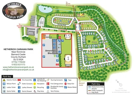
Woodland caravan park map with named pitch areas, walking routes and an enlarged amenities block.
Features may come from the sample artwork, its key or published park information. Approximate numbers describe the drawing and may cover only part of a park. They are intended to help you compare map examples. Current facilities and booking information should be checked with the park.
LET’S MAP YOUR PARK
For a map quotation, find your park and draw a rough boundary around it. The area you select helps us work out the design time and price.
Draw your park for a quote ↗Or talk to our map designers
01751 473136