
River Honddu
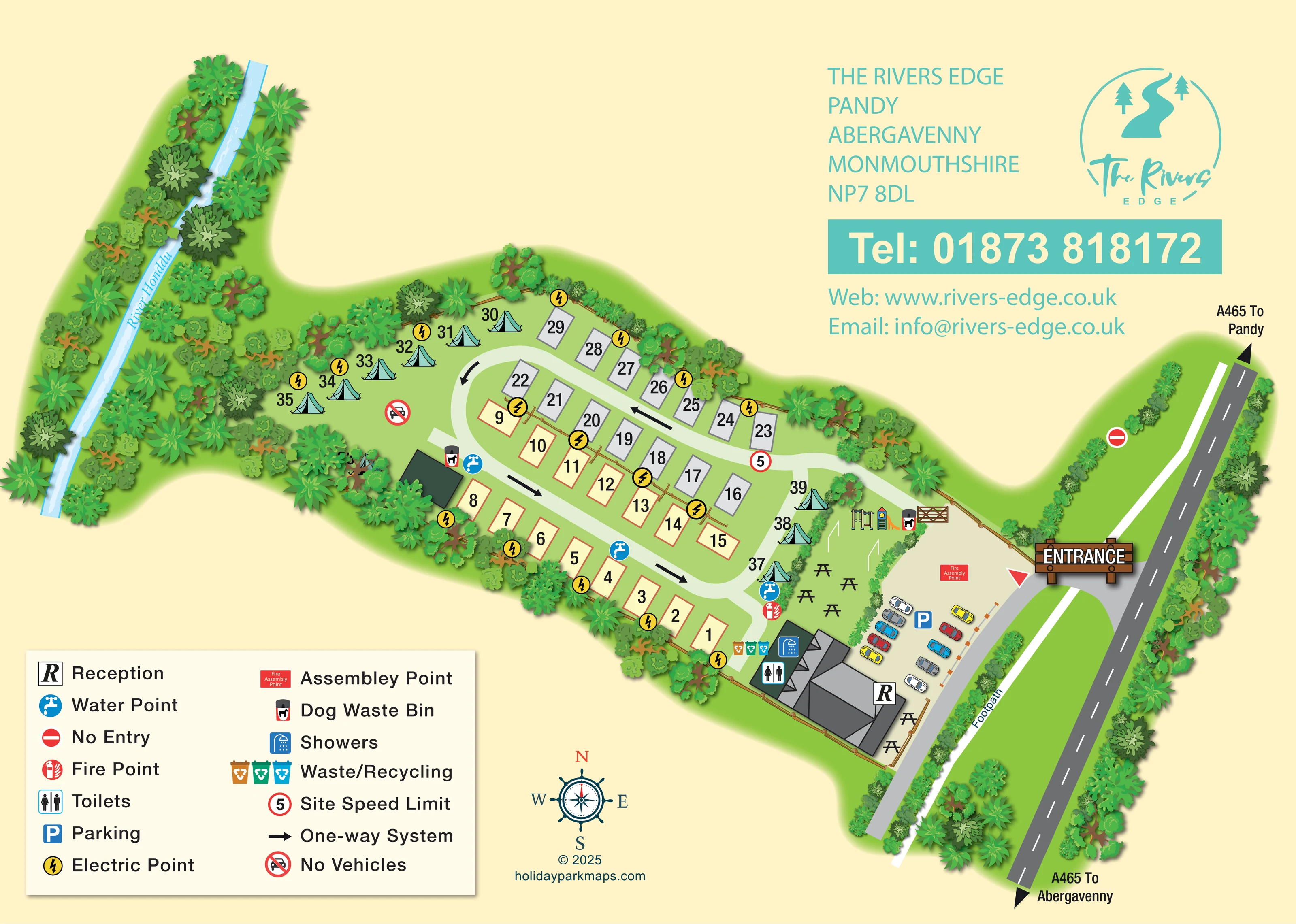
The named river runs along the far western side, drawn in pale blue with white water highlights and dense planting on both banks.
ILLUSTRATED PARK MAP · P277
Pandy, Abergavenny, Monmouthshire · United Kingdom
 Enlarge the map ↗
A SENSE OF THE PLACE
The Rivers Edge is an adults-only holiday park with a bar and restaurant at Pandy near Abergavenny. Its Monmouthshire countryside setting provides a base for a quieter break.
Grass electric and hardstanding pitches accommodate touring vehicles and roof-tent setups. Food and regular entertainment are offered on site, with the map helping visitors understand the relationship between the touring areas and social spaces.
LOOK CLOSER
The named river runs along the far western side, drawn in pale blue with white water highlights and dense planting on both banks.
Layered trees, shrubs, hedges and sections of timber fencing enclose the pitches, river corridor and roadside edge.
An R marker identifies reception within the main grey-roofed building beside the entrance car park.
Toilet and shower symbols mark the western end of the main entrance-side building complex.
A P symbol and two rows of illustrated cars distinguish the parking area immediately inside the entrance.
Repeated yellow lightning-bolt symbols mark electric points among the rectangular pitches and along part of the camping perimeter.
Blue tap symbols identify water points beside the internal lane and close to the eastern camping strip.
A grouped set of coloured bin symbols appears beside the toilet and shower building.
An R marker identifies reception within the main grey-roofed building beside the entrance car park.
Toilet and shower symbols mark the western end of the main entrance-side building complex.
A P symbol and two rows of illustrated cars distinguish the parking area immediately inside the entrance.
Repeated yellow lightning-bolt symbols mark electric points among the rectangular pitches and along part of the camping perimeter.
Blue tap symbols identify water points beside the internal lane and close to the eastern camping strip.
A grouped set of coloured bin symbols appears beside the toilet and shower building.
Dog waste bin symbols appear near the western utility building and the entrance-side recreation area; they do not establish a wider pet policy.
A red fire-point symbol is positioned near the eastern camping strip and amenity building.
A labelled red assembly-point marker occupies the open entrance forecourt above the car park.
Picnic-table illustrations are grouped on the entrance-side lawn and beside the main building.
The lawn beside the entrance contains swing and slide illustrations with two white goal frames. These are artwork features, not confirmation of a current family-oriented facility.
The named river runs along the far western side, drawn in pale blue with white water highlights and dense planting on both banks.
Layered trees, shrubs, hedges and sections of timber fencing enclose the pitches, river corridor and roadside edge.
A large timber-style ENTRANCE sign marks the approach from the A465 beside the parking and reception area.
The roadside strip carries directional labels towards Pandy at the top and Abergavenny at the bottom.
A white route labelled Footpath runs parallel to the A465 along the park frontage.
Black arrows on the pale internal lane communicate a one-way circuit around the central pitch rows.
The artwork includes a red-ringed 5 site-speed symbol, a no-vehicles marker near the western camping area and a no-entry marker beside the roadside frontage.
Published park information describes a bar and restaurant, food and regular entertainment. These uses are not separately labelled on the map.
READING THE MAP
This illustrated map of The Rivers Edge at Pandy places a compact touring and camping park between the A465 and the wooded River Honddu. The river is more than a background detail: its blue channel and densely planted banks give the western side of the artwork a recognisable shape, while the roadside entrance anchors the opposite end.
The map shows roughly 40 pitches arranged around a simple internal loop. Numbered rectangular plots distinguish the main touring rows, and turquoise tent illustrations identify camping areas beside the trees and near the entrance-side lawn. Reception, parking, toilets and showers are gathered at the arrival end, making their relationship to the pitches easy to understand.
A warm cream background, layered green planting and turquoise branding give the page a consistent visual character. Practical information remains prominent through large pitch numbers, colour-coded service symbols and directional arrows. For a small countryside park, this sample demonstrates how an illustrated plan can explain arrival, pitch organisation and everyday facilities while retaining the distinctive riverside setting.
The single landscape-format plan reads from the A465 frontage on the right towards the River Honddu on the left. A large timber-style entrance sign marks the access point, with a reception marker on the adjoining grey-roofed building and a blue parking symbol among two rows of illustrated cars. The roadside footpath is drawn separately as a white strip, while arrows at either end of the main road identify the directions towards Pandy and Abergavenny.
Inside the park, a pale lane forms a rounded one-way circuit. Bold black arrows explain circulation through the rectangular pitch rows, which use grey and cream fills with large black numbers. Tent-marked pitches follow the wooded western curve and a shorter strip beside the eastern lawn. Yellow electric-point symbols and blue water-point symbols punctuate the accommodation areas without competing with the plot labels.
The entrance-side building carries toilet and shower symbols, with waste and recycling bins nearby. Dog waste bins are shown in more than one part of the site, and a fire-point symbol sits near the eastern camping area. A labelled assembly point occupies the entrance forecourt. Picnic tables, illustrated play equipment and white goal frames give the adjacent lawn a distinct visual identity; their depiction should be read separately from the park's wider adults-only positioning.
The River Honddu is labelled along its pale-blue course, framed by overlapping trees and shrubs. Similar planting and timber fences define the pitch boundaries. A substantial two-column legend fills the lower-left corner, balanced by a compass below the plan and turquoise branding and contact details above the entrance. The result combines a straightforward site diagram with selective pictorial depth in the foliage, tents, cars and roof forms.
KEEP EXPLORING
Chosen for shared landscapes, accommodation or facilities.
 Explore the map ↗
United Kingdom
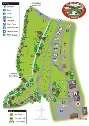
A stream-side farm campsite plan with car-free camping, caravan pitches and separate bell-tent areas.
 Explore the map ↗
United Kingdom
Woodland park map with mixed pitches, bell tents, lodges and a fishing lake.
 Explore the map ↗
United Kingdom
Woodland holiday homes, named camping fields and farm buildings on a colour-coded Nether Wasdale park map.
Features may come from the sample artwork, its key or published park information. Approximate numbers describe the drawing and may cover only part of a park. They are intended to help you compare map examples. Current facilities and booking information should be checked with the park.
LET’S MAP YOUR PARK
For a map quotation, find your park and draw a rough boundary around it. The area you select helps us work out the design time and price.
Draw your park for a quote ↗Or talk to our map designers
01751 473136