
Illustrated garden shelter
A small gazebo-like shelter is drawn on the landscaped green below the entrance, among decorative flower groups.
ILLUSTRATED PARK MAP · P582
Riverview Caravan Park, Marine Drive, Monifieth, By Dundee, Angus · United Kingdom
 Enlarge the map ↗
A SENSE OF THE PLACE
Riverview Caravan Park at Monifieth overlooks the River Tay and borders the beach and a golf course. The family-owned park offers touring stays and holiday home ownership.
Caravans, motorhomes and campervans are welcomed in its touring area. Village shops are within walking distance, while Dundee and the Angus coast provide options for excursions. The map explains the park's coastal layout and access routes.
LOOK CLOSER
A small gazebo-like shelter is drawn on the landscaped green below the entrance, among decorative flower groups.
Blue water, white surf, pale sand and scattered stones span the upper edge of the page, establishing the park's coastal setting.
Continuous tree planting encloses much of the site, with clipped hedge symbols separating touring rows and selected caravan areas.
An R symbol identifies reception in the service-building group below the entrance approach.
An information symbol is placed alongside reception in the same building group.
Separate toilet and wheelchair symbols mark buildings along the lower edge of the main accommodation area. The legend names the latter 'Disabled Toilets'.
A washing-machine symbol appears in a callout attached to the western service building.
A dishwashing symbol shares the service-building callout with laundry and vegetable preparation.
An R symbol identifies reception in the service-building group below the entrance approach.
An information symbol is placed alongside reception in the same building group.
Separate toilet and wheelchair symbols mark buildings along the lower edge of the main accommodation area. The legend names the latter 'Disabled Toilets'.
A washing-machine symbol appears in a callout attached to the western service building.
A dishwashing symbol shares the service-building callout with laundry and vegetable preparation.
A carrot symbol identifies a vegetable-preparation facility at the western end of the amenity row.
A labelled green space lies immediately below the laundry-side service building, beside the western extension.
Crossed table-tennis bats identify a separate small building between the touring pitches and reception group.
The leisure-suite symbol is placed on the building containing the reception and information symbols.
Blue tap symbols identify several water points around the accommodation roads and amenity buildings.
A blue chemical-waste symbol with a pointer marks a location beside the reception-side service building.
A motorhome drainage symbol identifies a servicing point along the lower amenity row.
A blue P and illustrated cars mark a parking area in the western extension, close to the lodges and drying green.
Repeated red circular extinguisher symbols are distributed beside accommodation roads and service buildings.
Bin and recycling symbols appear together between buildings in the lower amenity row.
A labelled grey area sits just inside the entrance, on the upper side of the arrival road.
A small gazebo-like shelter is drawn on the landscaped green below the entrance, among decorative flower groups.
The promotional panel on the left includes a 'Free WiFi' badge; it does not identify a particular coverage area.
Blue water, white surf, pale sand and scattered stones span the upper edge of the page, establishing the park's coastal setting.
A short brown boardwalk is labelled at the upper-right boundary, linking the park edge with the beach.
Continuous tree planting encloses much of the site, with clipped hedge symbols separating touring rows and selected caravan areas.
A prominent red entrance label marks the gated approach from the right. External arrows indicate 'Along Sea Front' and 'To Monifieth'.
Pale-grey roads connect the accommodation groups, with cyan directional arrows and repeated circular 10 signs.
Published park information places Riverview overlooking the River Tay, bordering the beach and a golf course. The water is illustrated but not named on the plan.
READING THE MAP
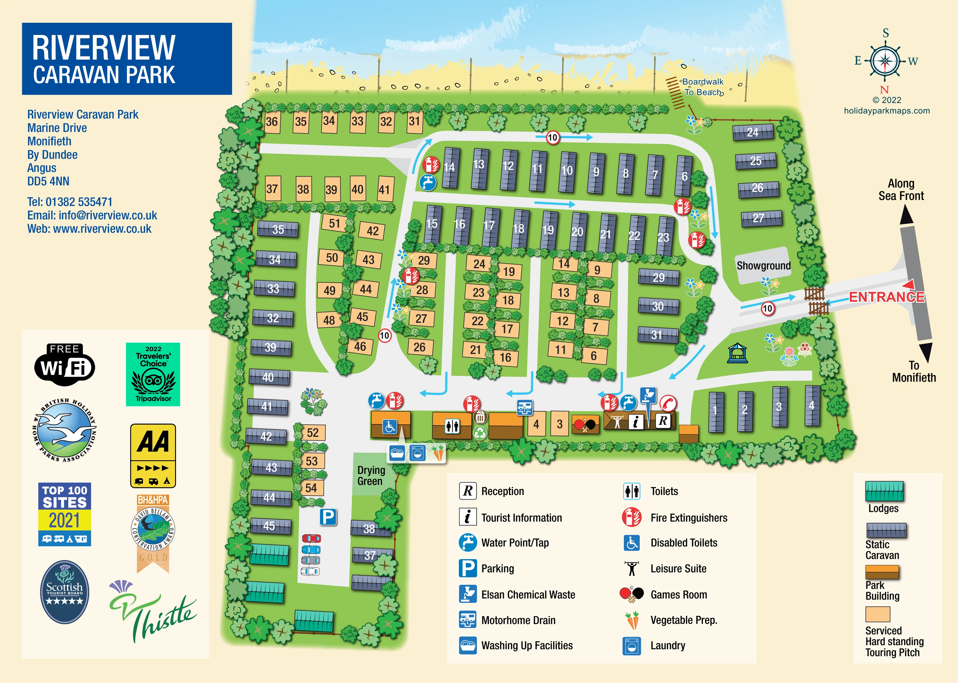
This illustrated map of Riverview Caravan Park in Monifieth brings together a beachfront setting, a mixed accommodation layout and practical visitor information on one landscape-format page. The shoreline stretches across the top of the artwork, with blue water, white surf and pale sand providing an immediate sense of place. Within the planted boundary, blue-grey static caravans, turquoise lodges and peach-coloured serviced hardstanding touring pitches are easy to distinguish.
The plan gives particular attention to arrival and everyday movement around the park. A bold red entrance label marks the approach from the right, cyan arrows trace the internal roads, and a labelled boardwalk identifies the connection to the beach. Reception and the main amenity buildings sit along the lower edge of the central accommodation area, supported by a generous pictorial key.
For a park combining touring visitors with holiday-home accommodation, this sample shows how a single illustrated plan can explain different accommodation areas while retaining the character of its coastal location.
The artwork presents the park as a mostly overhead plan, with south at the top according to its nautical compass. Two prominent rows of static caravans sit near the waterfront, with further caravans following the right-hand boundary and the long western extension. Touring pitches occupy the centre and upper-left of the plan, where repeated hedge symbols divide the rows into smaller, readable groups. A small cluster of turquoise-roofed lodges anchors the bottom of the western extension beside the illustrated parking area.
The entrance arrives from the right through a pair of drawn gates. A labelled showground lies just above the approach, while a planted green with a small gazebo-like shelter sits below it. Pale-grey roads connect the accommodation groups; cyan arrows indicate the depicted circulation, and circular 10 signs provide additional roadside cues. Outside the boundary, large arrows point towards Monifieth and along the seafront. At the upper-right edge, a slatted boardwalk is explicitly labelled as the route to the beach.
Facilities are concentrated in a row of orange-and-brown buildings below the main touring area. Symbols identify reception, tourist information, a leisure suite, games room, toilets and disabled toilets. A pointer callout groups laundry, washing-up and vegetable-preparation facilities, with a labelled drying green nearby. Water taps and fire extinguishers recur around the roads, while chemical-waste disposal, a motorhome drain, rubbish and recycling are also marked.
The complete page includes a left-hand title and contact column, a promotional badge panel, a broad facility legend and a separate accommodation key. The detail views enlarge portions of this same composition rather than introducing additional map variants.
KEEP EXPLORING
Chosen for shared landscapes, accommodation or facilities.
 Explore the map ↗
Ireland
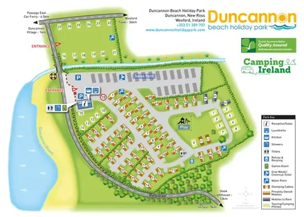
Beachside park plan with colour-coded mobile homes, touring/camping areas, glamping cabins and grouped service symbols.
 Explore the map ↗
United Kingdom
Colour-coded accommodation, central leisure facilities and coastal paths on an illustrated headland park map.
 Explore the map ↗
United Kingdom
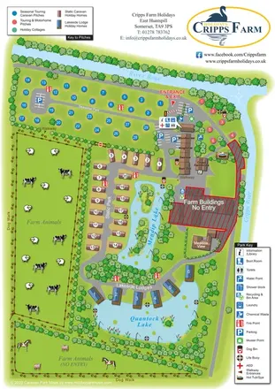
Illustrated farm holiday park plan combining riverside pitches, lakeside accommodation, animal fields and paw-print walking routes, with separate accommodation and facilities keys.
Features may come from the sample artwork, its key or published park information. Approximate numbers describe the drawing and may cover only part of a park. They are intended to help you compare map examples. Current facilities and booking information should be checked with the park.
LET’S MAP YOUR PARK
For a map quotation, find your park and draw a rough boundary around it. The area you select helps us work out the design time and price.
Draw your park for a quote ↗Or talk to our map designers
01751 473136