
Woodland and planted grounds
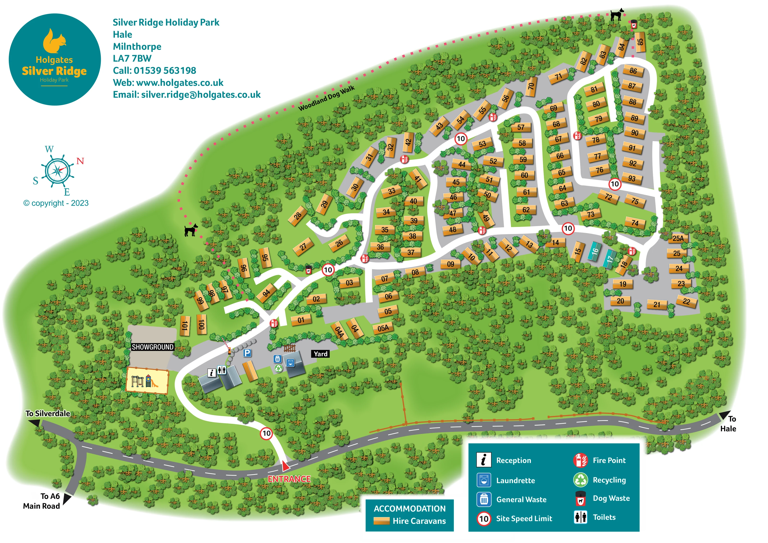
Dense illustrated trees surround the accommodation and fill substantial areas between the roads; smaller shrubs and hedges separate individual units.
ILLUSTRATED PARK MAP · P298
Silver Ridge Holiday Park, Hale, Milnthorpe · United Kingdom
 Enlarge the map ↗
A SENSE OF THE PLACE
Silver Ridge is a Holgates holiday home park near Milnthorpe. Its grounds follow a limestone ridge surrounded by Cumbrian woodland, with views towards the Yealands.
Holiday home ownership is the park's main focus. Walking routes and wildlife form part of the setting, while Arnside, Silverdale and nearby coastal areas provide options for outings. The map explains the layout across the sloping grounds.
LOOK CLOSER
Dense illustrated trees surround the accommodation and fill substantial areas between the roads; smaller shrubs and hedges separate individual units.
Information symbol identifies reception in the small building cluster beside the arrival road.
Toilet symbol appears on a building next to reception.
Washing-machine symbol marks the laundrette at the yard-side service building.
Blue P symbol marks parking beside the service buildings and illustrated vehicle barrier.
An enclosed pale-yellow rectangle contains illustrated swings and a climbing tower with slide, beside the showground and arrival road.
A labelled grey-beige area lies beside the play area near the entrance facilities.
A labelled service yard occupies the paved area behind the arrival buildings.
Information symbol identifies reception in the small building cluster beside the arrival road.
Toilet symbol appears on a building next to reception.
Washing-machine symbol marks the laundrette at the yard-side service building.
Blue P symbol marks parking beside the service buildings and illustrated vehicle barrier.
An enclosed pale-yellow rectangle contains illustrated swings and a climbing tower with slide, beside the showground and arrival road.
A labelled grey-beige area lies beside the play area near the entrance facilities.
A labelled service yard occupies the paved area behind the arrival buildings.
General waste and recycling symbols are grouped beside the laundrette and yard.
Repeated red fire-point symbols are distributed along the accommodation roads.
Dog waste symbols appear near the woodland walk connections at opposite ends of the route.
A named pink dotted route follows the upper and left-hand woodland edge, with black dog silhouettes reinforcing its purpose.
Dense illustrated trees surround the accommodation and fill substantial areas between the roads; smaller shrubs and hedges separate individual units.
A red entrance arrow leads from the public road into a curving white internal road. A striped barrier is illustrated farther inside beside the arrival facilities.
Black arrows on the grey external road identify directions to Hale, Silverdale and the A6 main road.
Red-ringed 10 signs are repeated along the arrival road and internal junctions, matching the site speed-limit entry in the legend.
Park information describes sloping grounds along a limestone ridge amid Cumbrian woodland, with views towards the Yealands. The map does not use contours or depict these views.
READING THE MAP
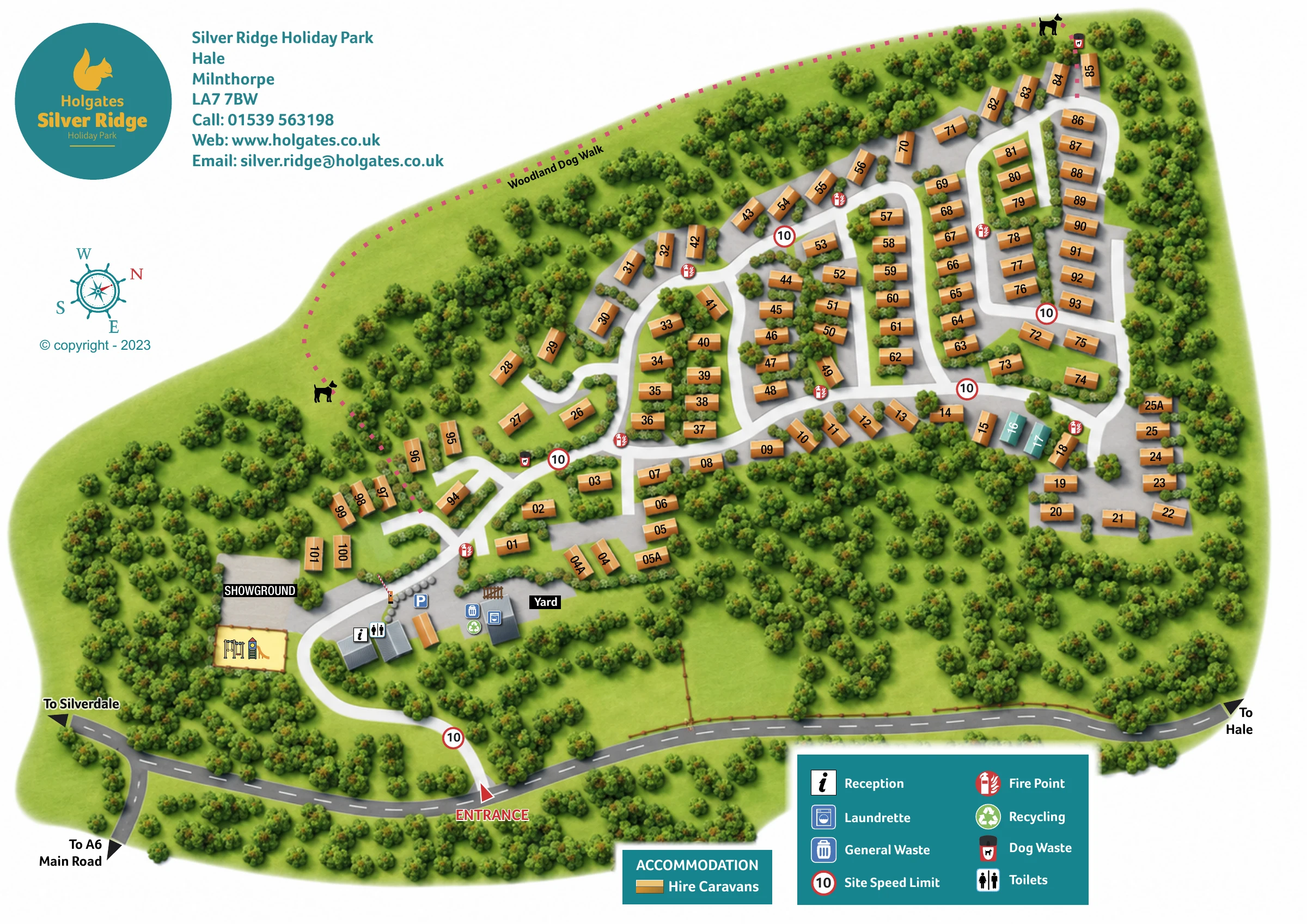
This illustrated map of Silver Ridge Holiday Park places its woodland setting at the centre of the design. Created for the Holgates park at Hale near Milnthorpe, it shows numbered caravan-style holiday accommodation arranged along curving roads, with generous belts of trees surrounding and separating the groups. The result is a site plan in which the landscape remains an important part of finding your way, rather than becoming a simple backdrop to the plots.
Arrival is clearly anchored by a red entrance arrow from the public road. Reception, toilets, parking, the laundrette and yard form a compact cluster just inside the park, alongside an illustrated play area and a labelled showground. A pink dotted Woodland Dog Walk traces the outer wooded edge, providing a distinctive secondary route. Teal legend panels and the circular Holgates squirrel branding give the sheet a consistent visual identity, while bold accommodation numbers and familiar service symbols keep the practical information easy to locate.
The plan is organised around a winding approach from the road along the bottom of the sheet. Direction arrows identify Hale, Silverdale and the A6 main road, while the entrance itself is picked out in red. Inside, the approach curves around the play area and showground towards reception and toilets. Parking, a striped vehicle barrier, the laundrette, waste and recycling points, and a labelled yard complete this arrival and service cluster.
Beyond it, broad white internal roads divide into connected loops and shorter branches serving roughly 100 illustrated accommodation units. The caravan symbols are mainly gold, with large black plot numbers placed directly on their roofs. Two teal units introduce a small colour variation that is not explained in the visible key. Grey plot surfaces distinguish the developed areas from green lawns, planted islands and woodland. Short rows alternate with more loosely arranged groups, reflecting the irregular shape of the grounds rather than imposing a single grid.
Trees are a major visual component throughout: dense perimeter planting is echoed by substantial wooded pockets within the site, and smaller shrubs separate neighbouring units. The named Woodland Dog Walk follows a pink dotted line around the upper and left-hand edge, supported by dog silhouettes and dog waste symbols. Red fire-point icons and red-ringed speed-limit markers recur along the roads.
The single landscape sheet includes a compass rose, an upper-left identity and contact block, and two lower teal keys. Its enlarged detail views show overlapping portions of this same design, rather than separate park sections or additional maps.
 Enlarge this map ↗
KEEP EXPLORING
Chosen for shared landscapes, accommodation or facilities.
 Explore the map ↗
United Kingdom
Woodland-framed Barnsoul map with mixed accommodation, shared facilities and paw-marked walking routes.
 Explore the map ↗
United Kingdom
A wooded, streamside park map with a linked farm, café, touring and cottage area.
 Explore the map ↗
United Kingdom
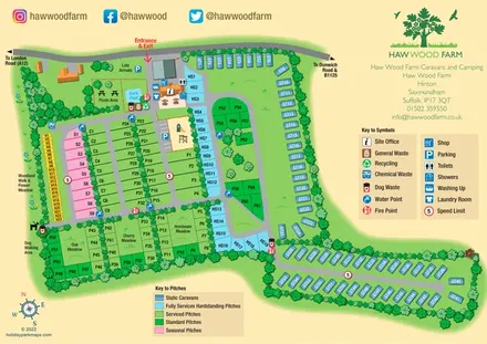
Colour-coded pitches, a leafy facilities hub and a long static-caravan wing at Haw Wood Farm, Suffolk.
Features may come from the sample artwork, its key or published park information. Approximate numbers describe the drawing and may cover only part of a park. They are intended to help you compare map examples. Current facilities and booking information should be checked with the park.
LET’S MAP YOUR PARK
For a map quotation, find your park and draw a rough boundary around it. The area you select helps us work out the design time and price.
Draw your park for a quote ↗Or talk to our map designers
01751 473136