
Golf course
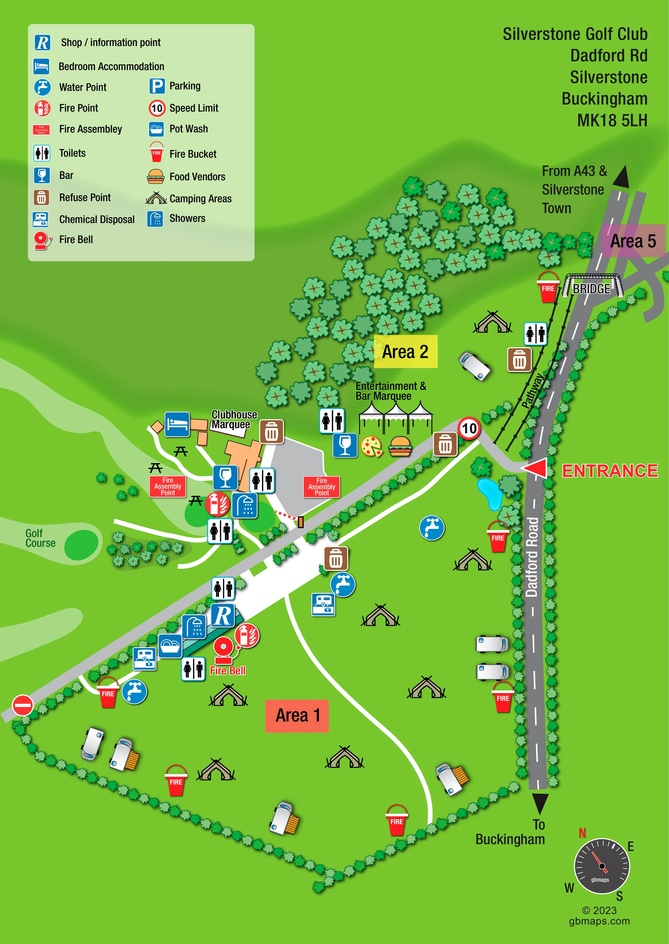
The golf course is labelled to the left of the clubhouse and illustrated with pale-green fairway shapes and darker circular greens.
ILLUSTRATED PARK MAP · P301
Silverstone Golf Club, Dadford Road, Silverstone, Buckingham · United Kingdom
 Enlarge the map ↗
A SENSE OF THE PLACE
Silverstone Golf Club Campsite provides event camping near the Silverstone racing circuit. Pitches are offered for visitors attending motorsport events, with electric options available in designated areas.
The map supports event arrivals and helps campers understand the pitch layout and internal routes. Accommodation arrangements follow the event campsite's booking rules, with pitches allocated by the team on arrival.
LOOK CLOSER
The golf course is labelled to the left of the clubhouse and illustrated with pale-green fairway shapes and darker circular greens.
A substantial cluster of illustrated trees borders Area 2, while repeated smaller trees trace field edges, the internal approach and Dadford Road.
A small bright-blue pond is drawn just inside the campsite near the entrance.
A blue R symbol marks the shop / information point within the elongated service cluster beside Area 1.
A labelled marquee sits beside the peach-coloured clubhouse building group.
A prominent three-peaked white marquee is labelled beside Area 2, close to the entrance approach.
Blue wine-glass symbols identify bar facilities at the clubhouse and entertainment marquee.
Pizza and burger illustrations mark food vendors beside the entertainment and bar marquee.
A blue R symbol marks the shop / information point within the elongated service cluster beside Area 1.
A labelled marquee sits beside the peach-coloured clubhouse building group.
A prominent three-peaked white marquee is labelled beside Area 2, close to the entrance approach.
Blue wine-glass symbols identify bar facilities at the clubhouse and entertainment marquee.
Pizza and burger illustrations mark food vendors beside the entertainment and bar marquee.
Repeated toilet symbols serve the clubhouse, entertainment area, roadside pathway and Area 1 service cluster; shower symbols appear at the clubhouse and lower service cluster.
A washing-up symbol is positioned in the Area 1 service cluster.
Blue tap symbols are distributed around Area 1, including beside the lower service cluster and towards Dadford Road.
Chemical disposal symbols appear beside the Area 1 service cluster and further along its upper field edge.
Brown bin symbols are distributed around the clubhouse, entertainment area, roadside pathway and upper edge of Area 1.
Red fire-point symbols appear at the clubhouse and lower service cluster. Fire buckets are distributed around the camping fields, and a labelled fire bell stands beside the Area 1 facilities.
Two red assembly-point labels are shown around the clubhouse and adjoining grey forecourt.
Black picnic-table silhouettes sit among the paths and green spaces around the clubhouse.
Parking has a blue P entry in the key, but no corresponding P marker is clearly visible on the plan. The grey clubhouse forecourt is not explicitly labelled as parking.
The golf course is labelled to the left of the clubhouse and illustrated with pale-green fairway shapes and darker circular greens.
A substantial cluster of illustrated trees borders Area 2, while repeated smaller trees trace field edges, the internal approach and Dadford Road.
A small bright-blue pond is drawn just inside the campsite near the entrance.
A large red entrance arrow marks the junction with Dadford Road. Road-end labels point towards the A43 and Silverstone town, and towards Buckingham.
A labelled black-lined pathway runs beside Dadford Road from near the entrance to a drawn bridge crossing the road near the Area 5 label.
A grey diagonal access road links the entrance with the clubhouse and lower site edge. White paths connect the buildings and curve through Area 1; a barrier is illustrated at the clubhouse forecourt.
A circular 10 speed-limit symbol appears near the entrance approach, and a no-entry symbol marks the lower-left end of the diagonal road.
READING THE MAP
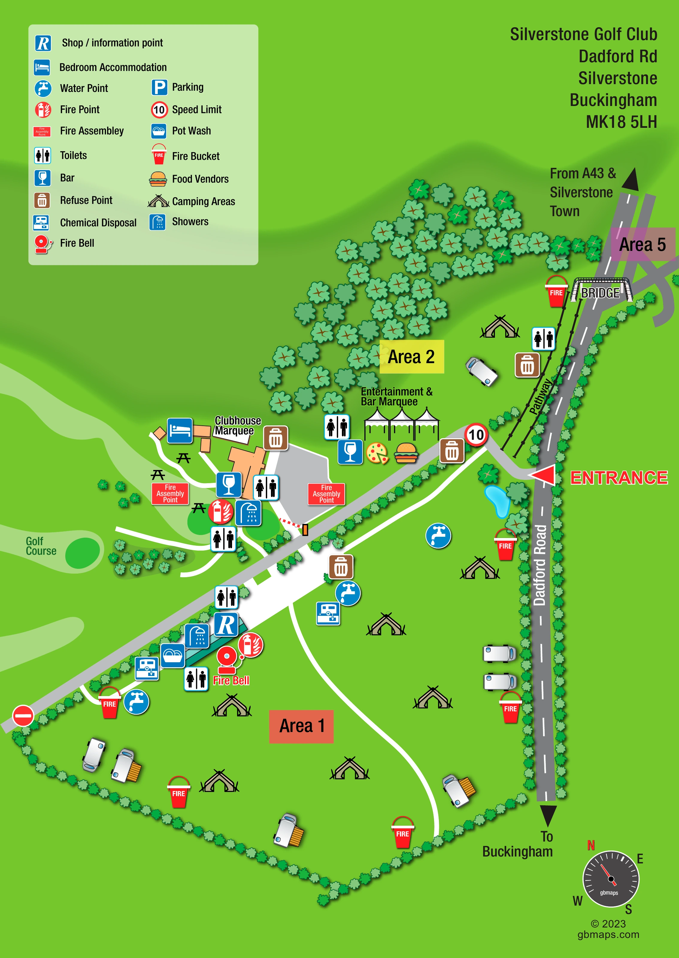
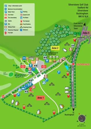
This illustrated map of Silverstone Golf Club Campsite presents event camping in a distinctive golf-course setting on Dadford Road, Silverstone. Rather than drawing a grid of individual pitches, it organises the site around broad camping areas, recognisable landmarks and clearly marked visitor facilities. The large lower field is labelled Area 1, while Area 2 sits beside a wooded belt and the entertainment marquee. An Area 5 label appears near the bridge at the upper edge of the plan.
The bright-green portrait design gives the entrance, internal approach and roadside pathway a clear visual relationship. A bold red arrow marks arrival from Dadford Road, while white paths connect the camping field with the clubhouse and service points. Tent and camping-vehicle illustrations explain the site's use without implying a fixed pitch count.
A substantial symbol key supports the practical detail: toilets, showers, water, washing-up, chemical disposal, refuse and fire provision. The clubhouse, bars, food vendors and three-peaked entertainment marquee give visitors memorable reference points within a map designed for event arrivals and everyday campsite orientation.
The single portrait plan places Dadford Road along the right-hand side, with directional labels for the A43 and Silverstone town above and Buckingham below. A large red entrance arrow marks the turn into the campsite. From here, a grey diagonal access road leads towards the clubhouse and continues to the lower-left boundary, where a no-entry symbol is drawn. A separate black-lined pathway follows the roadside to an illustrated bridge near the Area 5 label.
Area 1 fills the broad lower field, bounded by repeated tree symbols and crossed by a sweeping white path. Scattered tent and camping-vehicle illustrations communicate open-field camping rather than individual plots. Along its upper-left edge, an elongated service building is surrounded by symbols for the shop / information point, toilets, showers, pot wash and chemical disposal. A labelled fire bell and fire point make this cluster especially recognisable. Further water, refuse and chemical disposal symbols appear along the field's upper edge, with red fire buckets distributed around the camping space.
Above the diagonal road, peach building footprints, a labelled clubhouse marquee and a bed symbol form the clubhouse group. White connecting paths, picnic tables, bar, toilet and shower symbols surround it. Two fire assembly points are marked beside the buildings and grey forecourt.
Area 2 lies between the woodland and roadside pathway. Its entertainment and bar marquee is drawn with three white peaks, accompanied by bar, toilet, refuse and food-vendor symbols. Golf fairways extend to the left, while a small blue pond sits near the entrance. The upper-left key and lower-right compass complete the composition, balancing practical symbol-led navigation with a recognisable landscape setting.
KEEP EXPLORING
Chosen for shared landscapes, accommodation or facilities.
 Explore the map ↗
United Kingdom
Woodland holiday-park map with named accommodation areas, touring loops and illustrated recreation facilities.
 Explore the map ↗
United Kingdom
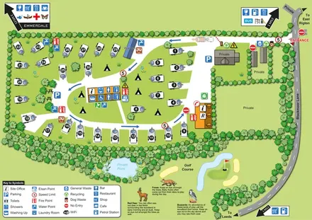
Numbered touring pitches, central amenities and wildlife illustrations in a tree-lined countryside site map.
 Explore the map ↗
United Kingdom
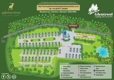
Woodland-framed Glentrool site map with numbered caravans, yellow touring pitches and a turquoise pond.
Features may come from the sample artwork, its key or published park information. Approximate numbers describe the drawing and may cover only part of a park. They are intended to help you compare map examples. Current facilities and booking information should be checked with the park.
TAKE A CLOSER LOOK
View the illustrated map in detail or choose a file to download. These are sample maps; contact the park for current visitor information.


LET’S MAP YOUR PARK
For a map quotation, find your park and draw a rough boundary around it. The area you select helps us work out the design time and price.
Draw your park for a quote ↗Or talk to our map designers
01751 473136
 silverstonemap_large.png