
Private buildings and grounds
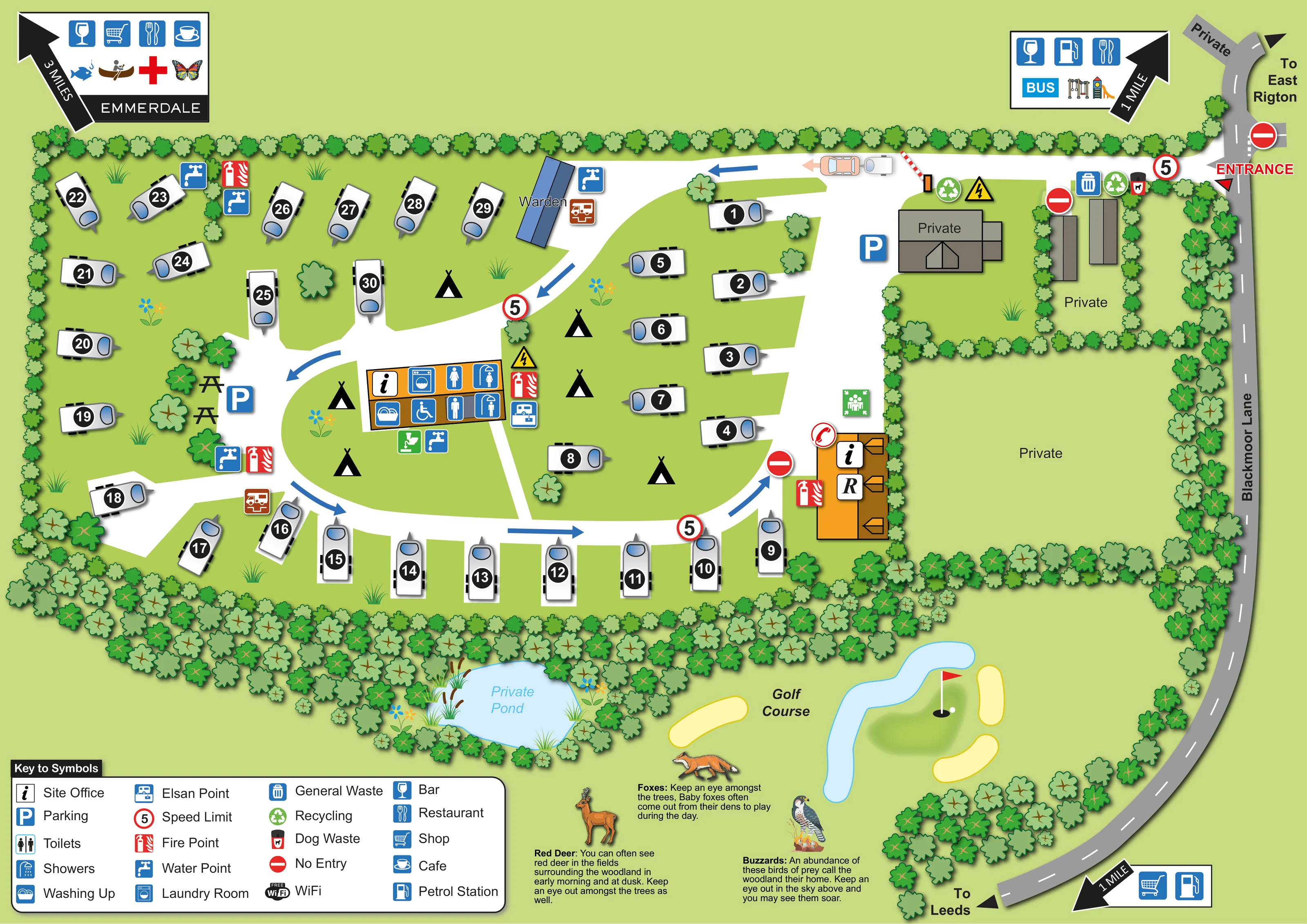
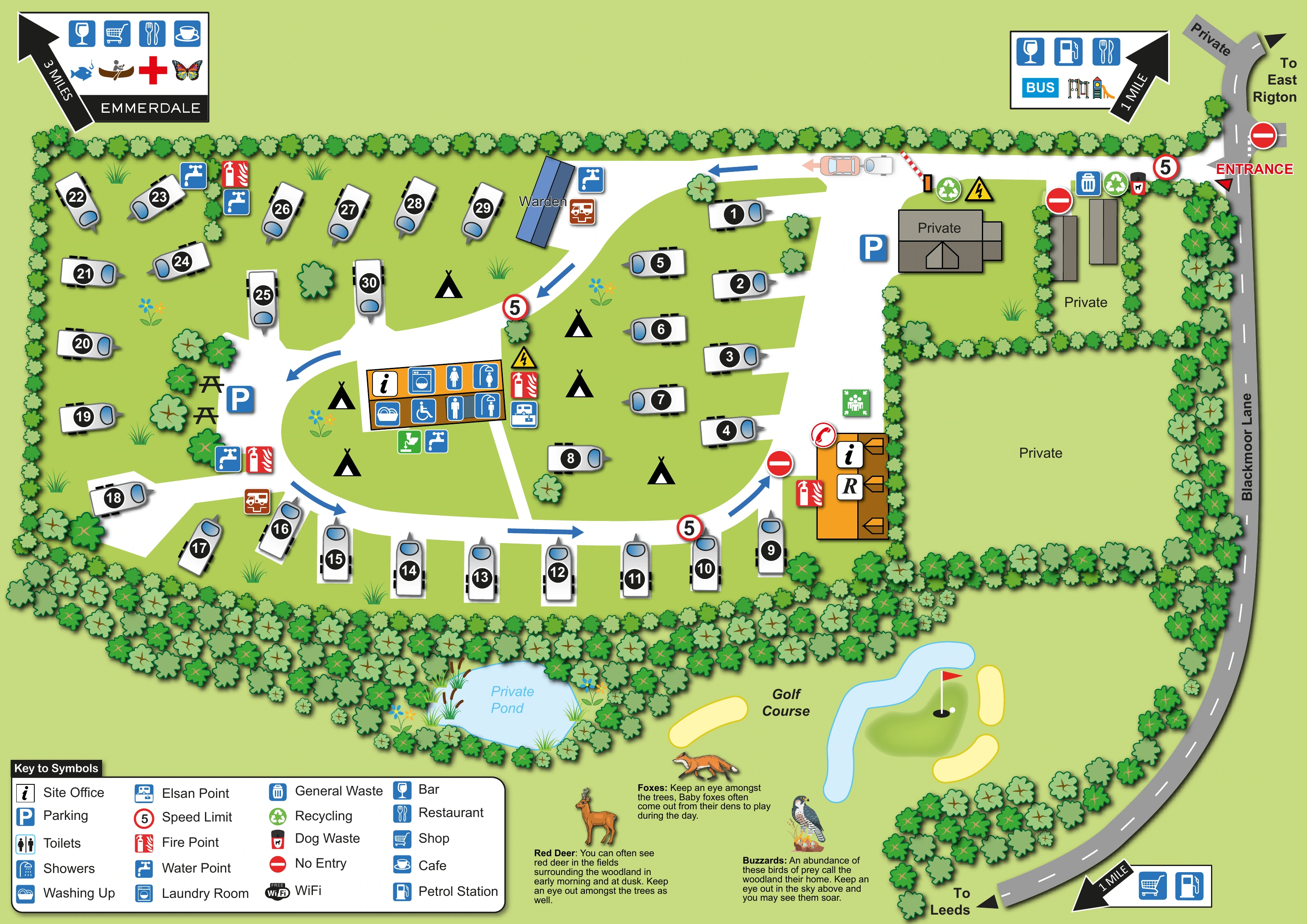
Private labels distinguish buildings near the entrance and a large hedged green enclosure east of the visitor accommodation.
ILLUSTRATED PARK MAP · P471
Blackmoor Lane, Bardsey, Leeds, West Yorkshire · United Kingdom
 Enlarge the map ↗
A SENSE OF THE PLACE
Glenfield Caravan Park is a family-run touring site at Bardsey between Leeds and Harrogate. Its south-facing grounds sit beside woodland and golf courses in the Yorkshire countryside.
Hardstanding pitches serve caravans and motorhomes, with grass available for tents. A heated amenities block, showers and an accessible room support stays, while Wi-Fi and a pet-friendly approach add practical conveniences.
LOOK CLOSER
Private labels distinguish buildings near the entrance and a large hedged green enclosure east of the visitor accommodation.
Continuous rows of stylised trees enclose the touring area, with a particularly deep wooded strip along the southern boundary.
A pale-blue pond surrounded by trees, reeds and flowers is labelled Private Pond below the touring area.
The southern context includes a labelled golf course illustrated with a putting green, flag, yellow bunkers and a curving water feature. It is not identified as a park-operated facility.
Illustrated wildlife notes describe red deer in surrounding fields and woodland, foxes among the trees and buzzards overhead.
The keyed information symbol appears on the orange building beside the eastern part of the internal road and on the central amenities building.
A blue-roofed building on the northern internal road is labelled Warden.
Male and female toilet and shower symbols are grouped on the central orange amenities block, alongside a wheelchair symbol. The symbol identifies an accessible provision without establishing its specification.
The keyed information symbol appears on the orange building beside the eastern part of the internal road and on the central amenities building.
A blue-roofed building on the northern internal road is labelled Warden.
Male and female toilet and shower symbols are grouped on the central orange amenities block, alongside a wheelchair symbol. The symbol identifies an accessible provision without establishing its specification.
Washing-up and washing-machine symbols are placed on the central amenities block.
Water points recur around the touring area and beside the amenities. Elsan-point symbols appear near the warden building, central facilities and south-western pitch area.
Waste and recycling symbols are concentrated near the northern entrance area and private buildings; a dog-waste symbol is also shown there.
Blue parking symbols mark a northern arrival-side area and a western area beside the picnic tables.
Two simple picnic-table drawings sit among trees beside the western parking area.
Red fire-point symbols are distributed around the touring layout, including the central amenities and eastern office building.
Wi-Fi appears in the key, but no individual Wi-Fi location is clearly plotted on the main plan.
A red entrance label and arrow identify the access at the north-eastern edge of the site.
A broad white road curves around the touring pitches, with blue directional arrows, repeated 5 speed-limit signs and red no-entry symbols. A barrier is drawn on the northern access road.
The grey road along the right-hand edge is labelled Blackmoor Lane, with directions towards East Rigton and Leeds and a private branch at the top.
Private labels distinguish buildings near the entrance and a large hedged green enclosure east of the visitor accommodation.
Continuous rows of stylised trees enclose the touring area, with a particularly deep wooded strip along the southern boundary.
A pale-blue pond surrounded by trees, reeds and flowers is labelled Private Pond below the touring area.
The southern context includes a labelled golf course illustrated with a putting green, flag, yellow bunkers and a curving water feature. It is not identified as a park-operated facility.
Illustrated wildlife notes describe red deer in surrounding fields and woodland, foxes among the trees and buzzards overhead.
Edge callouts use arrows and amenity symbols to indicate off-site bars, restaurants, shops, a café and petrol stations. The upper-right callout also includes bus and playground symbols. The upper-left destination is labelled Emmerdale.
READING THE MAP
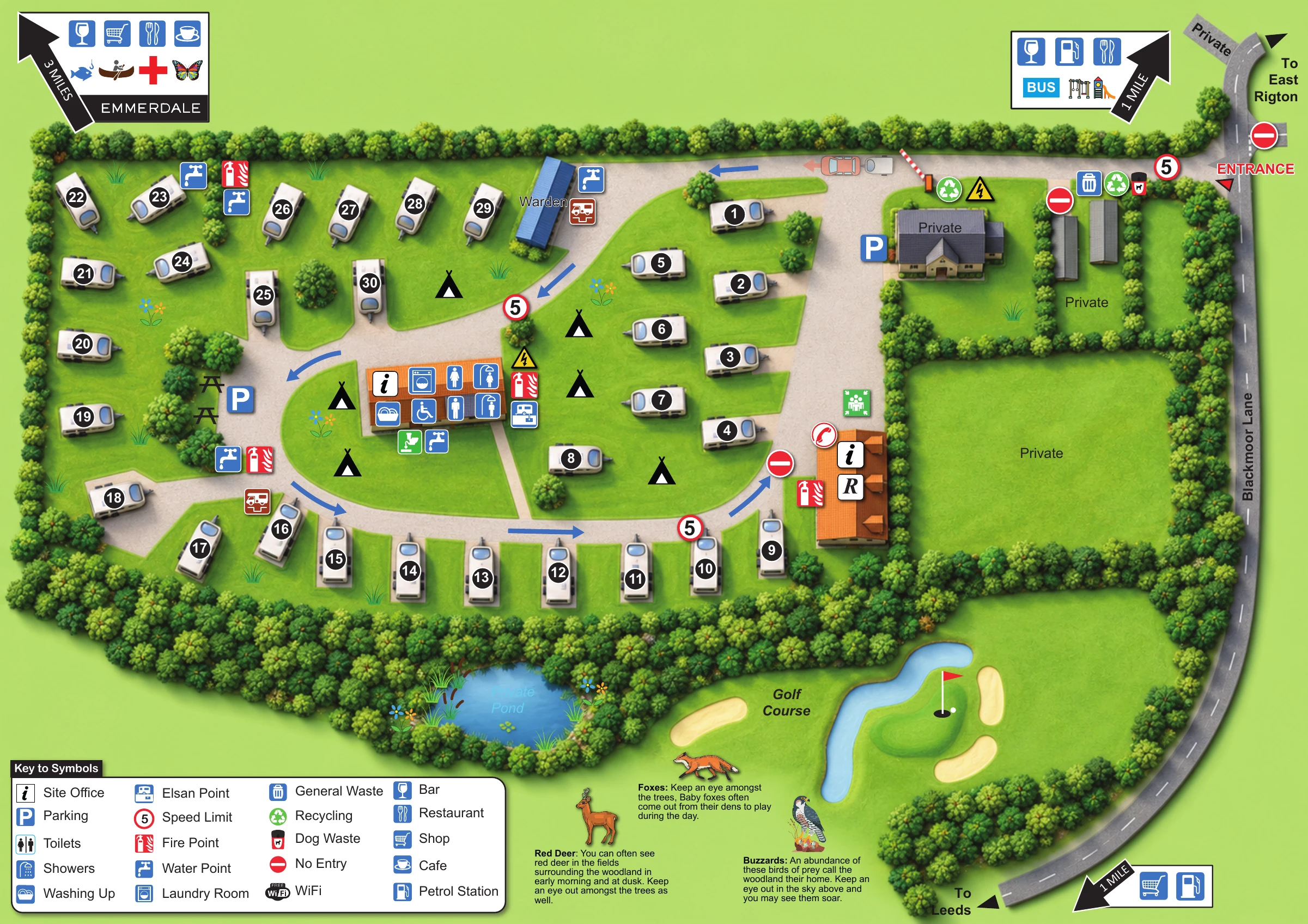
This illustrated map of Glenfield Caravan Park brings a compact touring and camping layout together with the wooded setting around it. Located at Bardsey, between Leeds and Harrogate, the park is shown beside Blackmoor Lane, with an entrance at the upper-right edge and a curving internal road serving the visitor pitches. Numbered caravan drawings make the accommodation easy to recognise, while tent symbols indicate camping spaces within the grassy centre.
The artwork gives equal attention to practical orientation and local character. An orange amenities building carries grouped symbols for toilets, showers, washing-up and laundry, with water, waste and other service points distributed around the plan. Dense illustrated tree belts frame the pitches and separate them from a private pond and neighbouring golf course. Along the bottom, drawings of a deer, fox and bird of prey accompany wildlife notes. A large symbol key and peripheral destination arrows complete a map designed to explain both the site and its immediate surroundings.
The main plan places the touring area to the left of Blackmoor Lane, which curves down the right-hand edge towards Leeds. A clearly labelled entrance connects the lane to the northern access road. From there, a broad white route bends through the caravan area, with blue arrows showing circulation and red signs marking restricted approaches. Parking is shown near the arrival area and on the western side, beside two picnic tables.
Roughly 30 caravan positions are illustrated with white bodies, blue window details and bold black number badges. They follow the western and southern boundaries and form smaller rows within the eastern half of the visitor area. Tent symbols appear in the intervening grass, rather than in a separately numbered camping field. The central orange amenities block groups toilet, shower, laundry, washing-up and wheelchair symbols. Water points, Elsan points and fire points appear at several locations, while waste and recycling symbols cluster near the entrance-side buildings. A blue building beside the northern road is labelled Warden.
To the east, hedged enclosures and grey buildings carry private labels, keeping them visually distinct from visitor accommodation. Below the pitches, a thick woodland belt surrounds a private pond. Beyond it, a compact golf-course illustration includes bunkers, a flag and water. Wildlife notes about red deer, foxes and buzzards occupy the lower part of the page.
The lower-left key explains the service symbols. Separate edge panels point towards off-site amenities, including an Emmerdale-labelled destination. This is a single landscape-format artwork; the enlarged lower-edge views show its key and wildlife content rather than additional park sections.
 Enlarge this map ↗
KEEP EXPLORING
Chosen for shared landscapes, accommodation or facilities.
 Explore the map ↗
United Kingdom
Woodland holiday-park map with named accommodation areas, touring loops and illustrated recreation facilities.
 Explore the map ↗
United Kingdom
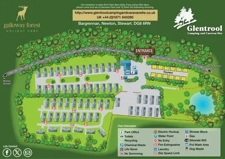
Woodland-framed Glentrool site map with numbered caravans, yellow touring pitches and a turquoise pond.
 Explore the map ↗
United Kingdom
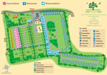
Colour-coded pitches, a leafy facilities hub and a long static-caravan wing at Haw Wood Farm, Suffolk.
Features may come from the sample artwork, its key or published park information. Approximate numbers describe the drawing and may cover only part of a park. They are intended to help you compare map examples. Current facilities and booking information should be checked with the park.
TAKE A CLOSER LOOK
View the illustrated map in detail or choose a file to download. These are sample maps; contact the park for current visitor information.


LET’S MAP YOUR PARK
For a map quotation, find your park and draw a rough boundary around it. The area you select helps us work out the design time and price.
Draw your park for a quote ↗Or talk to our map designers
01751 473136
 glenfieldmap_large.png