
Loch Greshornish and rocky shoreline
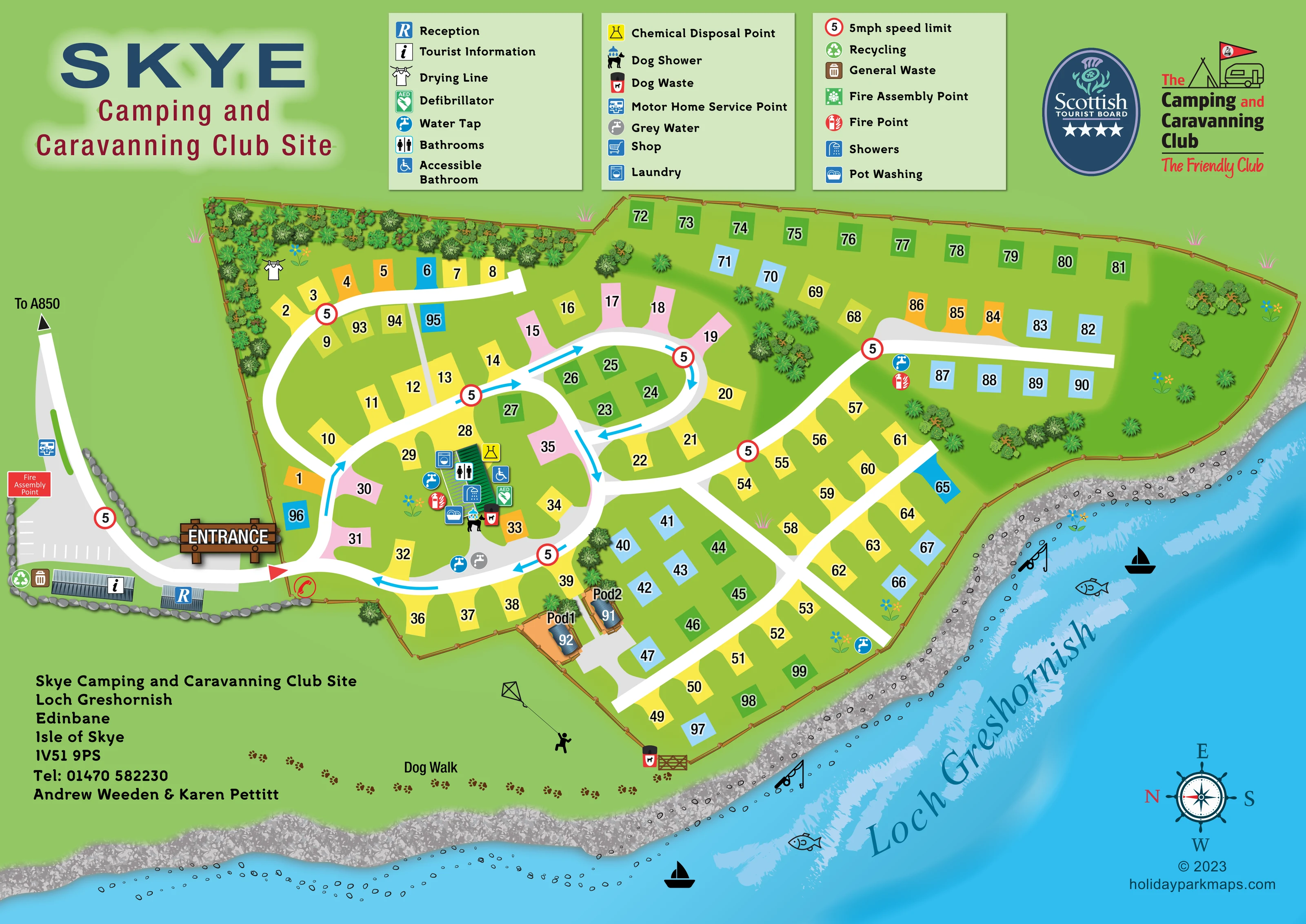
Blue loch water fills the lower and right-hand edges of the composition, separated from the campsite by a textured grey shore. The loch is named diagonally across the water.
ILLUSTRATED PARK MAP · P302
Skye Camping and Caravanning Club Site, Loch Greshornish, Edinbane, Isle of Skye · United Kingdom
 Enlarge the map ↗
A SENSE OF THE PLACE
Skye Camping and Caravanning Club Site occupies a lochside setting at Loch Greshornish near Edinbane. Mountains and the working-croft surroundings provide a backdrop for exploring the island.
An amenities block, motorhome service point and backpacker facilities support camping and touring. Glamping pods offer another way to stay, with the map helping visitors understand the arrangement of the site beside the loch.
LOOK CLOSER
Blue loch water fills the lower and right-hand edges of the composition, separated from the campsite by a textured grey shore. The loch is named diagonally across the water.
Dense illustrated shrubs line the upper-left boundary, with smaller planted groups between pitch areas and along the loch-facing side. Timber fencing encloses most of the pitch layout.
A large timber-style ENTRANCE sign marks the left-hand arrival point. The approach road has a directional label reading To A850.
Broad white routes form a western loop, a smaller central oval and branching lochside roads. Blue arrows indicate circulation on the western and central routes, with repeated 5mph signs.
White parking-bay markings occupy the grey arrival area outside the main pitch enclosure.
Two small roofed buildings beside the approach carry the reception and tourist-information symbols.
Bathroom, shower and accessible-bathroom symbols cluster around the green-roofed amenities building inside the western circulation loop.
Laundry and pot-washing symbols appear at the amenities building. A separate drying-line symbol is positioned beside the upper-left planting.
Blue loch water fills the lower and right-hand edges of the composition, separated from the campsite by a textured grey shore. The loch is named diagonally across the water.
Dense illustrated shrubs line the upper-left boundary, with smaller planted groups between pitch areas and along the loch-facing side. Timber fencing encloses most of the pitch layout.
A large timber-style ENTRANCE sign marks the left-hand arrival point. The approach road has a directional label reading To A850.
Broad white routes form a western loop, a smaller central oval and branching lochside roads. Blue arrows indicate circulation on the western and central routes, with repeated 5mph signs.
White parking-bay markings occupy the grey arrival area outside the main pitch enclosure.
Two small roofed buildings beside the approach carry the reception and tourist-information symbols.
Bathroom, shower and accessible-bathroom symbols cluster around the green-roofed amenities building inside the western circulation loop.
Laundry and pot-washing symbols appear at the amenities building. A separate drying-line symbol is positioned beside the upper-left planting.
Water taps are distributed around the pitch layout. Grey water is marked on the road near the amenities building, and chemical disposal is marked at the building.
The motorhome service symbol is positioned on the approach road outside the main entrance.
A labelled Dog Walk runs outside the lower campsite boundary, illustrated with a trail of paw prints beside the shore and a gate into the pitch area.
A dog-shower symbol and dog-waste bin appear beside the amenities building; another dog-waste point stands by the gate to the dog walk.
Recycling and general-waste symbols are grouped beside the tourist-information building in the arrival area.
A defibrillator is marked at the amenities building, fire points appear within the pitch layout, and a red Fire Assembly Point label sits beside the arrival area.
A shop symbol is included in the legend, but a corresponding position is not clearly identifiable on the plan.
The park context describes mountain scenery and working-croft surroundings. These are contextual setting details rather than separately illustrated features of this site plan.
READING THE MAP
This illustrated map of Skye Camping and Caravanning Club Site places its Loch Greshornish setting at the centre of the design. The campsite follows a curving rocky shoreline near Edinbane on the Isle of Skye, with bright blue water framing the lower and right-hand edges of the page. Within that landscape, coloured numbered pitches, broad white roads and a compact group of service buildings give visitors a clear overview of the site.
The map shows approximately 100 accommodation positions, predominantly camping and touring pitches, together with two individually drawn glamping pods. Arrival is easy to recognise through a large timber-style entrance sign, reception and tourist-information buildings, and an approach marked towards the A850. Inside the site, direction arrows help explain the road loops, while facility symbols identify washrooms, laundry, water and disposal points.
A paw-print dog walk beside the shore adds a memorable local detail. The sample combines practical campsite wayfinding with a distinctive lochside composition, making it useful for clients who need a pitch-based plan that also communicates the character of their setting.
The single landscape-format plan presents the campsite as an irregular fenced area beside Loch Greshornish. Its arrival road enters from the left, passing a motorhome service point and marked parking area before reaching two small buildings identified as reception and tourist information. A large illustrated ENTRANCE sign marks the transition into the main pitch layout, and the outward approach is labelled To A850.
Inside the boundary, a broad western road loop surrounds the amenities building and nearby pitches. A smaller oval sits towards the centre, while further branches serve long rows towards the upper boundary and loch-facing side. Cyan arrows indicate circulation around the western and central routes, and repeated red-ringed 5mph signs remain visible among the pitch numbers. The pitches use yellow, orange, pink, blue and green blocks; these colours are not explained by a pitch-type key. Two pods near the lower-central fence receive individual roof illustrations and Pod1 and Pod2 labels.
The green-roofed amenities building gathers bathroom, shower, accessible-bathroom, laundry, pot-washing, chemical-disposal, dog-shower and defibrillator symbols. Water taps and fire points also appear elsewhere, with grey water marked beside the internal road. Recycling and general waste sit in the arrival area, while a drying line is shown near the upper-left planting. The shop appears in the legend without a clearly identifiable mapped position.
Outside the lower fence, paw prints trace the labelled dog walk beside the shore. Textured stones, layered blue water and decorative fishing and boating motifs establish the lochside character. Three legend panels sit above the plan, with club branding to their right; address information and an ornamental compass balance the lower corners.
KEEP EXPLORING
Chosen for shared landscapes, accommodation or facilities.
 Explore the map ↗
United Kingdom
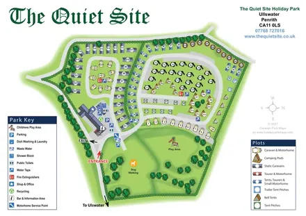
Illustrated Ullswater holiday-park map with mixed accommodation, two symbol keys and a spacious dog-walking and play green.
 Explore the map ↗
United Kingdom
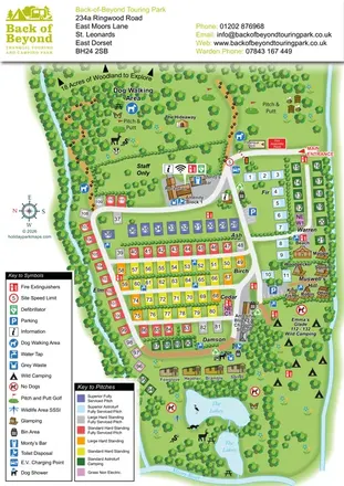
Colour-coded touring pitches, named glamping units and woodland routes at Back of Beyond Touring Park.
 Explore the map ↗
United Kingdom
Woodland park map with mixed pitches, bell tents, lodges and a fishing lake.
Features may come from the sample artwork, its key or published park information. Approximate numbers describe the drawing and may cover only part of a park. They are intended to help you compare map examples. Current facilities and booking information should be checked with the park.
LET’S MAP YOUR PARK
For a map quotation, find your park and draw a rough boundary around it. The area you select helps us work out the design time and price.
Draw your park for a quote ↗Or talk to our map designers
01751 473136