
Duck pond and pond entrance
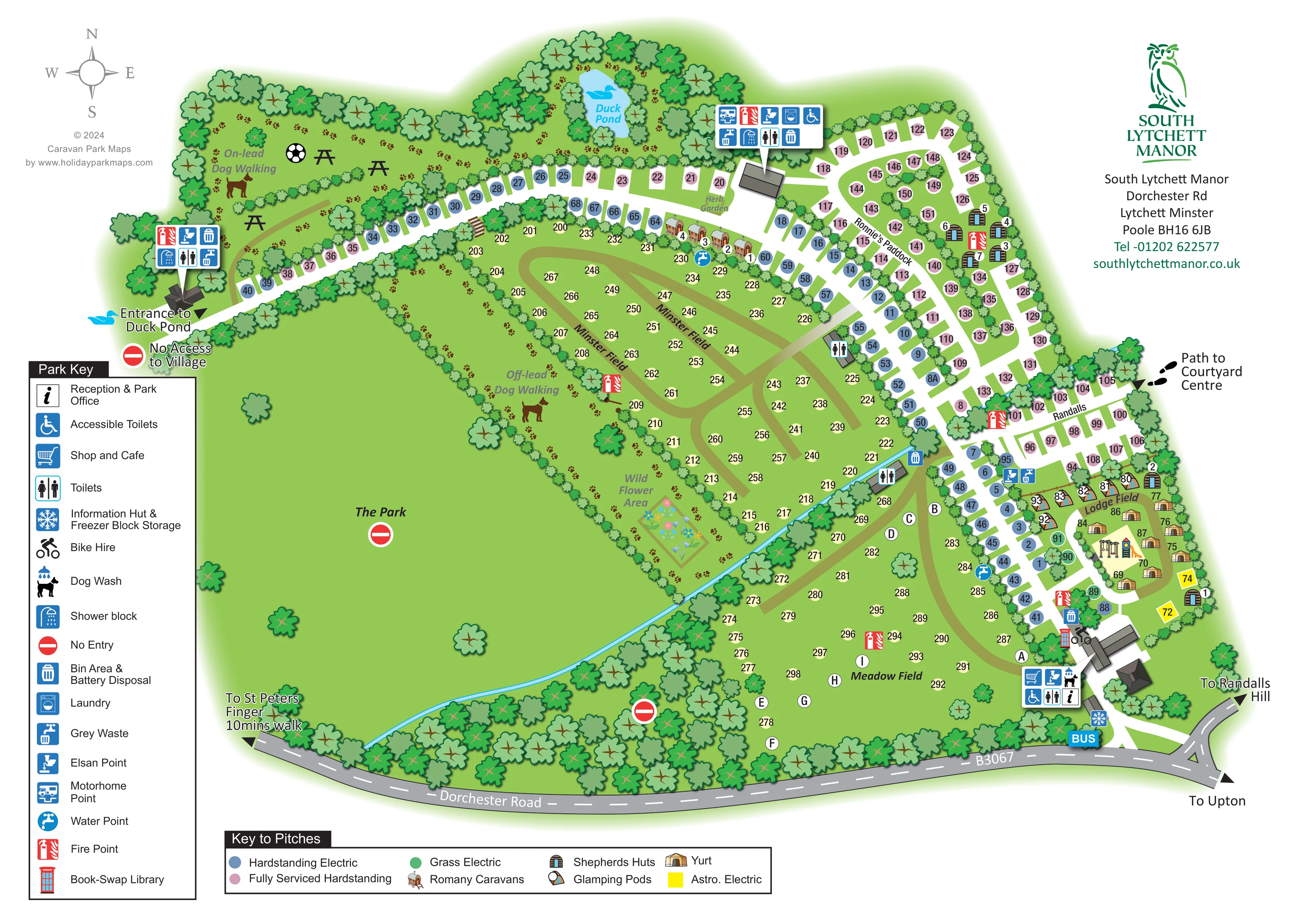
A blue pond sits within the northern tree belt, with an entrance to the duck pond labelled at the western facilities area.
ILLUSTRATED PARK MAP · P308
South Lytchett Manor, Dorchester Rd, Lytchett Minster, Poole · United Kingdom
 Enlarge the map ↗
A SENSE OF THE PLACE
South Lytchett Manor is a family-run touring, camping and glamping park near Poole in Dorset. Its landscaped grounds occupy part of an old manor estate and welcome caravans, motorhomes and tents.
Dogs are welcomed, and a bus stop outside the park offers an alternative way to explore the surrounding area. The park map brings together its accommodation areas, internal routes and shared facilities within the estate setting.
LOOK CLOSER
A blue pond sits within the northern tree belt, with an entrance to the duck pond labelled at the western facilities area.
A colourful flower-bed illustration marks a labelled area south of the off-lead dog walk.
A small labelled garden lies beside the northern facilities building.
A large open green area occupies the western half of the plan. Tree belts and hedged boundaries separate it from the accommodation fields, and a no-entry symbol appears within it.
An unlabelled narrow blue line follows the southern side of the open parkland and the edge of Meadow Field; its precise function is not stated.
Identified in the main arrival building cluster beside the entrance from Dorchester Road.
Shopping-basket symbol attached to the entrance-side facilities cluster.
Grouped facility signs identify washrooms at the entrance, beside the northern pitches and at the western pond approach; smaller toilet markers also serve the central fields.
Identified in the main arrival building cluster beside the entrance from Dorchester Road.
Shopping-basket symbol attached to the entrance-side facilities cluster.
Grouped facility signs identify washrooms at the entrance, beside the northern pitches and at the western pond approach; smaller toilet markers also serve the central fields.
Laundry symbol appears in the northern facilities cluster.
Service symbols are distributed among the northern, western, entrance-side and eastern pitch areas.
Blue circular tap symbols mark shared water points around the accommodation fields.
Repeated blue bin symbols identify disposal locations, with battery disposal included in the legend wording.
Red extinguisher symbols stand out at several accommodation and shared-facility locations.
A dog-wash symbol is included in the entrance-side facilities group.
Bicycle symbol marks bike hire beside the entrance buildings.
Snowflake symbol marks this facility close to the entrance and roadside bus stop.
A red telephone-box-style illustration beside the entrance buildings represents the book-swap library.
A climbing structure and slide are drawn within Lodge Field among the glamping accommodation.
Picnic tables and a football illustration occupy the north-western green area; no formal sports pitch is delineated.
Separate labelled dog-walking areas occupy the north-western grounds and the planted strip beside Minster Field.
A blue pond sits within the northern tree belt, with an entrance to the duck pond labelled at the western facilities area.
A colourful flower-bed illustration marks a labelled area south of the off-lead dog walk.
A small labelled garden lies beside the northern facilities building.
A large open green area occupies the western half of the plan. Tree belts and hedged boundaries separate it from the accommodation fields, and a no-entry symbol appears within it.
An unlabelled narrow blue line follows the southern side of the open parkland and the edge of Meadow Field; its precise function is not stated.
The principal entrance is shown at the south-east beside the reception buildings, opening from Dorchester Road, labelled B3067.
A blue BUS marker sits beside Dorchester Road near the park entrance.
A dashed black walking connection leaves the eastern Randalls area towards the Courtyard Centre.
Road arrows point towards Upton, Randalls Hill and St Peters Finger; the latter carries the map's '10mins walk' annotation.
Red no-entry markers identify restricted connections, including the western label 'No Access to Village'.
READING THE MAP
This illustrated map of South Lytchett Manor brings a varied touring, camping and glamping park into one readable estate plan. Set at Lytchett Minster near Poole in Dorset, the park is shown with tree-lined boundaries, broad grass fields and a substantial open parkland area alongside its more closely arranged pitches.
The design distinguishes electric hardstanding, fully serviced hardstanding, grass electric and Astro. Electric pitches through a compact colour key. Romany caravans, shepherds huts, glamping pods and yurts have their own miniature illustrations, helping visitors recognise the different accommodation areas without relying on numbers alone.
Arrival facilities sit beside Dorchester Road, while additional service points are distributed around the accommodation. The map also gives prominence to the duck pond, on-lead and off-lead dog walks, wild flower area and herb garden. Named fields, numbered pitches and grouped facility signs provide the practical framework; picnic tables, trees and small recreational details convey the landscaped setting. It is a useful example of a park map that combines detailed pitch finding with an overview of the grounds and their shared amenities.
The plan is organised around a south-eastern entrance from Dorchester Road, with reception, shop and cafe, bike hire, dog wash and other visitor facilities gathered beside the arrival buildings. A bus-stop marker sits on the roadside nearby. From here, white access lanes lead north through the accommodation, dividing into rows and loops that serve Randalls, Ronnie’s Paddock and the pitches around Lodge Field.
Blue and pink pitch markers identify electric and fully serviced hardstanding, with smaller groups of green grass-electric and yellow Astro. Electric markers. In the centre, Minster Field uses a broad looping track around numbered grass pitches; Meadow Field continues the open-field pattern towards the southern boundary. Illustrated Romany caravans line part of the northern field edge, while shepherds huts, pods and yurts form small clusters elsewhere. Play equipment is drawn within Lodge Field.
The western side is deliberately greener and less densely developed. The large area labelled The Park is edged by trees, with an on-lead dog-walking area and picnic tables towards the north-west. A separate off-lead area runs beside Minster Field, leading visually towards the wild flower area. The duck pond occupies a wooded pocket at the top of the map, and a small herb garden sits near the northern service building.
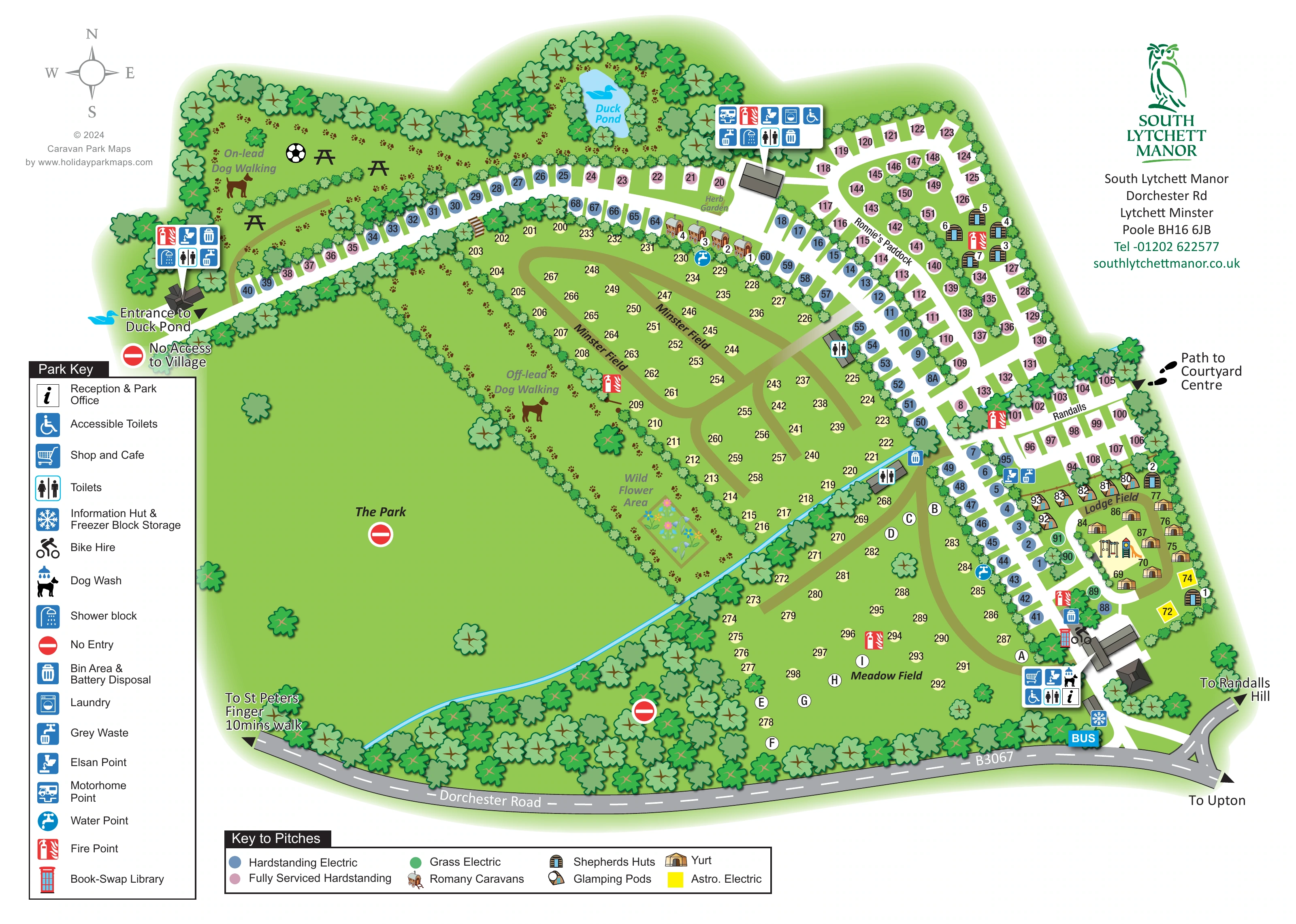
Grouped icon panels identify showers, toilets, accessible toilets, laundry and touring services. Smaller water, bin and fire-point symbols provide local reference points. Beyond the park, arrows indicate Upton, Randalls Hill and St Peters Finger, while a dashed path points towards the Courtyard Centre. The single illustrated plan is supported by separate facility and pitch legends; the accompanying enlarged views show portions of those same legends rather than additional park sections.
KEEP EXPLORING
Chosen for shared landscapes, accommodation or facilities.
 Explore the map ↗
United Kingdom
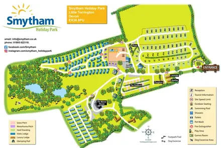
Colour-coded accommodation, woodland ponds and a Tarka Trail footpath on Smytham’s illustrated park map.
 Explore the map ↗
United Kingdom
Woodland-framed Barnsoul map with mixed accommodation, shared facilities and paw-marked walking routes.
 Explore the map ↗
United Kingdom
Woodland holiday-park map with named accommodation areas, touring loops and illustrated recreation facilities.
Features may come from the sample artwork, its key or published park information. Approximate numbers describe the drawing and may cover only part of a park. They are intended to help you compare map examples. Current facilities and booking information should be checked with the park.
TAKE A CLOSER LOOK
View the illustrated map in detail or choose a file to download. These are sample maps; contact the park for current visitor information.


LET’S MAP YOUR PARK
For a map quotation, find your park and draw a rough boundary around it. The area you select helps us work out the design time and price.
Draw your park for a quote ↗Or talk to our map designers
01751 473136
 southlycettmanor_large.png