
Large upper grass field
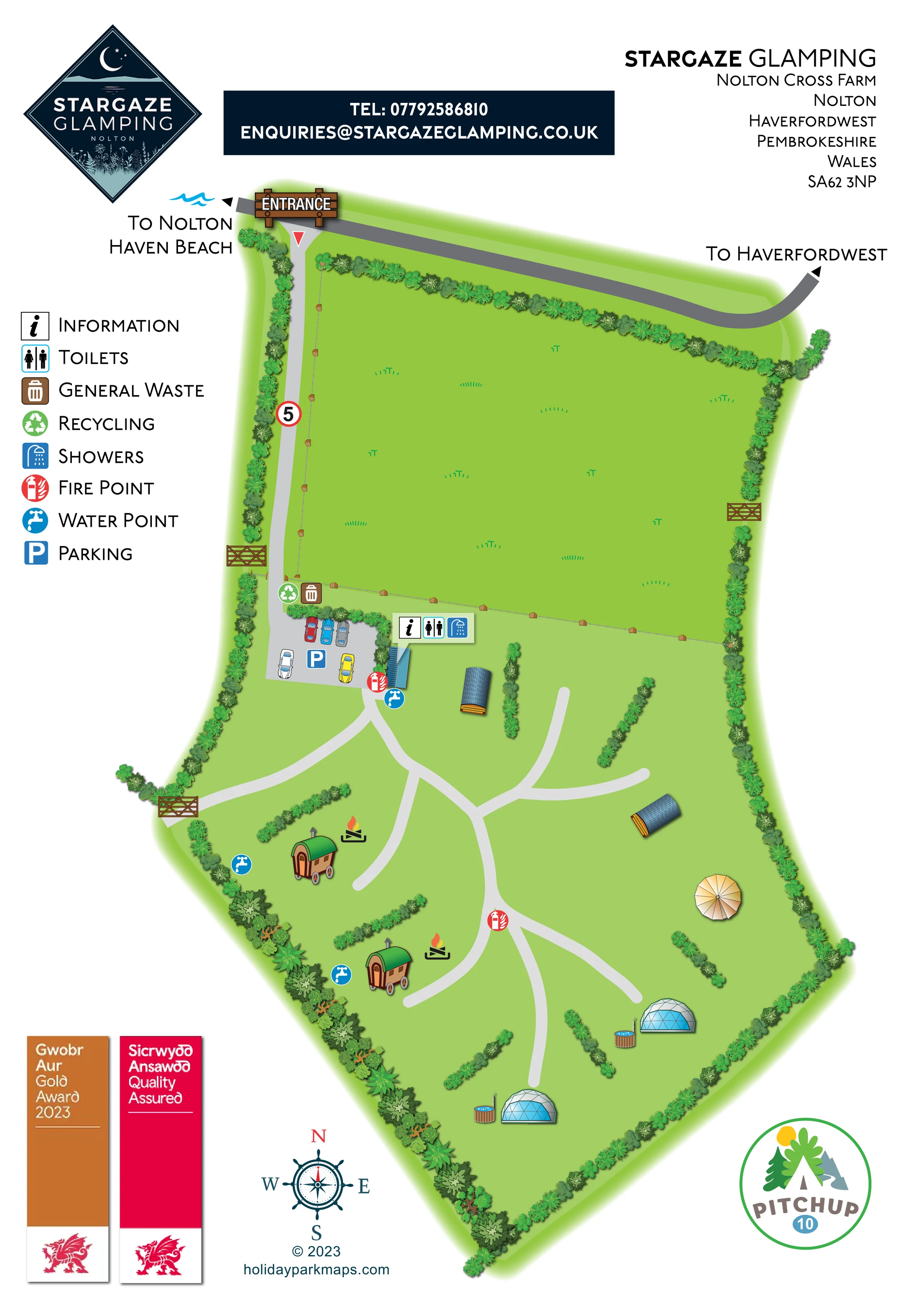
An open green field occupies much of the upper plan, separated from the accommodation enclosure by a post-and-wire fence.
ILLUSTRATED PARK MAP · P314
STARGAZE GLAMPING, Nolton Cross Farm, Nolton, Haverfordwest, Pembrokeshire, Wales · United Kingdom
 Enlarge the map ↗
A SENSE OF THE PLACE
Stargaze Glamping offers adults-only stays at Nolton Cross in Pembrokeshire. Domes and shepherd's huts create a small-scale countryside retreat with private outdoor spaces.
Accommodation combines camping-inspired surroundings with prepared beds and cooking facilities. Selected units offer a wood-fired hot tub or welcome dogs, with the individual accommodation details defining the facilities available for each stay.
LOOK CLOSER
An open green field occupies much of the upper plan, separated from the accommodation enclosure by a post-and-wire fence.
Dense illustrated planting encloses the site; shorter hedge strips divide spaces between accommodation units.
An information symbol shares a callout with toilets and showers beside the parking area.
Both facilities are identified at the blue-roofed building beside parking.
A grey parking area illustrated with cars sits where the entrance drive reaches the glamping enclosure.
Paired waste and recycling symbols appear beside the drive immediately above parking.
Blue tap symbols mark water points by the service building and beside the shepherd's hut areas.
Red fire-point symbols are placed near the service building and along the lower branching route.
An information symbol shares a callout with toilets and showers beside the parking area.
Both facilities are identified at the blue-roofed building beside parking.
A grey parking area illustrated with cars sits where the entrance drive reaches the glamping enclosure.
Paired waste and recycling symbols appear beside the drive immediately above parking.
Blue tap symbols mark water points by the service building and beside the shepherd's hut areas.
Red fire-point symbols are placed near the service building and along the lower branching route.
Small timber-sided tubs with blue water and adjacent flues are illustrated beside the two geodesic domes.
Flame-and-log graphics sit beside the shepherd's huts, distinct from the red fire-point symbols.
A cream circular structure with radial roof panels is shown on the right of the glamping enclosure. Its function is not identified.
An open green field occupies much of the upper plan, separated from the accommodation enclosure by a post-and-wire fence.
Dense illustrated planting encloses the site; shorter hedge strips divide spaces between accommodation units.
The entrance branches from the road at the upper left. A pale-grey drive follows the western edge of the open field towards parking.
A curving central route splits into short branches serving the dispersed accommodation and a western boundary gate.
Timber gate illustrations interrupt the planted boundaries of the upper field and lower enclosure.
Opposite ends of the upper road carry destination arrows; a blue wave graphic accompanies the beach direction. The beach itself is not depicted.
A red-ringed sign bearing the number 5 appears on the entrance drive.
READING THE MAP
This illustrated map presents Stargaze Glamping at Nolton Cross Farm in Pembrokeshire as a small countryside retreat with a clearly defined arrival route and a handful of distinctive places to stay. A broad grass field fills the upper part of the plan, while the accommodation sits in a separate, hedge-lined enclosure below. The road across the top is labelled towards Nolton Haven Beach in one direction and Haverfordwest in the other, giving visitors useful local orientation without turning the artwork into a regional map.
Within the glamping area, geodesic domes, wheeled shepherd's huts and curved-roof pod-like units are drawn as individual pictorial landmarks. Pale-grey routes branch between them, with short planted screens suggesting the separation of outdoor spaces. Parking and the shared information, toilet and shower facilities form a practical arrival hub. Blue water symbols, red fire-point markers and paired waste and recycling icons add everyday wayfinding detail. The portrait page also makes room for Stargaze's moon-and-stars branding, a clear symbol key and a decorative compass.
The single portrait plan combines an overhead layout with small oblique illustrations of accommodation, buildings, cars and gates. Its irregular green footprint is surrounded by dense planting, with a softly feathered edge separating the site from the white page. An open field dominates the northern half. A fence along its lower edge marks the transition to the glamping enclosure, while the entrance drive follows the western boundary from the road above.
At the end of this drive, a grey parking area sits beside a narrow blue-roofed building. A pale-green callout identifies information, toilets and showers together. Waste and recycling symbols appear just above parking, with water and fire-point markers nearby. From this hub, the internal route curves south and divides into several short branches, including one leading to a western gate.
The accommodation illustrations are deliberately varied. Green-roofed shepherd's huts with wheels and chimneys occupy the western side, accompanied by water symbols and separate flame-and-log graphics. Dark curved-roof pod-like units appear nearer the centre and eastern side. Two blue-fronted geodesic domes sit towards the southern end, each beside a timber-sided outdoor tub. Short hedge strips break up the spaces between units. A cream circular canopy or tent-like structure is also illustrated on the eastern side, although it is not labelled.
Large arrows along the upper road point towards Nolton Haven Beach and Haverfordwest. The left-hand legend explains eight facility symbols, while the header brings together the logo, contact banner and address. Welsh award panels and a Pitchup badge balance the compass and designer credit around the lower margins.
KEEP EXPLORING
Chosen for shared landscapes, accommodation or facilities.
 Explore the map ↗
United Kingdom
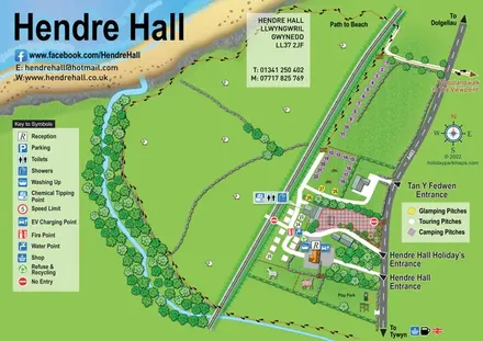
A colour-zoned coastal park map with touring areas, woodland trails, ponds and a leisure club.
 Explore the map ↗
United Kingdom
Coastal camping, touring and glamping map with a railway-side layout, beach path and illustrated rural surroundings.
 Explore the map ↗
United Kingdom
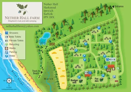
Tree-sheltered camping and named shepherd’s huts beside the River Stour at Nether Hall Farm.
Features may come from the sample artwork, its key or published park information. Approximate numbers describe the drawing and may cover only part of a park. They are intended to help you compare map examples. Current facilities and booking information should be checked with the park.
LET’S MAP YOUR PARK
For a map quotation, find your park and draw a rough boundary around it. The area you select helps us work out the design time and price.
Draw your park for a quote ↗Or talk to our map designers
01751 473136