
Farmhouse and farm buildings
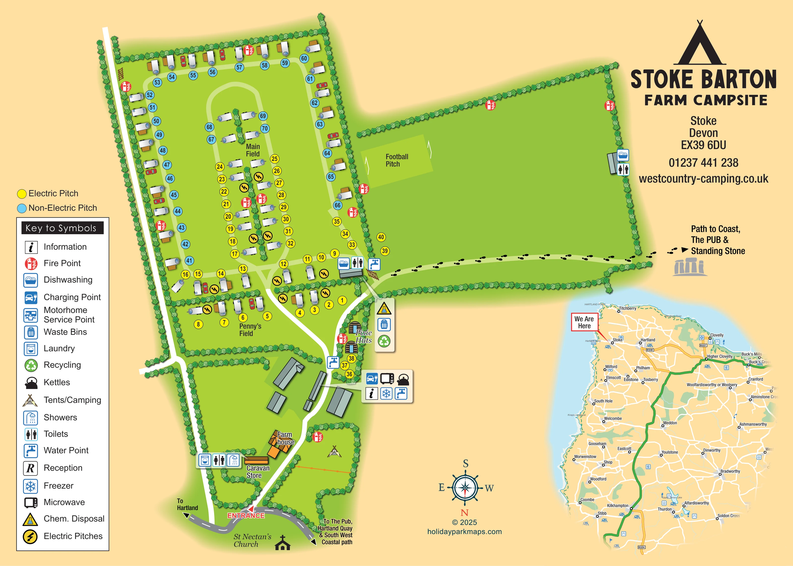
An orange-roofed farmhouse and several grey-roofed agricultural buildings form the entrance-side farmyard.
ILLUSTRATED PARK MAP · P315
Stoke Barton Farm, Stoke Barton, Hartland, Bideford, Devon · United Kingdom
 Enlarge the map ↗
A SENSE OF THE PLACE
Stoke Barton Farm & Campsite is based at Stoke Barton Farm, Stoke Barton, Hartland, Bideford, Devon. The campsite is on a working livestock and arable farm on the North Devon coast. Caravan and tent camping is offered, with electric hook-ups and seasonal-pitch enquiries accepted.
Facilities include toilets, showers, washing-up space, laundry and chemical disposal.
LOOK CLOSER
An orange-roofed farmhouse and several grey-roofed agricultural buildings form the entrance-side farmyard.
Continuous illustrated hedges enclose the main fields, separate Penny’s Field from the farmyard and form planted strips between central pitch rows.
A church silhouette and label appear beyond the entrance road as a neighbouring landmark, not a campsite facility.
A grouped symbol panel beside the caravan-store building identifies laundry, toilets and showers. Further toilet symbols appear at the boundary of the main pitch area and on the far side of the large eastern field.
Dishwashing symbols accompany toilet facilities beside Main Field and at the eastern edge of the large open field.
Blue tap symbols identify several water points around the farm buildings, Pixie Huts and field junction.
Yellow numbered pitch discs distinguish electric pitches from blue non-electric pitches; lightning symbols reinforce the electric-pitch designation.
A car-and-plug symbol appears in the amenity panel beside the farm buildings.
A grouped symbol panel beside the caravan-store building identifies laundry, toilets and showers. Further toilet symbols appear at the boundary of the main pitch area and on the far side of the large eastern field.
Dishwashing symbols accompany toilet facilities beside Main Field and at the eastern edge of the large open field.
Blue tap symbols identify several water points around the farm buildings, Pixie Huts and field junction.
Yellow numbered pitch discs distinguish electric pitches from blue non-electric pitches; lightning symbols reinforce the electric-pitch designation.
A car-and-plug symbol appears in the amenity panel beside the farm buildings.
Kettle, microwave and freezer symbols are grouped in the amenity panel beside the farm buildings.
An information symbol appears in the same amenity panel as the charging point and shared appliances.
A vertical symbol panel beside the Pixie Huts and field junction groups chemical disposal, waste bins and recycling.
Repeated red extinguisher symbols mark fire points around the pitch fields, huts, camping area and large open field.
A labelled green rectangle with two goal illustrations occupies the western side of the large eastern field.
A long building near the farmhouse is labelled Caravan Store.
An orange-roofed farmhouse and several grey-roofed agricultural buildings form the entrance-side farmyard.
Continuous illustrated hedges enclose the main fields, separate Penny’s Field from the farmyard and form planted strips between central pitch rows.
A red ENTRANCE label and arrow mark the turn from the grey public road into the white internal approach.
A white approach passes through the farmyard and branches towards the camping fields. Pale-green routes form an outer circuit and an elongated central loop in Main Field.
A footprint-marked route crosses the southern edge of the large eastern field and points off the plan towards the coast, pub and standing stone.
Road arrows indicate Hartland in one direction and the pub, Hartland Quay and South West Coastal path in the other.
A church silhouette and label appear beyond the entrance road as a neighbouring landmark, not a campsite facility.
A separate regional road map places the campsite near Stoke and Hartland using a red-bordered We Are Here callout. It includes the coast, surrounding settlements and inland road connections.
Listed in the key; a corresponding position is not clearly identifiable on the main plan.
Listed in the key with an R symbol, but no matching location is clearly marked on the plan.
Operator information describes the campsite as part of a working livestock and arable farm on the North Devon coast.
READING THE MAP
This illustrated map of Stoke Barton Farm & Campsite brings together a working-farm setting, numbered camping pitches and routes towards the North Devon coast. The plan shows the approach from the road beside St Nectan’s Church, the farmhouse and agricultural buildings, then opens into Main Field and Penny’s Field. Yellow and blue pitch markers distinguish electric and non-electric options without obscuring the hedges, access loops or individual caravan illustrations.
The artwork also gives prominence to features that make this campsite distinctive: two Pixie Huts beside the approach, a football pitch in the large adjoining field, and a footprint trail pointing towards the coast, pub and standing stone. Practical facilities are communicated through compact symbol groups, supported by a substantial key down the left-hand side.
A bold tent emblem and campsite contact block balance the main plan, while a regional inset places Stoke in relation to Hartland and the surrounding coastal roads. Together, these elements make the sample useful for farm campsites that need to explain both their on-site layout and their relationship to nearby places.
The main plan follows the campsite from its entrance at the bottom of the page into the farmyard and camping fields above. A red arrow marks the turn from the public road, with directions towards Hartland on one side and the pub, Hartland Quay and South West Coastal path on the other. The compass confirms that this is a south-up layout. St Nectan’s Church is drawn outside the campsite boundary as a local landmark.
Inside the entrance, an orange-roofed farmhouse contrasts with the grey agricultural buildings. A labelled caravan store sits beside a panel for laundry, toilets and showers. Another service panel identifies information, charging, a microwave, kettles, a freezer and water. The approach continues past the two illustrated Pixie Huts and a grouped chemical-disposal, waste-bin and recycling marker.
Main Field contains perimeter pitches and central rows served by pale-green loops. Penny’s Field forms a smaller enclosure immediately below. Around 70 numbered pitches give the plan a medium-scale touring layout, while a tent symbol identifies an additional camping area without specifying its capacity. Yellow and blue discs separate electric and non-electric pitches; caravan, car and awning drawings add character without replacing the numbering system.
To the right, a broad hedged field contains a labelled football pitch and an amenity point on its far boundary. Black footprints trace a route across its lower edge towards the coast, pub and standing stone. Repeated fire-point symbols and grouped water and washing facilities remain visible throughout the plan.
The lower-right regional inset provides wider road and coastal context. The enlarged detail view repeats part of this same artwork, making the legend and entrance-side facilities easier to read rather than introducing a separate site section.
KEEP EXPLORING
Chosen for shared landscapes, accommodation or facilities.
 Explore the map ↗
United Kingdom
A colour-zoned coastal park map with touring areas, woodland trails, ponds and a leisure club.
 Explore the map ↗
United Kingdom
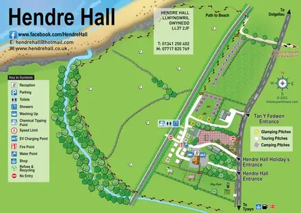
Coastal camping, touring and glamping map with a railway-side layout, beach path and illustrated rural surroundings.
 Explore the map ↗
United Kingdom
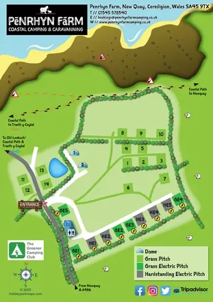
A colourful coastal farm campsite map with electric pitches, geodesic domes and footprint-marked walking routes.
Features may come from the sample artwork, its key or published park information. Approximate numbers describe the drawing and may cover only part of a park. They are intended to help you compare map examples. Current facilities and booking information should be checked with the park.
LET’S MAP YOUR PARK
For a map quotation, find your park and draw a rough boundary around it. The area you select helps us work out the design time and price.
Draw your park for a quote ↗Or talk to our map designers
01751 473136