
Campfire Field
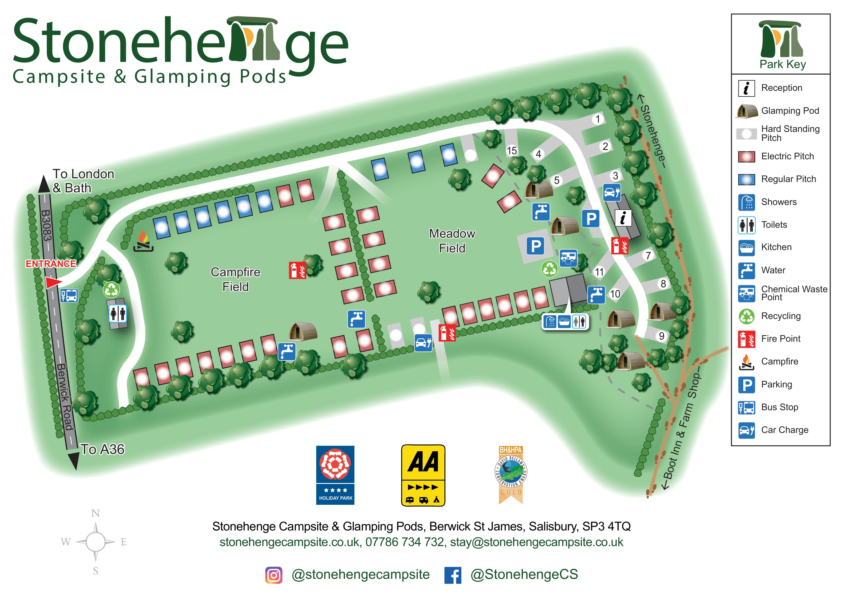
The western grass area, with pitch rows around its edges and a campfire symbol towards the upper-left corner.
ILLUSTRATED PARK MAP · P607
Stonehenge Campsite & Glamping Pods, Berwick St James, Salisbury · United Kingdom
 Enlarge the map ↗
A SENSE OF THE PLACE
Stonehenge Campsite offers camping, touring and glamping near the Stonehenge World Heritage Site in Wiltshire. A small, family-run setting accommodates tents, campervans, caravans, motorhomes and larger touring vehicles.
Grass and hardstanding options include serviced pitches, while pods and bell-tent accommodation provide alternatives to bringing equipment. Heated showers, washing-up facilities and a small shop support stays, with dogs welcomed and campfires permitted under the site's rules.
LOOK CLOSER
The western grass area, with pitch rows around its edges and a campfire symbol towards the upper-left corner.
The central and eastern grass area, bordered by pitches, hedges, scattered trees and pod accommodation.
Continuous hedge lines define the perimeter and internal divisions, with larger illustrated trees along boundaries and within the fields.
Information symbol on a grey building beside the eastern lane, near parking and hardstanding pitches.
A grouped callout identifies showers, kitchen and toilets at the building south of reception. A further toilet symbol appears near the entrance.
Blue tap symbols mark several water points around the pitch areas and service buildings.
A disposal symbol appears beside the eastern service area.
Green recycling symbols identify locations near the entrance and the eastern facilities.
Information symbol on a grey building beside the eastern lane, near parking and hardstanding pitches.
A grouped callout identifies showers, kitchen and toilets at the building south of reception. A further toilet symbol appears near the entrance.
Blue tap symbols mark several water points around the pitch areas and service buildings.
A disposal symbol appears beside the eastern service area.
Green recycling symbols identify locations near the entrance and the eastern facilities.
Red extinguisher symbols are distributed through the accommodation areas and beside reception.
A flame-and-logs symbol marks a campfire location in the north-western part of Campfire Field.
Two blue parking symbols sit on grey areas near reception and the eastern pods.
Car-and-plug symbols appear near reception and beside the southern pitch row.
A bus-stop symbol is positioned beside Berwick Road immediately below the entrance.
The western grass area, with pitch rows around its edges and a campfire symbol towards the upper-left corner.
The central and eastern grass area, bordered by pitches, hedges, scattered trees and pod accommodation.
Continuous hedge lines define the perimeter and internal divisions, with larger illustrated trees along boundaries and within the fields.
A red entrance arrow leads from Berwick Road, labelled B3083. Road-end arrows indicate London and Bath in one direction and the A36 in the other.
Broad white lanes connect the entrance with the northern boundary and eastern accommodation area. Pale links and grey dashed paths provide finer internal connections.
A brown route with footprint marks runs outside the eastern hedge and is labelled towards Stonehenge. No distance or journey time is stated.
The lower continuation of the external walking route is labelled towards Boot Inn & Farm Shop; these are directional destinations, not on-site facilities.
READING THE MAP
This illustrated map of Stonehenge Campsite & Glamping Pods brings together two camping fields, timber pods and practical visitor facilities in a compact countryside setting at Berwick St James, near Salisbury. Campfire Field and Meadow Field give the plan its main structure, with coloured pitch markers arranged around grassy spaces, hedges and scattered trees. The entrance from Berwick Road is immediately recognisable, while the white internal lanes lead visitors towards reception, parking and the eastern accommodation area.
The artwork makes several different kinds of information easy to distinguish. Red, blue and grey markers separate electric, regular and hardstanding pitches; small timber pod illustrations identify the glamping accommodation. A tall Park Key explains the facility symbols, including showers, toilets, kitchen, water, recycling, chemical waste and car charging. Beyond the site boundary, a footprint-marked route points towards Stonehenge and Boot Inn & Farm Shop.
The large green title, stone-inspired logo and softly shaded landscape give the page a distinctive local identity without obscuring the practical layout. It is a useful example for campsites that need to explain mixed accommodation and everyday arrival information on one illustrated sheet.
The plan is arranged across a landscape-format page, with the park title above the western half and a full-height key on the right. Berwick Road, labelled B3083, runs down the left edge. A red entrance arrow marks the turn into the campsite, and road arrows identify the directions towards London and Bath and towards the A36. Inside the boundary, broad white lanes branch around Campfire Field and continue along the northern edge before turning down the eastern side.
Campfire Field occupies the western portion of the site. Blue regular pitches and red electric pitches follow its upper boundary, while further electric pitches run along the lower edge and beside an internal hedge. A campfire symbol sits near the upper-left pitch row. Meadow Field fills the central and eastern area, with additional pitch rows, open grass, scattered trees and several illustrated pods. Grey hardstanding bays are particularly prominent beside the curving eastern lane; selected bays carry numbers.
Reception is marked on an eastern building close to parking and a car-charging symbol. A separate building below it has a grouped callout for showers, kitchen and toilets. Other symbols identify water points, chemical waste, recycling and fire points across the plan. A further toilet location and a roadside bus stop appear near the entrance.
The external brown walking route follows the eastern hedge, using footprint marks and arrows towards Stonehenge and Boot Inn & Farm Shop. Grey dashed paths supply smaller internal connections. Below the main illustration, a compass, award badges and a contact footer complete the page. The accompanying enlarged view shows the eastern facilities and Park Key in greater detail; it is a close-up of this same design, not an additional map variant.
KEEP EXPLORING
Chosen for shared landscapes, accommodation or facilities.
 Explore the map ↗
United Kingdom
Woodland park map with mixed pitches, bell tents, lodges and a fishing lake.
 Explore the map ↗
United Kingdom
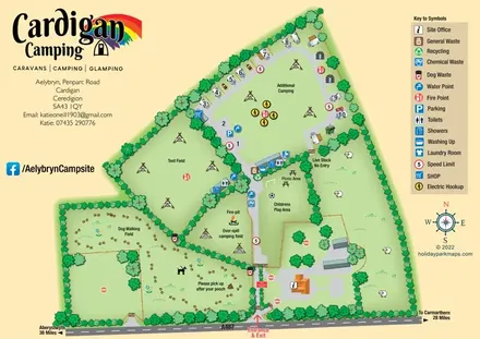
Illustrated farm-campsite map with mixed accommodation, named camping fields and a dedicated dog-walking area.
 Explore the map ↗
United Kingdom
Woodland holiday-park map with named accommodation areas, touring loops and illustrated recreation facilities.
Features may come from the sample artwork, its key or published park information. Approximate numbers describe the drawing and may cover only part of a park. They are intended to help you compare map examples. Current facilities and booking information should be checked with the park.
TAKE A CLOSER LOOK
View the illustrated map in detail or choose a file to download. These are sample maps; contact the park for current visitor information.


LET’S MAP YOUR PARK
For a map quotation, find your park and draw a rough boundary around it. The area you select helps us work out the design time and price.
Draw your park for a quote ↗Or talk to our map designers
01751 473136