
Tree-lined grounds
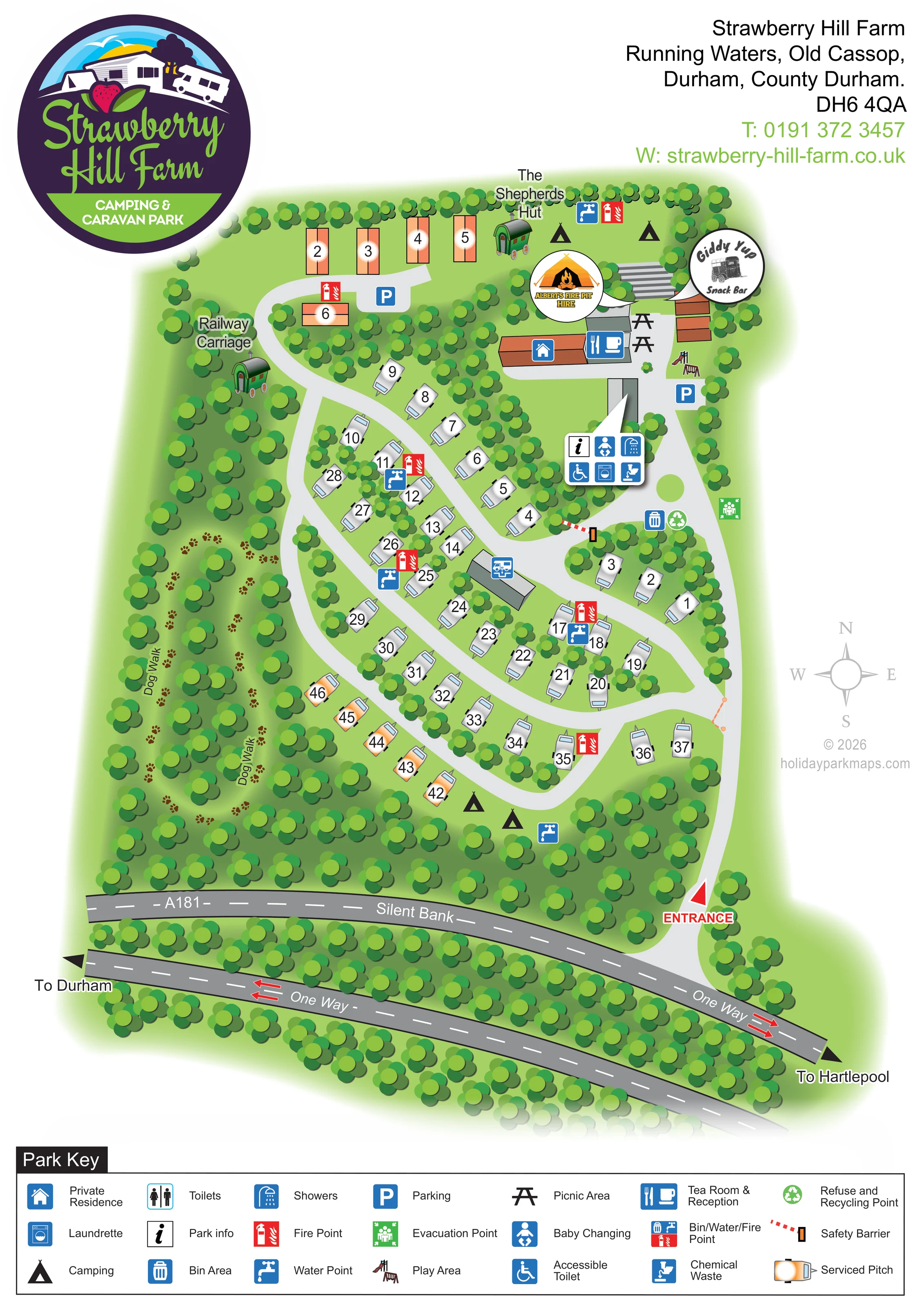
Dense illustrated trees frame the boundary, separate pitch rows, surround the dog walk and screen the roadside edge.
ILLUSTRATED PARK MAP · P316
Strawberry Hill Farm, Running Waters, Old Cassop, Durham, County Durham · United Kingdom
 Enlarge the map ↗
A SENSE OF THE PLACE
Strawberry Hill Farm is a family camping and touring site in the countryside near Durham. The farm setting provides a base for exploring the city and the wider county.
Grass and hardstanding pitches are available with electric connections, and the facilities include an accessible bathroom. The map helps visitors locate their pitch, shared amenities and routes around the site.
LOOK CLOSER
Dense illustrated trees frame the boundary, separate pitch rows, surround the dog walk and screen the roadside edge.
A blue food-and-drink symbol identifies the tea room and reception in the northern building cluster.
A branded callout marks the snack bar beside the northern buildings and picnic area.
A distinctive branded fire-pit-hire badge is placed above the northern facilities.
Picnic-table symbols sit beside the tea room and snack-bar buildings.
A small illustrated play structure is shown to the east of the northern buildings, close to parking.
Blue parking symbols identify spaces near the northern serviced pitches and beside the facilities.
A central-right callout groups park information, baby changing, showers, an accessible toilet, a laundrette and chemical-waste disposal beside a building.
A blue food-and-drink symbol identifies the tea room and reception in the northern building cluster.
A branded callout marks the snack bar beside the northern buildings and picnic area.
A distinctive branded fire-pit-hire badge is placed above the northern facilities.
Picnic-table symbols sit beside the tea room and snack-bar buildings.
A small illustrated play structure is shown to the east of the northern buildings, close to parking.
Blue parking symbols identify spaces near the northern serviced pitches and beside the facilities.
A central-right callout groups park information, baby changing, showers, an accessible toilet, a laundrette and chemical-waste disposal beside a building.
General toilets have a separate entry in the key; that specific male-and-female symbol is not clearly positioned on the plan.
Repeated blue tap and red extinguisher symbols mark service points around the touring and camping areas.
The key includes a combined three-part service-point symbol; the plan mainly displays individual tap and fire-point symbols.
Bin and recycling symbols are grouped beside the eastern approach to the main facilities.
Chemical-waste provision is marked in the amenity callout and by a separate disposal pictogram beside a central building.
A green assembly-style symbol is positioned on the eastern side of the amenity area.
A blue house symbol distinguishes a private building within the northern cluster.
Two labelled stretches of paw-print route run through the tree-filled western side of the site.
Dense illustrated trees frame the boundary, separate pitch rows, surround the dog walk and screen the roadside edge.
A prominent red entrance marker identifies the access at the south-eastern corner, leading north along the eastern side.
The southern road context includes A181, Silent Bank, one-way arrows and directional labels towards Durham and Hartlepool.
A red-and-white barrier is shown across an internal connection below the amenity area.
Published park information describes these touring options; the artwork does not separately identify every surface or electric connection.
READING THE MAP
This illustrated map of Strawberry Hill Farm presents a tree-lined camping and touring site at Running Waters, near Durham. Its portrait layout follows the shape of the grounds, from the roadside entrance at the lower right to the reception and shared facilities at the northern end. Numbered touring pitches sit beside gently curving lanes, with orange highlighting distinguishing serviced pitches from the grey caravan symbols.
The map also gives the site's individual character room to show. The Shepherds Hut and Railway Carriage are named and illustrated separately, while a paw-print dog walk winds through the wooded western margin. Camping areas, picnic tables, a play area and parking are identified alongside the practical water, fire and waste points.
A large park logo heads the page, and branded callouts for Giddy Up Snack Bar and Albert's Fire Pit Hire add local detail. The full-width key and grouped amenity panel bring this varied information together, creating a visitor map that balances pitch finding, shared facilities and the surrounding road approach.
The plan is organised around an elongated site bordered and divided by dense green tree illustrations. At the south-eastern corner, a red entrance marker connects the park to Silent Bank. A pale-grey lane runs north along the eastern edge, with curved internal routes serving the central touring pitches. Below the grounds, darker road bands carry the A181 and Silent Bank labels, one-way arrows and directions towards Durham and Hartlepool.
Numbered caravan-style symbols form staggered rows through the centre and lower half of the map. Orange serviced pitches appear in a northern group and along a south-western row. Black camping symbols identify grass areas towards both ends of the site without suggesting a fixed number of tents. The Shepherds Hut occupies the northern edge, while Railway Carriage is labelled among trees to the north-west.
The principal visitor facilities gather at the top right. Tea room and reception, picnic tables, parking and a small play structure sit around the building cluster, accompanied by Giddy Up Snack Bar and Albert's Fire Pit Hire badges. A separate pointer panel identifies park information, baby changing, showers, an accessible toilet, a laundrette and chemical-waste disposal. Repeated taps and fire symbols distribute practical service information around the pitches; refuse, recycling, an evacuation point and a safety barrier are also marked.
Along the western side, labelled paw-print trails distinguish the dog walk from vehicle routes. A restrained compass occupies the right margin, and the bordered Park Key spans the page below the road illustration. The enlarged key views repeat details from this same artwork rather than depicting additional areas.
KEEP EXPLORING
Chosen for shared landscapes, accommodation or facilities.
 Explore the map ↗
United Kingdom
Woodland-framed Barnsoul map with mixed accommodation, shared facilities and paw-marked walking routes.
 Explore the map ↗
United Kingdom
Riverside park map with named pitch fields, illustrated huts and a paw-print dog walk.
 Explore the map ↗
United Kingdom
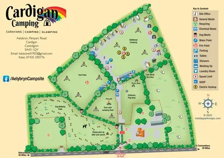
Illustrated farm-campsite map with mixed accommodation, named camping fields and a dedicated dog-walking area.
Features may come from the sample artwork, its key or published park information. Approximate numbers describe the drawing and may cover only part of a park. They are intended to help you compare map examples. Current facilities and booking information should be checked with the park.
TAKE A CLOSER LOOK
View the illustrated map in detail or choose a file to download. These are sample maps; contact the park for current visitor information.


LET’S MAP YOUR PARK
For a map quotation, find your park and draw a rough boundary around it. The area you select helps us work out the design time and price.
Draw your park for a quote ↗Or talk to our map designers
01751 473136