
Fishing lake
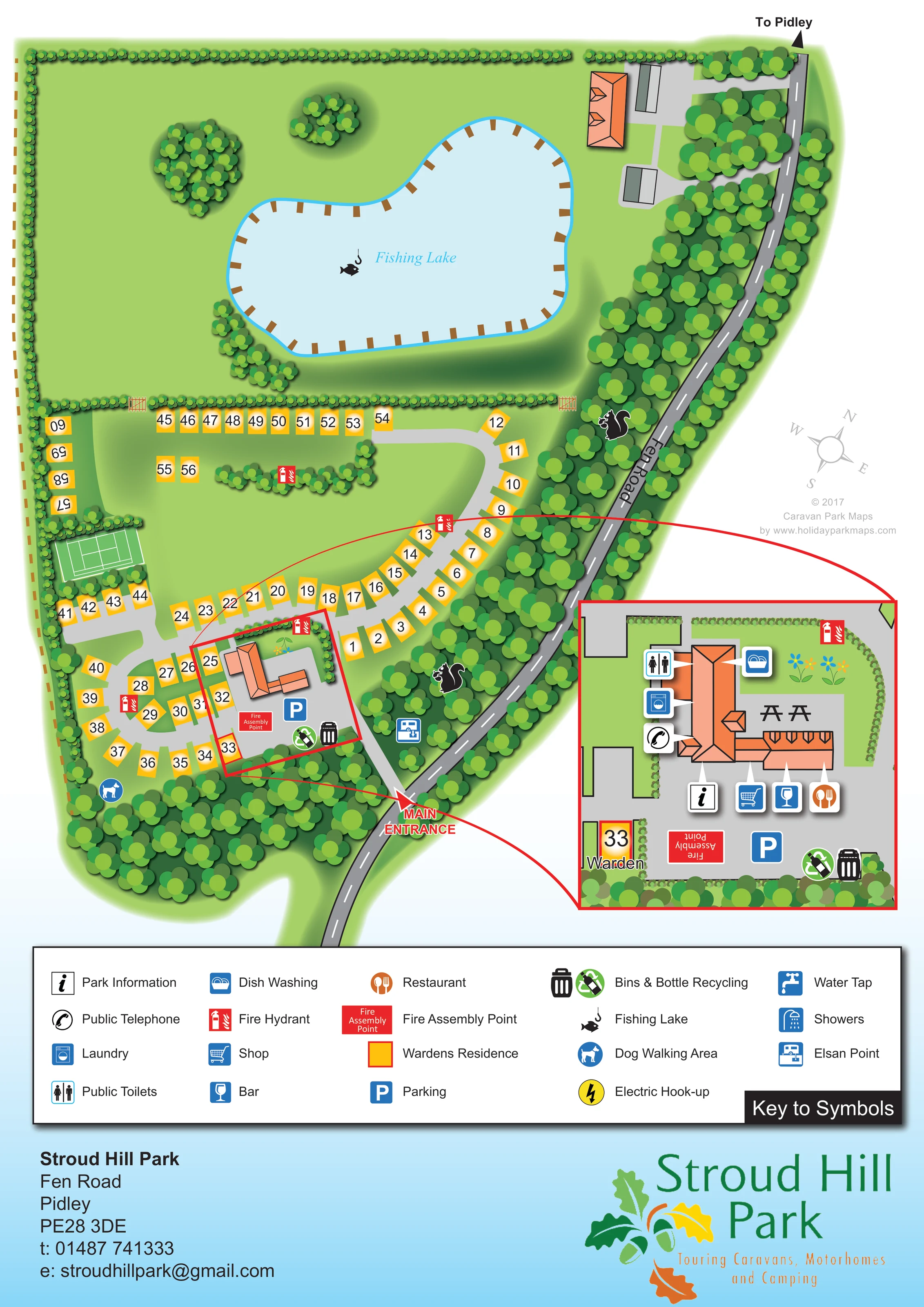
A large, irregularly shaped lake occupies the upper half of the plan, with a fish-and-hook symbol and repeated brown bank-side markers suggesting fishing positions.
ILLUSTRATED PARK MAP · P608
Stroud Hill Park, Fen Road, Pidley · United Kingdom
 Enlarge the map ↗
A SENSE OF THE PLACE
Stroud Hill Park is an adults-only touring and camping park at Pidley in Cambridgeshire. Caravans, motorhomes and tents are welcomed, with dog-friendly stays also described by the visitor listing.
Fully serviced hardstanding pitches sit alongside an oak-framed central building containing reception, a restaurant and washroom facilities. Accessible facilities are provided, and the map shows the arrangement of pitches and shared spaces.
LOOK CLOSER
A large, irregularly shaped lake occupies the upper half of the plan, with a fish-and-hook symbol and repeated brown bank-side markers suggesting fishing positions.
Dense tree planting borders Fen Road and the lower park, while hedges enclose the lake grounds and divide the touring area.
Broad green spaces and isolated tree clusters surround the lake; these spaces are not explicitly designated as camping.
A prominent red label marks the entrance near the bottom of the plan, connecting directly to the internal touring roads.
Fen Road follows the curved eastern boundary, with dashed white road markings and a directional arrow towards Pidley.
Light-grey roads form linked curves and short branches around the service building and through the numbered touring pitches.
Small gate illustrations interrupt the hedge separating the touring area from the lake grounds.
An information symbol is linked to the central building in the enlarged facilities inset.
A large, irregularly shaped lake occupies the upper half of the plan, with a fish-and-hook symbol and repeated brown bank-side markers suggesting fishing positions.
Dense tree planting borders Fen Road and the lower park, while hedges enclose the lake grounds and divide the touring area.
Broad green spaces and isolated tree clusters surround the lake; these spaces are not explicitly designated as camping.
A prominent red label marks the entrance near the bottom of the plan, connecting directly to the internal touring roads.
Fen Road follows the curved eastern boundary, with dashed white road markings and a directional arrow towards Pidley.
Light-grey roads form linked curves and short branches around the service building and through the numbered touring pitches.
Small gate illustrations interrupt the hedge separating the touring area from the lake grounds.
An information symbol is linked to the central building in the enlarged facilities inset.
Separate restaurant, bar and shop symbols identify services within the central orange-roofed building.
The enlarged building inset locates public toilets, laundry and dish-washing facilities using labelled-key pictograms and white pointer tails.
A telephone symbol points to the central building in the inset.
A blue parking symbol marks the paved area beside the main facilities building, repeated in the inset.
Paired waste and recycling symbols sit near the parking area and tree-lined edge of the central facilities compound.
A blue disposal-point symbol is shown beside the entrance-side internal road.
A blue dog symbol identifies a dog walking area at the wooded lower-left edge of the park.
A green rectangular court with recognisable tennis line markings is drawn beside the western pitch rows, although it is not named in the key.
Two picnic-table illustrations appear on the paved terrace in the enlarged facilities inset.
A yellow, red-bordered marker labelled Warden sits beside the central facilities compound.
Red fire-hydrant symbols recur around the pitch roads. A labelled fire assembly point is shown in the central parking area.
Included in the key as a yellow lightning-bolt symbol; individual hook-up positions are not clearly marked on the plan.
A water-tap symbol is included in the key without a clearly identifiable placement in the main plan.
Showers appear in the symbol key, but a separate shower location is not clearly identified in the building inset.
READING THE MAP
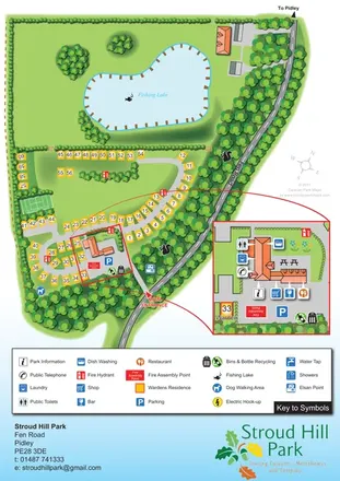
This illustrated map of Stroud Hill Park in Pidley, Cambridgeshire, brings together a compact touring layout and a substantial fishing lake within one portrait design. The lake fills much of the upper plan, while roughly 60 numbered pitch spaces follow curved roads in the lower section. Tree belts, hedges and open grass give the artwork a distinctly green character, with Fen Road providing a clear reference along the eastern boundary.
The main entrance is prominently marked, and the central facilities building is picked out through a red-framed enlargement. This inset makes room for the restaurant, bar, shop, toilets, laundry and other shared services without crowding the main pitch layout. A broad symbol key beneath the plan explains the practical markers used throughout the artwork.
Yellow pitch panels, orange roofs and blue service symbols contrast with the planting, helping visitors separate accommodation, buildings and amenities at a glance. The finished page also incorporates the park's oak-leaf branding, address block and touring, motorhome and camping identity, making it a useful example of a complete visitor-facing park map.
The plan is organised around two contrasting spaces: an expansive lake enclosure above and a more closely arranged touring area below. The fishing lake has an irregular outline, a pale-blue surface and repeated brown markers around its banks. Small copses sit in the surrounding grass, while a hedge separates these grounds from the numbered pitches. Illustrated gates indicate openings through this boundary.
Fen Road curves down the right-hand side, screened by a dense belt of trees. An arrow at its upper end points towards Pidley, while the main entrance is labelled near the bottom. From here, pale-grey internal roads pass the central facilities compound and branch into curved runs serving the yellow pitch markers. Short rows also sit along the hedge below the lake. A small tennis court is drawn on the western side, and a dog walking symbol appears near the wooded lower boundary.
The central building is shown with an orange, multi-part roof and an adjacent paved area. Red framing and connecting lines lead to an enlarged inset on the right. Here, pointer symbols identify park information, a public telephone, laundry, public toilets, dish washing, a shop, a bar and a restaurant. Picnic tables and flower details add context around the building. Parking, bins, bottle recycling, the warden's residence and the fire assembly point are also clearly represented.
Elsewhere, red fire-hydrant markers are distributed around the touring roads, and an Elsan point is shown near the entrance route. The lower-page key explains the symbols, including entries for electric hook-up, water taps and showers. A pale-blue footer completes the composition with the park's contact block and large leaf-and-acorn logo.
KEEP EXPLORING
Chosen for shared landscapes, accommodation or facilities.
 Explore the map ↗
United Kingdom
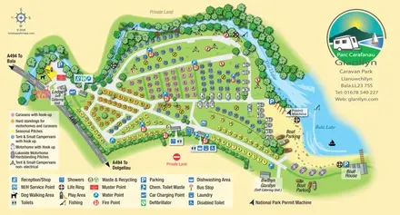
Colour-coded touring and camping map beside Afon Llafar and Bala Lake, with bilingual Glanllyn branding.
 Explore the map ↗
United Kingdom
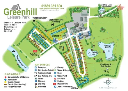
Illustrated camping and touring map with fishing lakes, dog areas and colour-coded pitches.
 Explore the map ↗
United Kingdom
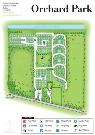
Orchard Holiday Park map with curved accommodation clusters, dog-walking lawns and a named waterside boundary.
Features may come from the sample artwork, its key or published park information. Approximate numbers describe the drawing and may cover only part of a park. They are intended to help you compare map examples. Current facilities and booking information should be checked with the park.
TAKE A CLOSER LOOK
View the illustrated map in detail or choose a file to download. These are sample maps; contact the park for current visitor information.


LET’S MAP YOUR PARK
For a map quotation, find your park and draw a rough boundary around it. The area you select helps us work out the design time and price.
Draw your park for a quote ↗Or talk to our map designers
01751 473136