
Pond
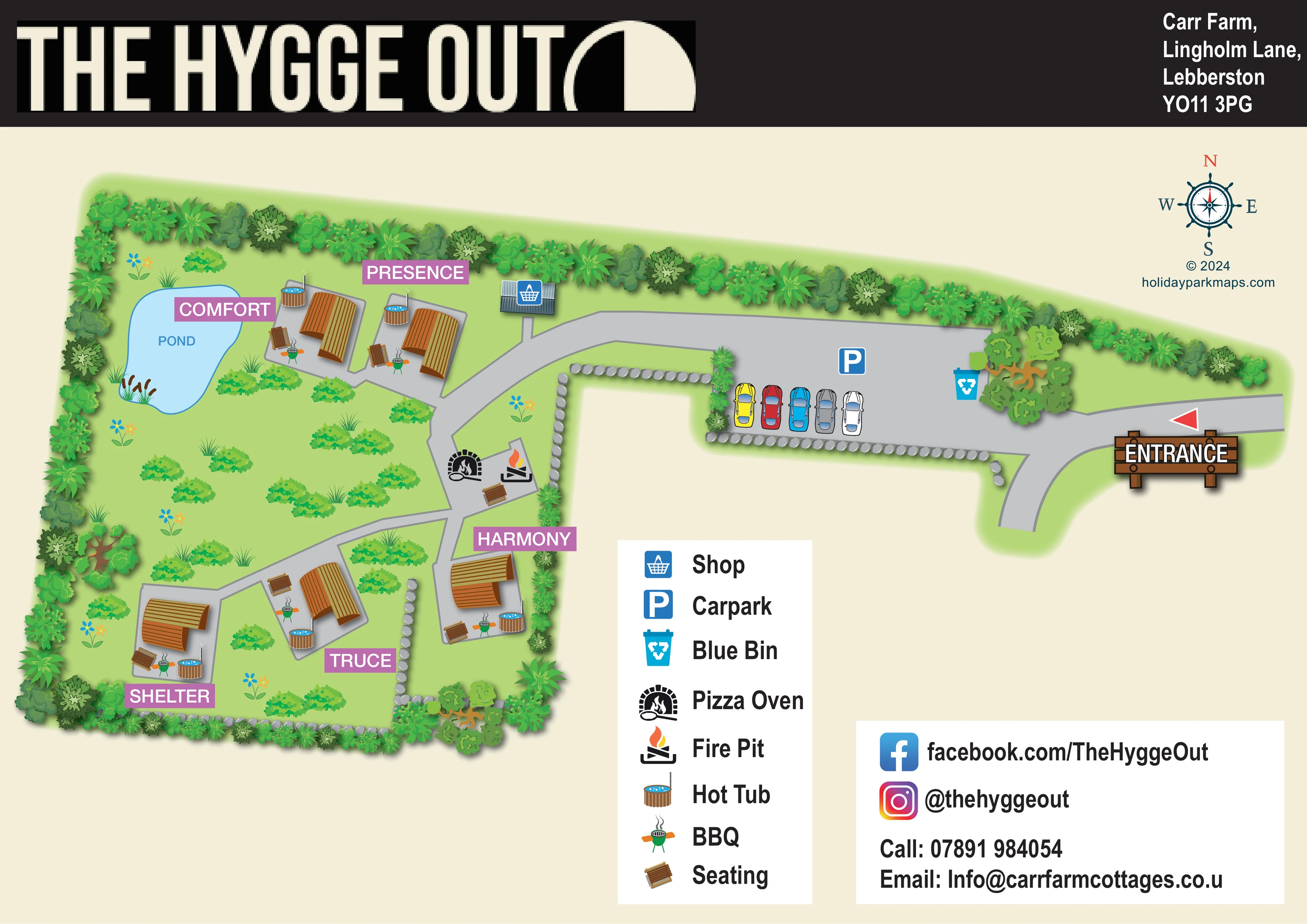
A pale-blue pond labelled POND occupies the upper-left corner, beside Comfort, with reeds illustrated along its edge.
ILLUSTRATED PARK MAP · P334
Lebberston Carr Farm, Lingholm Lane, Lebberston · United Kingdom
 Enlarge the map ↗
A SENSE OF THE PLACE
The Hygge Out is based at Lebberston Carr Farm, Lingholm Lane, Lebberston. Glamping pods and Bell Cottage occupy a countryside setting between Scarborough and Filey.
Dogs are accepted in the Harmony and Shelter pods. The pods have private wood-fired hot tubs, wood-burning stoves and Big Green Egg barbecues. A communal firepit and pizza oven are available.
LOOK CLOSER
A pale-blue pond labelled POND occupies the upper-left corner, beside Comfort, with reeds illustrated along its edge.
Green open ground is scattered with shrubs, grasses and flowers, while dense mixed tree and shrub illustrations frame the outer boundary.
Rows of individually drawn grey stones define the parking edge and sections of the southern and eastern accommodation boundary.
The right-hand approach is marked with a large illustrated timber entrance sign and a red directional arrow.
A broad grey parking area beside the entrance is identified by a blue P symbol and a row of coloured car illustrations.
Grey routes connect the arrival area, shop, communal terrace and individual pod terraces, branching through the landscaped grounds.
A small grey-roofed building off the northern side of the main route carries the blue shopping-basket symbol used in the key.
A blue bin with a recycling emblem is shown beside a large tree near the entrance end of the car park.
The right-hand approach is marked with a large illustrated timber entrance sign and a red directional arrow.
A broad grey parking area beside the entrance is identified by a blue P symbol and a row of coloured car illustrations.
Grey routes connect the arrival area, shop, communal terrace and individual pod terraces, branching through the landscaped grounds.
A small grey-roofed building off the northern side of the main route carries the blue shopping-basket symbol used in the key.
A blue bin with a recycling emblem is shown beside a large tree near the entrance end of the car park.
A pizza-oven symbol marks the shared grey terrace at the central path junction.
A flame-and-logs symbol appears beside the pizza oven on the shared terrace.
Round timber-sided hot tubs with blue water and small flues are illustrated on each pod terrace.
Small green barbecue illustrations appear beside the pods and are explained by the BBQ entry in the key.
Timber bench symbols are repeated on the private pod terraces and the communal fire-pit and pizza-oven terrace.
A pale-blue pond labelled POND occupies the upper-left corner, beside Comfort, with reeds illustrated along its edge.
Green open ground is scattered with shrubs, grasses and flowers, while dense mixed tree and shrub illustrations frame the outer boundary.
Rows of individually drawn grey stones define the parking edge and sections of the southern and eastern accommodation boundary.
Operator information describes wood-burning stoves inside the pods; these are not separately mapped.
READING THE MAP
This illustrated map of The Hygge Out presents a small countryside glamping site at Lebberston Carr Farm, between Scarborough and Filey. Rather than organising accommodation into numbered rows, the design introduces five individually named pods within a planted garden setting. Comfort and Presence sit near the pond, while Shelter, Truce and Harmony are reached by branching paths through the grounds.
The map gives particular attention to the outdoor spaces around each pod. Timber-sided hot tubs, green barbecues and benches are repeated on the private terraces, while a shared pizza oven and fire pit form a separate gathering point near the central path junction. The entrance, car park, shop and blue bin are also clearly represented.
A bold cream-on-charcoal brand header anchors the page, contrasting with the light green landscape and mauve pod labels below. This is a useful sample for a small glamping operator whose map needs to explain arrival, distinguish named accommodation and communicate the character of private and communal outdoor spaces.
The plan follows a simple arrival-to-accommodation sequence. On the right, a timber-style ENTRANCE sign and red arrow identify the approach. The grey access surface opens into a car park illustrated with coloured cars and a blue parking symbol. A blue recycling-bin symbol sits beside a large tree near the entrance, while the shop is shown farther left as a small grey-roofed building off the main route.
From the parking area, the route bends into the glamping grounds and divides between the individual terraces. Comfort and Presence occupy the upper part of the enclosure, with the labelled pond immediately to their left. Shelter and Truce sit across the lower-left grounds, and Harmony occupies a separate position along the right-hand boundary. A small communal terrace at the central junction contains the pizza-oven, fire-pit and seating symbols.
Each pod is drawn as a curved, timber-coloured form on a grey terrace, accompanied by a round hot tub, a green barbecue and a bench. Large mauve name panels make these small accommodation groups easier to identify than a numbered-pitch system would. Dense perimeter planting, scattered shrubs and flowers, and rows of grey stones give the grounds a recognisable landscaped structure without obscuring the paths.
The single landscape-format composition combines the site plan with a tall white symbol key and a separate social/contact panel. Above them, a decorative compass provides orientation. The oversized monochrome wordmark across the top gives the artwork a strong identity, while the warmer timber tones and varied greens carry the more intimate garden character of the accommodation area.
KEEP EXPLORING
Chosen for shared landscapes, accommodation or facilities.
 Explore the map ↗
United Kingdom
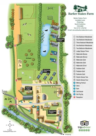
Portrait farm-stay map with pond-side lodges, glamping pods, orchard and illustrated animal paddocks.
 Explore the map ↗
United Kingdom
Woodland-framed Barnsoul map with mixed accommodation, shared facilities and paw-marked walking routes.
 Explore the map ↗
United Kingdom
A colour-zoned coastal park map with touring areas, woodland trails, ponds and a leisure club.
Features may come from the sample artwork, its key or published park information. Approximate numbers describe the drawing and may cover only part of a park. They are intended to help you compare map examples. Current facilities and booking information should be checked with the park.
LET’S MAP YOUR PARK
For a map quotation, find your park and draw a rough boundary around it. The area you select helps us work out the design time and price.
Draw your park for a quote ↗Or talk to our map designers
01751 473136