
Dog-walking area
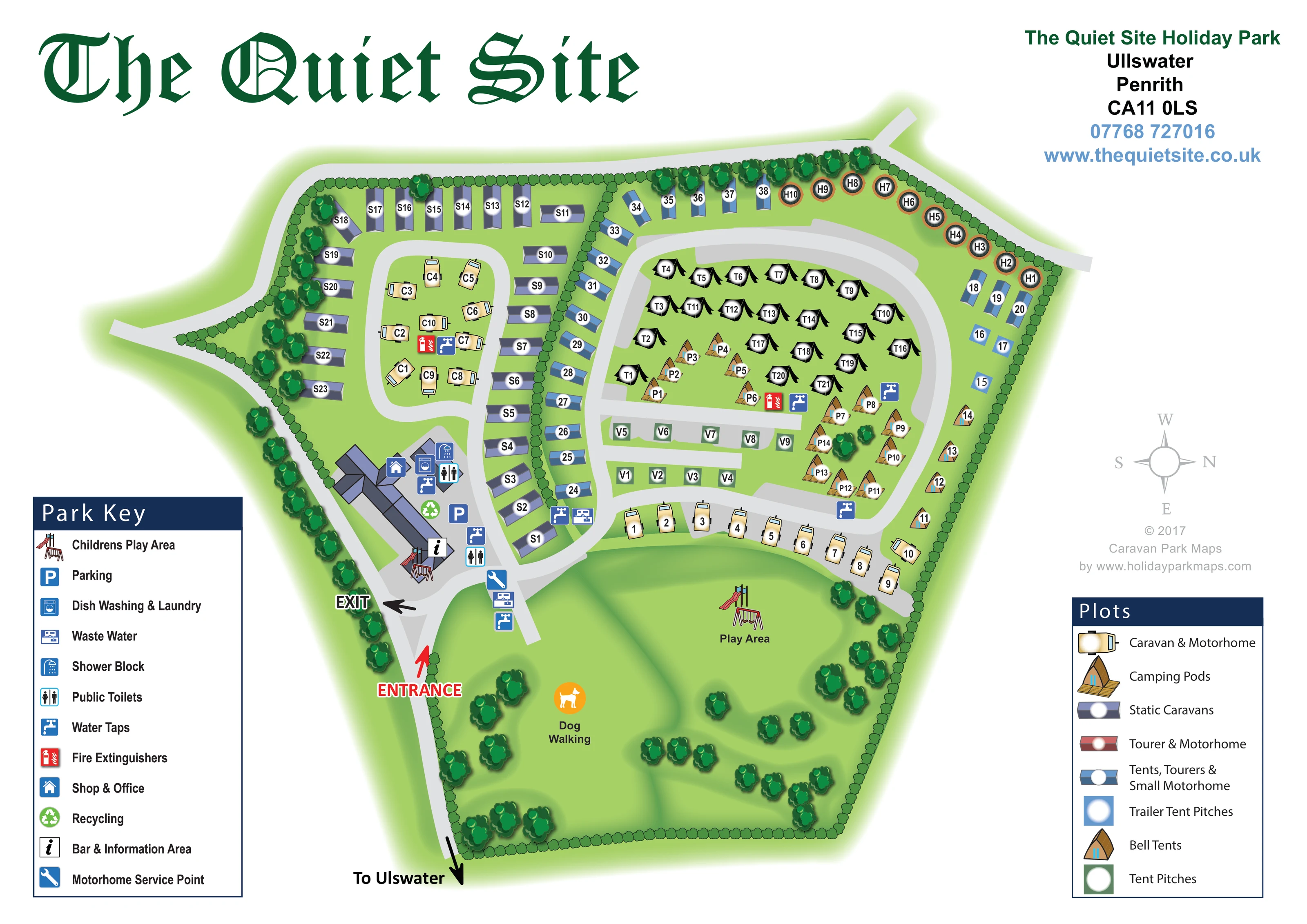
The southern landscaped green is labelled Dog Walking and marked with an orange dog pictogram.
ILLUSTRATED PARK MAP · P623
The Quiet Site Holiday Park, Ullswater, Penrith · United Kingdom
 Enlarge the map ↗
A SENSE OF THE PLACE
The Quiet Site offers camping, touring, glamping and self-catering stays above Ullswater in the Lake District. Its location on the Ullswater Way gives walking a central role in the holiday experience.
Facilities include a shop, bar, pizzas and modern washrooms, alongside serviced camping and touring pitches. Dog-friendly options and accessible accommodation are available, with the map helping visitors locate the park's different types of stay.
LOOK CLOSER
The southern landscaped green is labelled Dog Walking and marked with an orange dog pictogram.
Continuous hedging encloses much of the site, with larger trees along the western and northern edges and scattered across the southern green.
A house pictogram marks the shop and office within the building cluster near the entrance.
An information symbol identifies the bar and information area at the southern end of the main building group.
A blue parking symbol appears in the paved arrival and facilities area.
A laundry pictogram identifies the combined dish-washing and laundry facility beside the shop and washrooms.
Shower and toilet symbols are concentrated around the principal facilities buildings, with toilet provision marked at more than one point in that cluster.
Repeated tap symbols serve the arrival area and accommodation groups; waste-water symbols appear near the entrance and central accommodation division.
A house pictogram marks the shop and office within the building cluster near the entrance.
An information symbol identifies the bar and information area at the southern end of the main building group.
A blue parking symbol appears in the paved arrival and facilities area.
A laundry pictogram identifies the combined dish-washing and laundry facility beside the shop and washrooms.
Shower and toilet symbols are concentrated around the principal facilities buildings, with toilet provision marked at more than one point in that cluster.
Repeated tap symbols serve the arrival area and accommodation groups; waste-water symbols appear near the entrance and central accommodation division.
A blue spanner symbol marks the motorhome service point beside the entrance-side road junction.
A green recycling symbol is positioned in the main facilities and parking area.
Red extinguisher symbols identify points within the western vehicle-pitch loop and the eastern camping and pod enclosure.
Play-equipment illustrations appear beside the bar and information building and on the larger southern green labelled Play Area.
The southern landscaped green is labelled Dog Walking and marked with an orange dog pictogram.
Continuous hedging encloses much of the site, with larger trees along the western and northern edges and scattered across the southern green.
A red entrance arrow and black exit arrow distinguish movements at the south-western arrival junction.
Broad pale-grey roads connect the facilities cluster, western caravan loop, eastern accommodation loop and short central pitch spurs.
A southward page arrow labelled 'To Ulswater' points along the road beyond the entrance. The lake itself is not depicted.
READING THE MAP
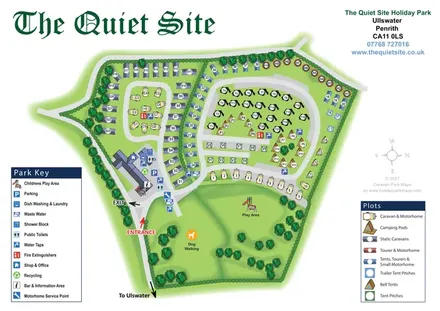
This illustrated map of The Quiet Site Holiday Park brings a varied Lake District holiday site into one readable plan. Set above Ullswater near Penrith, the park combines camping, touring and glamping, and the artwork gives each mapped accommodation type a recognisable visual identity. Static caravans, caravan-and-motorhome pitches, camping pods, bell tents and several camping pitch categories are distinguished through miniature illustrations and a dedicated accommodation key.
The layout is organised around two accommodation areas, with the main facilities gathered close to the entrance and a broad green space extending across the lower part of the site. Trees, hedges and softly shaded grass give the plan a landscaped character, while pale-grey roads make the internal connections easy to follow. The map also identifies the shop and office, bar and information area, washrooms, laundry, play areas and motorhome service point.
For a holiday park with several different ways to stay, this sample demonstrates how pictorial mapping can explain both the overall arrangement and the practical details visitors need on arrival.
The plan is framed by a large dark-green 'The Quiet Site' title, an upper-right contact block and two substantial keys in the lower corners. The central artwork uses an overhead layout with gently raised-looking accommodation illustrations, shaded roof forms and layered tree crowns. A pale-grey compass sits to the right, with north pointing towards the right-hand side of the page.
Visitors enter at the lower-left junction, where a red entrance arrow and a black exit arrow distinguish the two movements. Immediately inside is the principal building and parking cluster. Its symbols identify the shop and office, bar and information area, dish washing and laundry, shower block, public toilets and recycling. Water and waste-water points are marked nearby, together with the motorhome service point.
The western accommodation enclosure contains static caravans around a smaller loop of caravan-and-motorhome pitches. A hedge forms its eastern boundary, alongside a row of blue mixed-use pitches. Beyond this division, a larger curved road encloses illustrated tents and camping pods. Bell tents follow the north-eastern boundary and continue down the eastern edge, while short rows of tent pitches occupy the centre. A cream-coloured vehicle-pitch row follows the southern road curve.
The lower green is a substantial part of the composition rather than leftover background. It contains labelled dog walking, a separate play area and scattered trees; another play-equipment illustration appears beside the facilities buildings. Repeated water and fire-point symbols support wayfinding within the accommodation areas. An arrow beyond the entrance points towards Ullswater without depicting the lake. The accompanying enlargement reveals the same arrival area and facility key in greater detail, rather than a separate park section.
KEEP EXPLORING
Chosen for shared landscapes, accommodation or facilities.
 Explore the map ↗
United Kingdom
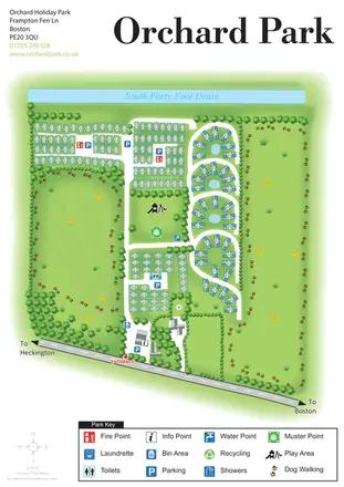
Orchard Holiday Park map with curved accommodation clusters, dog-walking lawns and a named waterside boundary.
 Explore the map ↗
United Kingdom
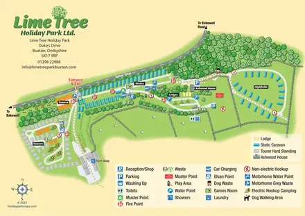
Mixed-accommodation park map with woodland, public footpaths and clearly differentiated service symbols.
 Explore the map ↗
United Kingdom
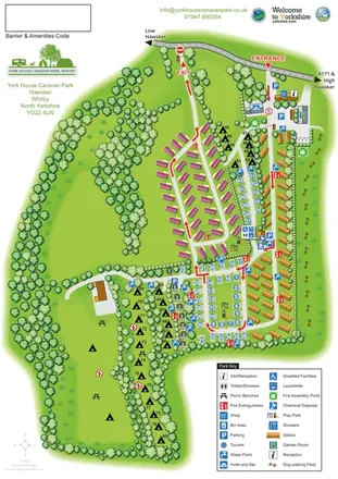
Portrait park map with mixed accommodation, directional roads, tree-lined camping and a paw-print dog-walking field.
Features may come from the sample artwork, its key or published park information. Approximate numbers describe the drawing and may cover only part of a park. They are intended to help you compare map examples. Current facilities and booking information should be checked with the park.
TAKE A CLOSER LOOK
View the illustrated map in detail or choose a file to download. These are sample maps; contact the park for current visitor information.


LET’S MAP YOUR PARK
For a map quotation, find your park and draw a rough boundary around it. The area you select helps us work out the design time and price.
Draw your park for a quote ↗Or talk to our map designers
01751 473136