
Gate Inn Brook
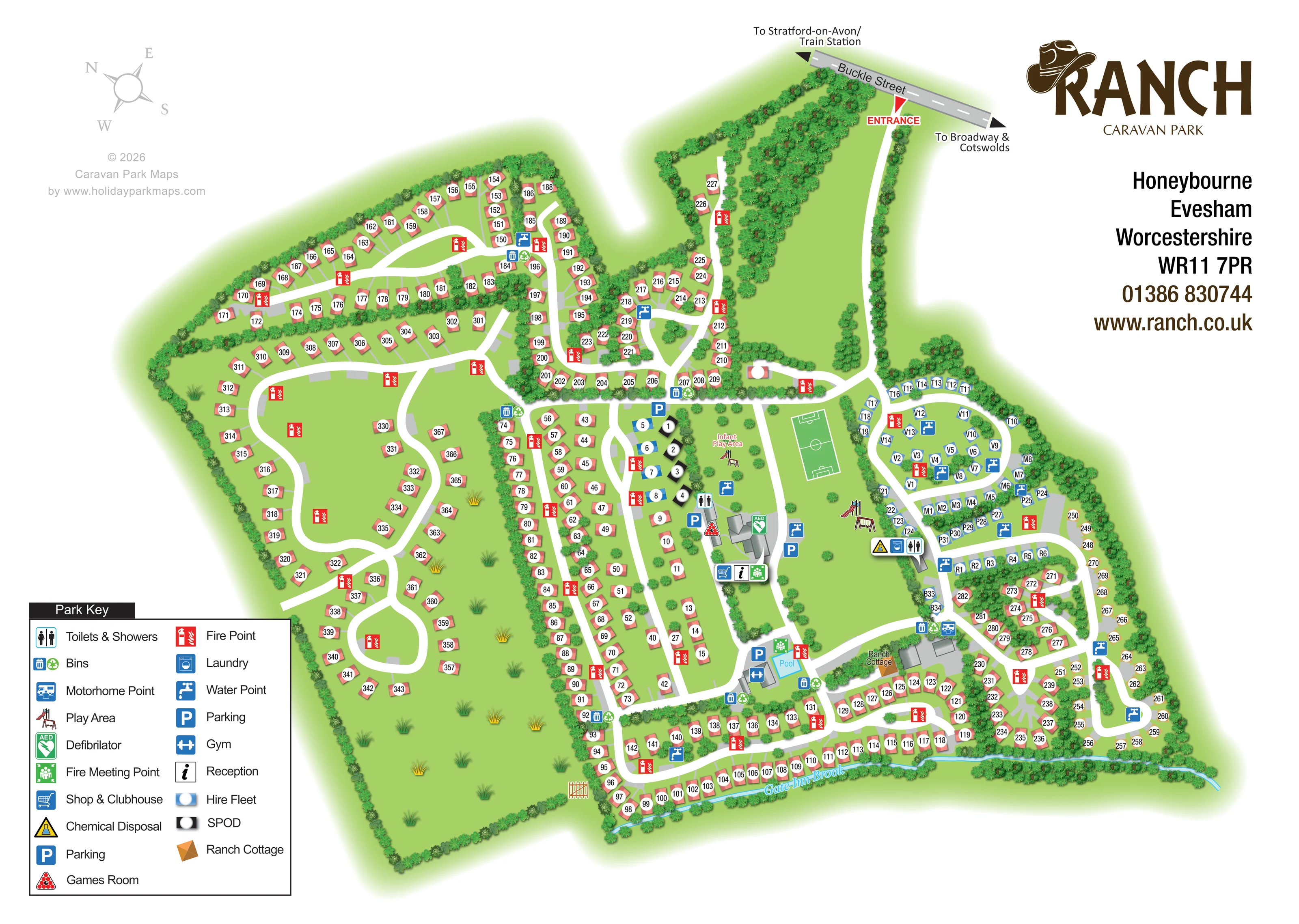
A narrow blue watercourse labelled Gate Inn Brook follows much of the lower park boundary.
ILLUSTRATED PARK MAP · P336
Honeybourne, Evesham, Worcestershire · United Kingdom
 Enlarge the map ↗
A SENSE OF THE PLACE
The Ranch is a family-run holiday park at Honeybourne in the Worcestershire countryside, close to the Cotswolds. Its location offers access to Broadway, Chipping Campden, Evesham and Stratford-upon-Avon.
Touring caravans, motorhomes, campervans and trailer tents are welcomed on grass and hardstanding pitches. A clubhouse, heated outdoor pool, play areas, shop and games room provide shared facilities within the park.
LOOK CLOSER
A narrow blue watercourse labelled Gate Inn Brook follows much of the lower park boundary.
Dense illustrated planting encloses the park, separates accommodation rows and forms a substantial belt beside the entrance approach. Larger grass areas remain open within the western loops and central recreation space.
An information symbol identifies reception within the main central building cluster.
A shopping-trolley symbol, interpreted through the key, marks the shop and clubhouse at the central facilities.
A triangular snooker-ball symbol marks the games room beside the main facilities.
A cyan rectangular pool labelled Pool is shown below the main facilities, next to parking and the gym.
A dumbbell symbol identifies the gym in a grey building beside the pool.
Illustrated play equipment marks a larger play area on the central green and a separately labelled Infant Play Area near the Hire Fleet and SPOD units.
An information symbol identifies reception within the main central building cluster.
A shopping-trolley symbol, interpreted through the key, marks the shop and clubhouse at the central facilities.
A triangular snooker-ball symbol marks the games room beside the main facilities.
A cyan rectangular pool labelled Pool is shown below the main facilities, next to parking and the gym.
A dumbbell symbol identifies the gym in a grey building beside the pool.
Illustrated play equipment marks a larger play area on the central green and a separately labelled Infant Play Area near the Hire Fleet and SPOD units.
A green rectangular playing area with white football markings occupies the central open space.
Toilet and shower symbols appear at the main facilities and at a separate service building adjoining the touring pitches.
A washing-machine symbol marks laundry facilities at the touring-area service building.
A yellow triangular symbol identifies chemical disposal beside the touring-area laundry and toilets.
A motorhome service symbol appears at the lower edge of the touring area, near bins and a grey service building.
Blue tap symbols are distributed among the accommodation loops and central facilities.
Paired waste-bin and recycling symbols mark several collection points around the park.
Blue P symbols mark parking around the principal facilities, accommodation cluster and pool.
A green AED symbol identifies a defibrillator at the main building cluster.
Red fire-point symbols recur throughout the accommodation areas; green fire meeting-point symbols appear at the main facilities and pool.
A narrow blue watercourse labelled Gate Inn Brook follows much of the lower park boundary.
Dense illustrated planting encloses the park, separates accommodation rows and forms a substantial belt beside the entrance approach. Larger grass areas remain open within the western loops and central recreation space.
A red entrance arrow connects Buckle Street to the long internal approach road.
Arrowed labels on Buckle Street point towards Stratford-on-Avon and the train station in one direction, and Broadway and the Cotswolds in the other.
READING THE MAP
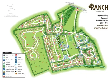
This illustrated map of The Ranch Caravan Park brings a large, irregular site in Honeybourne, Worcestershire, into one connected visitor plan. The entrance from Buckle Street leads down a long, tree-lined approach before the roads divide between curving accommodation loops, a compact touring area and the central shared facilities. Along the lower edge, Gate Inn Brook gives the park a distinctive natural boundary.
The artwork combines simple numbered accommodation symbols with more detailed planting, building roofs and play equipment. Salmon-red plots dominate the wider park, while blue letter-prefixed pitches create a contrasting group on the right. Hire Fleet units, black SPOD symbols and the orange-roofed Ranch Cottage add further visual distinctions.
At the heart of the map are the reception, shop and clubhouse, games room, play areas and football pitch, with the pool and gym slightly below. A substantial key explains the service symbols distributed around the site. The brown cowboy-hat logo, generous white margins and green landscape treatment give this practical wayfinding sheet a character specific to The Ranch.
The single landscape plan is arranged around a long arrival route from Buckle Street at the top of the page. A red entrance marker identifies the turn into the park, while external arrows indicate Stratford-on-Avon and the train station in one direction, and Broadway and the Cotswolds in the other. The approach follows the edge of a substantial planted belt before reaching the principal internal junction.
From here, broad white roads spread into several linked loops. The western side contains extensive numbered accommodation groups around generous grass interiors, with further rows screened by hedges towards the upper-left corner. The lower rows follow the blue line of Gate Inn Brook. On the right, blue letter-prefixed pitches form a compact arrangement of curved perimeter pitches, inner groups and short parallel rows. A smaller yellow plot group follows the outer right-hand boundary.
The recreation and facilities area provides the visual centre of the plan. A marked football pitch and illustrated play equipment occupy the main green, with a separate Infant Play Area beside the Hire Fleet and SPOD accommodation. Grey-roofed buildings carry symbols for reception, the shop and clubhouse, games room, toilets and showers, and a defibrillator. Below them, the labelled pool sits beside the gym, parking and a fire meeting point. Ranch Cottage is picked out nearby with an orange roof.
A separate touring-area service building is associated with laundry, toilets and showers, and chemical disposal. Water taps, bins and recycling, fire points and parking recur across the park, with a motorhome point near the lower touring junction. The lower-left key explains these symbols, while the upper-right logo and address block balance the irregular green site shape. The enlarged views show details of this same plan rather than separate map variants.
KEEP EXPLORING
Chosen for shared landscapes, accommodation or facilities.
 Explore the map ↗
United Kingdom
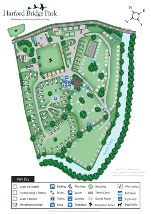
Riverside park map with colour-coded pitches, static caravan groups and a comprehensive facilities key.
 Explore the map ↗
United Kingdom
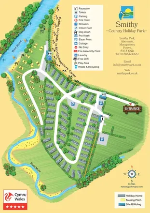
Illustrated Smithy Park map with riverside touring pitches, holiday-home rows and a footprint-marked canal footpath.
 Explore the map ↗
United Kingdom
Woodland park map with mixed pitches, bell tents, lodges and a fishing lake.
Features may come from the sample artwork, its key or published park information. Approximate numbers describe the drawing and may cover only part of a park. They are intended to help you compare map examples. Current facilities and booking information should be checked with the park.
TAKE A CLOSER LOOK
View the illustrated map in detail or choose a file to download. These are sample maps; contact the park for current visitor information.


LET’S MAP YOUR PARK
For a map quotation, find your park and draw a rough boundary around it. The area you select helps us work out the design time and price.
Draw your park for a quote ↗Or talk to our map designers
01751 473136
 rancha_large.png