
Lake
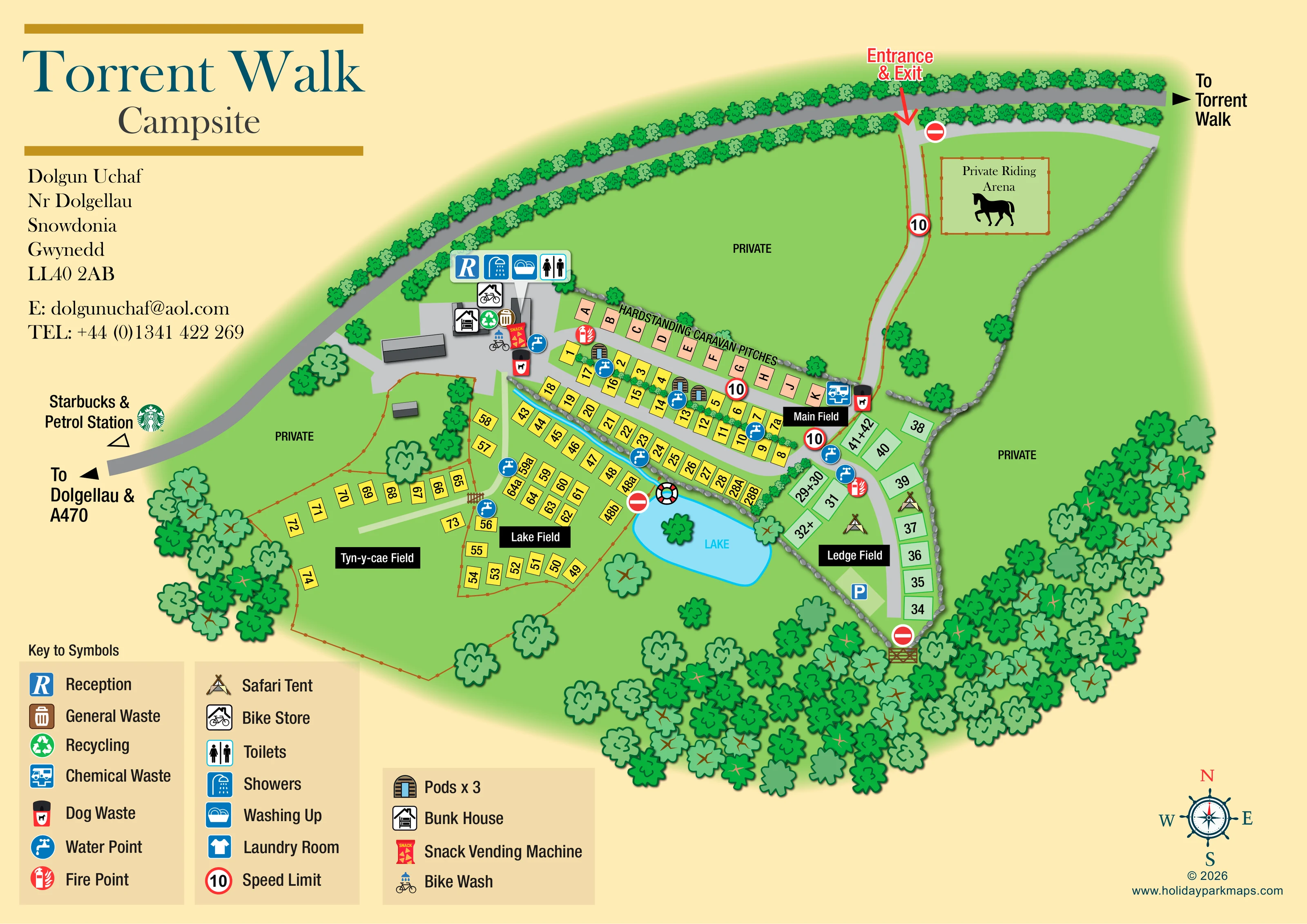
A light-blue lake forms a central landscape landmark between Lake Field and Ledge Field; a lifebuoy symbol is drawn at its north-western edge.
ILLUSTRATED PARK MAP · P344
Torrent Walk Campsite, Dolgun Uchaf, Nr Dolgellau, Snowdonia, Gwynedd · United Kingdom
 Enlarge the map ↗
A SENSE OF THE PLACE
Torrent Walk offers glamping accommodation near Dolgellau in Eryri, also known as Snowdonia. Mountains and farmland surround the site, with the Torrent Walk route beginning nearby.
The setting provides a base for walking, cycling and exploring the national park. Dolgellau, Cadair Idris and the coast around Barmouth and Fairbourne offer different ways to enjoy the surrounding area.
LOOK CLOSER
A light-blue lake forms a central landscape landmark between Lake Field and Ledge Field; a lifebuoy symbol is drawn at its north-western edge.
A thin blue watercourse follows the boundary between the upper and lower pitch rows towards the lake.
Dense stylised woodland borders the southern and eastern edges. Tree-lined roads, grey stone boundaries and brown fences distinguish the fields and neighbouring land.
Several areas around the accommodation are labelled private, separating them from the visitor-facing campsite.
A fenced rectangle with a horse silhouette is explicitly labelled 'Private Riding Arena' near the entrance; it is not presented as a guest amenity.
A prominent blue R identifies reception at the western building cluster.
A grouped callout places toilets, showers and washing-up facilities beside reception.
A bicycle-under-a-roof symbol marks bike storage within the main building cluster.
A prominent blue R identifies reception at the western building cluster.
A grouped callout places toilets, showers and washing-up facilities beside reception.
The key includes a laundry-room symbol, but its position is not clearly identifiable on the plan.
A bicycle-under-a-roof symbol marks bike storage within the main building cluster.
A bicycle-and-water symbol locates a bike wash beside the reception-area services.
A bright red vending-machine illustration appears at the service hub.
Repeated blue tap symbols identify water points across the accommodation fields and near the buildings.
General waste and recycling symbols appear at the building cluster, with dog-waste symbols there and beside the eastern access route.
A blue chemical-waste symbol appears beside the access route at the eastern end of the hardstanding row.
Red extinguisher symbols mark fire points at the service hub and within the pitch areas.
A blue P marks a parking area towards the southern end of Ledge Field.
A large red arrow identifies the entrance and exit from the tree-lined road at the top of the plan.
Circular 10 speed-limit signs and no-entry symbols punctuate the internal routes. A gate is illustrated at the southern edge.
A right-pointing arrow on the upper road indicates the direction to Torrent Walk; the walking route itself is not drawn.
Left-side annotations point towards Dolgellau and the A470, with a separate reference to Starbucks and a petrol station outside the campsite.
A light-blue lake forms a central landscape landmark between Lake Field and Ledge Field; a lifebuoy symbol is drawn at its north-western edge.
A thin blue watercourse follows the boundary between the upper and lower pitch rows towards the lake.
Dense stylised woodland borders the southern and eastern edges. Tree-lined roads, grey stone boundaries and brown fences distinguish the fields and neighbouring land.
Several areas around the accommodation are labelled private, separating them from the visitor-facing campsite.
A fenced rectangle with a horse silhouette is explicitly labelled 'Private Riding Arena' near the entrance; it is not presented as a guest amenity.
READING THE MAP
This illustrated map of Torrent Walk Campsite presents a field-based site at Dolgun Uchaf, near Dolgellau in Eryri, also known as Snowdonia. Its layout combines numbered pitches, a lettered hardstanding caravan row, glamping pods, safari tents and a bunk house, all set among green fields and wooded boundaries. A small lake gives the plan a memorable central landmark, while four named fields help visitors understand how the accommodation areas relate to one another.
The design balances practical campsite information with a distinctive rural illustration. Reception and washroom facilities are grouped beside the main buildings, and repeated symbols identify water points, waste facilities and fire points throughout the site. Bike storage and a bike wash add useful detail for visitors exploring the surrounding area on two wheels.
A large title and address block occupy the left side, with a clear pictorial key below. Across the plan, arrival arrows, pitch labels, private-land annotations and directions towards Torrent Walk and Dolgellau turn a varied landscape into a readable visitor guide.
The plan is arranged beneath a sweeping, tree-lined road, with the entrance and exit marked by a red arrow near the upper-right corner. From here, a grey lane descends past a fenced private riding arena and connects with the accommodation rows. External arrows indicate Torrent Walk to the right and Dolgellau and the A470 to the left; Starbucks and a petrol station are also referenced beyond the campsite.
A lettered strip of peach-coloured hardstanding caravan pitches runs above Main Field. Below it, yellow numbered pitches follow parallel lanes, with three illustrated pods integrated into the upper accommodation area. Lake Field extends around the western side of the blue lake, while Tyn-y-cae Field spreads into a more open enclosure to the left. Ledge Field forms a narrower pale-green strip on the right, containing numbered pitches, two safari-tent illustrations and a parking marker near its lower end.
The western building cluster acts as the service hub. A raised pictogram panel identifies reception, showers, washing up and toilets. Nearby symbols locate the bunk house, bike store, bike wash, snack vending machine, general waste and recycling. Water points, dog-waste points, chemical-waste disposal and fire points are marked elsewhere across the plan. The key also includes a laundry-room symbol.
Trees, fences and stone-style boundaries explain the site's edges, while a narrow blue watercourse leads towards the lake. Black field-name panels stand out against the green ground. Three legend panels sit below the title block, and a compass rose completes the lower-right corner. The enlarged detail views show this same key and page corner, rather than separate campsite sections.
KEEP EXPLORING
Chosen for shared landscapes, accommodation or facilities.
 Explore the map ↗
United Kingdom
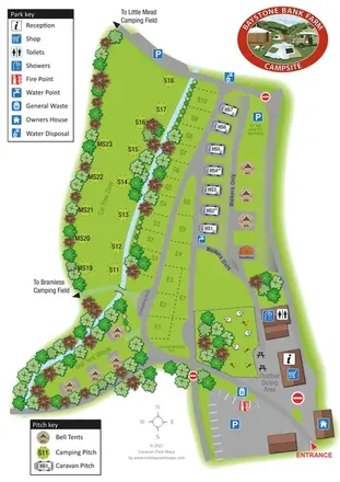
A stream-side farm campsite plan with car-free camping, caravan pitches and separate bell-tent areas.
 Explore the map ↗
United Kingdom
Woodland park map with mixed pitches, bell tents, lodges and a fishing lake.
 Explore the map ↗
United Kingdom
Woodland holiday homes, named camping fields and farm buildings on a colour-coded Nether Wasdale park map.
Features may come from the sample artwork, its key or published park information. Approximate numbers describe the drawing and may cover only part of a park. They are intended to help you compare map examples. Current facilities and booking information should be checked with the park.
TAKE A CLOSER LOOK
View the illustrated map in detail or choose a file to download. These are sample maps; contact the park for current visitor information.

LET’S MAP YOUR PARK
For a map quotation, find your park and draw a rough boundary around it. The area you select helps us work out the design time and price.
Draw your park for a quote ↗Or talk to our map designers
01751 473136