
Tree and hedge planting
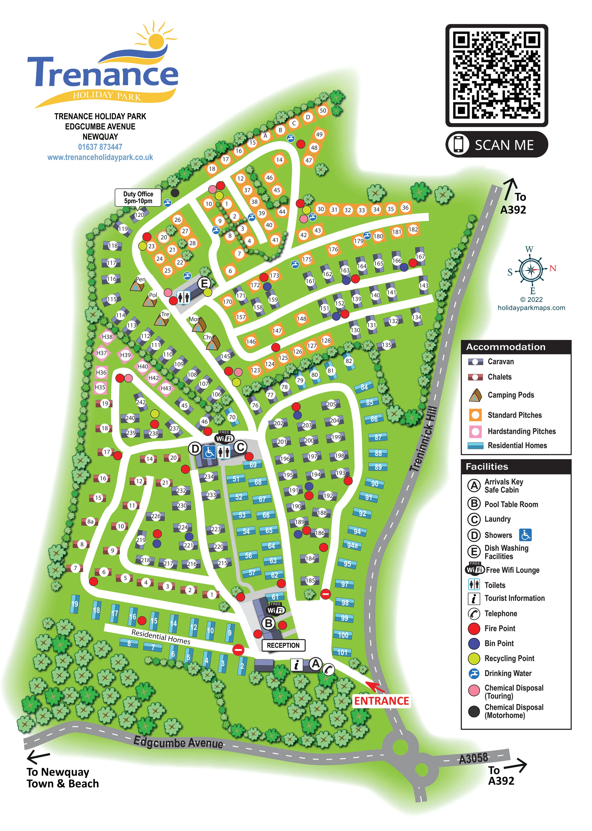
Continuous leafy boundaries, internal planted dividers and a broad tree-filled frontage frame the accommodation.
ILLUSTRATED PARK MAP · P628
Edgcumbe Avenue, Newquay, Cornwall · United Kingdom
 Enlarge the map ↗
A SENSE OF THE PLACE
Trenance Holiday Park is based at Edgcumbe Avenue, Newquay, Cornwall. It is in Newquay's Trenance valley, close to the town and beaches. The park offers chalets, static caravans, camping pods, touring and camping pitches.
Gardens, a boating lake, historic cottages and sports facilities are in the surrounding Trenance Leisure Park.
LOOK CLOSER
Continuous leafy boundaries, internal planted dividers and a broad tree-filled frontage frame the accommodation.
Prominently labelled beside the lower arrival route, close to the pool table room and Wi-Fi lounge symbol.
Letter A marks the cabin beside the entrance approach.
A callout identifies a duty office towards the upper-left boundary.
Letter B locates the room in the reception-side building group.
Wi-Fi lounge symbols appear at the reception-side buildings and central facilities block.
Letter C identifies laundry facilities at the central service block.
Letter D marks showers at the central service block, accompanied by a wheelchair symbol.
Prominently labelled beside the lower arrival route, close to the pool table room and Wi-Fi lounge symbol.
Letter A marks the cabin beside the entrance approach.
A callout identifies a duty office towards the upper-left boundary.
Letter B locates the room in the reception-side building group.
Wi-Fi lounge symbols appear at the reception-side buildings and central facilities block.
Letter C identifies laundry facilities at the central service block.
Letter D marks showers at the central service block, accompanied by a wheelchair symbol.
Toilet pictograms locate facilities at the central block and beside the camping pods.
Letter E marks the upper service building beside the pods and standard pitches.
An information symbol appears beside the arrivals cabin near the entrance.
A handset symbol identifies a telephone near the arrivals cabin.
Blue tap symbols are distributed mainly through the upper pitch areas.
Pink circles identify touring chemical disposal points; a dark circle near the upper-left boundary identifies motorhome chemical disposal.
Purple bin-point circles and yellow-green recycling circles are repeated around the accommodation groups.
Red circular markers are distributed throughout the park.
Continuous leafy boundaries, internal planted dividers and a broad tree-filled frontage frame the accommodation.
A large red arrow and entrance label mark access from the road along the right-hand boundary.
White branching lanes form loops, curved perimeter routes and short cross-lanes between accommodation rows.
Named grey roads surround the lower and right edges, with a linked roundabout junction at the bottom.
External arrows point towards Newquay town and beach, and towards the A392 in two directions.
Two conventional no-entry signs appear on internal lanes near the lower residential and reception areas.
READING THE MAP
This portrait map of Trenance Holiday Park brings together a varied accommodation mix within a compact, tree-framed layout in Newquay, Cornwall. The artwork shows caravans, chalets, camping pods, standard pitches, hardstandings and residential homes, each with a distinct colour or illustration. That separation is particularly useful on a site where different accommodation groups share the same branching network of lanes.
Arrival is made prominent with a red entrance arrow from Treninnick Hill, followed by reception and the arrivals key safe cabin. Beyond this first cluster, white lanes lead through caravan rows towards the upper pitch areas and their service points. Five named timber-style pods provide a recognisable landmark beside the toilet and dishwashing facilities.
The surrounding road labels and arrows towards Newquay town and beach give the plan a local frame without turning it into a wider area map. A blue-and-yellow park logo, large QR code, nautical compass and two organised legends complete the page. The result is a useful sample for mixed-accommodation parks needing both an arrival guide and a detailed on-site reference.
The plan follows the park's elongated shape, with a tree-lined upper tip and a broader lower frontage beside Edgcumbe Avenue. Treninnick Hill runs along the right-hand side, meeting the A3058 at the illustrated roundabout junction below. A red entrance arrow leads into the lower-right corner, where the arrivals key safe cabin, tourist information and telephone symbols sit close to reception. The pool table room and a Wi-Fi lounge marker appear in the reception-side building group.
Accommodation is organised through colour rather than lengthy area labels. Orange standard pitches occupy most of the upper section, including curved perimeter groups and short rows beside branching lanes. Pink hardstandings form a smaller group on the left. Purple-grey caravans extend through the middle in angled rows and loops, while red-brown chalets are concentrated lower left. Cyan residential homes line the lower boundary, central lanes and right-hand edge. The five camping pods—Pen, Pol, Tre, Mor and Chy—are drawn as small timber structures beside the upper facilities building.
Two service clusters anchor the internal layout. The upper block is marked for toilets and dishwashing; the central block carries laundry, showers, toilets, a wheelchair symbol and a Wi-Fi lounge marker. Drinking water, chemical disposal, fire, bin and recycling points are shown with repeated symbols, allowing visitors to locate services near their accommodation.
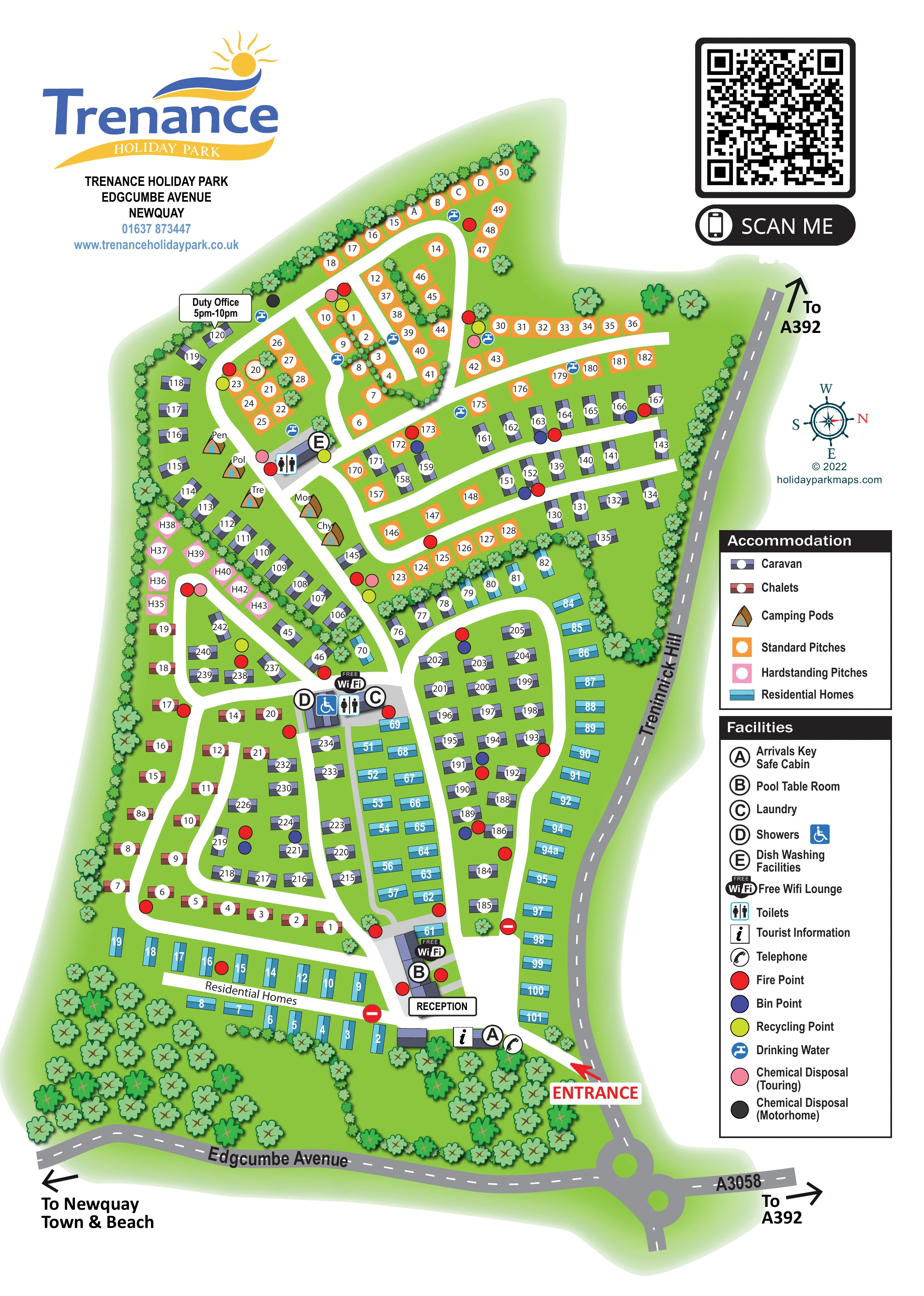
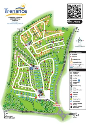
The single-page artwork combines broad white internal lanes with grey public roads, numbered units and leafy planted dividers. Its right-hand legends explain accommodation colours and facility symbols. Overlapping detail views enlarge this same plan rather than showing additional sections or separate park variants.
KEEP EXPLORING
Chosen for shared landscapes, accommodation or facilities.
 Explore the map ↗
United Kingdom
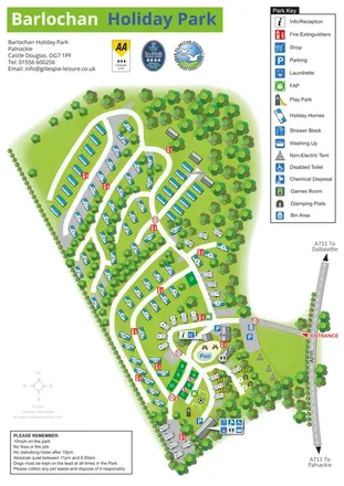
A wooded, mixed-accommodation park plan with winding lanes, a pool, camping areas and a clear facility key.
 Explore the map ↗
United Kingdom
Woodland-framed Barnsoul map with mixed accommodation, shared facilities and paw-marked walking routes.
 Explore the map ↗
United Kingdom
Coastal park plan with colour-coded pitches, named neighbourhoods and a Morecambe Bay walking route.
Features may come from the sample artwork, its key or published park information. Approximate numbers describe the drawing and may cover only part of a park. They are intended to help you compare map examples. Current facilities and booking information should be checked with the park.
TAKE A CLOSER LOOK
View the illustrated map in detail or choose a file to download. These are sample maps; contact the park for current visitor information.


LET’S MAP YOUR PARK
For a map quotation, find your park and draw a rough boundary around it. The area you select helps us work out the design time and price.
Draw your park for a quote ↗Or talk to our map designers
01751 473136
 trenancemap_large.png