
River Vyrnwy
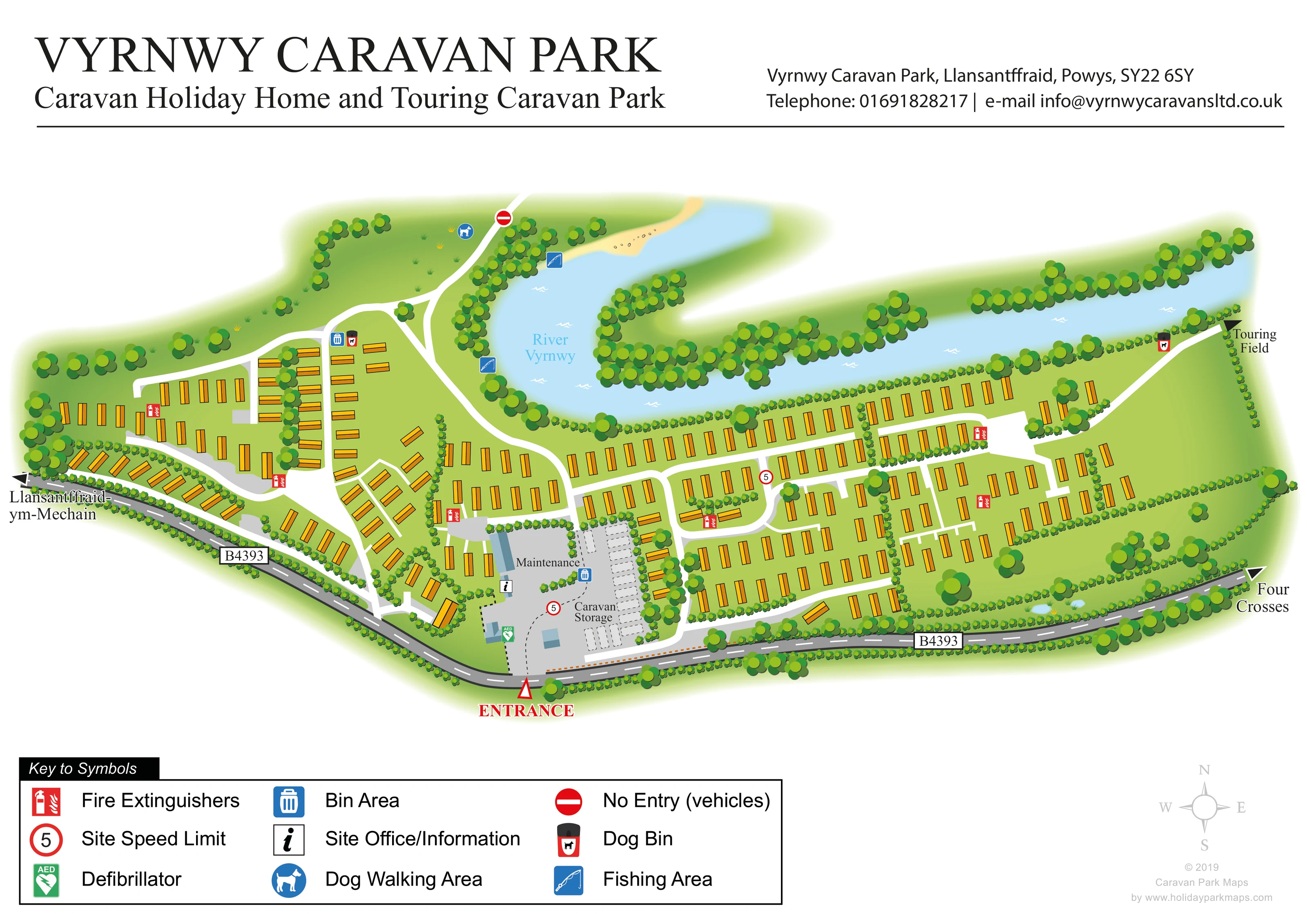
The named river curves around the northern side of the accommodation area, with tree-lined banks and a small sandy-coloured bank detail.
ILLUSTRATED PARK MAP · P634
Vyrnwy Caravan Park, Llansantraid, Powys · United Kingdom
 Enlarge the map ↗
A SENSE OF THE PLACE
Vyrnwy Caravan Park is a holiday caravan and lodge site near Llansantffraid in Powys. The operator presents it as a quieter base in the Mid Wales countryside.
The wider region offers access to Lake Vyrnwy and the landscapes of Eryri and Snowdonia. The map shows the park's accommodation areas and access routes within its own grounds.
LOOK CLOSER
The named river curves around the northern side of the accommodation area, with tree-lined banks and a small sandy-coloured bank detail.
Dense tree belts frame the river and public road; hedges divide accommodation groups, with scattered trees and open grass between units.
Two blue fishing symbols mark locations beside the western river bend.
A blue dog symbol identifies the open grassy area north-west of the main accommodation rows.
An information symbol marks the building area beside the maintenance and storage compound, close to the entrance.
A labelled grey compound with simple blue-grey building shapes occupies the south-central part of the plan.
A separate entrance-side compound contains rows of pale outlined caravan shapes and is explicitly labelled Caravan Storage.
A green AED symbol appears beside an entrance-side building.
The named river curves around the northern side of the accommodation area, with tree-lined banks and a small sandy-coloured bank detail.
Dense tree belts frame the river and public road; hedges divide accommodation groups, with scattered trees and open grass between units.
Two blue fishing symbols mark locations beside the western river bend.
A blue dog symbol identifies the open grassy area north-west of the main accommodation rows.
An information symbol marks the building area beside the maintenance and storage compound, close to the entrance.
A labelled grey compound with simple blue-grey building shapes occupies the south-central part of the plan.
A separate entrance-side compound contains rows of pale outlined caravan shapes and is explicitly labelled Caravan Storage.
A green AED symbol appears beside an entrance-side building.
Repeated red fire symbols are distributed through the accommodation areas.
Blue bin symbols identify waste points near the western accommodation rows and the central service compound.
Dog-bin symbols appear near the western riverside approach and the route towards the touring field.
A red outlined triangle and prominent ENTRANCE label mark access from the B4393 at the lower centre of the artwork.
The public road follows the southern boundary, with directional arrows towards Llansantffraid-ym-Mechain on the left and Four Crosses on the right.
White branching routes serve the accommodation rows and connect the entrance area with the western river bend and eastern touring-field direction.
A red no-entry symbol marks the northern continuation of the route through the dog walking area.
Red-ringed signs displaying 5 appear near the entrance compound and on a central internal road.
A labelled arrow at the north-eastern edge points beyond the illustrated accommodation area towards the Touring Field.
READING THE MAP
This illustrated map of Vyrnwy Caravan Park places its riverside setting at the centre of the design. The River Vyrnwy sweeps around the northern edge of the holiday-home area, while the B4393 follows the southern boundary, giving visitors two clear reference points for understanding the park. Yellow caravan symbols sit within green lawns, hedges and tree belts, linked by a network of white internal roads.
The entrance is prominently marked beside the office, maintenance area and caravan storage compound. From there, the plan separates into smaller western accommodation groups and longer rows extending east along the river. Fishing locations and a dog walking area are shown around the western river bend, while an arrow at the opposite end points towards the touring field.
Designed for a countryside caravan park near Llansantffraid in Powys, this sample combines a broad accommodation overview with practical arrival and facility information. Its generous title panel, recognisable symbols and substantial legend make it a useful example of a landscape-led visitor map.
The artwork is a single landscape plan, with a large title and park contact panel above the illustration. A thin black rule separates this header from the map, while a boxed symbol key and pale compass sit below. The enlarged legend views show details of this same page rather than separate park sections.
Within the plan, the River Vyrnwy curves behind the accommodation, widening around the western bend before continuing across the upper right. Pale blue water, white ripple marks, a sandy bank and dense clusters of trees give the river a distinct visual identity. Along the opposite boundary, the dark grey B4393 carries directional labels for Llansantffraid-ym-Mechain and Four Crosses.
The entrance lies near the lower centre, immediately beside the labelled caravan storage and maintenance areas. Stored caravans are drawn as pale outlined shapes, contrasting with the yellow holiday homes throughout the park. An information marker and green defibrillator symbol identify points around the entrance-side buildings.
White internal roads branch into the compact western groups and the more regular eastern rows. Some units are angled to follow the southern boundary, while others form long parallel lines beside hedges and the river. The plan uses accommodation shapes rather than individual plot numbers.
Blue fishing symbols mark two riverside locations, and a dog walking symbol appears in the open north-western grass area. Fire extinguisher points, bin areas and dog bins are distributed around the grounds. Red-ringed speed signs and a vehicle no-entry marker add route information. At the eastern edge, a Touring Field arrow indicates onward access without depicting that field's pitches.
KEEP EXPLORING
Chosen for shared landscapes, accommodation or facilities.
 Explore the map ↗
United Kingdom
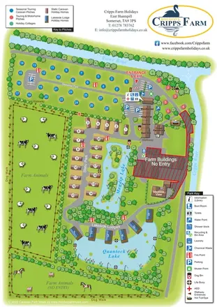
Illustrated farm holiday park plan combining riverside pitches, lakeside accommodation, animal fields and paw-print walking routes, with separate accommodation and facilities keys.
 Explore the map ↗
United Kingdom
A woodland estate park map combining caravan loops, touring pitches, riverside paths and Bruce’s Cave landmarks.
 Explore the map ↗
United Kingdom
Woodland park map with mixed pitches, bell tents, lodges and a fishing lake.
Features may come from the sample artwork, its key or published park information. Approximate numbers describe the drawing and may cover only part of a park. They are intended to help you compare map examples. Current facilities and booking information should be checked with the park.
TAKE A CLOSER LOOK
View the illustrated map in detail or choose a file to download. These are sample maps; contact the park for current visitor information.


LET’S MAP YOUR PARK
For a map quotation, find your park and draw a rough boundary around it. The area you select helps us work out the design time and price.
Draw your park for a quote ↗Or talk to our map designers
01751 473136