
River Derwent
The named river wraps around the northern accommodation island and continues along the western side of the lower grounds.
ILLUSTRATED PARK MAP · P639
4 Buttercrambe Road, Stamford Bridge, York · United Kingdom
 Enlarge the map ↗
A SENSE OF THE PLACE
Weir Holiday Park occupies an inland island in the River Derwent at Stamford Bridge near York. Riverside surroundings and a focus on wildlife give this family-run park a distinctive setting.
Touring caravans, motorhomes and holiday homes are accommodated, with seasonal touring provision also described. A private fishing lake adds to the water-based character of the grounds, while village amenities are nearby.
LOOK CLOSER
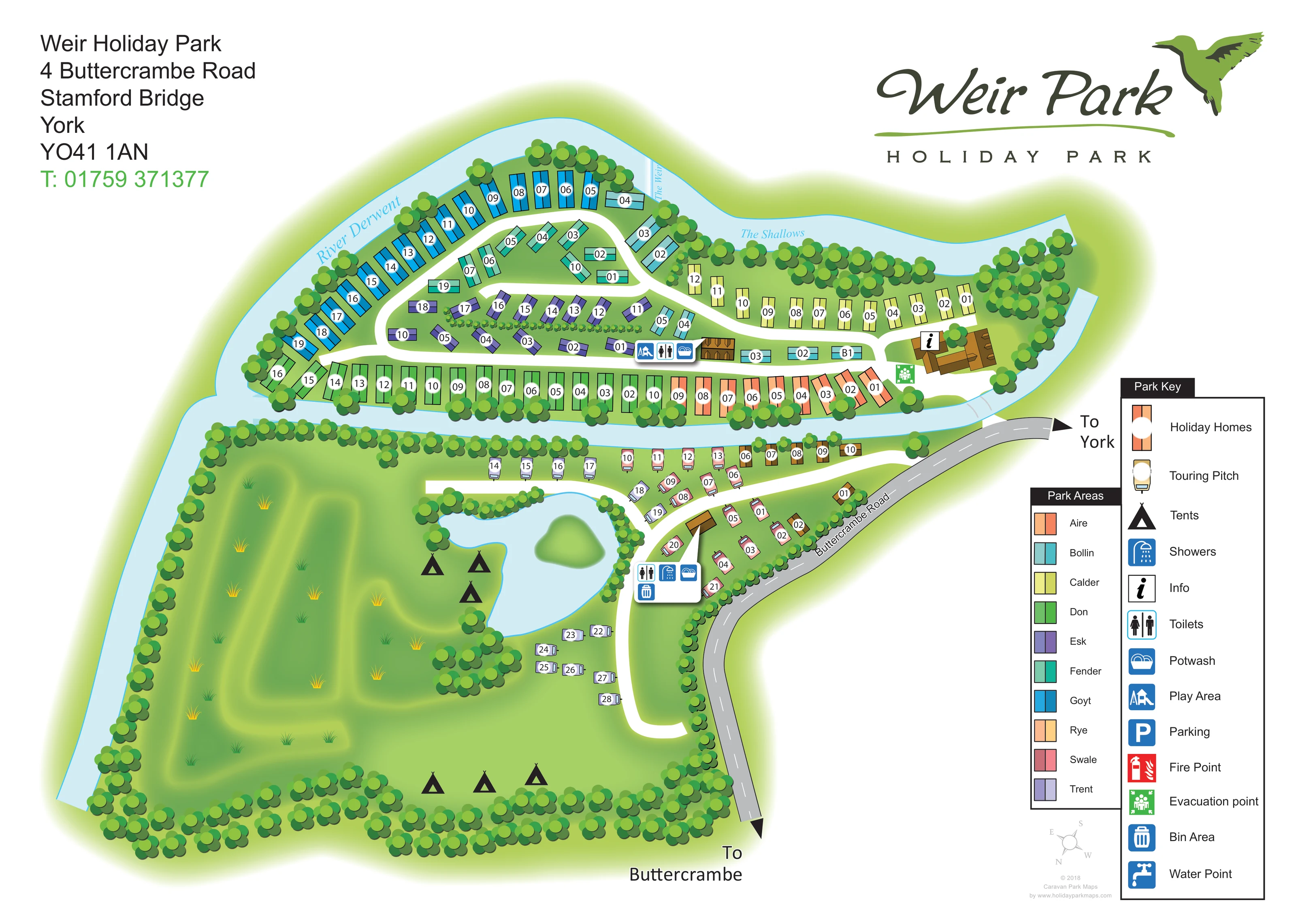
The named river wraps around the northern accommodation island and continues along the western side of the lower grounds.
Both water features are labelled along the upper river channel, giving the map a locally specific riverside identity.
An irregular pale-blue lake with a green central island forms the focal point of the southern camping and touring grounds.
Dense stylised trees edge the waterways and site boundaries, while broad southern lawns include grass tufts and softly shaded green forms.
An information symbol is placed on the large brown-roofed building near the eastern end of the northern island.
A blue play-area symbol appears beside the central amenity building on the northern island.
Toilet symbols are shown at the central island amenity cluster and at the southern lake-side service cluster.
A shower symbol is positioned in the southern service cluster beside the touring approach and lake.
The named river wraps around the northern accommodation island and continues along the western side of the lower grounds.
Both water features are labelled along the upper river channel, giving the map a locally specific riverside identity.
An irregular pale-blue lake with a green central island forms the focal point of the southern camping and touring grounds.
The park context describes a private fishing lake. Fishing is not labelled or symbolised on the map.
Dense stylised trees edge the waterways and site boundaries, while broad southern lawns include grass tufts and softly shaded green forms.
An information symbol is placed on the large brown-roofed building near the eastern end of the northern island.
A blue play-area symbol appears beside the central amenity building on the northern island.
Toilet symbols are shown at the central island amenity cluster and at the southern lake-side service cluster.
A shower symbol is positioned in the southern service cluster beside the touring approach and lake.
Potwash symbols accompany the amenity clusters on the northern island and beside the lake.
A bin-area symbol is included in the southern lake-side service cluster.
A green evacuation-point symbol is positioned beside the eastern information building.
Parking is included in the Park Key, but a corresponding position is not clearly identifiable on the plan.
A red fire-point symbol is explained in the Park Key; its placement is not clearly visible within the mapped grounds.
The key includes a water-point symbol without a clearly identifiable mapped location.
The grey public road follows the eastern edge, with directional arrows towards York and Buttercrambe.
A short bridge crosses the eastern river channel from the road-side approach to the northern accommodation island.
White lanes form connected loops through the northern accommodation and a curving route beside the southern touring and camping grounds.
The Park Areas key identifies Aire, Bollin, Calder, Don, Esk, Fender, Goyt, Rye, Swale and Trent through distinct accommodation colours.
READING THE MAP
This illustrated map of Weir Holiday Park at Stamford Bridge near York makes its unusual riverside layout the starting point for visitor orientation. The River Derwent curves around the northern holiday-home island, with The Weir and The Shallows named along the water. A small bridge links this closely arranged accommodation area to the road-side approach, while the southern grounds open out around a lake, touring pitches and tent-camping grass.
The design combines a practical numbered plan with a strong landscape identity. Ten colours separate the named park areas, helping visitors distinguish neighbouring rows without relying on plot numbers alone. White internal lanes stand out against green lawns, and repeated tree illustrations define the riverbanks and boundaries. Amenity symbols identify information, play, washing and toilet facilities in compact clusters.
The large Weir Park logo, bird motif and generous right-hand legends give the page a clear visual hierarchy. It is a useful sample for parks where water, bridges and separate accommodation zones need to be understood together rather than reduced to a simple rectangular pitch grid.
The single-page plan places the northern accommodation island across the upper half of the artwork. Holiday homes follow the outer riverbank and several interior rows, with broad white lanes threading between them. Their coloured rectangular symbols correspond to the Park Areas legend: Aire, Bollin, Calder, Don, Esk, Fender, Goyt, Rye, Swale and Trent. White oval labels keep individual plot numbers distinct from the area colours.
At the eastern end of the island, a brown-roofed building carries the information symbol, with a green evacuation-point marker nearby. Further west, a smaller building and grouped blue symbols identify the play area, toilets and potwash. A short bridge crosses the river channel towards Buttercrambe Road, which curves down the eastern edge of the page. Large arrows mark the directions to York and Buttercrambe.
South of the channel, the layout becomes more spacious. Smaller touring-caravan symbols sit beside a curving internal lane and near the lake. Black tent symbols identify camping grass beside the water and along the southern boundary. The irregular lake contains a small green island and is enclosed by tree planting; a nearby white-backed amenity cluster shows toilets, showers, potwash and a bin area.
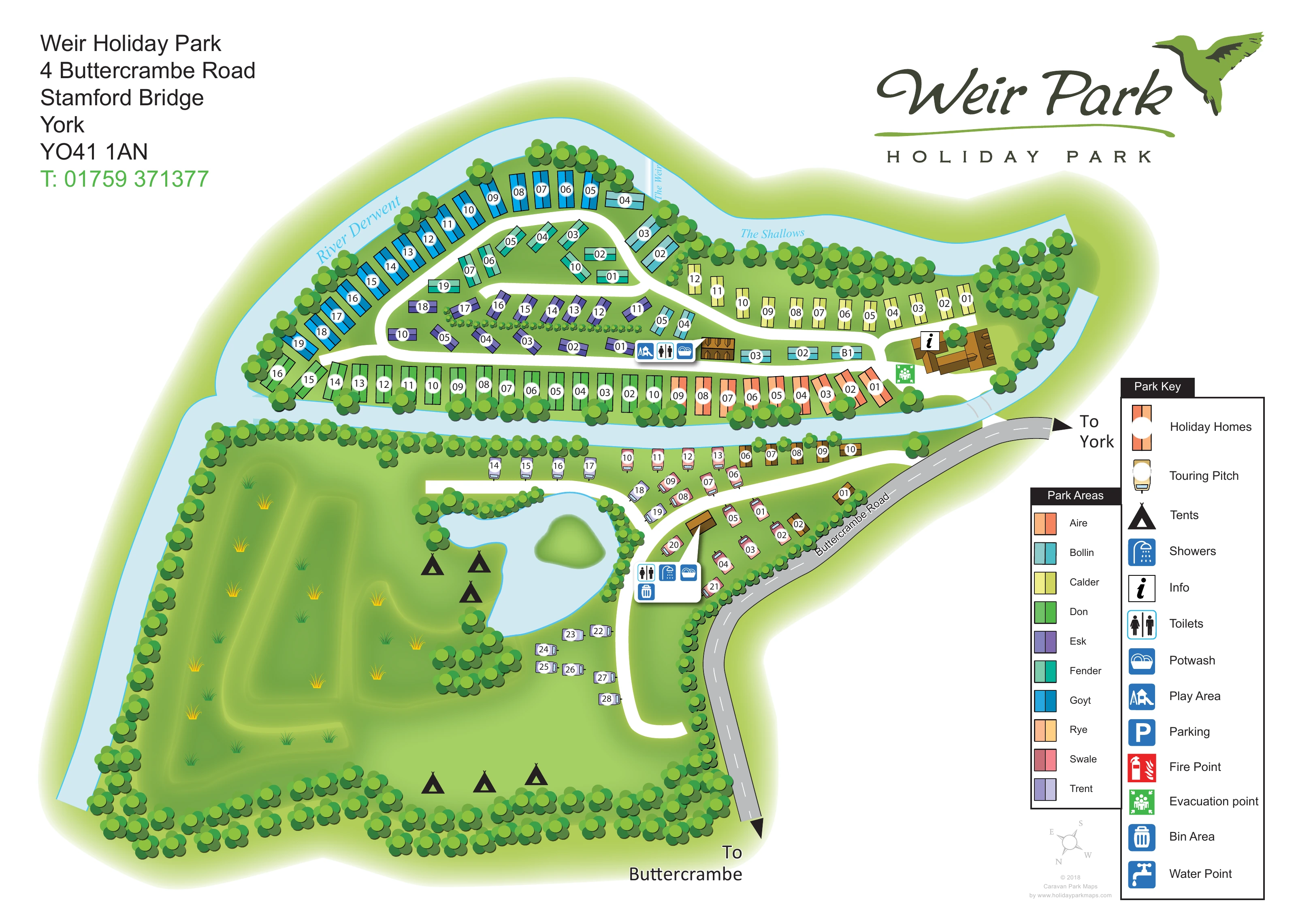
Pale-blue waterways, rounded tree crowns and softly shaded grass establish the landscape without competing with the accommodation labels. The right-hand Park Key explains facilities separately from the area-colour key, including parking, fire-point and water-point symbols. The upper corners hold the address block and bird-branded logo, while a small compass completes the layout below the legends. The accompanying enlarged view shows this same legend and road-side detail, not an additional park section.
KEEP EXPLORING
Chosen for shared landscapes, accommodation or facilities.
 Explore the map ↗
United Kingdom
A lakeside holiday-park and fishery map with numbered accommodation, fishing positions and clearly grouped visitor services.
 Explore the map ↗
United Kingdom
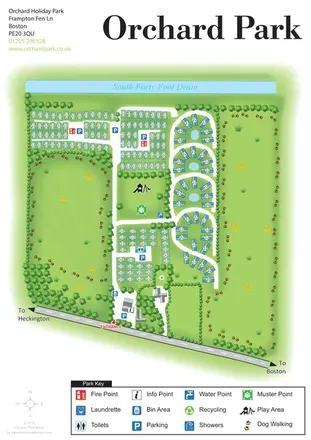
Orchard Holiday Park map with curved accommodation clusters, dog-walking lawns and a named waterside boundary.
 Explore the map ↗
United Kingdom
Woodland park map with mixed pitches, bell tents, lodges and a fishing lake.
Features may come from the sample artwork, its key or published park information. Approximate numbers describe the drawing and may cover only part of a park. They are intended to help you compare map examples. Current facilities and booking information should be checked with the park.
TAKE A CLOSER LOOK
View the illustrated map in detail or choose a file to download. These are sample maps; contact the park for current visitor information.


LET’S MAP YOUR PARK
For a map quotation, find your park and draw a rough boundary around it. The area you select helps us work out the design time and price.
Draw your park for a quote ↗Or talk to our map designers
01751 473136
 weirpark_large.png