
Ponds and lakes
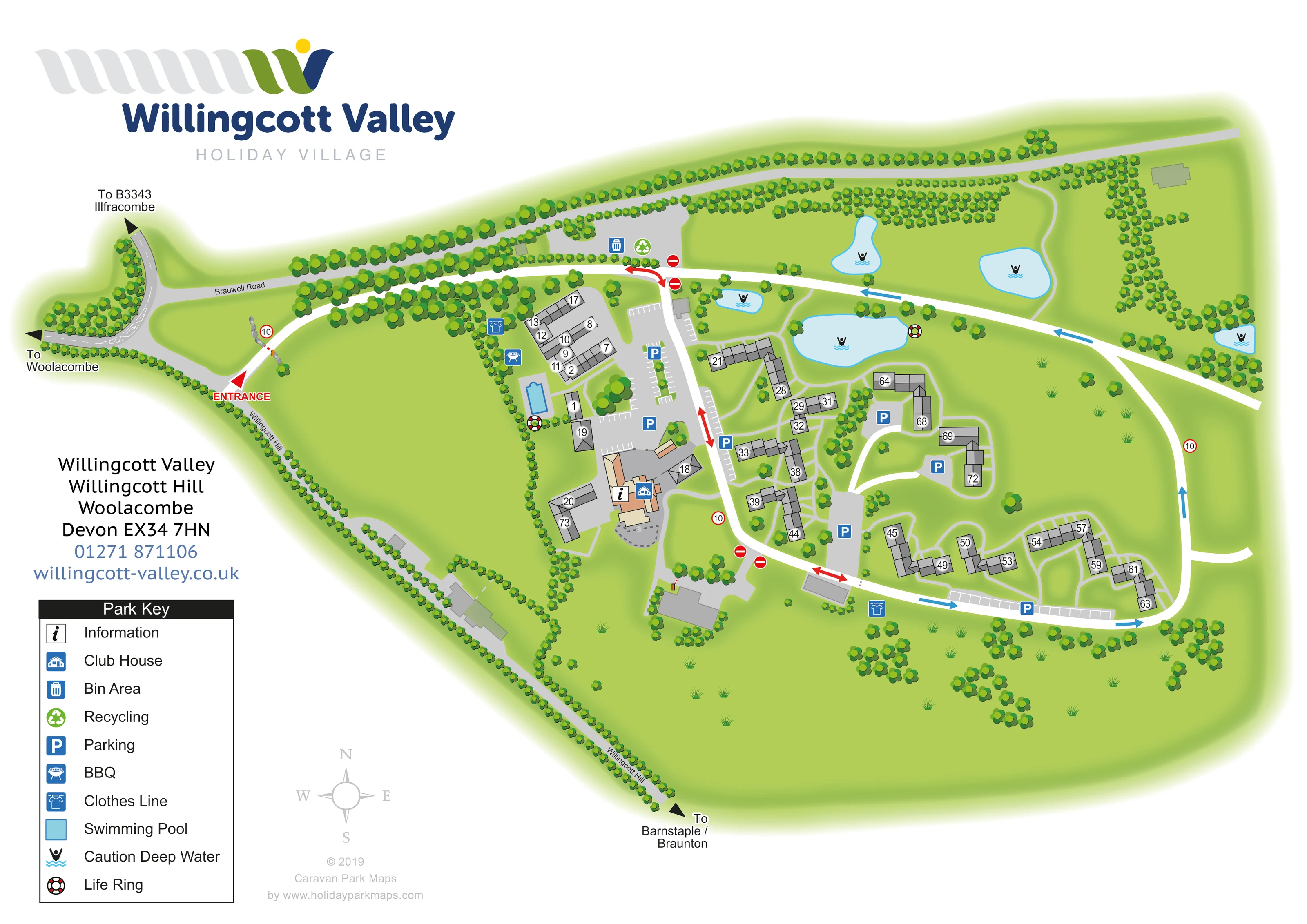
Five irregular blue water bodies are illustrated across the northern and eastern grounds, including a larger pond above the central cottages.
ILLUSTRATED PARK MAP · P648
Willingcott Valley, Willingcott Hill, Woolacombe, Devon · United Kingdom
 Enlarge the map ↗
A SENSE OF THE PLACE
Willingcott Valley Holiday Village is based at Willingcott Valley, Willingcott Hill, Woolacombe, Devon. The holiday village is set in over 100 acres of countryside, with ponds and lakes, about two miles from Woolacombe Beach. Self-catering cottages have two, three or four bedrooms, with the largest accommodating eight guests.
There are two children’s play areas, communal outdoor seating and barbecue areas. A heated outdoor swimming pool is provided seasonally.
LOOK CLOSER
Five irregular blue water bodies are illustrated across the northern and eastern grounds, including a larger pond above the central cottages.
Dense rows of stylised trees frame the external roads, divide the western grounds and soften the accommodation courts.
Broad green spaces surround the cottage clusters, with scattered trees, grass tufts and light paths.
An information symbol marks the main clubhouse building beside the central arrival and parking area.
A tan-roofed building forms the main facility hub on the western side of the accommodation.
A blue outdoor pool sits just north of the clubhouse, beside the western cottage group.
Blue parking symbols and marked bays identify several grey parking courts and roadside parking strips serving different cottage groups.
A barbecue symbol appears beside the pool-side cottage area.
An information symbol marks the main clubhouse building beside the central arrival and parking area.
A tan-roofed building forms the main facility hub on the western side of the accommodation.
A blue outdoor pool sits just north of the clubhouse, beside the western cottage group.
Blue parking symbols and marked bays identify several grey parking courts and roadside parking strips serving different cottage groups.
A barbecue symbol appears beside the pool-side cottage area.
Clothes line symbols are placed near the north-western cottages and along the southern accommodation edge.
Bin and recycling symbols are grouped in a service area beside the northern internal road.
Five irregular blue water bodies are illustrated across the northern and eastern grounds, including a larger pond above the central cottages.
Deep-water warning symbols mark the ponds; life ring symbols appear beside the swimming pool and the larger central pond.
Dense rows of stylised trees frame the external roads, divide the western grounds and soften the accommodation courts.
Broad green spaces surround the cottage clusters, with scattered trees, grass tufts and light paths.
A prominent red entrance arrow identifies the western approach from Willingcott Hill.
White roads form a broad outer loop and central connection. Blue and red directional arrows, no-entry symbols and circular 10 signs distinguish traffic movements.
Bradwell Road and Willingcott Hill provide local context, with arrows towards Woolacombe, the B3343 and Ilfracombe, and Barnstaple/Braunton.
Fine pale paths link cottage entrances, parking courts and landscaped spaces, with a curving route through the northern pond area.
Operator information describes two children’s play areas and communal outdoor seating. These are not separately identified on this artwork.
READING THE MAP
This illustrated map of Willingcott Valley Holiday Village brings together a cottage-based holiday site and its green Devon setting. The village is at Willingcott Hill near Woolacombe, and the artwork gives visitors a clear view of the accommodation, surrounding roads and landscaped grounds. Rather than presenting the cottages as a uniform grid, it shows short terraces and angled groups arranged around parking courts, lawns and connecting paths.
The main arrival point is picked out in red on the western side. From there, white internal roads lead towards the clubhouse, outdoor swimming pool and the different cottage groups. Blue facility symbols identify parking, barbecue and clothes line points, while ponds across the northern grounds carry distinct water-safety symbols.
A large branded heading and a practical key occupy the left of the page, leaving most of the sheet for the site plan. Grey cottage roofs, bright green planting and pale blue water make the different parts of the village easy to distinguish. The result is a useful sample for cottage resorts needing both individual accommodation identification and a readable overview of a spacious rural layout.
The plan shows an irregular green site framed by Bradwell Road to the north and Willingcott Hill along the western and south-western boundary. Directional arrows connect this local road context with Woolacombe, the B3343 and Ilfracombe, and Barnstaple/Braunton. A red entrance marker leads into a broad white internal route running towards the main village.
Accommodation occupies the central and south-eastern part of the artwork. Approximately 70 cottage units are represented by grey roof shapes, divided into attached sections and labelled with individual numbers. Their arrangement varies from straight terraces to bent rows and small courtyard-like groups. Grey parking courts and marked roadside bays sit close to the buildings, with blue P symbols helping visitors locate them. Fine pale paths link the cottages through the surrounding lawns.
The clubhouse is distinguished by tan and peach roofs near the western accommodation group. An information symbol sits on the same building, and the outdoor swimming pool is immediately to its north. Nearby symbols identify a barbecue point and a clothes line; another clothes line point appears beside the southern road. Bins and recycling are grouped along the northern internal route.
Five blue ponds punctuate the upper half of the plan. Deep-water symbols mark these water bodies, and life rings are shown beside the larger central pond and swimming pool. Tree belts line boundaries and roads, while scattered planting separates cottage groups. Red and blue route arrows, no-entry signs and circular 10 signs add a clear traffic layer. The lower-left key explains the symbols, supported by a compass rose. The accompanying enlargement shows part of this same artwork in greater detail, not a separate site or additional accommodation area.
KEEP EXPLORING
Chosen for shared landscapes, accommodation or facilities.
 Explore the map ↗
United Kingdom
Illustrated lakeside park plan with numbered holiday units, leisure buildings and a looping Woodland Walk.
 Explore the map ↗
United Kingdom
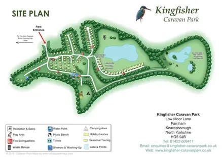
Tree-framed accommodation, lakeside homes and a woodland trail on Kingfisher Caravan Park's illustrated site plan.
 Explore the map ↗
United Kingdom
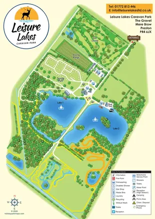
Illustrated Leisure Lakes map combining a loop-road touring area, golf course, driving range and lakeside recreation in a green-and-blue portrait layout.
Features may come from the sample artwork, its key or published park information. Approximate numbers describe the drawing and may cover only part of a park. They are intended to help you compare map examples. Current facilities and booking information should be checked with the park.
TAKE A CLOSER LOOK
View the illustrated map in detail or choose a file to download. These are sample maps; contact the park for current visitor information.


LET’S MAP YOUR PARK
For a map quotation, find your park and draw a rough boundary around it. The area you select helps us work out the design time and price.
Draw your park for a quote ↗Or talk to our map designers
01751 473136