
 Explore the map ↗
United Kingdom
Hidden Valley Holiday Home Park
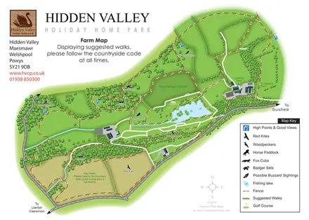
Hidden Valley farm map with suggested walks, wildlife landmarks, viewpoints and a fishing lake.
ILLUSTRATED PARK MAP COLLECTION
Explore illustrated maps of Hidden Valley Holiday Home Park, Trevornick, Waterfoot Park, Weir Holiday Park, Wheal Rodney Holiday Park and Wheal Rose Caravan & Camping Park. Compare the layouts, landscape and facilities, and discover each park in more detail.
← Browse map collectionsExplore the map ↗United Kingdom
Hidden Valley farm map with suggested walks, wildlife landmarks, viewpoints and a fishing lake.
 Explore the map ↗
United Kingdom
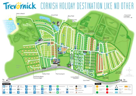
Trevornick’s colour-coded park map, with mixed accommodation, fishing ponds, golf and wooded trails.
 Explore the map ↗
United Kingdom
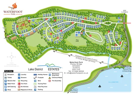
Wooded Waterfoot Park site map with mixed accommodation, touring facilities and walking links to Ullswater.
 Explore the map ↗
United Kingdom
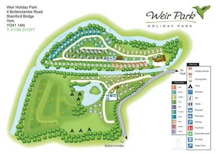
A river-island park plan with colour-coded holiday homes, touring pitches and lake-side camping.
 Explore the map ↗
United Kingdom
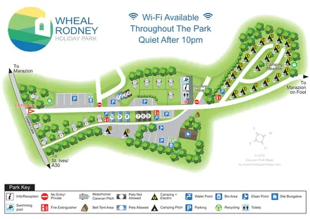
Tree-lined mixed-accommodation park map with Camping Meadow, central pool and reception, and a full-width visitor key.
 Explore the map ↗
United Kingdom
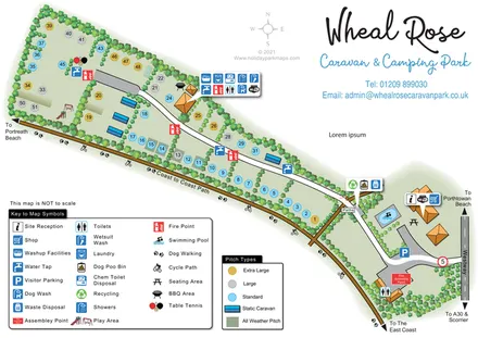
A tree-lined Cornish campsite map with colour-coded pitches, grouped facility callouts and the Coast to Coast Path.
LET’S MAP YOUR PARK
For a map quotation, find your park and draw a rough boundary around it. The area you select helps us work out the design time and price.
Draw your park for a quote ↗Or talk to our map designers
01751 473136