
 Explore the map ↗
United Kingdom
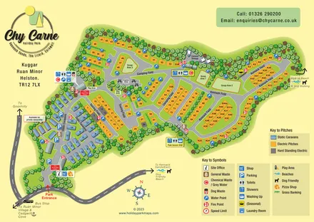
Chy Carne Holiday Park
Tree-framed caravan, touring and camping map with named fields, seasonal facilities and beach-walk directions.
ILLUSTRATED PARK MAP COLLECTION
Explore illustrated maps of Chy Carne Holiday Park, Drumhoney Holiday Park, Duncannon Beach Holiday Park, Foggy Bottom Holiday Home Park, Fraser Range Station and Frisby Lakes Lodge Park. Compare the layouts, landscape and facilities, and discover each park in more detail.
← Browse map collectionsExplore the map ↗United Kingdom
Tree-framed caravan, touring and camping map with named fields, seasonal facilities and beach-walk directions.
 Explore the map ↗
United Kingdom
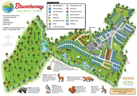
Illustrated caravan park plan with woodland and riverside walks, fishing pools and wildlife panels.
 Explore the map ↗
Ireland
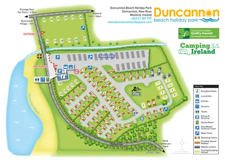
Beachside park plan with colour-coded mobile homes, touring/camping areas, glamping cabins and grouped service symbols.
 Explore the map ↗
United Kingdom
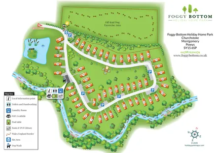
Numbered holiday homes, a riverside border setting and a dedicated dog exercise field at Foggy Bottom.
 Explore the map ↗
Australia
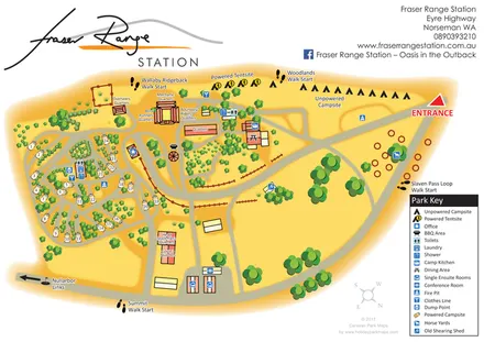
Warm-toned station campsite map with numbered caravan pitches, named quarters, horse yards and four walking starts.
 Explore the map ↗
United Kingdom
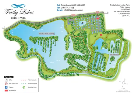
Landscape-led lodge park map with a fishery, swimming lake, nature reserve and colour-coded footpaths.
LET’S MAP YOUR PARK
For a map quotation, find your park and draw a rough boundary around it. The area you select helps us work out the design time and price.
Draw your park for a quote ↗Or talk to our map designers
01751 473136