
Wild flower meadow
A large labelled grass area north of the entrance drive is decorated with small flower illustrations.
ILLUSTRATED PARK MAP · P022
Loch Lomond, Inverarnan, Arrochar · United Kingdom
 Enlarge the map ↗
A SENSE OF THE PLACE
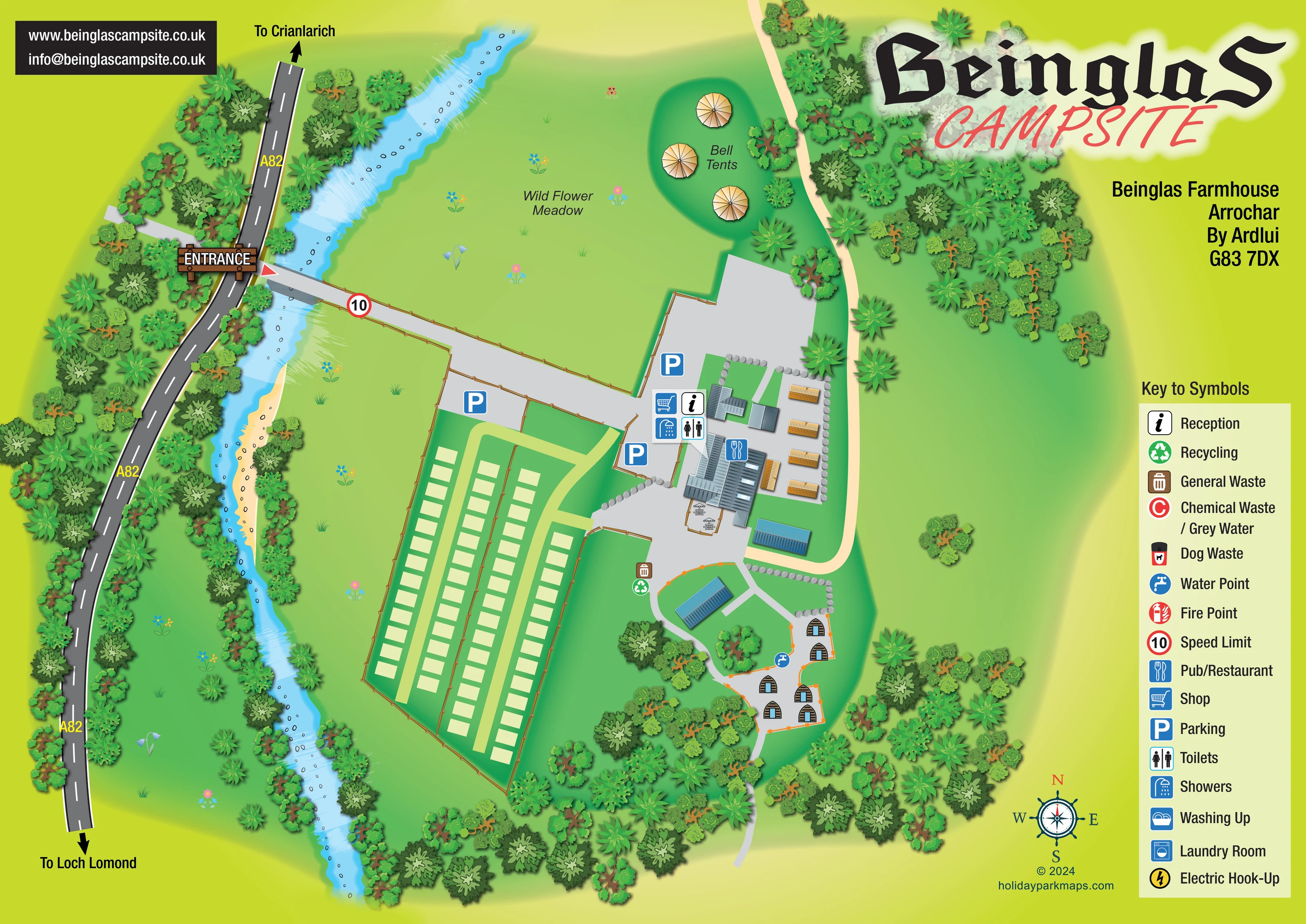
Beinglas Campsite is based at Loch Lomond, Inverarnan, Arrochar. The campsite is beside the West Highland Way at Inverarnan, surrounded by mountain scenery. The park provides three camping fields, campervan pitches, hiking huts, bell tents and chalet rooms.
A campers' kitchen, onsite shop and restaurant are advertised.
LOOK CLOSER
A large labelled grass area north of the entrance drive is decorated with small flower illustrations.
A winding blue river separates the campsite from the A82, with drawn stones, pale bank edges and white water-like strokes.
Dense illustrated trees frame the road, river and southern boundary, with further groups around the bell tents and eastern paths.
Information and shopping symbols mark the northern part of the central building cluster beside parking.
A cutlery symbol identifies the larger central building, with an illustrated outdoor seating terrace beside it.
Toilet and shower symbols are grouped with the central reception and service buildings.
Three blue parking symbols identify areas around the arrival drive and central facilities.
A blue tap symbol is positioned beside the southern hut paths.
Information and shopping symbols mark the northern part of the central building cluster beside parking.
A cutlery symbol identifies the larger central building, with an illustrated outdoor seating terrace beside it.
Toilet and shower symbols are grouped with the central reception and service buildings.
Three blue parking symbols identify areas around the arrival drive and central facilities.
A blue tap symbol is positioned beside the southern hut paths.
Paired general-waste and recycling symbols sit between the main buildings and the southern accommodation area.
Included in the key; no corresponding site position is clearly identified.
Included in the key without a clearly located symbol on the plan.
A yellow lightning symbol appears in the key; individual hook-up locations are not established by the visible plan.
Listed in the key, but no disposal location is clearly marked in the campsite drawing.
A dog-waste bin symbol is supplied in the key without a clearly visible mapped position.
The key includes a fire-point symbol; a site position is not clearly identifiable.
A large labelled grass area north of the entrance drive is decorated with small flower illustrations.
A winding blue river separates the campsite from the A82, with drawn stones, pale bank edges and white water-like strokes.
Dense illustrated trees frame the road, river and southern boundary, with further groups around the bell tents and eastern paths.
A timber-style entrance sign marks the turn from the A82 onto a bridge and broad drive leading to the facilities.
The road is labelled A82, with arrows towards Crianlarich at the top and Loch Lomond at the bottom.
A red-bordered 10 sign is drawn on the entrance drive and explained as a speed-limit symbol in the key.
Pale lanes serve the pitch rows; a cream route follows the eastern side of the building cluster, while grey paths branch through the hut area.
Advertised in the park context, but not separately labelled in this artwork.
The park context places the campsite beside the West Highland Way. The visible eastern path is not named as that route.
READING THE MAP
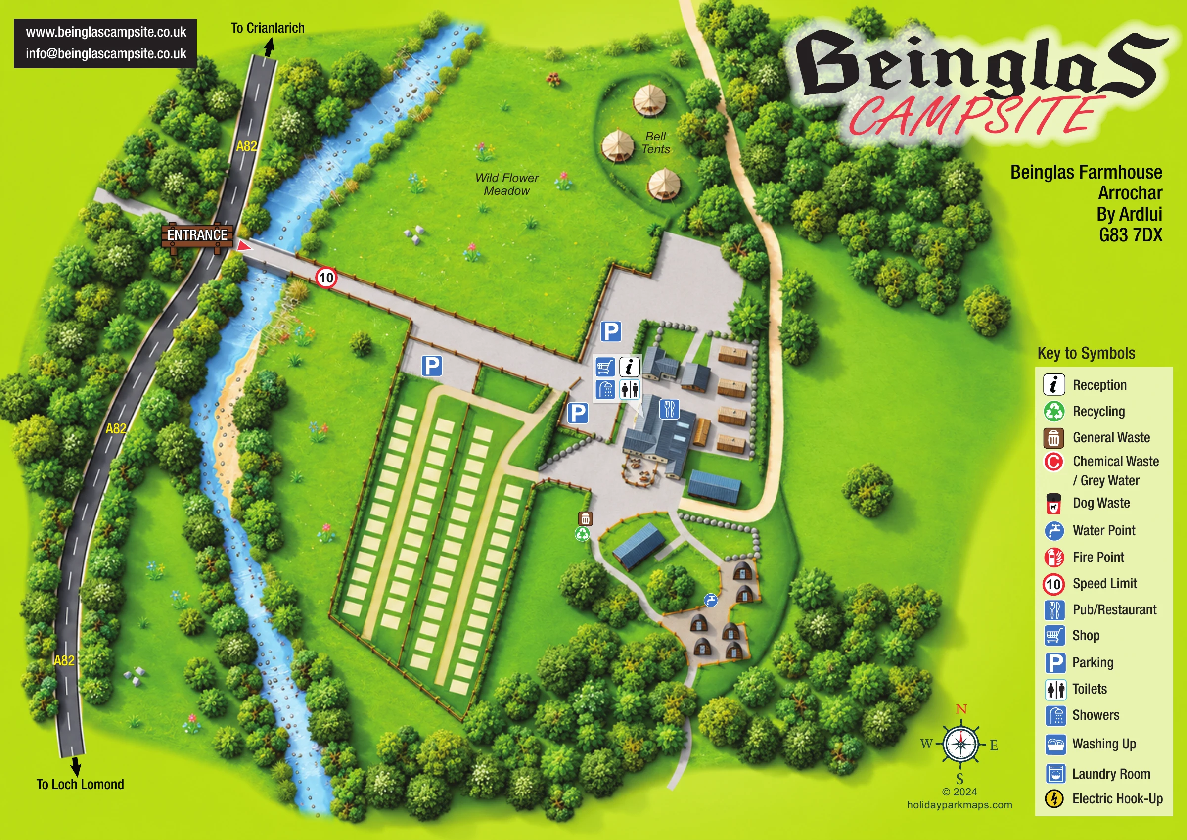
This illustrated map of Beinglas Campsite brings together a riverside arrival route, open grass areas and a compact visitor hub in one colourful plan. Set at Inverarnan in the Loch Lomond area, the campsite is introduced through its relationship with the A82: a clearly marked entrance crosses the river before leading guests towards parking, reception and the main buildings.
The artwork gives different parts of the site distinct visual identities. Long rows of pale pitch markers occupy the lower-left section, while small timber huts sit among trees along branching paths to the right. Three bell tents are illustrated in a separate green clearing beside the labelled wild flower meadow. The river, wooded margins and scattered flowers provide setting without obscuring the practical layout.
A large campsite title anchors the upper-right corner, balanced by a contact panel opposite and a tall symbol key down the right edge. The result is a useful sample for campsites that need to explain several accommodation areas, a shared facilities hub and a recognisable landscape-led entrance without relying on plot numbers.
The plan places the A82 along the western edge, with directional arrows towards Crianlarich and Loch Lomond. Between the road and campsite, a winding blue river is illustrated with stones, pale banks and white streaks. A timber-style ENTRANCE sign draws attention to the turn onto the bridge, and a red-bordered 10 marker appears on the drive leading into the site.
Arrival is organised around several parking areas and a central group of buildings. Reception, shop, toilets and showers are marked together near the northern part of this cluster. A cutlery symbol identifies the pub or restaurant in the larger building below, where a small outdoor terrace is furnished with illustrated picnic tables. General waste and recycling symbols appear further south, close to the route towards the huts.
Accommodation areas use deliberately different graphic treatments. Roughly 60 simple rectangular pitch markers form four long rows, separated by pale lanes and enclosed by fence lines. In the south-east, around six arched timber huts face short branching paths, with a water-point symbol nearby. North of the buildings, three radial-roof bell tents sit in a green clearing beside the wild flower meadow. Open lawns remain largely uncluttered, while layered tree illustrations define the site edges and smaller spaces.
The right-hand key explains the service and safety symbols, including additional entries such as washing up, laundry and electric hook-up whose positions are not clearly marked in the plan. A compass rose completes the orientation aids. This is a single landscape-format artwork; the enlarged detail view reveals the same hut area and legend rather than a separate map or accommodation section.
 Enlarge this map ↗
KEEP EXPLORING
Chosen for shared landscapes, accommodation or facilities.
 Explore the map ↗
United Kingdom
Woodland park map with mixed pitches, bell tents, lodges and a fishing lake.
 Explore the map ↗
United Kingdom
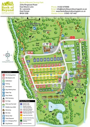
Colour-coded touring pitches, named glamping units and woodland routes at Back of Beyond Touring Park.
 Explore the map ↗
United Kingdom
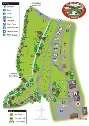
A stream-side farm campsite plan with car-free camping, caravan pitches and separate bell-tent areas.
Features may come from the sample artwork, its key or published park information. Approximate numbers describe the drawing and may cover only part of a park. They are intended to help you compare map examples. Current facilities and booking information should be checked with the park.
LET’S MAP YOUR PARK
For a map quotation, find your park and draw a rough boundary around it. The area you select helps us work out the design time and price.
Draw your park for a quote ↗Or talk to our map designers
01751 473136