
River Don
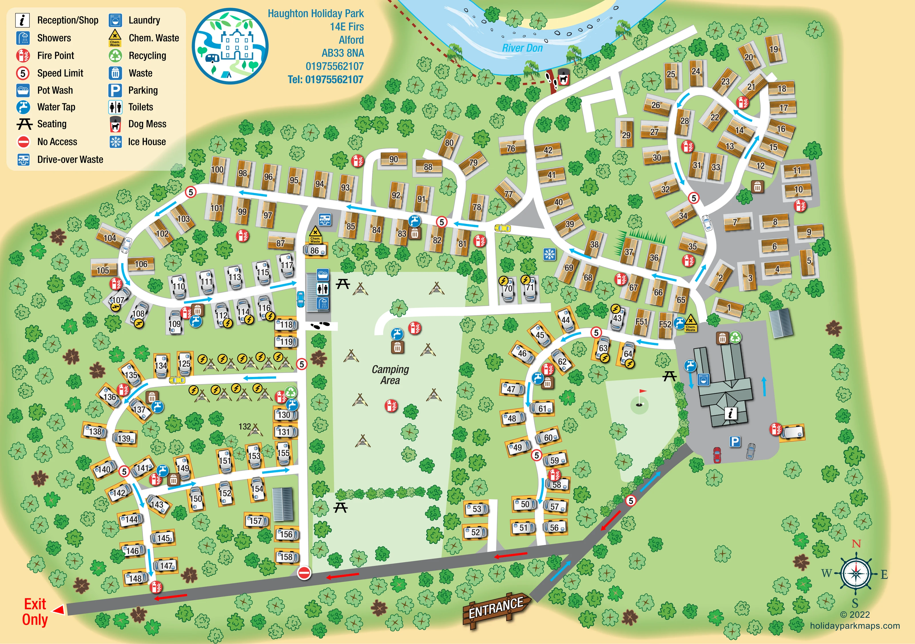
The named river curves along the northern edge, illustrated with pale-blue water, white current strokes, stones and riverside trees.
ILLUSTRATED PARK MAP · P154
Haughton Holiday Park, 14E Firs, Alford · United Kingdom
 Enlarge the map ↗
A SENSE OF THE PLACE
Haughton Holiday Park offers several ways to stay in Alford, Aberdeenshire. Options include holiday apartments, caravan hire, holiday home ownership, touring hardstandings and tent camping.
A sheltered walled garden provides a distinctive camping area. A provisions shop, heated washrooms and a small children's play area support stays, with further recreation available in neighbouring Haughton Park.
LOOK CLOSER
The named river curves along the northern edge, illustrated with pale-blue water, white current strokes, stones and riverside trees.
Repeated broadleaf-tree symbols surround the park and separate accommodation groups; denser planting outlines parts of the central camping space and arrival drive.
A small lawn beside reception contains a golf-style flag, hole and ball illustration, although no facility name or extent is provided.
The information symbol identifies the large grey-roofed building beside the arrival forecourt on the eastern side.
A parking symbol and illustrated cars mark the forecourt immediately in front of reception.
A washing-machine symbol is positioned on the main reception building complex.
Toilet and shower symbols identify a service building west of the central camping area.
The pot-wash symbol appears at the washroom building beside the camping area.
The information symbol identifies the large grey-roofed building beside the arrival forecourt on the eastern side.
A parking symbol and illustrated cars mark the forecourt immediately in front of reception.
A washing-machine symbol is positioned on the main reception building complex.
Toilet and shower symbols identify a service building west of the central camping area.
The pot-wash symbol appears at the washroom building beside the camping area.
Blue tap symbols are distributed around the touring areas, camping area, reception and static-caravan roads.
Repeated bin symbols and green recycling symbols identify disposal points around accommodation groups and beside reception.
Yellow chemical-waste symbols mark service points near the western washroom approach and the eastern accommodation junction.
A blue vehicle-and-drain symbol marks a disposal point just north of the washroom building.
Red fire-point symbols recur throughout the accommodation areas and beside service buildings.
Yellow lightning symbols mark selected touring pitches and the smaller western tent group; these symbols are not explained in the printed key.
Black picnic-table symbols appear beside reception and around the central camping area.
A dog-waste symbol is positioned beside the riverside route at the northern edge.
A blue snowflake symbol, identified as Ice House in the legend, appears beside the central road junction.
The named river curves along the northern edge, illustrated with pale-blue water, white current strokes, stones and riverside trees.
Repeated broadleaf-tree symbols surround the park and separate accommodation groups; denser planting outlines parts of the central camping space and arrival drive.
A red dashed line follows part of the river edge, with footprint symbols indicating pedestrian connections.
The entrance is marked at the lower centre, while the lower-left road is labelled Exit Only.
Blue arrows guide arrivals and movement through internal roads; red arrows identify the outward route along the southern edge. Repeated circular 5 signs and a no-access symbol reinforce the route information.
A small lawn beside reception contains a golf-style flag, hole and ball illustration, although no facility name or extent is provided.
Published park information describes a sheltered walled garden used for camping; the map does not explicitly label its walls or garden identity.
Mentioned in the published park information but not clearly identified in the artwork.
READING THE MAP
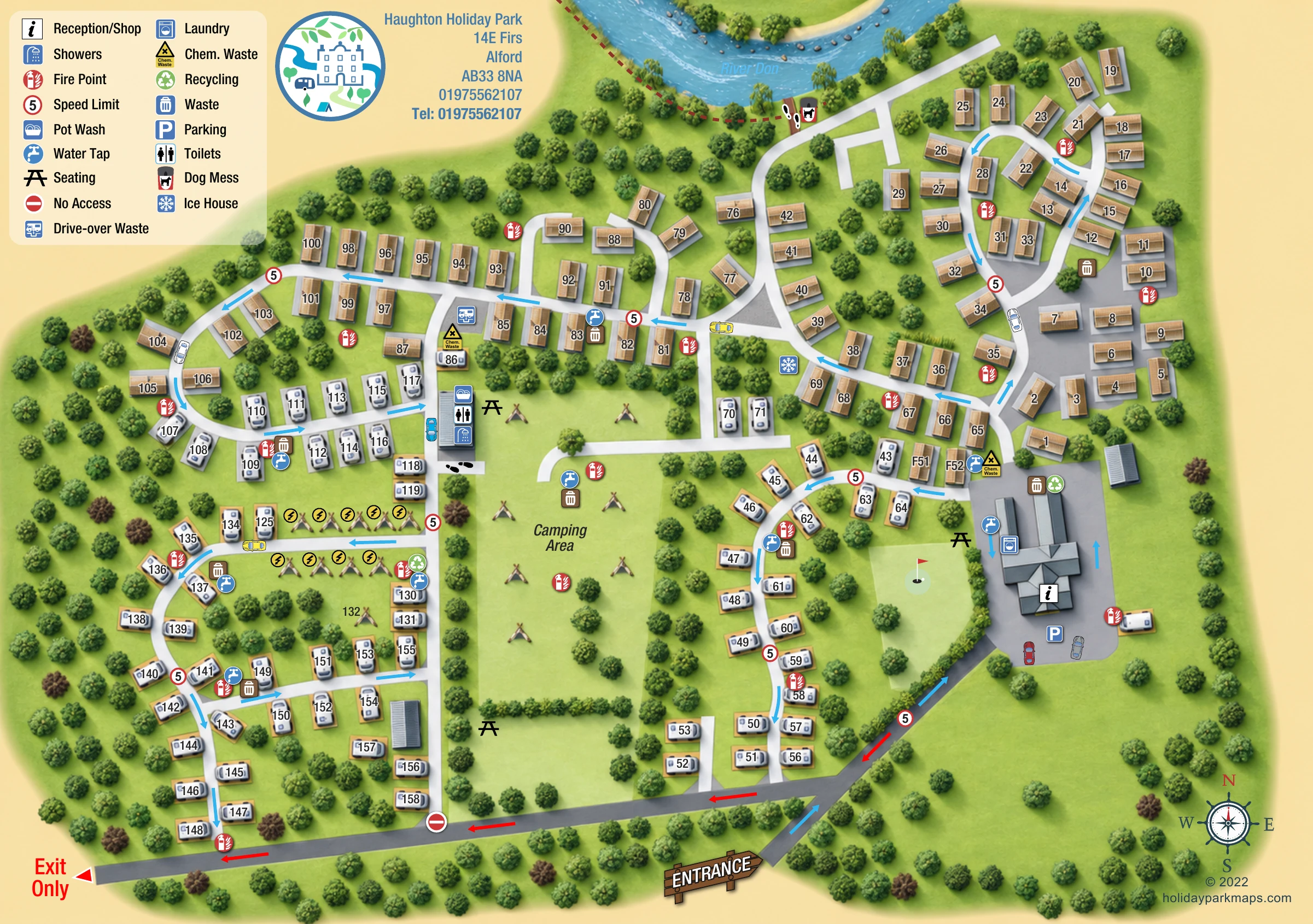
This illustrated map of Haughton Holiday Park places a mixed caravan and camping site within its leafy setting beside the River Don in Alford, Aberdeenshire. The river curves across the top of the artwork, while clusters of trees surround the accommodation roads and frame a generous central camping area. Gold-roofed static caravans contrast with white touring-caravan symbols, helping visitors recognise the different parts of the park at a glance.
Arrival information is particularly prominent. A timber-style entrance sign marks the approach from the bottom of the page, leading towards reception, the shop and parking on the eastern side. Blue directional arrows carry the route through the park, while red arrows pick out the separate exit-only road along the lower edge.
The large illustrated key brings together everyday facilities such as showers, toilets, laundry, water taps, waste disposal and picnic seating. Combined with numbered accommodation, clearly drawn road loops and a decorative compass, the design gives guests a practical overview without losing the character of a green, riverside holiday setting.
The single landscape plan is arranged around a pale-green central space labelled Camping Area. Static caravans occupy much of the northern and eastern ground, including an oval road loop near the river and short rows along connecting roads. Touring caravans follow the curving routes to the south and west, with orange-edged pitch pads distinguishing many of their positions. A smaller western group of illustrated tents carries yellow electrical connection symbols, while tents scattered across the central lawn communicate camping use rather than a fixed capacity.
At the eastern arrival forecourt, a large, multi-roofed building is identified by the reception/shop symbol, with laundry and water symbols nearby. Parking is shown directly in front. A separate service building west of the main camping space carries toilets, showers and pot-wash symbols. Chemical waste and drive-over waste facilities are marked nearby, with another chemical-waste point on the eastern side. Water taps, fire points and waste bins recur around the accommodation groups, and recycling points appear near reception and in the western area. Picnic-table symbols identify seating beside the main building and camping lawn.
The River Don provides a strong visual boundary across the top, drawn with stones, current strokes and riverside trees. A dashed riverside line and footprint markers suggest pedestrian connections. The entrance drive, internal road loops and southern exit route are differentiated through road colour and blue or red arrows. Repeated circular 5 signs and a no-access symbol add traffic information.
The upper-left key and adjacent circular logo balance the illustrated plan, while the lower-right compass completes the page. An Ice House symbol and a small flag-and-hole lawn illustration add distinctive details, although the latter is not given a facility label.
 Enlarge this map ↗
KEEP EXPLORING
Chosen for shared landscapes, accommodation or facilities.
 Explore the map ↗
United Kingdom
Riverside park map with named pitch fields, illustrated huts and a paw-print dog walk.
 Explore the map ↗
United Kingdom
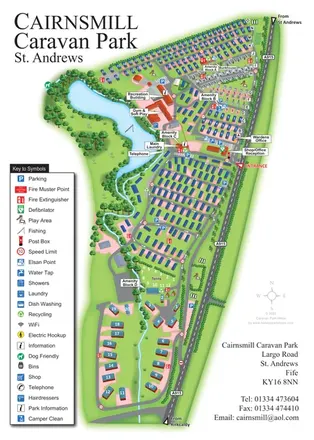
Portrait park map combining numbered caravan rows, touring and tent areas with a reservoir-side recreation hub.
 Explore the map ↗
United Kingdom
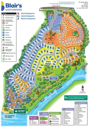
A colourful riverside park map combining touring pitches, holiday accommodation and treetop adventures.
Features may come from the sample artwork, its key or published park information. Approximate numbers describe the drawing and may cover only part of a park. They are intended to help you compare map examples. Current facilities and booking information should be checked with the park.
LET’S MAP YOUR PARK
For a map quotation, find your park and draw a rough boundary around it. The area you select helps us work out the design time and price.
Draw your park for a quote ↗Or talk to our map designers
01751 473136