
Wooded boundaries and planted pitch divisions
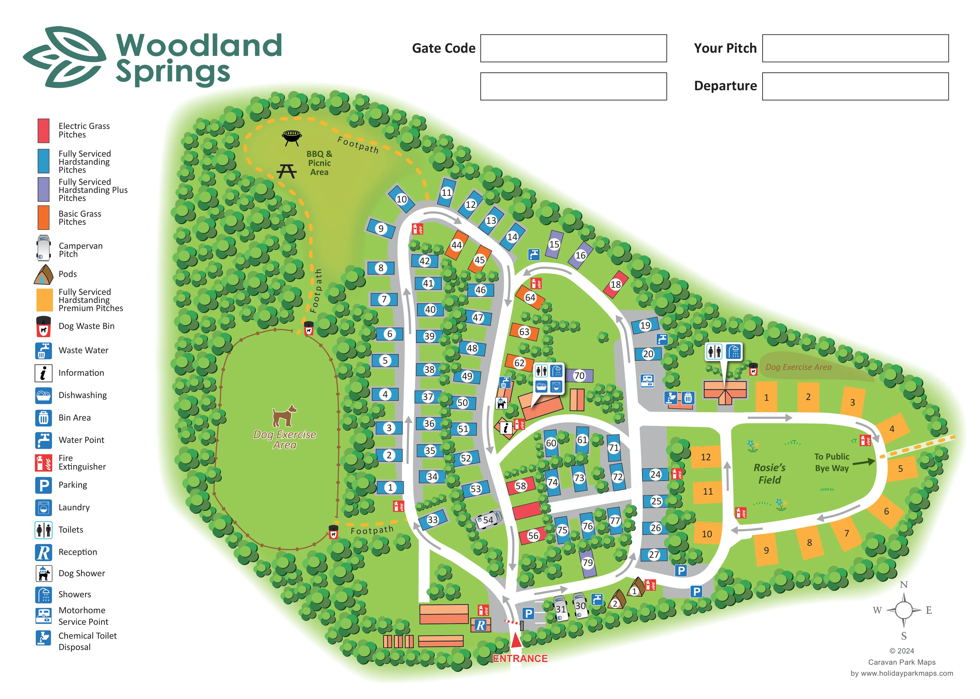
Dense illustrated trees enclose the park, create a substantial western woodland area and divide many of the pitch rows.
ILLUSTRATED PARK MAP · P373
Woodland Springs Touring Park, Venton, Drewsteignton, Devon · United Kingdom
 Enlarge the map ↗
A SENSE OF THE PLACE
Woodland Springs Touring Park is based at Woodland Springs Touring Park, Venton, Drewsteignton, Devon. The touring and camping park is within Dartmoor National Park, surrounded by farmland and trees. The park provides hardstanding serviced pitches, electric and non-electric grass tent pitches, and heated camping pods.
A fenced acre is available for off-lead dog exercise, alongside a smaller dog area and a dog shower. The park offers accessible washing facilities, showers, a small essentials shop, laundry equipment and free Wi-Fi.
LOOK CLOSER
Dense illustrated trees enclose the park, create a substantial western woodland area and divide many of the pitch rows.
A named green centre occupies the eastern loop, surrounded by golden-yellow Premium pitches.
A reception symbol identifies a building immediately west of the entrance.
An information symbol marks a small building beside the central facilities and road junction.
Toilet and shower symbols appear in white pointer panels over the central facilities building and the building north of Rosie’s Field.
Dishwashing and laundry symbols are grouped with the central toilet and shower facilities.
A large fenced oval exercise area occupies the western side, with a second, smaller labelled area along the northern edge of Rosie’s Field.
A dog-shower symbol is placed beside the central facilities.
A reception symbol identifies a building immediately west of the entrance.
An information symbol marks a small building beside the central facilities and road junction.
Toilet and shower symbols appear in white pointer panels over the central facilities building and the building north of Rosie’s Field.
Dishwashing and laundry symbols are grouped with the central toilet and shower facilities.
A large fenced oval exercise area occupies the western side, with a second, smaller labelled area along the northern edge of Rosie’s Field.
A dog-shower symbol is placed beside the central facilities.
Distinctive red-and-black dog-bin symbols occur beside the exercise areas and western footpath.
A labelled clearing at the northern end of the western woodland contains barbecue and picnic-table illustrations.
A service-point symbol is positioned on the hardstanding beside the eastern facilities area.
Chemical toilet disposal is marked beside the eastern service building.
Water points are distributed among the pitch areas; waste-water and bin symbols identify service locations near the facilities.
Repeated red fire-extinguisher symbols punctuate the pitch loops, buildings and pod area.
Blue parking symbols mark spaces near the entrance and along the southern access road.
Dense illustrated trees enclose the park, create a substantial western woodland area and divide many of the pitch rows.
A named green centre occupies the eastern loop, surrounded by golden-yellow Premium pitches.
A red entrance marker and illustrated barrier lead into interconnected white roads with grey directional arrows.
A dashed yellow footpath links the western dog exercise area and BBQ clearing. A separate eastern path is labelled as leading to a public byway.
READING THE MAP
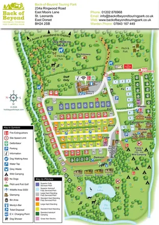
This map of Woodland Springs Touring Park brings a tree-lined Devon touring site into a clear, colour-coded visitor plan. Set at Venton, near Drewsteignton within Dartmoor National Park, the park is represented as a series of connected pitch roads enclosed by woodland and planting. The artwork gives particular prominence to the differences between serviced hardstanding, Plus and Premium pitches, electric grass and basic grass pitches, with separate illustrations for campervan spaces and camping pods.
The layout also makes the park’s outdoor spaces easy to recognise. A large fenced dog exercise area occupies the western side, a woodland footpath reaches a BBQ and picnic clearing, and the eastern Premium pitches wrap around the green centre of Rosie’s Field. Reception, parking and the entrance are gathered along the bottom of the plan, while facility symbols identify washing, laundry and touring-service points further inside the site.
Teal leaf branding, a full-height legend and blank guest-information fields give the page the character of a practical arrival handout rather than a purely promotional illustration.
The plan is drawn from above, using an irregular green site outline softened by a pale green halo. Dense clusters of round-canopied trees trace the perimeter and divide the accommodation into smaller groups. White roads branch from the southern entrance, with grey arrows indicating the circulation shown in the artwork. Reception sits just west of the entrance, while parking, campervan pitches and two brown-roofed pods are arranged along the southern approach.
The main pitch section extends northwards in rows beside a long curved road. Blue rectangles identify fully serviced hardstanding pitches; lavender marks the Plus category, red identifies electric grass and orange denotes basic grass. Most numbers appear in white circles, keeping them distinct from the coloured pitch surfaces. To the east, golden-yellow Premium pitches form a separate loop around Rosie’s Field, a named green space decorated with a few flowers and grass marks. A dashed path leaves this section towards the labelled public byway connection.
The western landscape has a different emphasis: a large fenced dog exercise oval, woodland planting and a yellow dashed footpath leading north to the BBQ and picnic area. A smaller dog exercise area is labelled above the eastern pitch loop. Dog waste bins and a dog shower add useful detail to these spaces.
Two roof-plan buildings carry prominent toilet and shower callouts; the central block also displays dishwashing and laundry symbols. Information, motorhome servicing, chemical toilet disposal, water, waste water, bins, parking and fire-extinguisher points complete the practical content. The left-hand legend explains both accommodation colours and service icons, while the upper guest-information fields and lower-right compass frame the single-page map.
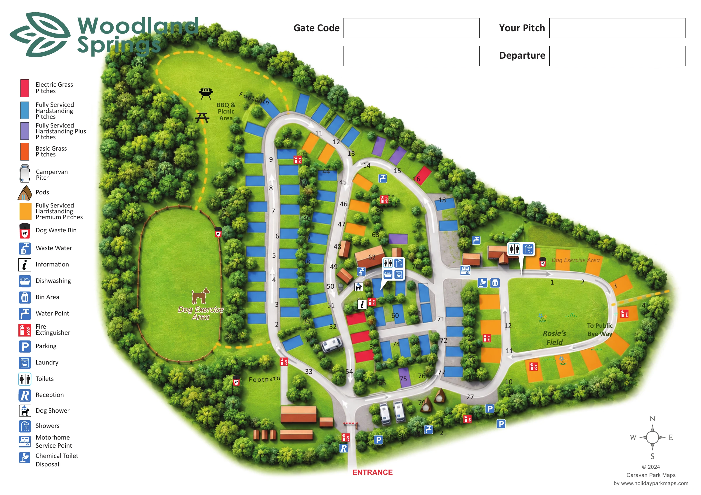 Enlarge this map ↗
KEEP EXPLORING
Chosen for shared landscapes, accommodation or facilities.
 Explore the map ↗
United Kingdom
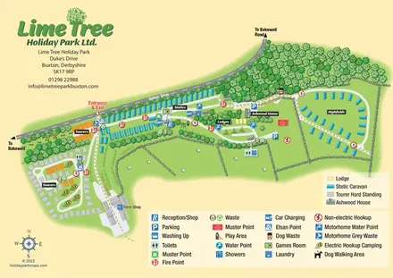
Mixed-accommodation park map with woodland, public footpaths and clearly differentiated service symbols.
 Explore the map ↗
United Kingdom
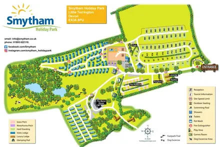
Colour-coded accommodation, woodland ponds and a Tarka Trail footpath on Smytham’s illustrated park map.
 Explore the map ↗
United Kingdom
Colour-coded touring pitches, named glamping units and woodland routes at Back of Beyond Touring Park.
Features may come from the sample artwork, its key or published park information. Approximate numbers describe the drawing and may cover only part of a park. They are intended to help you compare map examples. Current facilities and booking information should be checked with the park.
LET’S MAP YOUR PARK
For a map quotation, find your park and draw a rough boundary around it. The area you select helps us work out the design time and price.
Draw your park for a quote ↗Or talk to our map designers
01751 473136