
Post-and-rail fences and hedged boundaries
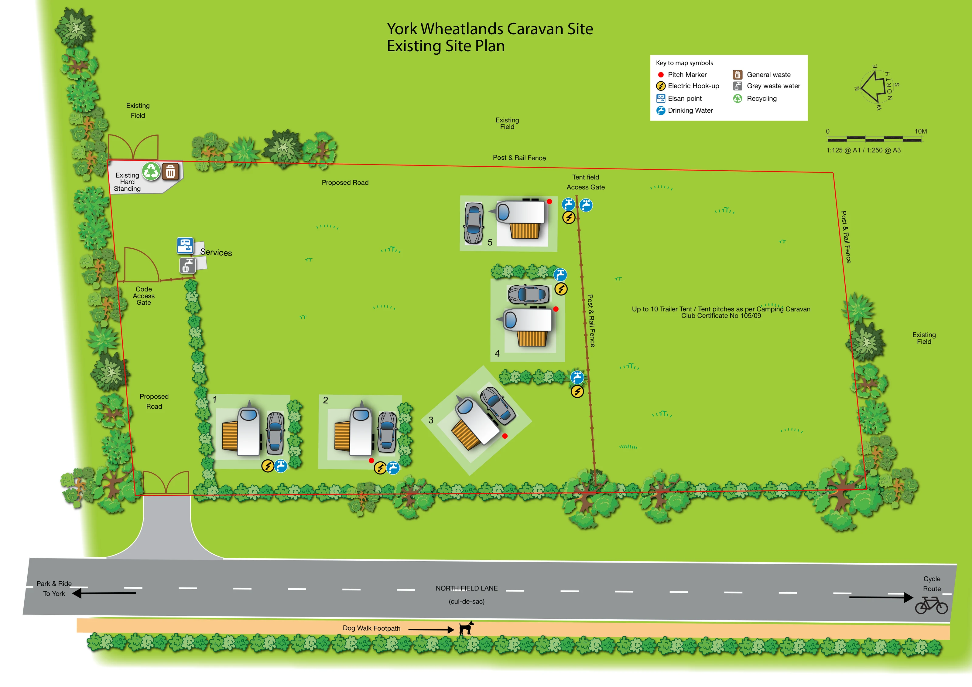
Labelled post-and-rail boundaries frame the tent field and divide it from the touring area. Illustrated hedges separate several touring pitches and line parts of the perimeter.
ILLUSTRATED PARK MAP · P387
Northfield Lane, Poppleton, York · United Kingdom
 Enlarge the map ↗
A SENSE OF THE PLACE
York Wheatlands is a small, family-run Camping and Caravanning Club certificated site at Poppleton near York. Its location provides access to local walks, cycle paths and the villages outside the city.
Serviced caravan and motorhome pitches are offered alongside grass pitches. Visitors need their own toilet and shower provision, as these facilities are not supplied on site; the map helps show the camping layout and access routes.
LOOK CLOSER
Labelled post-and-rail boundaries frame the tent field and divide it from the touring area. Illustrated hedges separate several touring pitches and line parts of the perimeter.
Existing fields are labelled outside the site boundary. Varied overhead tree crowns soften the western, southern and eastern edges.
Yellow lightning-bolt symbols are positioned beside the illustrated touring pitches.
Blue tap symbols identify water points beside the touring pitches and at the tent-field access.
A blue Elsan symbol marks the services area on the western side of the site.
A grey disposal symbol accompanies the Elsan point in the western services area.
General waste and recycling symbols sit on the labelled existing hardstanding near the upper-left boundary.
Red dots identify pitch-marker positions around the touring group, supported by individual pitch numbers.
Yellow lightning-bolt symbols are positioned beside the illustrated touring pitches.
Blue tap symbols identify water points beside the touring pitches and at the tent-field access.
A blue Elsan symbol marks the services area on the western side of the site.
A grey disposal symbol accompanies the Elsan point in the western services area.
General waste and recycling symbols sit on the labelled existing hardstanding near the upper-left boundary.
Red dots identify pitch-marker positions around the touring group, supported by individual pitch numbers.
The public approach road runs across the bottom of the plan and is explicitly labelled as a cul-de-sac.
Swing-gate graphics show the entrance from North Field Lane and gates along the western boundary. One is labelled as a code-access gate, without an access code. A separate label identifies tent-field access.
Proposed-road labels describe a route up the western side and across the upper part of the touring area; these sections are not rendered as finished grey roads.
A peach-coloured strip beyond North Field Lane is labelled Dog Walk Footpath, with a directional arrow and dog silhouette.
A right-pointing arrow and bicycle graphic indicate the cycle-route direction along North Field Lane.
A left-pointing arrow indicates the direction towards Park & Ride for York; the facility itself is outside the depicted site.
Labelled post-and-rail boundaries frame the tent field and divide it from the touring area. Illustrated hedges separate several touring pitches and line parts of the perimeter.
Existing fields are labelled outside the site boundary. Varied overhead tree crowns soften the western, southern and eastern edges.
READING THE MAP
This illustrated plan of York Wheatlands Caravan Site presents a small touring and camping setting at Poppleton, near York. Rather than showing a dense holiday park, it concentrates on a handful of caravan pitches, a separate open tent field and the practical connections between them. Caravan roofs, striped awnings and parked cars make the touring area immediately recognisable, while hedges and varied tree illustrations establish the field boundaries.
North Field Lane anchors the lower edge of the page, with a gated entrance leading into the site. Beyond the road, a labelled dog-walk footpath adds useful local context; arrows also indicate the directions towards York Park & Ride and a cycle route. Water, electric hook-up and disposal symbols bring the everyday servicing arrangements into the same view.
The result is a sample of a compact, field-based site map that combines visitor-friendly illustration with the language of a site plan, including fence lines, pitch markers, a scale bar and proposed-road annotations.
The single landscape plan places the site above North Field Lane, a grey road with a dashed white centre line. A curved entrance apron meets a drawn gate at the lower-left corner. Inside the boundary, the touring pitches follow a loose L-shaped arrangement along the southern hedge and beside the fence separating them from the tent field. Each is illustrated with a white caravan, an ochre-striped awning and an adjacent car. Pale surrounds, hedge dividers, pitch numbers and red markers distinguish the individual positions.
The right-hand field is deliberately left open, with small grass marks rather than rows of tent symbols. Its label refers to up to ten trailer-tent or tent pitches. Post-and-rail fencing outlines this area, and a tent-field access label appears near its upper-left corner. Drinking-water and electric hook-up icons sit beside the touring group, with an additional water symbol on the camping side of the divide.
On the western side, the labelled services area contains Elsan and grey-water disposal symbols. General waste and recycling are grouped on the existing hardstanding farther up the boundary. Proposed-road labels identify internal circulation along the west and upper edge without depicting a completed surfaced route.
Surrounding fields, mature-looking tree illustrations and continuous hedge strips provide the landscape framework. Outside the site, a peach dog-walk footpath runs beyond North Field Lane, while arrows indicate Park & Ride towards York and a cycle route. The upper-right legend, rotated north indicator and scale bar complete the sheet. The enlarged detail repeats this same artwork, clarifying the key and tent-field annotations rather than presenting a separate map.
KEEP EXPLORING
Chosen for shared landscapes, accommodation or facilities.
 Explore the map ↗
United Kingdom
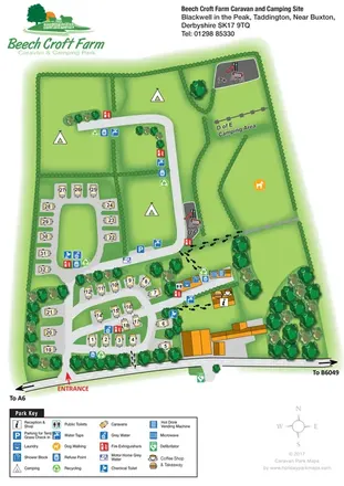
Illustrated touring and camping map with hedge-divided fields, age-labelled play areas and a detailed service key.
 Explore the map ↗
United Kingdom
Woodland park map with mixed pitches, bell tents, lodges and a fishing lake.
 Explore the map ↗
United Kingdom
Tree-framed mixed-accommodation park map with two entrances, touring loops and a clearly illustrated social hub.
Features may come from the sample artwork, its key or published park information. Approximate numbers describe the drawing and may cover only part of a park. They are intended to help you compare map examples. Current facilities and booking information should be checked with the park.
LET’S MAP YOUR PARK
For a map quotation, find your park and draw a rough boundary around it. The area you select helps us work out the design time and price.
Draw your park for a quote ↗Or talk to our map designers
01751 473136