
 Explore the map ↗
United Kingdom
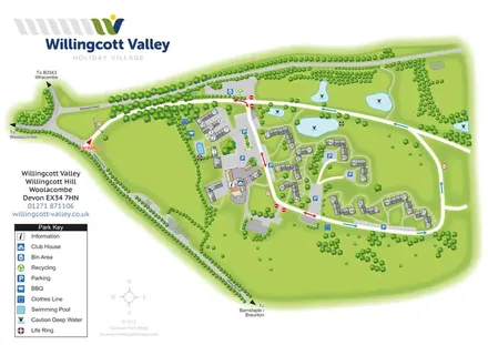
Willingcott Valley Holiday Village
A branded cottage-village plan with numbered accommodation, parking courts, an outdoor pool and landscaped ponds.
THE HOLIDAY PARK MAP COLLECTION
Browse 24 map examples, from Willingcott Valley Holiday Village to York Wheatlands Caravan Site.
Combine a country, landscape, facilities and accommodation type to find relevant examples.
Showing 553–576 of 577 · Select a map to read its story
Explore the map ↗United Kingdom
A branded cottage-village plan with numbered accommodation, parking courts, an outdoor pool and landscaped ponds.
 Explore the map ↗
United Kingdom
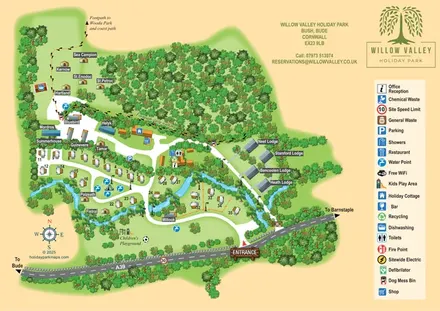
A woodland-valley park map combining named glamping stays, numbered pitches, riverside lodges and footprint-marked walking routes.
 Explore the map ↗
United Kingdom
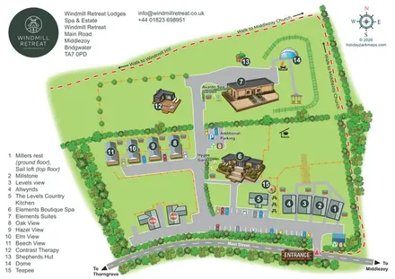
Illustrated Somerset lodge-and-spa estate map with named gardens, parking and local walking links.
 Explore the map ↗
United Kingdom
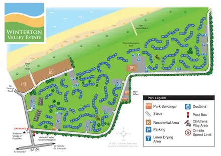
Numbered chalet clusters, shared facilities and valley-to-beach connections at Winterton Valley Estate, Norfolk.
 Explore the map ↗
United Kingdom
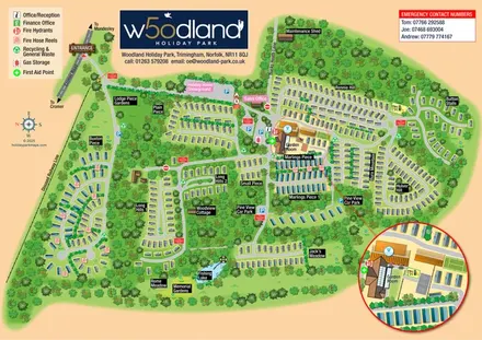
Woodland holiday-home map with named neighbourhoods, a fishing lake and an enlarged leisure-complex inset.
 Explore the map ↗
United Kingdom
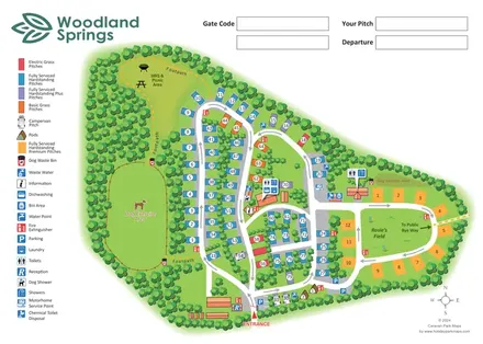
Colour-coded touring park map with woodland paths, dog exercise areas and a Premium-pitch loop around Rosie’s Field.
 Explore the map ↗
United Kingdom
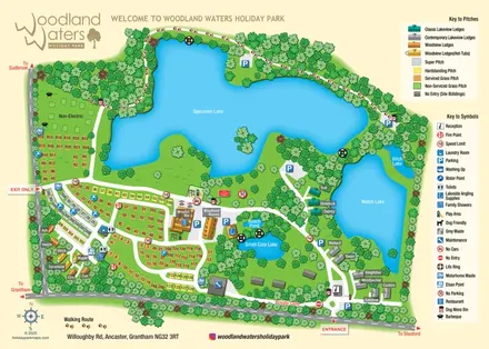
Lake-led holiday park map with colour-coded pitches, named lodges and a paw-print woodland route.
 Explore the map ↗
United Kingdom
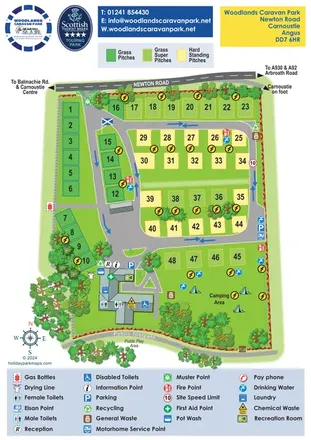
Colour-coded touring pitches, an open camping lawn and detailed service symbols at Woodlands Caravan Park, Carnoustie.
 Explore the map ↗
United Kingdom
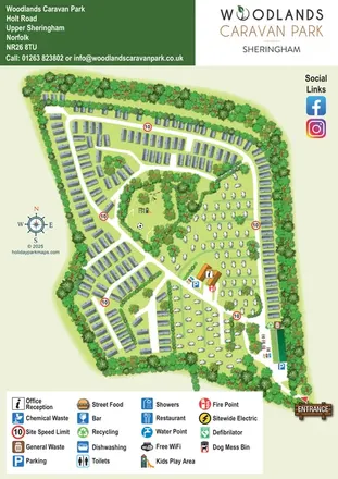
Woodland-framed caravan park map with touring areas, reception and a central play clearing.
 Explore the map ↗
United Kingdom
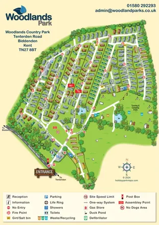
Numbered park-home lanes, duck ponds and an open camping field at Woodlands Country Park, Kent.
 Explore the map ↗
United Kingdom
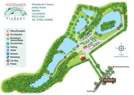
Illustrated fishery map with lakeside routes, wooded waters and a compact touring area.
 Explore the map ↗
United Kingdom
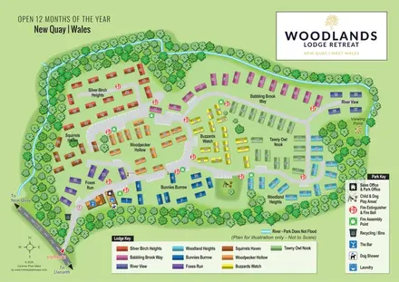
Colour-coded lodge neighbourhoods within a wooded, stream-side park near New Quay.
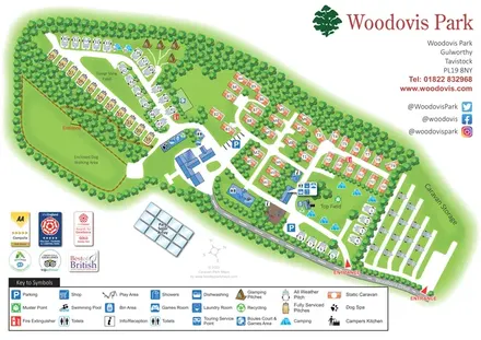 Explore the map ↗
United Kingdom
Tree-framed Woodovis Park map with touring, camping, glamping, static caravans and a detailed facility key.
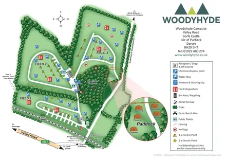 Explore the map ↗
United Kingdom
Three camping fields, woodland amenities and a linked glamping inset at Woodyhyde Campsite, Dorset.
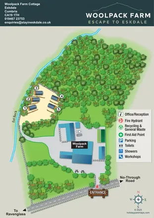 Explore the map ↗
United Kingdom
Woodland glamping pods, Eel Beck and a farm courtyard on a branded Eskdale site map.
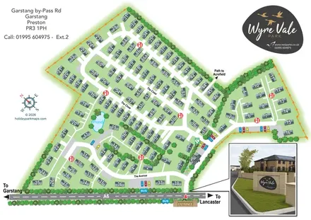 Explore the map ↗
United Kingdom
Numbered residential park home map with landscaped routes, A6 access and an illustrated entrance inset.
 Explore the map ↗
United Kingdom
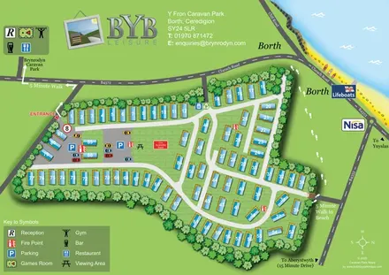
Numbered caravan layout with coastal landmarks and walking links to the beach and Brynrodyn.
 Explore the map ↗
United Kingdom
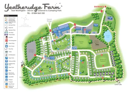
Colour-coded pitches, farm facilities and lakeside walking connections at Yeatheridge Farm, Devon.
 Explore the map ↗
United Kingdom
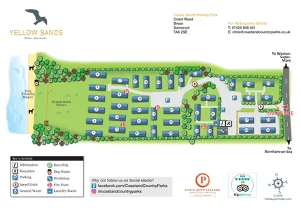
Numbered holiday homes, dune-side grounds and a clearly marked road entrance at Yellow Sands, Brean.
 Explore the map ↗
United Kingdom
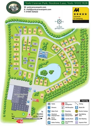
Tree-lined touring loops, superior pitches and a fishing pond on the York Caravan Park map.
 Explore the map ↗
United Kingdom
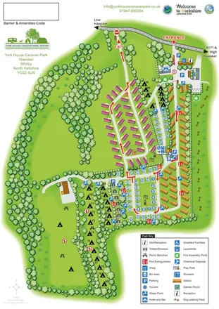
Portrait park map with mixed accommodation, directional roads, tree-lined camping and a paw-print dog-walking field.
 Explore the map ↗
United Kingdom
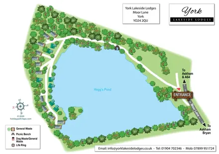
A pond-led lodge park map with wooded shores, illustrated roofs and a prominent Moor Lane entrance.
 Explore the map ↗
United Kingdom
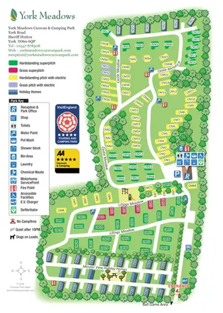
Tree-framed visitor map with colour-coded touring pitches, holiday-home rows and a prominent facilities key.
 Explore the map ↗
United Kingdom
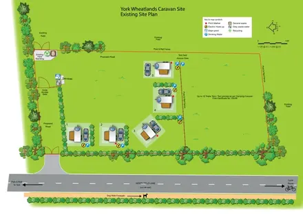
An illustrated touring and camping plan with serviced pitches, a separate tent field and local route directions.
LET’S MAP YOUR PARK
For a map quotation, find your park and draw a rough boundary around it. The area you select helps us work out the design time and price.
Draw your park for a quote ↗Or talk to our map designers
01751 473136