
 Explore the map ↗
United Kingdom
Bryn Gloch
Riverside park map with named pitch fields, illustrated huts and a paw-print dog walk.
THE HOLIDAY PARK MAP COLLECTION
Browse 24 map examples, from Bryn Gloch to Craggwood Holiday Home Park.
← Explore the whole collectionCombine a country, landscape, facilities and accommodation type to find relevant examples.
Showing 25–48 of 239 · Select a map to read its story
Explore the map ↗United Kingdom
Riverside park map with named pitch fields, illustrated huts and a paw-print dog walk.
 Explore the map ↗
United Kingdom
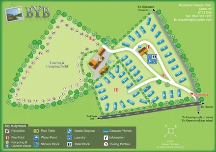
A tree-lined touring field and blue caravan plots linked by curving roads and clearly marked shared facilities.
 Explore the map ↗
United Kingdom
Illustrated lakeside park plan with numbered holiday units, leisure buildings and a looping Woodland Walk.
 Explore the map ↗
United Kingdom
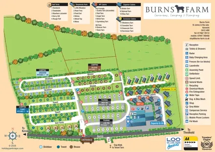
Colour-coded camping and touring sections, illustrated glamping units and a detailed amenities hub at Burns Farm.
 Explore the map ↗
United Kingdom
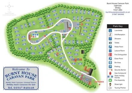
A tree-lined caravan park plan with static homes, seasonal touring pitches and a clear central-loop layout.
 Explore the map ↗
United Kingdom
Colour-coded accommodation, lakeside facilities and woodland routes at Burton Constable Holiday Park & Arboretum.
 Explore the map ↗
United Kingdom
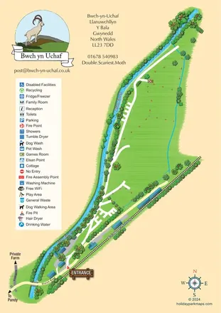
Landscape-led campsite map framed by Afon Twrch and the Bala Lake Railway.
 Explore the map ↗
United Kingdom
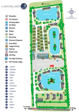
A lake-led park map combining named lodges, touring pitches and shared facilities at Caistor Lakes.
 Explore the map ↗
United Kingdom
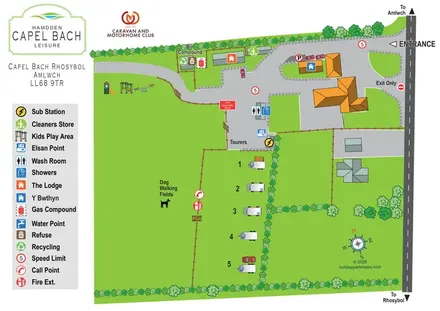
A small Anglesey touring-site map with dog-walking fields, stone-edged drives and a bold amenity key.
 Explore the map ↗
United Kingdom
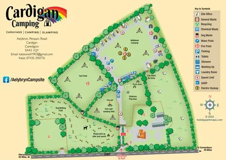
Illustrated farm-campsite map with mixed accommodation, named camping fields and a dedicated dog-walking area.
 Explore the map ↗
United Kingdom
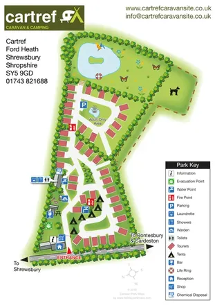
Tree-lined touring and camping map with an adult-only loop, island pond and clear facility key.
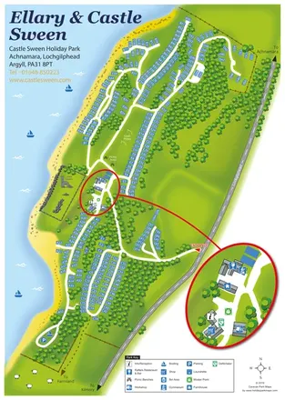 Explore the map ↗
United Kingdom
A wooded Loch Sween holiday-park map with numbered plots, castle ruins and an enlarged facilities inset.
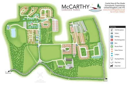 Explore the map ↗
United Kingdom
Tree-framed static, lodge and touring areas at Castle View & The Glade, with a pond, practical facilities and a clear colour-coded key.
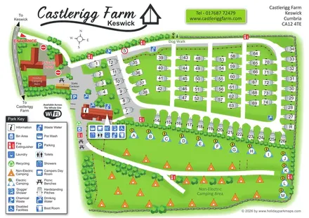 Explore the map ↗
United Kingdom
Castlerigg Farm’s bright illustrated plan combines numbered touring rows, lettered electric camping and an open camping field with a detailed amenities key and dog-facility wayfinding.
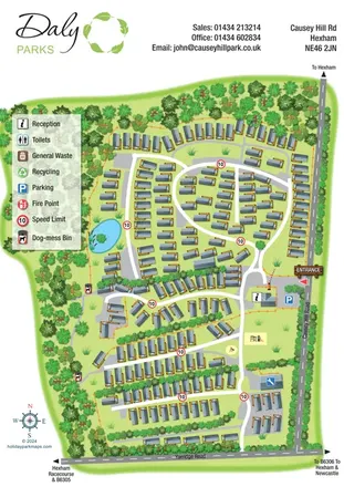 Explore the map ↗
United Kingdom
Portrait holiday-park map with static homes, wooded boundaries, a pond and a clearly marked reception entrance.
 Explore the map ↗
United Kingdom
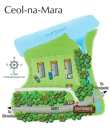
A compact Ceol-na-Mara site map showing three units, adjacent parking and the A861 entrance beside Loch Sunart.
 Explore the map ↗
United Kingdom
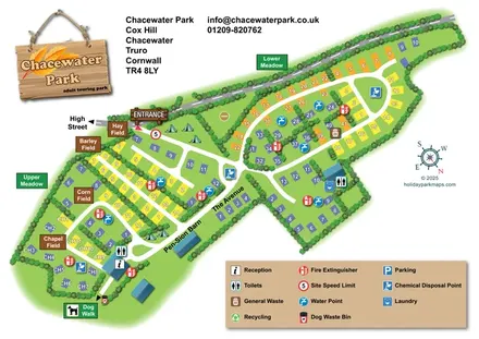
Chacewater Park touring map with named pitch fields, hedge-lined lanes and a large service key.
 Explore the map ↗
United Kingdom
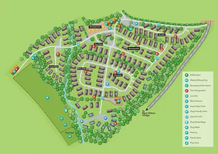
Numbered holiday homes, named sections and a tree-lined stream at Chantry Holiday Park.
 Explore the map ↗
United Kingdom
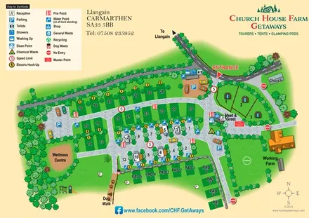
A rural Carmarthenshire site map combining touring pitches, glamping pods, farm landmarks and clear facility symbols.
 Explore the map ↗
United Kingdom
Woodland holiday homes, named camping fields and farm buildings on a colour-coded Nether Wasdale park map.
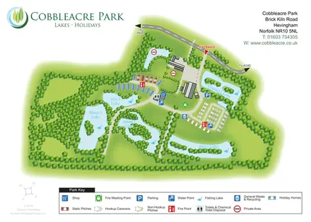 Explore the map ↗
United Kingdom
Lake-led park map with five named fishing waters, mixed accommodation and colour-coded visitor facilities.
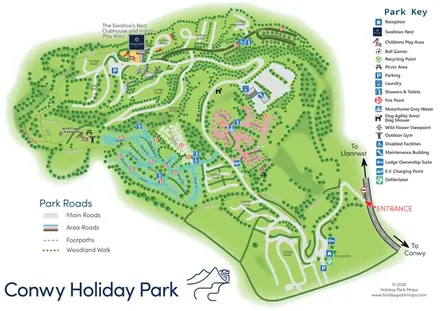 Explore the map ↗
United Kingdom
Colour-coded pitch areas, lodge roads and woodland walks at Conwy Holiday Park.
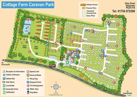 Explore the map ↗
United Kingdom
Illustrated touring and camping park map with numbered pitches, a fishing pond and a central farm courtyard.
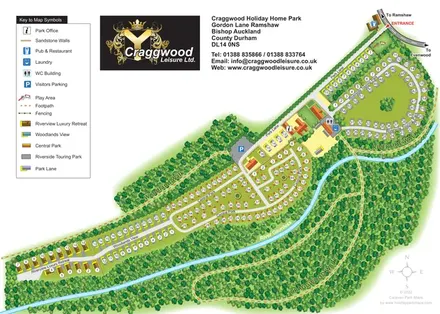 Explore the map ↗
United Kingdom
Colour-coded holiday-home and touring areas beside the River Gaunless, with woodland walks and a detailed visitor key.
LET’S MAP YOUR PARK
For a map quotation, find your park and draw a rough boundary around it. The area you select helps us work out the design time and price.
Draw your park for a quote ↗Or talk to our map designers
01751 473136