
 Explore the map ↗
United Kingdom
Burrowhead Holiday Village
Colour-coded accommodation, central leisure facilities and coastal paths on an illustrated headland park map.
THE HOLIDAY PARK MAP COLLECTION
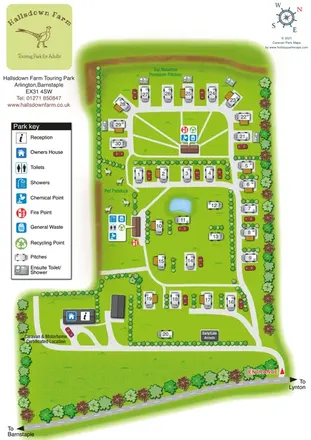
Browse 24 map examples, from Burrowhead Holiday Village to Hallsdown Farm Touring Park.
← Explore the whole collectionCombine a country, landscape, facilities and accommodation type to find relevant examples.
Showing 25–48 of 121 · Select a map to read its story
Explore the map ↗United Kingdom
Colour-coded accommodation, central leisure facilities and coastal paths on an illustrated headland park map.
 Explore the map ↗
United States
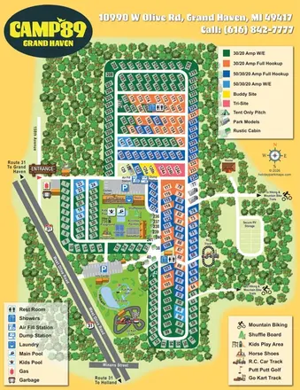
Colour-coded RV pitches, woodland borders and two activity hubs at Camp '89 Grand Haven.
 Explore the map ↗
Czechia
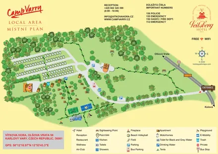
Tree-framed campsite and hotel map with motorhome rows, apartments, sports courts and footprint-marked walking paths.
 Explore the map ↗
Mexico
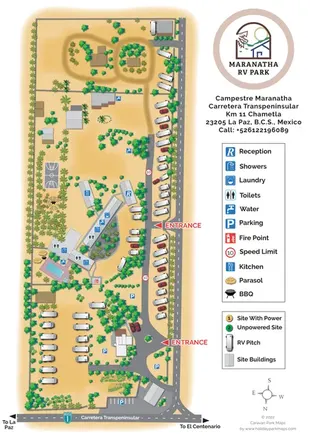
Palm-lined RV park plan with two entrances, a pool and a central amenity complex.
 Explore the map ↗
Spain
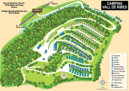
Wooded campsite map with a river-crossing approach, curved touring rows, lodges and paired outdoor pools.
 Explore the map ↗
United Kingdom
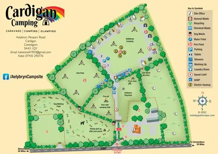
Illustrated farm-campsite map with mixed accommodation, named camping fields and a dedicated dog-walking area.
 Explore the map ↗
United Kingdom
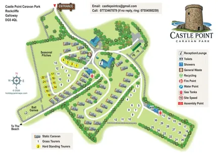
Illustrated mixed-accommodation park map with colour-coded touring pitches and a beach-direction route.
 Explore the map ↗
United Kingdom
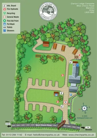
Tree-lined campsite map with touring bays, pod-style accommodation and clearly marked shared facilities.
 Explore the map ↗
United Kingdom
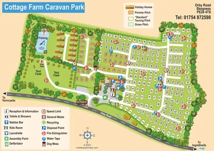
Illustrated touring and camping park map with numbered pitches, a fishing pond and a central farm courtyard.
 Explore the map ↗
United Kingdom
Woodland holiday-park map with named accommodation areas, touring loops and illustrated recreation facilities.
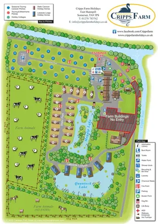 Explore the map ↗
United Kingdom
Illustrated farm holiday park plan combining riverside pitches, lakeside accommodation, animal fields and paw-print walking routes, with separate accommodation and facilities keys.
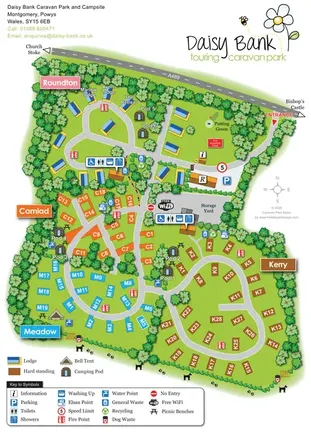 Explore the map ↗
United Kingdom
Colour-coded touring areas, illustrated lodges and glamping units within Daisy Bank’s tree-lined park plan.
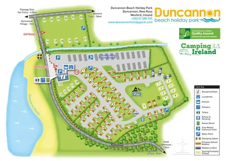 Explore the map ↗
Ireland
Beachside park plan with colour-coded mobile homes, touring/camping areas, glamping cabins and grouped service symbols.
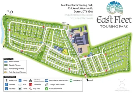 Explore the map ↗
United Kingdom
Coastal touring-park plan with three named fields, four pitch categories and lagoon-side walking connections.
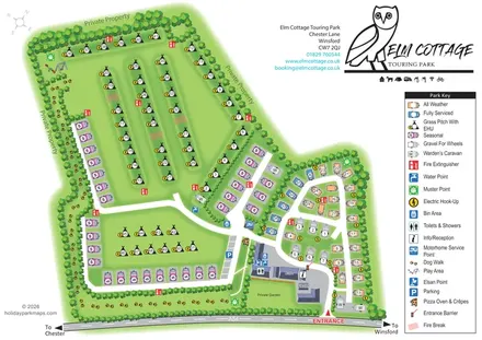 Explore the map ↗
United Kingdom
Tree-lined touring park plan with colour-coded pitches, a pawprint dog walk and distinctive owl branding.
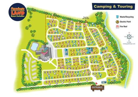 Explore the map ↗
United Kingdom
Colour-coded camping and touring plan with lettered pitches, numbered groups and illustrated landscape boundaries.
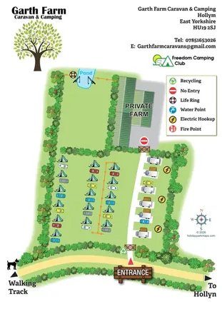 Explore the map ↗
United Kingdom
Illustrated farm campsite map with tent camping, electric touring bays, a pond and clearly marked private farm access.
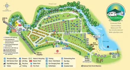 Explore the map ↗
United Kingdom
Colour-coded touring and camping map beside Afon Llafar and Bala Lake, with bilingual Glanllyn branding.
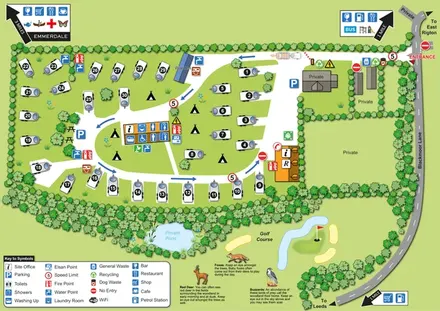 Explore the map ↗
United Kingdom
Numbered touring pitches, central amenities and wildlife illustrations in a tree-lined countryside site map.
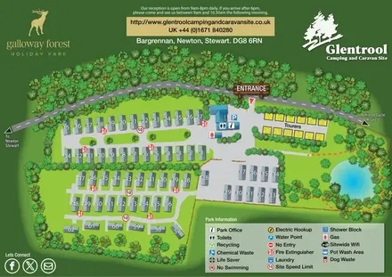 Explore the map ↗
United Kingdom
Woodland-framed Glentrool site map with numbered caravans, yellow touring pitches and a turquoise pond.
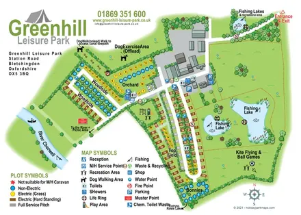 Explore the map ↗
United Kingdom
Illustrated camping and touring map with fishing lakes, dog areas and colour-coded pitches.
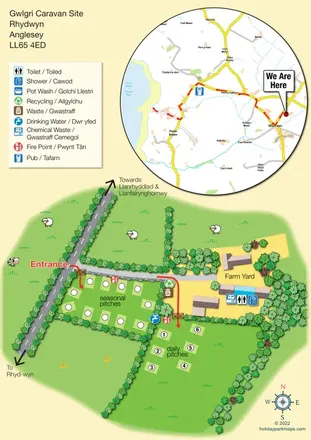 Explore the map ↗
United Kingdom
Bilingual Anglesey caravan-site map with seasonal and daily pitches, farmyard facilities and a circular Church Bay locator inset.
 Explore the map ↗
United Kingdom
A lakeside holiday-park and fishery map with numbered accommodation, fishing positions and clearly grouped visitor services.
 Explore the map ↗
United Kingdom
A countryside touring-park map with premium en-suite pitches, a pond and clear arrival wayfinding.
LET’S MAP YOUR PARK
For a map quotation, find your park and draw a rough boundary around it. The area you select helps us work out the design time and price.
Draw your park for a quote ↗Or talk to our map designers
01751 473136