
 Explore the map ↗
United Kingdom
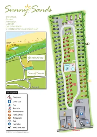
Sunny Sands Caravan Park
Colour-coded caravan park plan with an entrance leisure hub and a coastal location inset.
THE HOLIDAY PARK MAP COLLECTION
Browse 24 map examples, from Sunny Sands Caravan Park to Vyrnwy Caravan Park.
← Explore the whole collectionCombine a country, landscape, facilities and accommodation type to find relevant examples.
Showing 289–312 of 336 · Select a map to read its story
Explore the map ↗United Kingdom
Colour-coded caravan park plan with an entrance leisure hub and a coastal location inset.
 Explore the map ↗
United Kingdom
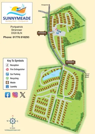
Illustrated Sunnymeade map with two entrances, pond-side accommodation and a nautical information column.
 Explore the map ↗
United Kingdom
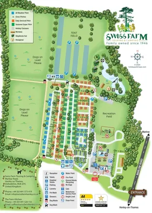
Portrait park map with colour-coded touring pitches, lakeside glamping and clearly grouped visitor facilities.
 Explore the map ↗
United Kingdom
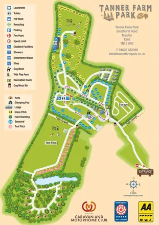
Colour-coded pitches, central facilities and woodland yurts on Tanner Farm Park's illustrated visitor map.
 Explore the map ↗
United Kingdom
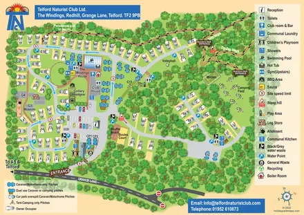
Woodland club map with colour-coded caravan pitches, camping, sports courts and named walking routes.
 Explore the map ↗
United Kingdom
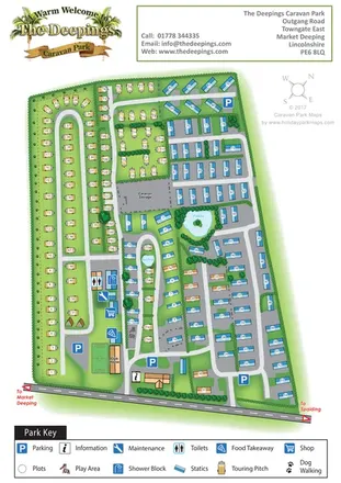
A mixed touring and static caravan park map with two ponds, a western dog-walking route and clearly grouped visitor facilities.
 Explore the map ↗
United Kingdom
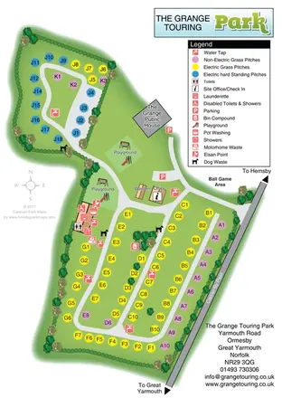
Colour-coded touring pitches, two playgrounds and a central facilities hub at The Grange Touring Park, Norfolk.
 Explore the map ↗
United Kingdom
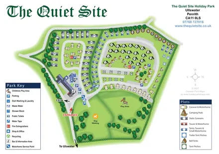
Illustrated Ullswater holiday-park map with mixed accommodation, two symbol keys and a spacious dog-walking and play green.
 Explore the map ↗
United Kingdom
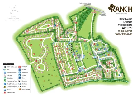
Illustrated Ranch Caravan Park map with looping accommodation roads, central leisure facilities and Gate Inn Brook.
 Explore the map ↗
United Kingdom
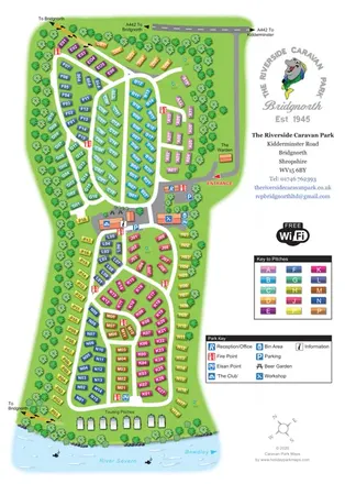
Colour-coded caravan plots, central facilities and riverside touring at The Riverside Caravan Park, Bridgnorth.
 Explore the map ↗
United Kingdom
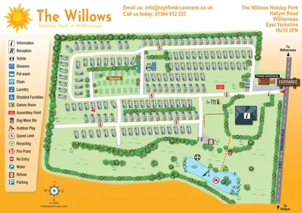
An overhead caravan and touring park map with sun branding, a pictogram key and an illustrated fishing lake.
 Explore the map ↗
United Kingdom
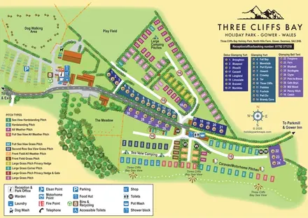
Colour-coded Gower park map with sea-view pitches, named glamping units and clearly grouped visitor facilities.
 Explore the map ↗
Australia
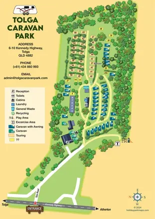
Tree-lined caravan park map with touring rows, central amenities and a clearly illustrated highway approach.
 Explore the map ↗
United Kingdom
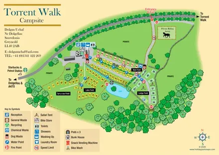
Illustrated campsite plan with four named fields, a central lake, glamping accommodation and cycling facilities.
 Explore the map ↗
United Kingdom
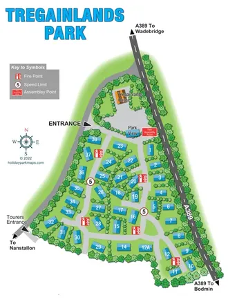
Tree-lined touring park plan with numbered spaces, separate entrances and A389 directions.
 Explore the map ↗
United Kingdom
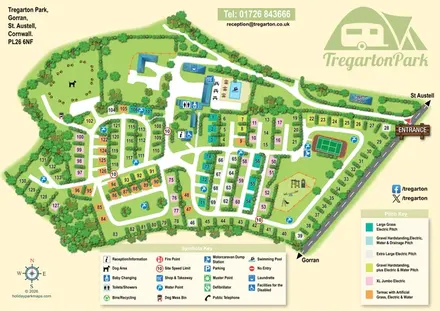
Hedge-divided pitches, colour-coded specifications and illustrated facilities at Tregarton Park, Cornwall.
 Explore the map ↗
United Kingdom
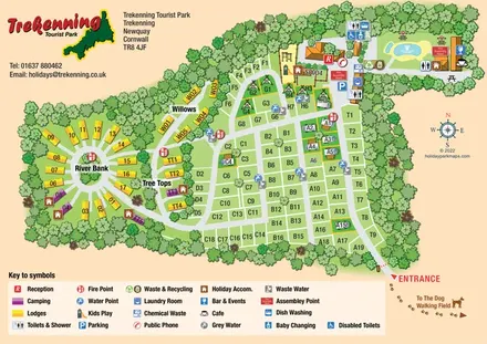
Tree-framed park map combining a touring grid, circular lodge section and illustrated pool area.
 Explore the map ↗
United Kingdom
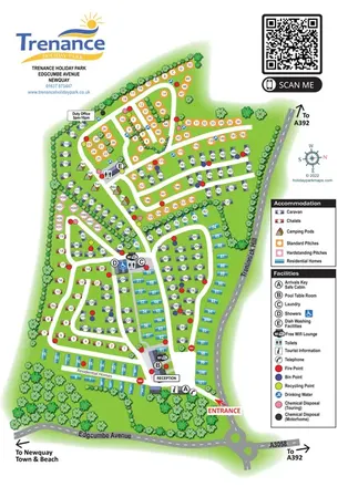
Colour-coded Newquay park map with named camping pods, residential areas and detailed facility wayfinding.
 Explore the map ↗
United Kingdom
Trevornick’s colour-coded park map, with mixed accommodation, fishing ponds, golf and wooded trails.
 Explore the map ↗
United Kingdom
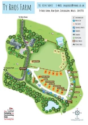
Illustrated farm campsite map with named pitches, two ponds and a Gothic Pod near New Quay.
 Explore the map ↗
United Kingdom
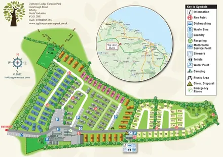
Tree-lined caravan and touring park map with play areas, a dog walk and a circular Whitby-area inset.
 Explore the map ↗
United Kingdom
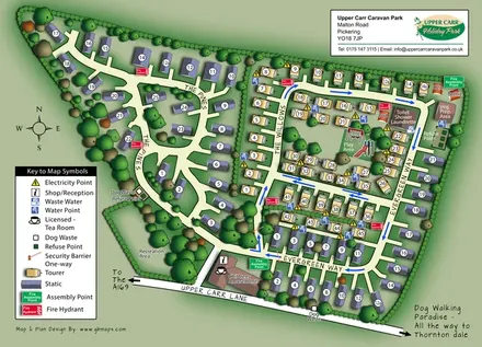
Upper Carr park map with wooded static-caravan areas, touring rows and clearly marked visitor facilities.
 Explore the map ↗
United Kingdom
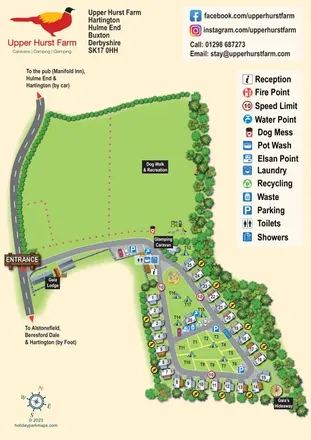
Upper Hurst Farm map with touring and tent pitches, named glamping stays and a large recreation field.
 Explore the map ↗
United Kingdom
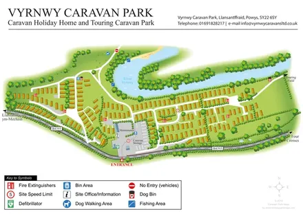
Riverside caravan park map with holiday-home rows, an entrance-side service compound and a touring-field direction.
LET’S MAP YOUR PARK
For a map quotation, find your park and draw a rough boundary around it. The area you select helps us work out the design time and price.
Draw your park for a quote ↗Or talk to our map designers
01751 473136